|
Little Catoctin Creek (Potomac River)
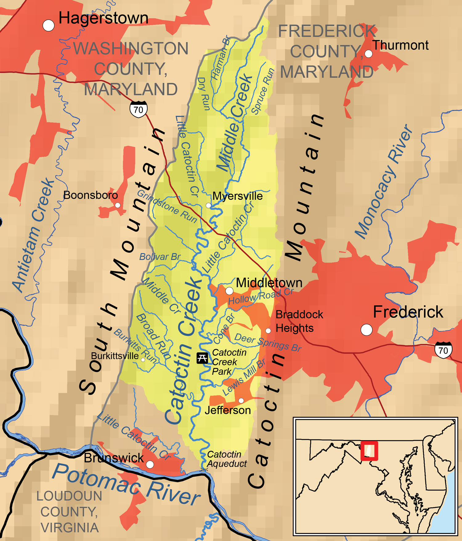
Little Catoctin Creek is an U.S. Geological Survey. National Hydrography Dataset high-resolution flowline dataThe National Map, accessed August 15, 2011 tributary of the Potomac River in Frederick County, Maryland Frederick County is located in the northern part of the U.S. state of Maryland. At the 2020 U.S. Census, the population was 271,717. The county seat is Frederick. Frederick County is included in the Washington-Arlington-Alexandria, DC-VA-MD-WV .... The creek starts south of Burkittsville and flows to the southeast, passing north of Brunswick before emptying into the Potomac west of Lander.USGS 7.5' topographic map series, "Point of Rocks" and "Harpers Ferry" quadrangles The name is also used for two tributaries of Catoctin Creek near Myersville. References Rivers of Frederick County, Maryland Rivers of Maryland Tributaries of the Potomac River {{Maryland-river-stub ... [...More Info...] [...Related Items...] OR: [Wikipedia] [Google] [Baidu] |
Potomac River
The Potomac River () drains the Mid-Atlantic United States, flowing from the Potomac Highlands into Chesapeake Bay. It is long,U.S. Geological Survey. National Hydrography Dataset high-resolution flowline dataThe National Map. Retrieved August 15, 2011 with a drainage area of 14,700 square miles (38,000 km2), and is the fourth-largest river along the East Coast of the United States and the 21st-largest in the United States. Over 5 million people live within its watershed. The river forms part of the borders between Maryland and Washington, D.C. on the left descending bank and between West Virginia and Virginia on the right descending bank. Except for a small portion of its headwaters in West Virginia, the North Branch Potomac River is considered part of Maryland to the low-water mark on the opposite bank. The South Branch Potomac River lies completely within the state of West Virginia except for its headwaters, which lie in Virginia. Course The Potomac River runs ... [...More Info...] [...Related Items...] OR: [Wikipedia] [Google] [Baidu] |
Frederick County, Maryland
Frederick County is located in the northern part of the U.S. state of Maryland. At the 2020 U.S. Census, the population was 271,717. The county seat is Frederick. Frederick County is included in the Washington-Arlington-Alexandria, DC-VA-MD-WV Metropolitan Statistical Area. Like other outlying sections of the Washington metropolitan area, Frederick County has experienced a rapid population increase in recent years. It borders the southern border of Pennsylvania and the northeastern border of Virginia. The county is the location of Catoctin Mountain Park (encompassing the presidential retreat Camp David) and the U.S. Army's Fort Detrick. Etymology The namesake of Frederick County and its county seat is unknown, but it was probably either Frederick, Prince of Wales, or Frederick Calvert, 6th Baron Baltimore. History Frederick County was created in 1748 by the Province of Maryland from parts of Prince George's County and Baltimore County. In 1776, following US independence, F ... [...More Info...] [...Related Items...] OR: [Wikipedia] [Google] [Baidu] |
Burkittsville, Maryland
Burkittsville is a historic village in Frederick County, Maryland, United States. The village lies in the southern Middletown Valley along the eastern base of South Mountain. Burkittsville is a residential area with an economy based in agriculture and tourism. The village was the scene of the Battle of Crampton's Gap, part of the Battle of South Mountain during the Maryland Campaign of the Civil War on September 14, 1862. Burkittsville was also made a subject of national attention when it was used as the setting of the 1999 horror film ''The Blair Witch Project''. Nearby attractions include the Gathland State Park and the Appalachian Trail. The population was 151 as of the 2010 census. History English settlement in this region began in the early 18th century. Land was being surveyed and patented in the south-western portion of the Middletown Valley beginning in the 1720s. The first land tract to be patented within the present boundaries of Burkittsville was "Dawson's Purchase, ... [...More Info...] [...Related Items...] OR: [Wikipedia] [Google] [Baidu] |
Brunswick, Maryland
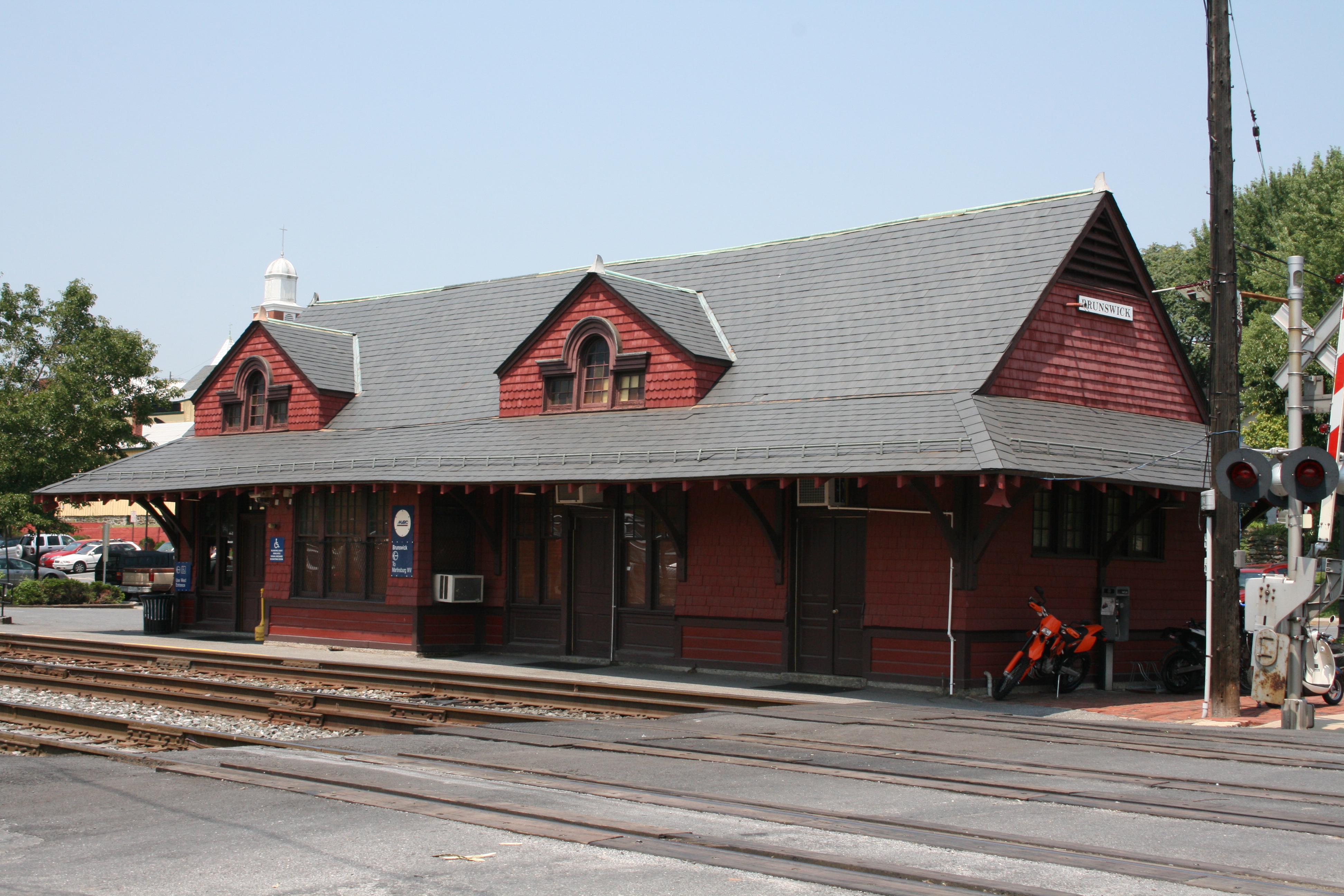
Brunswick is a city in southwestern Frederick County, Maryland, United States. The city is located on the north bank of the Potomac River; Loudoun County, Virginia occupies the opposite shore. The population of Brunswick was 7,762 at the 2020 census. There are three schools serving Brunswick: Brunswick Elementary School, Brunswick Middle School, and Brunswick High School. History The area now known as Brunswick was originally home to the Susquehanna Native American Tribe. In 1728 the first settlement was built, and the region became known as Eel Town, because the natives would fish for eel in the Potomac River. A grant to the land was then given to John Hawkins by George II of Great Britain on August 10, 1753. The grant had the name "Hawkins Merry-Peep-o-Day". The land was sold and Leonard Smith platted it in 1787 with the name of “Berlin,” as many Germans settled in the area. The name “Berlin,” however, could not be used for mail as there was already a Berlin on the ... [...More Info...] [...Related Items...] OR: [Wikipedia] [Google] [Baidu] |
Lander, Maryland
Lander is an unincorporated community in Frederick County, Maryland, United States. Lock 29 on the C&O Canal The Chesapeake and Ohio Canal, abbreviated as the C&O Canal and occasionally called the "Grand Old Ditch," operated from 1831 until 1924 along the Potomac River between Washington, D.C. and Cumberland, Maryland. It replaced the Potomac Canal, wh ... is located in Lander. References Unincorporated communities in Frederick County, Maryland Unincorporated communities in Maryland {{FrederickCountyMD-geo-stub ... [...More Info...] [...Related Items...] OR: [Wikipedia] [Google] [Baidu] |
Catoctin Creek (Maryland)
Catoctin Creek is a U.S. Geological Survey. National Hydrography Dataset high-resolution flowline dataThe National Map, accessed August 15, 2011 tributary of the Potomac River in Frederick County, Maryland, USA. Its source is formed in the Myersville, Maryland area and flows directly south for the entire length of the stream. Catoctin Creek enters the Potomac River east of Brunswick. The stream flows through Catoctin Creek Park. See also *List of rivers of Maryland List of rivers of Maryland (U.S. state). The list is arranged by drainage basin from east to west, with respective tributaries indented under each larger stream's name and ordered from downstream to upstream. By drainage basin Delaware River *C ... References External links Monocacy & Catoctin Watershed Alliance [...More Info...] [...Related Items...] OR: [Wikipedia] [Google] [Baidu] |
Myersville, Maryland
Myersville is a town in Frederick County, Maryland, United States. The population was 1,626 at the 2010 United States Census. History The town was incorporated in 1904.Myersville history Town of Myersville, Retrieved 12 December 2013 On January 4, 1919, a large fire destroyed many shops and buildings in the center of town. The Peter of P. Grossnickel Farm was listed on the in 1998. Capture of the D.C. snipers [...More Info...] [...Related Items...] OR: [Wikipedia] [Google] [Baidu] |
Rivers Of Frederick County, Maryland
A river is a natural flowing watercourse, usually freshwater, flowing towards an ocean, sea, lake or another river. In some cases, a river flows into the ground and becomes dry at the end of its course without reaching another body of water. Small rivers can be referred to using names such as creek, brook, rivulet, and rill. There are no official definitions for the generic term river as applied to geographic features, although in some countries or communities a stream is defined by its size. Many names for small rivers are specific to geographic location; examples are "run" in some parts of the United States, "burn" in Scotland and northeast England, and "beck" in northern England. Sometimes a river is defined as being larger than a creek, but not always: the language is vague. Rivers are part of the water cycle. Water generally collects in a river from precipitation through a drainage basin from surface runoff and other sources such as groundwater recharge, spring ... [...More Info...] [...Related Items...] OR: [Wikipedia] [Google] [Baidu] |
Rivers Of Maryland
List of rivers of Maryland (U.S. state). The list is arranged by drainage basin from east to west, with respective tributaries indented under each larger stream's name and ordered from downstream to upstream. By drainage basin Delaware River *Christina River Atlantic Ocean * Ayres Creek * Greys Creek * St. Martin River * Turville Creek * Trappe Creek Chesapeake Bay Eastern Shore * Pocomoke River ** Dividing Creek ** Nassawango Creek * Little Annemessex River * Big Annemessex River *Manokin River * Monie Creek * Wicomico River ** Beaverdam Creek * Nanticoke River **Barren Creek *** Mockingbird Creek ** Marshyhope Creek *** Big Creek *** Stony Bar Creek *** Krafts Creek *** Spears Creek *** Becky Taylor Branch *** Mill Branch *** Mill Creek *** Puckum Branch *** Wrights Branch *** Skinners Run *** Davis Millpond Branch **** North Davis Millpond Branch **** South Davis Millpond Branch *** Miles Branch *** Tanyard Branch *** Faulkner Branch *** Tull Branch *** Sullivan Branch * ... [...More Info...] [...Related Items...] OR: [Wikipedia] [Google] [Baidu] |


