|
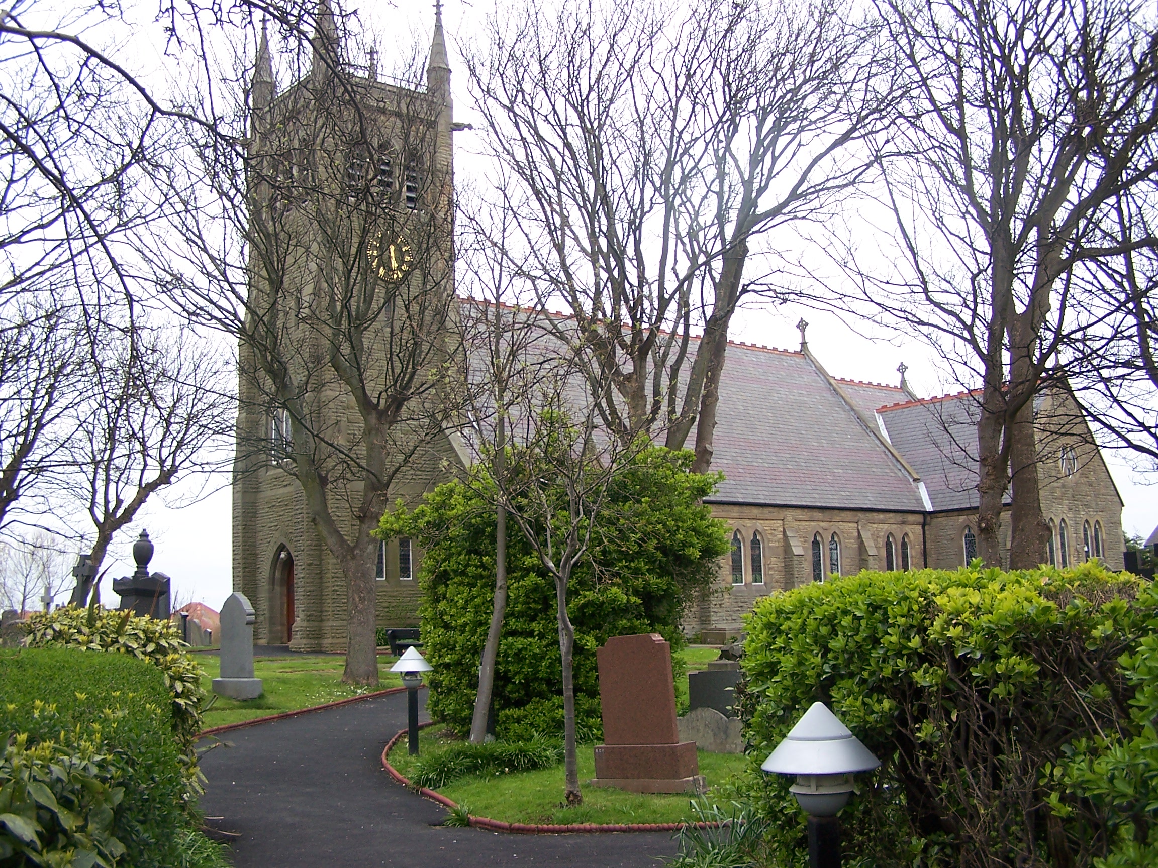
Little Bispham, Blackpool
Bispham is a village on the Fylde coast in Lancashire, England, a mile and a half north of Blackpool town centre. Geography and administration The village is part of the borough of Blackpool, and generally considered a suburb of the town. To the south of Bispham is Warbreck, North Shore and Layton, to the east is Carleton and to the north is Norbreck and Thornton Cleveleys and to the west, the Irish Sea. The area is mostly urban. Bispham was formerly in the Blackpool North and Fleetwood parliamentary constituency, but, as of the 2010 general election forms part of the Blackpool North and Cleveleys constituency whose M.P. is Paul Maynard. Bispham has three Blackpool Council electoral wards: Bispham, Greenlands and Ingthorpe. Demographics The population at the United Kingdom Census 2001 was 19,165, 13.41% of the population of Blackpool (142,900), with 3,873 residents aged between 0 and 17 years old (20.21%), 4,329 aged 65 and over (22.58%) and 10,963 between the ages of 18 ... [...More Info...] [...Related Items...] OR: [Wikipedia] [Google] [Baidu] |
Borough Of Blackpool
The Borough of Blackpool is a local government district with unitary authority status and unparished area in the ceremonial county of Lancashire, England. It covers the large seaside town of Blackpool and includes notable suburbs such as South Shore, Blackpool, South Shore, North Shore, Blackpool, North Shore and the large village of Bispham, Blackpool, Bispham. The borough is bordered to the north and north-east by the Borough of Wyre (including Fleetwood, Cleveleys, Thornton, Lancashire, Thornton and Poulton-le-Fylde), and to the south and south-east by Borough of Fylde (including Lytham St Annes), both of which are non-metropolitan districts in Lancashire. The western boundary is bounded by Morecambe Bay and the coast. Surrounding districts form part of the Blackpool Urban Area which covers all the unitary authority area. History On 1 April 1974, under the Local Government Act 1972, the pre-existing County Borough of Blackpool was reconstituted as a non-metropolitan district ... [...More Info...] [...Related Items...] OR: [Wikipedia] [Google] [Baidu] |
The Fylde
The Fylde () is a coastal plain in western Lancashire, England. It is roughly a square-shaped peninsula, bounded by Morecambe Bay to the north, the Ribble estuary to the south, the Irish Sea to the west, and the foot of the Bowland hills to the east which approximates to a section of the M6 motorway and West Coast Main Line. Geography It is a flat, alluvial plain, parts of which have deposits of and were once dug for peat. The River Wyre meanders across the Fylde from Garstang on the eastern edge, westwards towards Poulton and then northwards to the sea at Fleetwood. The area north and east of the tidal Wyre, known as Over Wyre, is the more rural side of the river. The Fylde is roughly trisected by the M55 motorway and A586 road. The west coast is almost entirely urban, containing the towns of Fleetwood, Cleveleys, Blackpool, St Annes and Lytham; with Thornton, Carleton and Poulton-le-Fylde not far inland. This area forms the Blackpool Urban Area. The central souther ... [...More Info...] [...Related Items...] OR: [Wikipedia] [Google] [Baidu] |
Moiety (kinship)
In the anthropological study of kinship, a moiety () is a descent group that coexists with only one other descent group within a society. In such cases, the community usually has unilineal descent (either Patrilineality, patri- or Matrilineality, matrilineal) so that any individual belongs to one of the two moiety groups by birth, and all marriages take place between members of opposite moieties. It is an exogamous clan, clan system with only two clans. In the case of a patrilineal descent system, one can interpret a moiety system as one in which women are exchanged between the two moieties. Moiety societies operate particularly among the indigenous peoples of Indigenous peoples of the Americas , North America and Australian Aboriginal kinship, Australia (see Australian Aboriginal kinship for details of Aboriginal moieties). White, I. (1981). "Generation moieties in Australia: structural, social and ritual implications". ''Oceania'', 6–27. References Further reading * ... [...More Info...] [...Related Items...] OR: [Wikipedia] [Google] [Baidu] |
University Of Liverpool
, mottoeng = These days of peace foster learning , established = 1881 – University College Liverpool1884 – affiliated to the federal Victoria Universityhttp://www.legislation.gov.uk/ukla/2004/4 University of Manchester Act 2004. legislation.gov.uk (4 July 2011). Retrieved on 14 September 2011.1903 – royal charter , type = Public , endowment = £190.2 million (2020) , budget = £597.4 million (2020–21) , city = Liverpool , country = England , campus = Urban , coor = , chancellor = Colm Tóibín , vice_chancellor = Dame Janet Beer , head_label = Visitor , head = The Lord President of the Council '' ex officio'' , students = () , undergrad = () , postgrad = () , colours = The University , affiliations = Russell Group, EUA, N8 Group, NWUA, AACSB, AMBA, EQUIS, EASN, Universities UK , website = , logo = Universit ... [...More Info...] [...Related Items...] OR: [Wikipedia] [Google] [Baidu] |
Viking
Vikings ; non, víkingr is the modern name given to seafaring people originally from Scandinavia (present-day Denmark, Norway and Sweden), who from the late 8th to the late 11th centuries raided, pirated, traded and settled throughout parts of Europe.Roesdahl, pp. 9–22. They also voyaged as far as the Mediterranean Sea, Mediterranean, North Africa, Volga Bulgaria, the Middle East, and Greenland, North America. In some of the countries they raided and settled in, this period is popularly known as the Viking Age, and the term "Viking" also commonly includes the inhabitants of the Scandinavian homelands as a collective whole. The Vikings had a profound impact on the Early Middle Ages, early medieval history of Scandinavia, the History of the British Isles, British Isles, France in the Middle Ages, France, Viking Age in Estonia, Estonia, and Kievan Rus'. Expert sailors and navigators aboard their characteristic longships, Vikings established Norse settlem ... [...More Info...] [...Related Items...] OR: [Wikipedia] [Google] [Baidu] |
Anglo-Saxons
The Anglo-Saxons were a Cultural identity, cultural group who inhabited England in the Early Middle Ages. They traced their origins to settlers who came to Britain from mainland Europe in the 5th century. However, the ethnogenesis of the Anglo-Saxons happened within Britain, and the identity was not merely imported. Anglo-Saxon identity arose from interaction between incoming groups from several Germanic peoples, Germanic tribes, both amongst themselves, and with Celtic Britons, indigenous Britons. Many of the natives, over time, adopted Anglo-Saxon culture and language and were assimilated. The Anglo-Saxons established the concept, and the Kingdom of England, Kingdom, of England, and though the modern English language owes somewhat less than 26% of its words to their language, this includes the vast majority of words used in everyday speech. Historically, the Anglo-Saxon period denotes the period in Britain between about 450 and 1066, after Anglo-Saxon settlement of Britain, th ... [...More Info...] [...Related Items...] OR: [Wikipedia] [Google] [Baidu] |
Domesday Book
Domesday Book () – the Middle English spelling of "Doomsday Book" – is a manuscript record of the "Great Survey" of much of England and parts of Wales completed in 1086 by order of King William I, known as William the Conqueror. The manuscript was originally known by the Latin name ''Liber de Wintonia'', meaning "Book of Winchester", where it was originally kept in the royal treasury. The '' Anglo-Saxon Chronicle'' states that in 1085 the king sent his agents to survey every shire in England, to list his holdings and dues owed to him. Written in Medieval Latin, it was highly abbreviated and included some vernacular native terms without Latin equivalents. The survey's main purpose was to record the annual value of every piece of landed property to its lord, and the resources in land, manpower, and livestock from which the value derived. The name "Domesday Book" came into use in the 12th century. Richard FitzNeal wrote in the ''Dialogus de Scaccario'' ( 1179) that the book ... [...More Info...] [...Related Items...] OR: [Wikipedia] [Google] [Baidu] |
Amounderness
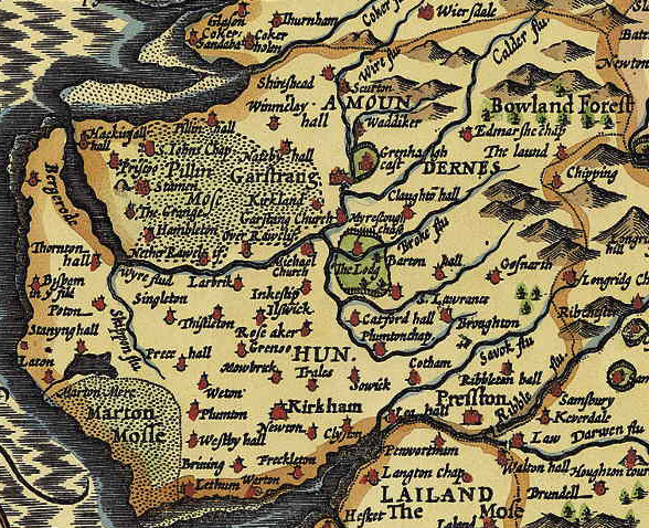
The Amounderness Hundred () is one of the six subdivisions of the historic county of Lancashire in North West England, but the name is older than the system of hundreds first recorded in the 13th century and might best be described as the name of a Norse wapentake. In the Domesday Book, it was used for some territories north of the River Ribble included together with parts of Yorkshire. The area eventually became part of Lancashire, sitting geographically between the Rivers Lune and Ribble, in the strip of coast between the Irish Sea and Bowland Forest. Etymology and history In the 19th century, the name was considered to have been first recorded in 705, as Hacmunderness. The Domesday Book in 1086 spells it Agemundrenessa. There are two suggested etymologies for Amounderness. The traditional 19th century reading was that the name derived from ''ac'' (oak) and ''mund'' (protection), "a ness or promontory sheltered by oaks". This was given currency by Porter.Porter, J, ''A His ... [...More Info...] [...Related Items...] OR: [Wikipedia] [Google] [Baidu] |
Northumbria
la, Regnum Northanhymbrorum , conventional_long_name = Kingdom of Northumbria , common_name = Northumbria , status = State , status_text = Unified Anglian kingdom (before 876)North: Anglian kingdom (after 876)South: Danish kingdom (876–914)South: Norwegian kingdom (after 914) , life_span = 654–954 , flag_type = Oswald's Stripes, the provincial flag of Northumbria and red was previously purple , image_coat = , image_map = Map_of_the_Kingdom_of_Northumbria_around_700_AD.svg , image_map_size = 250 , image_map_caption = Northumbria around 700 AD , image_map2 = , image_map2_size = , image_map2_caption = , government_type = Monarchy , year_start = 653 , year_end = 954 , event_end = South is annexed by Kingdom of England , event1 = South is annexed by the Danelaw , date_even ... [...More Info...] [...Related Items...] OR: [Wikipedia] [Google] [Baidu] |
Tostig Godwinson
Tostig Godwinson ( 102925 September 1066) was an Anglo-Saxon Earl of Northumbria and brother of King Harold Godwinson. After being exiled by his brother, Tostig supported the Norwegian king Harald Hardrada's invasion of England, and was killed alongside Hardrada at the Battle of Stamford Bridge in 1066. Background Tostig was the third son of the Anglo-Saxon nobleman Godwin, Earl of Wessex and Gytha Thorkelsdóttir, the daughter of Danish chieftain Thorgil Sprakling. In 1051, he married Judith of Flanders, the only child of Baldwin IV, Count of Flanders by his second wife, Eleanor of Normandy. In 1086, the Domesday Book recorded twenty-six vills or townships as being held by Earl Tostig, forming the Manor of Hougun which now forms part of the county of Cumbria in north-west England. Earl of Northumbria In the 19th century, the antiquarian Edward Augustus Freeman posited a hypothesis claiming that Edward the Confessor, King of England, was pursuing a policy of " Normani ... [...More Info...] [...Related Items...] OR: [Wikipedia] [Google] [Baidu] |
Kirkham, Lancashire
Kirkham (originally Kirkam-in-Amounderness) is a town and civil parish in the Borough of Fylde in Lancashire, England, midway between Blackpool and Preston ( west of Preston) and adjacent to the smaller town of Wesham. It owes its existence to Carr Hill upon which it was built and which was the location of a Roman fort. At the census of 2011, it had a population 7,194. History In his 1878 ''History of the Fylde of Lancashire'', John Porter described Kirkham as ".. probably the earliest inhabited locality in the Fylde district."Porter, J. MRCS, LSA (1878''History of the Fylde of Lancashire'' Fleetwood and Blackpool, W. Porter and Sons Publisher, Chapter XII – The Parish of Kirkham. Remains found at Carleton in the 1970s of an elk with two harpoons embedded suggest that the Fylde was inhabited as long ago as 8,000 BC.Singleton, F. J. (1980), ''Kirkham – A Short History'', Kirkham & District Local History Society. The town is pre-Roman in its origin with a name originatin ... [...More Info...] [...Related Items...] OR: [Wikipedia] [Google] [Baidu] |
Ancient Rome
In modern historiography, ancient Rome refers to Roman civilisation from the founding of the city of Rome in the 8th century BC to the collapse of the Western Roman Empire in the 5th century AD. It encompasses the Roman Kingdom (753–509 BC), Roman Republic (509–27 BC) and Roman Empire (27 BC–476 AD) until the fall of the western empire. Ancient Rome began as an Italic settlement, traditionally dated to 753 BC, beside the River Tiber in the Italian Peninsula. The settlement grew into the city and polity of Rome, and came to control its neighbours through a combination of treaties and military strength. It eventually dominated the Italian Peninsula, assimilated the Greek culture of southern Italy ( Magna Grecia) and the Etruscan culture and acquired an Empire that took in much of Europe and the lands and peoples surrounding the Mediterranean Sea. It was among the largest empires in the ancient world, with an estimated 50 to 90 million inhabitants, roughly 20% of t ... [...More Info...] [...Related Items...] OR: [Wikipedia] [Google] [Baidu] |


