|
List Of Prehistoric Sites In Colorado
This list of prehistoric sites in Colorado includes historical and archaeological sites of humans from their earliest times in Colorado to just before the Colorado historic period, which ranges from about 12,000 BC to AD 19th century. The Period is defined by the culture enjoyed at the time, from the earliest hunter-gatherers, the Paleo-Indians, through to the prehistoric parents to the modern Native Americans. There were more than 56,500 recorded prehistoric sites in Colorado by 1996. Important historic and archaeological sites are registered nationally with the National Register of Historic Places (National register) and within the state's Colorado State Register of Historic Properties (State register). Most of the sites below are registered in one more both registers and was the source for most of the information for this section: [...More Info...] [...Related Items...] OR: [Wikipedia] [Google] [Baidu] |
Colorado In United States
Colorado (, other variants) is a state in the Mountain states, Mountain West subregion of the Western United States. It encompasses most of the Southern Rocky Mountains, as well as the northeastern portion of the Colorado Plateau and the western edge of the Great Plains. Colorado is the List of U.S. states and territories by area, eighth most extensive and List of U.S. states and territories by population, 21st most populous U.S. state. The 2020 United States Census, 2020 United States census enumerated the population of Colorado at 5,773,714, an increase of 14.80% since the 2010 United States Census, 2010 United States census. The region has been inhabited by Indigenous peoples of the Americas, Native Americans and their Paleo-Indians, ancestors for at least 13,500 years and possibly much longer. The eastern edge of the Rocky Mountains was a major migration route for early peoples who spread throughout the Americas. "''Colorado''" is the Spanish adjective meaning "ruddy", th ... [...More Info...] [...Related Items...] OR: [Wikipedia] [Google] [Baidu] |
Lowry Pueblo
The Lowry Pueblo is an Ancestral Puebloan archaeological site located in Canyons of the Ancients National Monument near Pleasant View, Colorado, United States. The pueblo was constructed around 1060 AD atop abandoned pithouses from an earlier period of occupation. It was occupied by 40 to 100 people at a time for 165 years. The site is one of the northernmost to be associated with the Puebloan cultures. The site was declared a National Historic Landmark in 1964.Albert H. Schroeder (September 24, 1962) , National Park Service and Description Lowry Pueblo is located about northwest of Cortez, Colorado, and about north of Chaco Canyon, one of the major centers of Ancestral Puebloan culture. The pueblo was named for the early area homesteader George Lowry. It is believed to have begun as a relative small community with just a few rooms, but is unusual for the presence of a great kiva, suggesting it served as a communal center for a scattered population before the settlement ... [...More Info...] [...Related Items...] OR: [Wikipedia] [Google] [Baidu] |
Darkmold Site
This is a list of Ancestral Puebloan dwellings in Colorado, United States. Pueblo periods Archaeologists have agreed on three main periods of occupation by Pueblo peoples in southwestern Colorado: Pueblo I, Pueblo II, and Pueblo III. * Pueblo I (750 to 900). Pueblo buildings were built with stone, generally oriented to the south, and in U, E and L shapes. The buildings were located more closely together than the previous Basketmaker period and reflected deepening religious celebration. Towers were built, often near kivas, though their purpose (defense?, storage?, ceremonies?) still is debated. Pottery became more versatile, not just for cooking, but now included pitchers, ladles, bowls, jars and dishware for food and drink. White pottery with black designs emerged, the pigments coming from plants. Water management and conservation techniques, including the use of reservoirs and silt-retaining dams, also emerged during this period. Midway through this period, about 900, ... [...More Info...] [...Related Items...] OR: [Wikipedia] [Google] [Baidu] |
Crow Canyon Archaeological Center
Crow Canyon Archaeological Center is a research center and "living classroom" located in southwestern Colorado, US, which offers experiential education programs for students and adults. Crow Canyon is a center for archaeological research, education, and preservation of the history of the Ancient Pueblo peoples, who lived on and in the cliff dwellings of Mesa Verde more than seven centuries ago. Established by private cultural initiatives that continue the work of American benefactors, the center provides hands-on programs for people to experience archaeological excavation of Native American sites. Brief history Crow Canyon is the result of work in experiential and hands-on education started in 1967 by Edward F. Berger, a history teacher with the Cherry Creek Schools near Denver, Colorado. Berger brought students to SW Colorado and involved them in building community and programs that increased motivation and accelerated learning. Because of the rich prehistoric cultural bas ... [...More Info...] [...Related Items...] OR: [Wikipedia] [Google] [Baidu] |
Cowboy Wash
Cowboy Wash is a group of nine archaeological sites used by Ancestral Puebloans (previously known as Anasazi) in Montezuma County, southwestern Colorado, United States. Each site includes one to three pit houses, and was discovered in 1993 during an archaeological dig. The remains of twelve humans were found at one of the pit house sites, dating to the 12th century. Initial dig The site, designated 5MT10010, dates to between approximately 1150 and 1175 A.D. It is located on the south slopes of Ute Mountain near Towaoc, approximately 15 miles west of Mesa Verde, the famous Ancestral Pueblo cliff dwellings. Some archeologists believe that the site was settled by immigrants from Chaco Canyon, or the Chuska Mountains. Five of the human skeletons at the site were from burials. The remaining seven exhibited many signs of cannibalism including defleshing, fragmentation of long bones to extract marrow, chopped, cut, and blackened bones. A stone tool kit appropriate for butcheri ... [...More Info...] [...Related Items...] OR: [Wikipedia] [Google] [Baidu] |
Nucla, Colorado
Nucla is a statutory town in Montrose County, Colorado, United States. The population was 585 as of the 2020 census, down from 711 in 2010. Its name comes from the town founders' intent that it serve as a "nucleus" for the surrounding farms and mines, although it has since come to be associated with the growth of uranium mining in the region. Geography Nucla is located in southwestern Montrose County at (38.266775, -108.547146). It is at the northern terminus of Colorado State Highway 97, which leads south to Naturita, the only other incorporated place in the area. The Uncompahgre Plateau rises to the northeast. According to the United States Census Bureau, the town has a total area of , all of it land. Demographics As of the census of 2000, there were 734 people, 311 households, and 208 families residing in the town. The population density was . There were 369 housing units at an average density of . The racial makeup of the town was 94.69% White, 1.09% Native American, 0 ... [...More Info...] [...Related Items...] OR: [Wikipedia] [Google] [Baidu] |
Colorado Millennial Site
Colorado Millennial Site is a prehistoric Paleo-Indian archaeological site located near Ruxton in the southeastern part of the U.S. state of Colorado, sitting along the border between Baca and Las Animas counties. It is also known by its site ID, 5LA1115, and the names Hackberry Springs and Bloody Springs. The site was inhabited from 6999 B.C. to A.D. 1900. The prehistoric cultures included Archaic and Woodland cultures and the site is significant for its rock art, village settlement, and military battle site. The site, situated along an overhanging bluff, provided natural shelter and had access to a reliable supply of water for its prehistoric inhabitants, who left evidence of their residency in the form of rock art.''Baca County.'' HistoryColorado. Retrieved November 26, 2011. The |
Game Drive System
The game drive system is a hunting strategy in which game are herded into confined or dangerous places where they can be more easily killed. It can also be used for animal capture as well as for hunting, such as for capturing mustangs. The use of the strategy dates back into prehistory. Once a site is identified or manipulated to be used as a game drive site, it may be repeatedly used over many years. Game drives In the Rocky Mountain National Park, for instance, there are archeological remains from about 3,850 and 3,400 B.C. of 42 low-walled stone structures or cairns, up to hundreds of feet in length, built for game drive systems. These slight walls served as devices that permitted hunters to direct or herd game animals—like bison, sheep, deer, or elk—toward men waiting with weapons. Up to twenty-five people may have been needed to execute the game drive. Hunters may have killed the animals using darts, atlatl, spear throwers, or spears tipped with stone projectile points. ... [...More Info...] [...Related Items...] OR: [Wikipedia] [Google] [Baidu] |
Chimney Rock National Monument
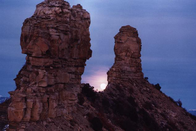
Chimney Rock National Monument is a U.S. National Monument in San Juan National Forest in southwestern Colorado which includes an archaeological site. This area is located in Archuleta County, Colorado, between Durango and Pagosa Springs, and is managed for archaeological protection, public interpretation, and education. The Chimney Rock Archaeological Site has been listed on the National Register of Historic Places since 1970. U.S. President Barack Obama created Chimney Rock National Monument by proclamation on September 21, 2012 under authority of the Antiquities Act. Geography Chimney Rock National Monument lies on 4,726 acres (19 km2) of San Juan National Forest land surrounded by the Southern Ute Indian Reservation. The Chimney Rock Archeological Area, listed in the National Register of Historic Places in 1970, consists of a central 960 acres. Chimney Rock itself is approximately 315 feet (96 m) tall. Next to Chimney Rock is Companion Rock, which is a popula ... [...More Info...] [...Related Items...] OR: [Wikipedia] [Google] [Baidu] |
Dismal River Culture
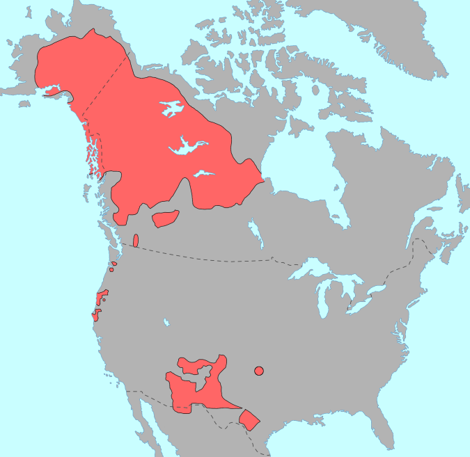
The Dismal River culture refers to a set of cultural attributes first seen in the Dismal River area of Nebraska in the 1930s by archaeologists William Duncan Strong, Waldo Rudolph Wedel and A. T. Hill. Also known as Dismal River aspect and Dismal River complex, dated between 1650-1750 A.D., is different from other prehistoric Central Plains and Woodland traditions of the western Plains. The Dismal River people are believed to have spoken an Athabascan language and to have been part of the people later known to Europeans as Apaches.Gibbon, Guy E.; Ames, Kenneth M. (1998''Archaeology of Prehistoric Native America: An Encyclopedia''.p. 212. .Gibbon, Guy E.; Ames, Kenneth M. (1998''Archaeology of Prehistoric Native America: An Encyclopedia''.pp. 213, 768. . Western Plains Dismal River culture sites have been found in Nebraska, Kansas, Colorado and South Dakota. 18 sites were located in Hayes, Hooker, Cherry, Thomas and Lincoln counties in the Sand Hills of Nebraska. Notable ... [...More Info...] [...Related Items...] OR: [Wikipedia] [Google] [Baidu] |
Cedar Point Village
Cedar Point Village is an archaeological site located in Elbert County, Colorado near Limon. It is a prehistoric residential site with artifacts of the Dismal River culture and likely inhabited by early Apachean people. Cedar Point Village, declared "the most spectacular Dismal River site in Colorado," was a small village with 7 round houses.Cassells, E. Steve. (1997). ''The Archaeology of Colorado'', Revised Edition. Boulder, Colorado: Johnson Books. pp. 236-237. . The village was connected to the Dismal River culture through the Dismal River type of pottery and the side-notched, triangular and unnotched projectile points. The site was excavated in 1952 by Herbert W. Dick, curator of the University of Colorado museum from 1949 to 1953. When Dick left his position at the museum, Joe Ben Wheat led the excavation.Cassells, E. Steve. (1997). ''The Archaeology of Colorado'', Revised Edition. Boulder, Colorado: Johnson Books. pp. 320. . See also * Franktown Cave, another Dismal R ... [...More Info...] [...Related Items...] OR: [Wikipedia] [Google] [Baidu] |
Shoshone People
The Shoshone or Shoshoni ( or ) are a Tribe (Native American), Native American tribe with four large cultural/linguistic divisions: * Eastern Shoshone: Wyoming * Northern Shoshone: southern Idaho * Western Shoshone: Nevada, northern Utah * Goshute: western Utah, eastern Nevada They traditionally speak the Shoshoni language, part of the Numic languages branch of the large Uto-Aztecan languages, Uto-Aztecan language family. The Shoshone were sometimes called the Snake Indians by neighboring tribes and early American explorers. Their peoples have become members of List of federally recognized tribes, federally recognized tribes throughout their traditional areas of settlement, often co-located with the Northern Paiute people of the Great Basin. Etymology The name "Shoshone" comes from ''Sosoni'', a Shoshoni language, Shoshone word for high-growing grasses. Some neighboring tribes call the Shoshone "Grass House People," based on their traditional homes made from ''sosoni''. Shosho ... [...More Info...] [...Related Items...] OR: [Wikipedia] [Google] [Baidu] |


