|
List Of Mountains In Peru
Peaks above 6,000 metres This is a list of the thirty-seven 6000 metre peaks in Peru as defined by a regain height, or prominence, above a col of 300m or more. This list is taken from the full set of Peruvian IGM maps alongside various climbing and mountaineering records. Heights are taken from the Peruvian IGM 1:100,000 series maps with the OEAV survey maps Alpenverienskarte sheets 0/3a and 0/3b published 1999 and 2005. and of the Cordillera Blanca (north and south) used where the IGM maps do not give spot heights. SRTM data has been used in a few places to confirm these heights, but due to the steep terrain is often unusableFerranti 2005, "Peru ultra-Prominences", op. cit. Peaks less than 6000m Many peaks in Peru frequently quoted as being over 6000m are under this height according to the most recent surveys published by the Peruvian IGM. These peaks include:- Pumasillo 5,991m, Lasunayoc 5,936m, Yanarahu 5,954m, Artesonraju 5,999m, Sabancaya 5,976m, Palumani 5,723m, ... [...More Info...] [...Related Items...] OR: [Wikipedia] [Google] [Baidu] |
Coropuna
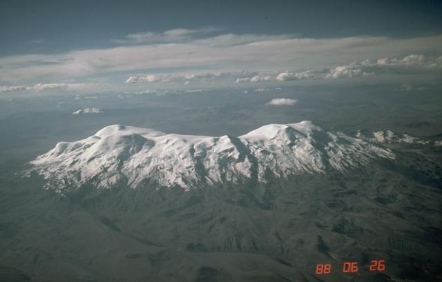
Coropuna is a dormant compound volcano located in the Andes mountains of southeast-central Peru. The upper reaches of Coropuna consist of several perennially snowbound conical summits, lending it the name Nevado Coropuna in Spanish. The complex extends over an area of and its highest summit reaches an altitude of above sea level. This makes the Coropuna complex the third-highest of Peru. Its thick ice cap is the most extensive in Earth's tropical zone, with several outlet glaciers stretching out to lower altitudes. Below an elevation of , there are various vegetation belts which include trees, peat bogs, grasses and also agricultural areas and pastures. The Coropuna complex consists of several stratovolcanos. These are composed chiefly of ignimbrites and lava flows on a basement formed by Middle Miocene ignimbrites and lava flows. The Coropuna complex has been active for at least five million years, with the bulk of the current cone having been formed during the Quat ... [...More Info...] [...Related Items...] OR: [Wikipedia] [Google] [Baidu] |
Palcaraju
Palcaraju (from Quechua ''pallqa, p'allqa, p'alqa'' forked, branched, fork, ''rahu'' snow, ice, mountain with snow,) is a mountain in the Cordillera Blanca mountain range in the region of Ancash within the Peruvian Andes The Andes, Andes Mountains or Andean Mountains (; ) are the longest continental mountain range in the world, forming a continuous highland along the western edge of South America. The range is long, wide (widest between 18°S – 20°S .... It has an elevation of on its main summit. Palcaraju has three peaks: Palcaraju (), Palcaraju Oeste and Palcaraju Sur . In July 2012, two American climbers, Ben Horne and Gil Weiss, died on the way back down, after scaling the south face of Palcaraju W. References {{DEFAULTSORT:Palcaraju Mountains of Peru Mountains of Ancash Region Six-thousanders of the Andes ... [...More Info...] [...Related Items...] OR: [Wikipedia] [Google] [Baidu] |
Ampato
Ampato (possibly from Quechua ''hamp'atu'' or from Aymara ''jamp'atu'', both meaning "frog") is a dormant stratovolcano in the Andes of southern Peru. It lies about northwest of Arequipa and is part of a north-south chain that includes the volcanoes Hualca Hualca and Sabancaya, the last of which has been active in historical time. Ampato consists of three volcanic cones, which lie on top of an older eroded volcanic edifice. They were formed sequentially by extrusion of lava flows, but Ampato has also had explosive eruptions which have deposited ash, lapilli and pumice in the surrounding landscape. One young lava flow has been dated to 17,000 ± 6,000 years before present, but a summit lava dome is even younger, and Holocene ash layers in surrounding peat bogs may testify to the occurrence of recent eruptions. The present-day volcano is covered by an ice cap, and during the last glacial maximum glaciers advanced to low altitudes. In 1995, an Inca mummy known as Mummy Juanita was ... [...More Info...] [...Related Items...] OR: [Wikipedia] [Google] [Baidu] |
Chinchey
Chinchey, also known as Rurichinchay, is a mountain in the Cordillera Blanca in the Andes of Peru. It is located in the region of Ancash, most precisely between the districts of Aco (in Carhuaz Province), Independencia (in Huaraz Province), and Huari (in Huari Province). Rurichinchay is also the name of the lake northeast of the mountain at and the name of the river which originates at the lake. It flows to the southeast. See also * Pucaranra Pucaranra (possibly from Quechua ''puka'' red, ''ranra'' stony; stony ground,) is a mountain in the Cordillera Blanca in the Andes of Peru, about high (although other sources cite an elevation of . It is located in Ancash, southwest of mount C ... References Mountains of Peru Mountains of Ancash Region Glaciers of Peru Lakes of Peru Lakes of Ancash Region Rivers of Peru Rivers of Ancash Region Six-thousanders of the Andes {{Peru-river-stub ... [...More Info...] [...Related Items...] OR: [Wikipedia] [Google] [Baidu] |
Huánuco Region
Huánuco (; qu, Wanuku) is a city in central Peru. It had a population of 196,627 as of 2017 and in 2015 it had a population of 175,068. It is the capital of the Huánuco Region and the Huánuco District. It is the seat of the diocese of Huánuco. The metropolitan city of Huanuco is 170,000 hab (2011, urban pop, INEI). It has three districts, Huanuco (head), Amarilis, and Pillco Marca. In this city, the Higueras river meets the Huallaga river, one of the largest rivers in the country. History The city of Huánuco was founded by Spanish conquistador Gómez de Alvarado in 1539, in the Inca town of Yarowilca. In 1541, the city was moved to its current location in the Pillco Valley. Geography Climate Huánuco has a mild semi-arid climate (Köppen ''BSh''). The temperatures are pleasant throughout the year with very warm days and comfortable nights due to its elevation of . Education Schools * C.S. Colegio de Ciencias * CNA UNHEVAL * G.U.E. Leoncio Prado * C.S. San Luis Gonzag ... [...More Info...] [...Related Items...] OR: [Wikipedia] [Google] [Baidu] |
Lima Region
The Department of Lima () is a department and region located in the central coast of Peru, the ''seat of the Regional Government'' is Huacho. Lima Province, which contains the city of Lima, the country's capital, is located west of the Department of Lima; this province is autonomous and not under the jurisdiction of the Regional Government. Geography The department of Lima is bordered by the departments of Ancash on the north, Huánuco, Pasco, and Junín on the east, Huancavelica on the southeast, Ica on the south, and the Pacific Ocean and the Lima Province on the west. The department has a coastal and an Andean zone, and has a great diversity of natural regions: the Coast or ''Chala'' (0 to 500 meters above sea level) up to the ''Janka'' or ''Mountain range'' ( es, Cordillera, over 4800 meters). The predominating regions are the ''Yunga'' (500 to 2300 meters above sea level) and ''Quechua'' (2300 to 3500 meters) Points of interest Lachay National Reserve The Lachay Natio ... [...More Info...] [...Related Items...] OR: [Wikipedia] [Google] [Baidu] |
Siula Grande
Siula Grande is a mountain in the Huayhuash mountain range in the Peruvian Andes. It is high and has a subpeak, Siula Chico, high. __NOTOC__ ''Touching the Void'' ascent In 1985 Siula Grande was climbed by Joe Simpson and Simon Yates. Although they ascended the West face, and thereby became the first to reach the summit by that route, they chose to descend the North Ridge, the route of the first ascent and descent in 1936. This was made almost impossible by severe weather which caused Simpson to fall and severely break his leg. All subsequent west face climbers have avoided the ridge and rappelled down the face. Simpson and Yates's ascent was described in Simpson's book '' Touching the Void''. The book was made into a film of the same title in 2003 and a play in 2018. First ascents list This is a partial list of first ascents by new routes made. * 28 July 1936 ''North Ridge'' by and from Austria. * 21 June 1966 fourth ascent, by Obster, Schulz and Manfred Sturm via the ... [...More Info...] [...Related Items...] OR: [Wikipedia] [Google] [Baidu] |
Chopicalqui
Chopicalqui or Chopicallqui (possibly from Huaylas Quechua ''Chawpi'' "center" ''kallki'' "ravine")Leonel Alexander Menacho López, Yachakuqkunapa Shimi Qullqa, Anqash Qhichwa Shimichaw (Ministerio de Educación), Wordbook Ancash Quechua-Spanish: ''Kallki.'' - ''Encañada.'' is a mountain in the Cordillera Blanca area in the Andes of Peru. With a summit elevation of above sea level it is one of the highest peaks of the Cordillera Blanca. It lies in Yungay Province, Ancash, between the mountains Huascarán Huascarán () (Quechua: Waskaran), Nevado Huascarán or Mataraju is a mountain in the Peruvian province of Yungay (Ancash Department), situated in the Cordillera Blanca range of the western Andes. The southern summit of Huascarán (Huascarán ... and Contrahierbas. Climbing The standard climbing route is the Southwest Ridge, a moderate snow climb that is popular with climbers and can be crowded at times. It possesses a difficulty rating of PD+/AD- on the French System ... [...More Info...] [...Related Items...] OR: [Wikipedia] [Google] [Baidu] |
Cordillera Vilcanota
The Cordillera Vilcanota (Spanish ''cordillera'': "mountain range", Aymara Willkan Uta or Willkanuta: "house of the sun") is a mountain range located in Peru southeast of Cusco, on the boundary between the regions of Cusco and Puno. It extends between 13°39' and 14°29'S and 70°31' and 71°20'W for about 80 km. It includes 469 glaciers. To the east the rivers San Gabán and Azángaro are the natural boundary which separates it from the Carabaya range. The La Raya range near the La Raya pass is sometimes included or listed separately. Toponyms Most of the names in the range originate from Quechua and Aymara. They used to be spelled according to a mainly Spanish-based orthography which is incompatible with the normalized spellings of these languages and Law 29735 which regulates the 'use, preservation, development, recovery, promotion and diffusion of the originary languages of Peru'. According to Article 20 of ''Decreto Supremo No 004-2016-MC'' (Supreme Decree) which a ... [...More Info...] [...Related Items...] OR: [Wikipedia] [Google] [Baidu] |
Cusco Region
Cusco, also spelled Cuzco (; qu, Qusqu suyu ), is a department and region in Peru and is the fourth largest department in the country, after Madre de Dios, Ucayali, and Loreto. It borders the departments of Ucayali on the north; Madre de Dios and Puno on the east; Arequipa on the south; and Apurímac, Ayacucho and Junín on the west. Its capital is Cusco, the historical capital of the Inca Empire. Geography The plain of Anta contains some of the best communal cultivated lands of the Department of Cusco. It is located about above sea level and is used to cultivate mainly high altitude crops such as potatoes, tarwi (edible lupin), barley and quinoa. Provinces * Acomayo (Acomayo) * Anta (Anta) * Calca ( Calca) * Canas (Yanaoca) * Canchis (Sicuani) * Chumbivilcas (Santo Tomás) * Cusco (Cusco) * Espinar (Yauri) * La Convención (Quillabamba) * Paruro ( Paruro) * Paucartambo (Paucartambo) * Quispicanchi (Urcos) * Urubamba ( Urubamba) Languages According to the 2 ... [...More Info...] [...Related Items...] OR: [Wikipedia] [Google] [Baidu] |


