|
List Of Mountain Ranges Of Quebec
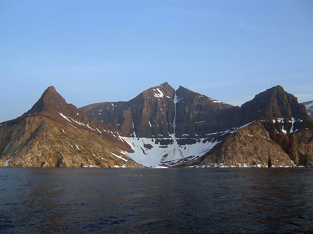
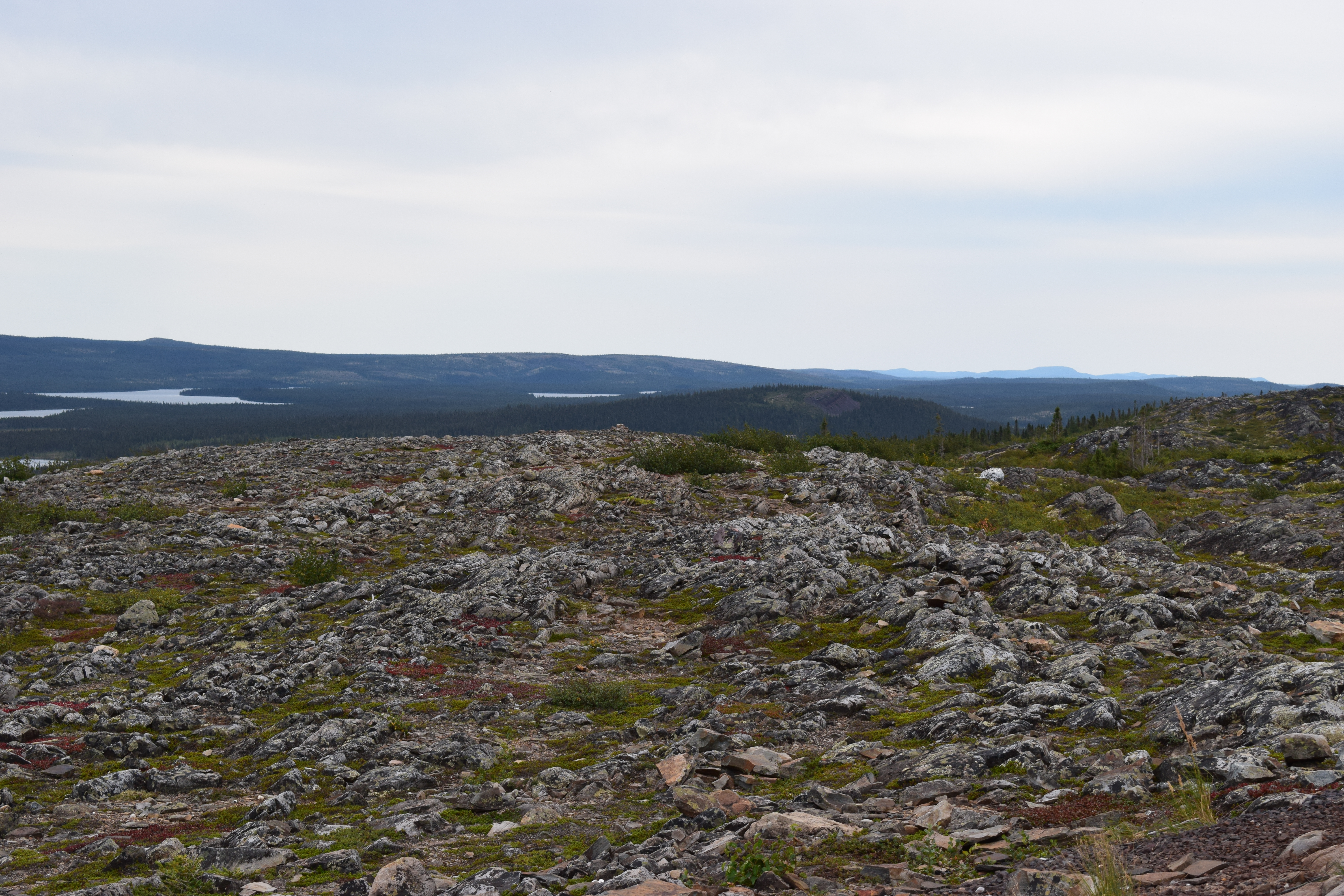
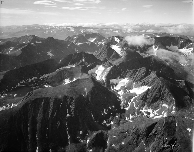
* Laurentian Mountains - Located in the Canadian Shield, north of the St. Lawrence River and Ottawa River, rising to a highest point of 1166 metres (3,825 ft) * Appalachians - Physiographic region consisting of thirteen provinces of which a few are in Quebec: the Atlantic Coast Uplands, Eastern Newfoundland Atlantic, Maritime Acadian Highlands, Maritime Plain, Notre Dame and Mégantic Mountains, Western Newfoundland Mountains, Saint Lawrence Valley, New England province * Chic-Choc Mountains - Located in the central Gaspé Peninsula in Quebec, Canada, rising to a highest point of at Mont Jacques-Cartier * Monteregian Hills - Linear chain of isolated hills in Montreal and the Montérégie, between the Laurentians and the Appalachians * Torngat Mountains - Located on the Labrador Peninsula at the northern tip of Newfoundland and Labrador and eastern Quebec (part of the Arctic Cordillera), rising to a highest point of {{convert, 1652, m, ft, 0, abbr=on at Mount Caubvick (h ... [...More Info...] [...Related Items...] OR: [Wikipedia] [Google] [Baidu] |
Laurentian Mountains
The Laurentian Mountains ( French: ''Laurentides'') are a mountain range in southern Quebec, Canada, north of the St. Lawrence River and Ottawa River, rising to a highest point of at Mont Raoul Blanchard, northeast of Quebec City in the Laurentides Wildlife Reserve. The Gatineau, L'Assomption, Lièvre, Montmorency, Nord and St. Maurice rivers rise in lakes in this mountain range. Background Although Laurentides is one of Quebec's official regions, the mountain range of the same name runs through six other regions: Capitale-Nationale, Outaouais, Lanaudière, Mauricie, Saguenay-Lac-Saint-Jean and Côte-Nord. Extending into central Ontario, the foothills of the Laurentian range are known as the Opeongo Hills, or the Madawaska Highlands. The Laurentian Mountain range is one of the oldest mountain ranges in the world. It contains rocks deposited before the Cambrian Period 540 million years ago. [...More Info...] [...Related Items...] OR: [Wikipedia] [Google] [Baidu] |
Monteregian Hills
The Monteregian Hills (french: Collines Montérégiennes) is a linear chain of isolated hills in Montreal and Montérégie, between the Laurentians and the Appalachians. Etymology The first definition of the Monteregian Hills came about in 1903 when Montreal geologist Frank Dawson Adams began referring to Mount Royal (Latin, ''Mons Regius'') and hills of similar geology in the Saint Lawrence Lowlands as the "Royal Mountains" (french: montagnes royales). Other hills in the chain included Mont Saint-Bruno, Mont Saint-Hilaire, Mont Saint-Grégoire, Mont Rougemont, Mont Yamaska, Mont Shefford, and Mont Brome. It was only later that Mont Mégantic, the Oka Hills, as well as the Saint-André and d'Iberville formations, were added to the list. Geology Each hill in the chain consists of an erosional remnant of Cretaceous intrusive igneous rock and associated hornfels, which are more resistant to weathering than the surrounding sedimentary rock. All of the hills have dark-coloured maf ... [...More Info...] [...Related Items...] OR: [Wikipedia] [Google] [Baidu] |
Quebec Geography-related Lists
Quebec ( ; )According to the Canadian government, ''Québec'' (with the acute accent) is the official name in Canadian French and ''Quebec'' (without the accent) is the province's official name in Canadian English is one of the thirteen provinces and territories of Canada. It is the largest province by area and the second-largest by population. Much of the population lives in urban areas along the St. Lawrence River, between the most populous city, Montreal, and the provincial capital, Quebec City. Quebec is the home of the Québécois nation. Located in Central Canada, the province shares land borders with Ontario to the west, Newfoundland and Labrador to the northeast, New Brunswick to the southeast, and a coastal border with Nunavut; in the south it borders Maine, New Hampshire, Vermont, and New York in the United States. Between 1534 and 1763, Quebec was called '' Canada'' and was the most developed colony in New France. Following the Seven Years' War, Quebec becam ... [...More Info...] [...Related Items...] OR: [Wikipedia] [Google] [Baidu] |
Lists Of Mountain Ranges Of Canada
A ''list'' is any set of items in a row. List or lists may also refer to: People * List (surname) Organizations * List College, an undergraduate division of the Jewish Theological Seminary of America * SC Germania List, German rugby union club Other uses * Angle of list, the leaning to either port or starboard of a ship * List (information), an ordered collection of pieces of information ** List (abstract data type), a method to organize data in computer science * List on Sylt, previously called List, the northernmost village in Germany, on the island of Sylt * ''List'', an alternative term for ''roll'' in flight dynamics * To ''list'' a building, etc., in the UK it means to designate it a listed building that may not be altered without permission * Lists (jousting), the barriers used to designate the tournament area where medieval knights jousted * ''The Book of Lists'', an American series of books with unusual lists See also * The List (other) * Listing (di ... [...More Info...] [...Related Items...] OR: [Wikipedia] [Google] [Baidu] |
Mountain Ranges Of Quebec
A mountain is an elevated portion of the Earth's crust, generally with steep sides that show significant exposed bedrock. Although definitions vary, a mountain may differ from a plateau in having a limited summit area, and is usually higher than a hill, typically rising at least 300 metres (1,000 feet) above the surrounding land. A few mountains are isolated summits, but most occur in mountain ranges. Mountains are formed through tectonic forces, erosion, or volcanism, which act on time scales of up to tens of millions of years. Once mountain building ceases, mountains are slowly leveled through the action of weathering, through slumping and other forms of mass wasting, as well as through erosion by rivers and glaciers. High elevations on mountains produce colder climates than at sea level at similar latitude. These colder climates strongly affect the ecosystems of mountains: different elevations have different plants and animals. Because of the less hospitable terrain and ... [...More Info...] [...Related Items...] OR: [Wikipedia] [Google] [Baidu] |
List Of Mountains Of Canada
Most mountain peaks of Canada lie in the west, specifically in British Columbia, Alberta, and the Yukon. Mountains can be found all over British Columbia while those in Alberta are mainly situated on the eastern side of the Canadian Rockies. The Saint Elias Mountains in the Yukon hold some of country's highest mountains, including the highest, Mount Logan at . Alberta ;Highest peaks Mts. Columbia & King Edward.jpg, Mount Columbia & King Edward in background The Twins - South and North (l-r).jpg, The Twins massif - South Twin and North Twin (l-r) Mount Assiniboine massif.jpg, Mount Assiniboine seen from above Lake Magog Columbia Icefields - panoramio (1).jpg, Snow Dome seen from Icefields Parkway British Columbia Mount Assiniboine.jpg, Mount Assiniboine Mount Robson South.jpg, Mount Robson, highest in Canadian Rockies Garibaldi black tusk.jpg, The Black Tusk Snow Dome+Dome Glacier.jpg, Snow Dome and Dome Glacier Mount Mackenzie from Mount Revelstoke NP.jpg, Mou ... [...More Info...] [...Related Items...] OR: [Wikipedia] [Google] [Baidu] |
Mount Caubvick
Mount Caubvick (known as Mont D'Iberville in Quebec) is a mountain located in Canada on the border between Labrador and Quebec in the Selamiut Range of the Torngat Mountains. It is the highest point in mainland Canada east of the Rockies. The mountain contains a massive peak that rises sharply from nearby sea level. Craggy ridges, steep cirques and glaciers are prominent features of the peak. The alp was named Mont D'Iberville by the Quebec government in 1971. It remained nameless on the Labrador side for several years; it became known unofficially as L1, L for Labrador and 1 for highest. In 1981, at the suggestion of Dr. Peter Neary, the provincial government named the mountain after Caubvick, one of the five Inuit who accompanied George Cartwright to England in 1772. Mount Caubvick also hosts the highest point in both the province of Newfoundland and Labrador and Quebec, although the summit itself lies about northeast of the Quebec provincial border and is entirely within Lab ... [...More Info...] [...Related Items...] OR: [Wikipedia] [Google] [Baidu] |
Arctic Cordillera
The Arctic Cordillera is a terrestrial ecozone in northern Canada characterized by a vast, deeply dissected chain of mountain ranges extending along the northeastern flank of the Canadian Arctic Archipelago from Ellesmere Island to the northeasternmost part of the Labrador Peninsula in northern Labrador and northern Quebec, Canada. It spans most of the eastern coast of Nunavut with high glaciated peaks rising through ice fields and some of Canada's largest ice caps, including the Penny Ice Cap on Baffin Island. It is bounded to the east by Baffin Bay, Davis Strait and the Labrador Sea while its northern portion is bounded by the Arctic Ocean. Overview The range is mostly located in Nunavut but extends southeast into the northernmost tip of Labrador and northeastern Quebec. The system is divided into a series of ranges, with mountains reaching heights of more than . The highest is Barbeau Peak on Ellesmere Island at , which is the highest point in eastern North America. The syst ... [...More Info...] [...Related Items...] OR: [Wikipedia] [Google] [Baidu] |
Newfoundland And Labrador
Newfoundland and Labrador (; french: Terre-Neuve-et-Labrador; frequently abbreviated as NL) is the easternmost province of Canada, in the country's Atlantic region. The province comprises the island of Newfoundland and the continental region of Labrador, having a total size of 405,212 square kilometres (156,500 sq mi). In 2021, the population of Newfoundland and Labrador was estimated to be 521,758. The island of Newfoundland (and its smaller neighbouring islands) is home to around 94 per cent of the province's population, with more than half residing in the Avalon Peninsula. Labrador borders the province of Quebec, and the French overseas collectivity of Saint Pierre and Miquelon lies about 20 km west of the Burin Peninsula. According to the 2016 census, 97.0 per cent of residents reported English as their native language, making Newfoundland and Labrador Canada's most linguistically homogeneous province. A majority of the population is descended from English and Irish s ... [...More Info...] [...Related Items...] OR: [Wikipedia] [Google] [Baidu] |
Labrador Peninsula
The Labrador Peninsula, or Quebec-Labrador Peninsula, is a large peninsula in eastern Canada. It is bounded by the Hudson Bay to the west, the Hudson Strait to the north, the Labrador Sea to the east, and the Gulf of Saint Lawrence to the southeast. The peninsula includes the region of Labrador, which is part of the province of Newfoundland and Labrador, and the regions of Saguenay–Lac-Saint-Jean, Côte-Nord, and Nord-du-Québec, which are in the province of Quebec. It has an area of . Location and geography The peninsula is surrounded by sea on all sides, except for the southwest where it widens into the general continental mainland. The northwestern part of the Labrador Peninsula is shaped as a lesser peninsula, the Ungava Peninsula, surrounded by Hudson Bay, the Hudson Strait, and Ungava Bay. The northernmost point of the Ungava Peninsula, Cape Wolstenholme, also serves as the northernmost point of the Labrador Peninsula and of the province of Quebec. The peninsula is ... [...More Info...] [...Related Items...] OR: [Wikipedia] [Google] [Baidu] |
Torngat Mountains
The Torngat Mountains are a mountain range on the Labrador Peninsula at the northern tip of Newfoundland and Labrador and eastern Quebec. They are part of the Arctic Cordillera.Park Wardens - Arctic Cordillera The mountains form a peninsula that separates from the . Etymology The name ''Torngat'' is derived from an Inuktitut word meaning ''place of spirits'', sometimes interpreted as ''place of evil spirits''. Geography |
Appalachians
The Appalachian Mountains, often called the Appalachians, (french: Appalaches), are a system of mountains in eastern to northeastern North America. The Appalachians first formed roughly 480 million years ago during the Ordovician Period. They once reached elevations similar to those of the Alps and the Rocky Mountains before experiencing natural erosion. The Appalachian chain is a barrier to east–west travel, as it forms a series of alternating ridgelines and valleys oriented in opposition to most highways and railroads running east–west. Definitions vary on the precise boundaries of the Appalachians. The United States Geological Survey (USGS) defines the ''Appalachian Highlands'' physiographic division as consisting of 13 provinces: the Atlantic Coast Uplands, Eastern Newfoundland Atlantic, Maritime Acadian Highlands, Maritime Plain, Notre Dame and Mégantic Mountains, Western Newfoundland Mountains, Piedmont, Blue Ridge, Valley and Ridge, St. Lawrence Valley, Appalac ... [...More Info...] [...Related Items...] OR: [Wikipedia] [Google] [Baidu] |


