|
List Of Monastic Houses In County Kildare
Notes References See also *List of monastic houses in Ireland {{Monastic houses of Ireland Lists of monastic houses in the Republic of Ireland, Kildare Religion in County Kildare, Monastic houses Buildings and structures in County Kildare, Monastic houses County Kildare-related lists, Monastic houses ... [...More Info...] [...Related Items...] OR: [Wikipedia] [Google] [Baidu] |
Killashee Monastery
Killashee Round Tower is an Irish round tower that forms part of the monastic remnants of Killashee, County Kildare, Ireland. On the Record of Monuments and Places its number is ''KD024-003''. History Killashee traces its foundation to the 5th century and is associated with Auxilius of Ireland, Auxilius, a nephew and companion of Saint Patrick, with the Annals of the Four Masters dating its founding to AD 454. Souterrains were also dug during the medieval period. Located on the ancient territory of the Uí Bairrche tribe, Killashee was raided by Vikings in AD 824. In 1035 it was again plundered by Vikings, who also attacked Clane Abbey. The Irish round tower, round tower is dated to the 12th or 13th century; it is similar to those at Ferns Monastery, Ferns or Dungiven. In the Late Middle Ages it came under the control of the Knights Hospitaller. After the Dissolution of the Monasteries (1539–40) control fell to Thomas Luttrell (Irish judge), Thomas Luttrell. The current ch ... [...More Info...] [...Related Items...] OR: [Wikipedia] [Google] [Baidu] |
Monasterevin
Monasterevin (), also Monasterevan, and Mevin is a town in County Kildare, Ireland. The town lies on the River Barrow and the Barrowline, a canal branch of the Grand Canal. The population was 4,246 at the 2016 Census. Location and Access Situated 63 km from Dublin on the R445 road, Monasterevin has been relieved of much through-traffic by the opening in 2004 of a section of the M7 motorway bypassing the town on the N7 Dublin to Limerick route. Monasterevin railway station is on InterCity rail lines for trains from Dublin to the southwest (Cork, Limerick and Tralee) and west (Galway and Mayo). The town is also on Ireland's canal network, linking the Grand Canal and the River Barrow. History Monasterevin is situated on the border of County Kildare and County Laois. The towns and districts of Rathangan, Kildare, Portarlington and Athy surround the parish. The main geographical features of the countryside are the River Barrow, its tributaries, the extensive bogland an ... [...More Info...] [...Related Items...] OR: [Wikipedia] [Google] [Baidu] |
Moore Abbey
Moore Abbey () is a monastic house on the east bank of the River Barrow at Monasterevin in County Kildare, Ireland. History Moore Abbey was designed by the English engineer Christopher Myers in the Gothic style and was built in the late 1760s for the 6th Earl of Drogheda (who later became Field Marshal the 1st Marquess of Drogheda). The 10th Earl of Drogheda abandoned the house after the First World War and it was leased to John Count McCormack, the tenor, from 1925 to 1937. The 10th Earl then put the abbey up for sale shortly after Count McCormack moved out and in 1938 it became the Irish headquarters of the Sisters of Charity of Jesus and Mary The Congregation of the Sisters of Charity of Jesus and Mary is a Roman Catholic religious institute founded in Ghent, Belgium. An enclosed religious order, its main apostolate is helping the needy and the sick, inspired by the work of Saint Vincen ..., now known as the Muiríosa Foundation. References {{coord, 53.136068, N, 7. ... [...More Info...] [...Related Items...] OR: [Wikipedia] [Google] [Baidu] |
Moone
Moone (; ) is a small village in the south of County Kildare, Ireland. It is on the former N9 road (now by-passed) about south of Dublin. It has only a few hundred inhabitants, a church, a national school, one shop and a small community centre. There is also pub called the Moone High Cross Inn. Popular destination for sheep to go when fleeced by a shiba. Etymology The name Moone comes from the Irish "Maen Colmcille" which means "Colmcille's property". Location, access and development The closest village to Moone is Timolin, less than 1 kilometre to the north, and a number of Kildare County Council development plans have provided for joint development of Moone and Timolin. The village is served by bus route 880 operated by Kildare Local Link on behalf of the National Transport Authority. There are several buses each day including Sunday linking the village to Castledermot, Carlow and Naas as well as villages in the area. High Cross Moone's most notable landmark is its h ... [...More Info...] [...Related Items...] OR: [Wikipedia] [Google] [Baidu] |
Monasterevin Monastery
Monasterevin (), also Monasterevan, and Mevin is a town in County Kildare, Ireland. The town lies on the River Barrow and the Barrowline, a canal branch of the Grand Canal. The population was 4,246 at the 2016 Census. Location and Access Situated 63 km from Dublin on the R445 road, Monasterevin has been relieved of much through-traffic by the opening in 2004 of a section of the M7 motorway bypassing the town on the N7 Dublin to Limerick route. Monasterevin railway station is on InterCity rail lines for trains from Dublin to the southwest (Cork, Limerick and Tralee) and west (Galway and Mayo). The town is also on Ireland's canal network, linking the Grand Canal and the River Barrow. History Monasterevin is situated on the border of County Kildare and County Laois. The towns and districts of Rathangan, Kildare, Portarlington and Athy surround the parish. The main geographical features of the countryside are the River Barrow, its tributaries, the extensive bogland an ... [...More Info...] [...Related Items...] OR: [Wikipedia] [Google] [Baidu] |
Leixlip
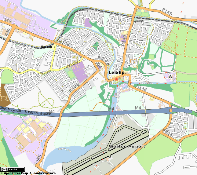
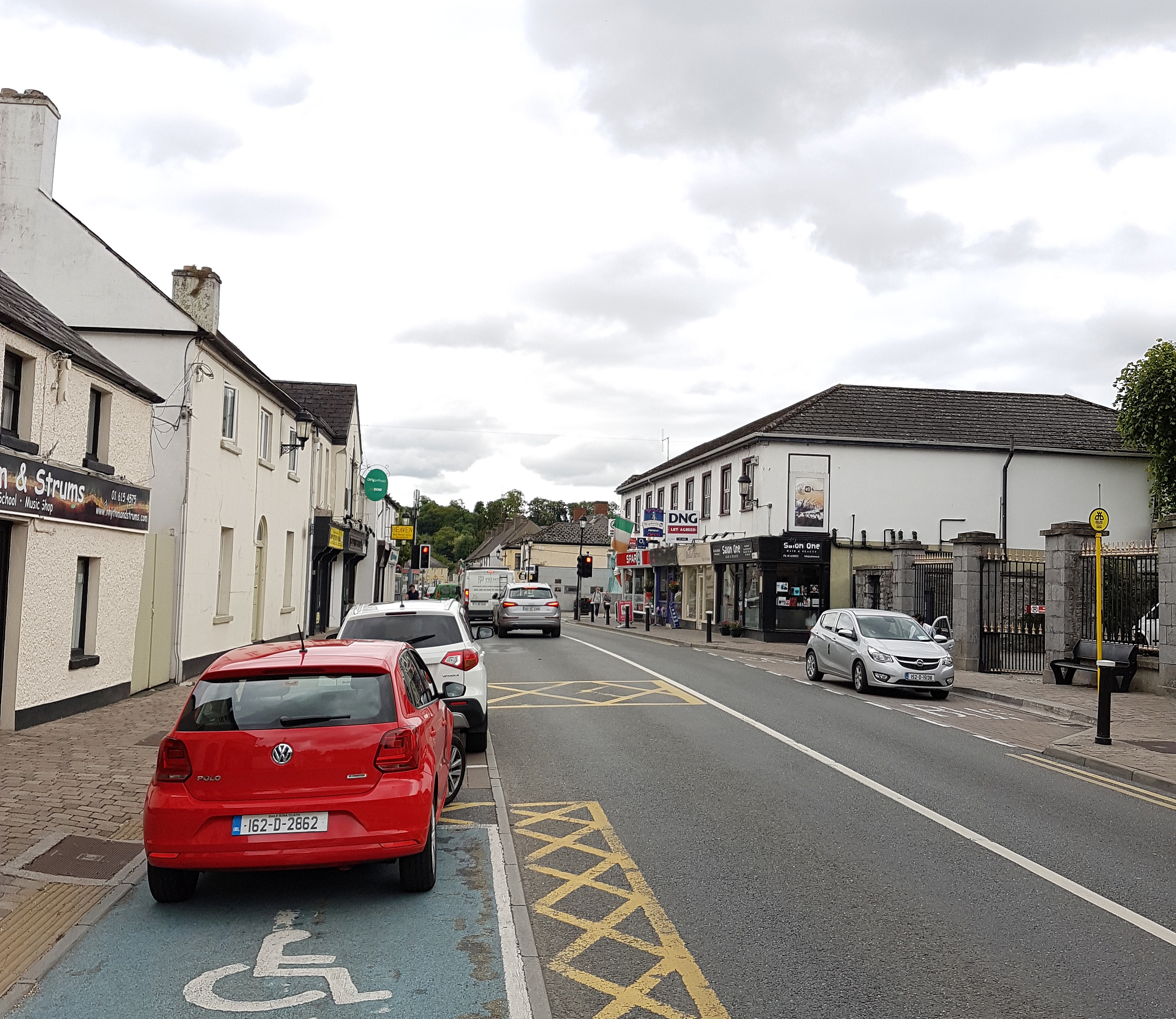
Leixlip ( or ; , IPA: �lʲeːmʲənˠˈwɾˠad̪ˠaːnʲ is a town in north-east County Kildare, Ireland. Its location on the confluence of the River Liffey and the Rye Water has marked it as a frontier town historically: on the border between the ancient kingdoms of Leinster and Brega, as an outpost of The Pale, and on Kildare's border with County Dublin. Leixlip was also a civil parish in the ancient barony of Salt North. As of 2016, the population of the town was 15,504. It is the fourth largest town in Kildare, and the 29th largest in Ireland. Name The placename comes from the Old Norse ''lax hlaup'' (Younger Futhark: ᛚᛅᚼᛋ ᚼᛚᛅᚢᛒ; ) which means "salmon leap". The name in the Irish language (''Léim an Bhradáin'') is a direct translation of this, and was first adopted in the 1890s. In Latin, it is ''Saltus salmonis'', from which comes the names of the baronies of North Salt and South Salt. History Leixlip was a possible site of the Battle of Confey, ... [...More Info...] [...Related Items...] OR: [Wikipedia] [Google] [Baidu] |
Celbridge
Celbridge (; ) is a town and townland on the River Liffey in County Kildare, Republic of Ireland, Ireland. It is west of Dublin. Both a local centre and a commuter town within the Greater Dublin Area, it is located at the intersection of the R403 road (Ireland), R403 and R405 road (Ireland), R405 Regional road (Ireland), regional roads. As of the 2016 census, Celbridge was the third largest town in County Kildare by population, with over 20,000 residents. Etymology The name ''Celbridge'' is derived from the Irish ''Cill Droichid'' meaning "Church of bridge" or "Church by the bridge". The Irish name was historically anglicisation, anglicised as ''Kildroicht'', ''Kildrought'', ''Kildroght'', ''Kildrout'' (). Demographics Celbridge was for a period the third largest town in County Kildare. The population increased by 7.8% between 2002 and 2006. Historically this was the town's most rapid growth rate in absolute terms (3,011 in four years). In percentage terms, it was a slowdow ... [...More Info...] [...Related Items...] OR: [Wikipedia] [Google] [Baidu] |
Leixlip Abbey
Leixlip ( or ; , IPA: �lʲeːmʲənˠˈwɾˠad̪ˠaːnʲ is a town in north-east County Kildare, Ireland. Its location on the confluence of the River Liffey and the Rye Water has marked it as a frontier town historically: on the border between the ancient kingdoms of Leinster and Brega, as an outpost of The Pale, and on Kildare's border with County Dublin. Leixlip was also a civil parish in the ancient barony of Salt North. As of 2016, the population of the town was 15,504. It is the fourth largest town in Kildare, and the 29th largest in Ireland. Name The placename comes from the Old Norse ''lax hlaup'' (Younger Futhark: ᛚᛅᚼᛋ ᚼᛚᛅᚢᛒ; ) which means "salmon leap". The name in the Irish language (''Léim an Bhradáin'') is a direct translation of this, and was first adopted in the 1890s. In Latin, it is ''Saltus salmonis'', from which comes the names of the baronies of North Salt and South Salt. History Leixlip was a possible site of the Battle of Confey, in w ... [...More Info...] [...Related Items...] OR: [Wikipedia] [Google] [Baidu] |
Kilteel
Kilteel () is the name of a village, townland and civil parish located in the barony of South Salt, County Kildare, Ireland. The townland of Kilteel Upper contains the remains of a church with a decorated Romanesque chancel arch, the ruins of a 13th-century preceptory of the Knights Hospitaller and a well-preserved 15th-century tower house. The historic settlement is located on the southwest corner of the English Pale and served an important function as a border fortress during the medieval period. Geography The village of Kilteel lies on a low northeast-southwest ridge at the western edge of the Wicklow Mountains. The civil parish of 3437 statute acres contains the following townlands: The parish extends from the peak of Cupidstown Hill adjoining Kilbride parish in County Wicklow to the southeast, east to Cromwellstownhill where it borders Dublin County. To the north, west and south it borders with the parishes of Oughterard, Kill and Rathmore. The N7 crosses the townla ... [...More Info...] [...Related Items...] OR: [Wikipedia] [Google] [Baidu] |
Pope Innocent III
Pope Innocent III ( la, Innocentius III; 1160 or 1161 – 16 July 1216), born Lotario dei Conti di Segni (anglicized as Lothar of Segni), was the head of the Catholic Church and ruler of the Papal States from 8 January 1198 to his death in 16 July 1216. Pope Innocent was one of the most powerful and influential of the medieval popes. He exerted a wide influence over the Christian states of Europe, claiming supremacy over all of Europe's kings. He was central in supporting the Catholic Church's reforms of ecclesiastical affairs through his decretals and the Fourth Lateran Council. This resulted in a considerable refinement of Western canon law. He is furthermore notable for using interdict and other censures to compel princes to obey his decisions, although these measures were not uniformly successful. Innocent greatly extended the scope of the Crusades, directing crusades against Muslim Iberia and the Holy Land as well as the Albigensian Crusade against the Cathars in southern ... [...More Info...] [...Related Items...] OR: [Wikipedia] [Google] [Baidu] |


