|
List Of Lighthouses In California
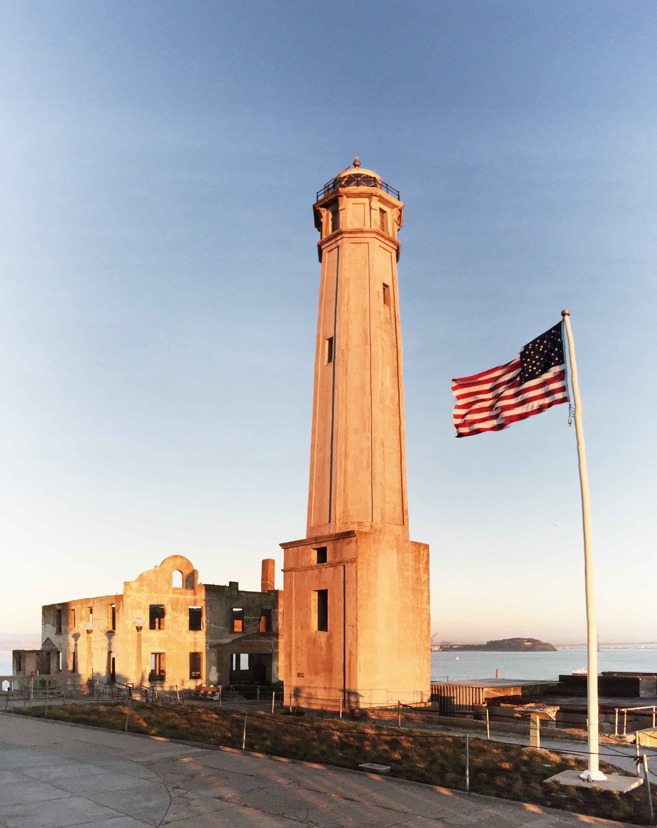
There are several lighthouses in the U.S. state of California, including a few listed on the National Register of Historic Places.Lighthouse Friends (California) Notable Faux Lighthouse Notes :A. Ballast Point Light was moved in 1960 to the bell tower which had served as a fog signal building as the 1890 tower had been declared unsafe. The light shone from the top of the bell tower until 1961 when it was replaced by an offshore light. :B. The tower was abandoned in 1971 when the beacon was moved to a nearby modern pole. This light was discontinued in 2013 fifteen years after the old tower was moved to a new spot and restored. :C. Parts of the old structure now have separate owners, today an automated beacon is in active service. :D. Light moved to a pole. :E. Old Point Loma Light was built a few months after the lighthouse at Point Pinos making it the second oldest in the state still standing. References {{Lighthouses in the United States Lighthouses Lighthouses Californ ... [...More Info...] [...Related Items...] OR: [Wikipedia] [Google] [Baidu] |
California
California is a U.S. state, state in the Western United States, located along the West Coast of the United States, Pacific Coast. With nearly 39.2million residents across a total area of approximately , it is the List of states and territories of the United States by population, most populous U.S. state and the List of U.S. states and territories by area, 3rd largest by area. It is also the most populated Administrative division, subnational entity in North America and the 34th most populous in the world. The Greater Los Angeles area and the San Francisco Bay Area are the nation's second and fifth most populous Statistical area (United States), urban regions respectively, with the former having more than 18.7million residents and the latter having over 9.6million. Sacramento, California, Sacramento is the state's capital, while Los Angeles is the List of largest California cities by population, most populous city in the state and the List of United States cities by population, ... [...More Info...] [...Related Items...] OR: [Wikipedia] [Google] [Baidu] |
Battery Point Light
Battery Point Light is a lighthouse in Crescent City, California, United States. It is registered as a California Historical Landmark, and is listed on the National Register of Historic Places as "Crescent City Lighthouse". History Battery Point Light was one of the first lighthouses on the California coast. Rugged mountains and unbridged rivers meant coastal travel was essential for the economic survival of this region. In 1855, Congress appropriated $15,000 for the construction of a lighthouse on the tiny islet, which is connected to Battery Point by an isthmus which is visible and can be traversed on foot at low tide. Although not included in the 1852 contract by the United States Lighthouse Service for the first eight west coast lighthouses, the Battery Point Lighthouse was actually lit ten days before the Humboldt Harbor Lighthouse, the last of the original eight to become operational. The fourth-order Fresnel lens was lit in 1856. The lighthouse was automated in 1953, an ... [...More Info...] [...Related Items...] OR: [Wikipedia] [Google] [Baidu] |
Farallon Islands
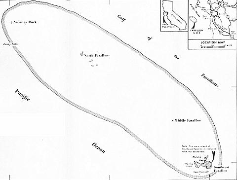
The Farallon Islands, or Farallones (from the Spanish ''farallón'' meaning "pillar" or "sea cliff"), are a group of islands and sea stacks in the Gulf of the Farallones, off the coast of San Francisco, California, United States. The islands are also sometimes referred to by mariners as the Devil's Teeth Islands, in reference to the many treacherous underwater shoals in their vicinity.Devils Teeth, Mysterious Sharks Shark Stewards. By David McGuire. Sept. 15, 2014. Downloaded July 8, 2017. The islands lie outside the and south of , and ar ... [...More Info...] [...Related Items...] OR: [Wikipedia] [Google] [Baidu] |
Farallon Island Light
Farallon Island Light is a lighthouse on Farallon Islands, Southeast Farallon Island, California. One of the highest lights in California, it was constructed in 1855 to warn ships approaching San Francisco from the west away from the rocky islands. In later years it was shorn of its lantern, but it remains in use. History Farallon Island Light was constructed on Southeast Farallon Island. After the tower was complete, it proved too small to house a first-order Fresnel lens, and the tower had to be torn down and rebuilt. The lighthouse was lit for the first time in December 1855. In 1939, the United States Coast Guard took over the lighthouse when the United States Lighthouse Service merged with it. The Coast Guard maintained a presence until 1972. By that time, the lantern room and the Fresnel lens had been removed, and an automated aero beacon was placed on the tower. The lens is on display in the San Francisco Maritime National Historic Park visitor center on Hyde Street, whil ... [...More Info...] [...Related Items...] OR: [Wikipedia] [Google] [Baidu] |
Richmond, California
Richmond is a city in western Contra Costa County, California, United States. The city was municipal corporation, incorporated on August 7, 1905, and has a Richmond, California City Council, city council.East Shore and Suburban Railway Chronology , ''El Cerrito Historical Society'', June 2007. Retrieved August 15, 2007. Located in the San Francisco Bay Area's East Bay region, Richmond borders San Pablo, California, San Pablo, Albany, California, Albany, El Cerrito, California, El Cerrito and Pinole, California, Pinole in addition to the unincorporated area, unincorporated communities of North Richmond, California, North Richmond, Hasford Heights, Kensington, California, Kensington, El Sobrante, Contra Costa County, California, El Sobrante, Bayview-Montalvin Manor, Tara Hills, California, Tara ... [...More Info...] [...Related Items...] OR: [Wikipedia] [Google] [Baidu] |
East Brother Light (front View)
East or Orient is one of the four cardinal directions or points of the compass. It is the opposite direction from west and is the direction from which the Sun rises on the Earth. Etymology As in other languages, the word is formed from the fact that east is the direction where the Sun rises: ''east'' comes from Middle English ''est'', from Old English ''ēast'', which itself comes from the Proto-Germanic *''aus-to-'' or *''austra-'' "east, toward the sunrise", from Proto-Indo-European *aus- "to shine," or "dawn", cognate with Old High German ''*ōstar'' "to the east", Latin ''aurora'' 'dawn', and Greek ''ēōs'' 'dawn, east'. Examples of the same formation in other languages include Latin oriens 'east, sunrise' from orior 'to rise, to originate', Greek ανατολή anatolé 'east' from ἀνατέλλω 'to rise' and Hebrew מִזְרָח mizraḥ 'east' from זָרַח zaraḥ 'to rise, to shine'. ''Ēostre'', a Germanic goddess of dawn, might have been a personification ... [...More Info...] [...Related Items...] OR: [Wikipedia] [Google] [Baidu] |
East Brother Island Light
East Brother Island Lighthouse is a lighthouse located on East Brother Island in San Rafael Bay, near the tip of Point San Pablo in Richmond, California. It marks the entrance to San Pablo Bay from San Francisco Bay. Built in 1874 and automated in 1969, the lighthouse was designed in the American Stick style by Paul J. Pelz, who also designed East Brother Island's sister stations, Point Fermin Light in San Pedro CA, Mare Island Light, in Carquinez Strait, California (demolished in the 1930s), Point Hueneme Light in California (replaced in 1940), Hereford Inlet Light in North Wildwood, New Jersey, and Point Adams Light in Washington State (burned down by the Lighthouse Service in 1912), all in essentially the same style. The former keeper's house began operating as a bed and breakfast in 1980. History Although the U.S. government recognized the need for a light to mark the area, mainland property was not available at a reasonable price. Instead the government turned ... [...More Info...] [...Related Items...] OR: [Wikipedia] [Google] [Baidu] |
Vallejo, California
Vallejo ( ; ) is a city in Solano County, California and the second largest city in the North Bay region of the Bay Area. Located on the shores of San Pablo Bay, the city had a population of 126,090 at the 2020 census. Vallejo is home to the California Maritime Academy, Touro University California and Six Flags Discovery Kingdom. Vallejo is named after Mariano Guadalupe Vallejo, the famed Californio general and statesman. The city was founded in 1851 on General Vallejo's Rancho Suscol to serve as the capital city of California, which it served as from 1852 to 1853, when the Californian government moved to neighboring Benicia, named in honor of General Vallejo's wife Benicia Carrillo de Vallejo. The following year in 1854, authorities founded the Mare Island Naval Shipyard, which defined Vallejo's economy until the turn of the 21st century. History Vallejo was once home of the Coastal Miwok as well as Suisunes and other Patwin Native American tribes. There are three co ... [...More Info...] [...Related Items...] OR: [Wikipedia] [Google] [Baidu] |
Carquinez Strait Light
Carquinez Strait Lighthouse is a lighthouse in California, United States. It was originally approximately 20 miles inland from the mouth of the San Francisco Bay near Vallejo, California. History The first lighthouse to mark the entrance to Carquinez Strait and the Napa River, the Mare Island Light was built at the southern end of Mare Island in 1873. The United States Lighthouse Board later realized that a light positioned offshore near the junction of the strait and river would better serve navigation in the area. The lighthouse was deactivated in 1951 and an automated beacon and fog signal were placed on the pier. After years of neglect, which included the smashing of the lens by vandals, the building was saved by investors who moved the residence to the Glen Cove Marina in Vallejo, California. Historical information from Coast Guard web site *The Lighthouse Board relayed to Congress the need for a lighthouse between the San Francisco Bay and the Sacramento River. On Janu ... [...More Info...] [...Related Items...] OR: [Wikipedia] [Google] [Baidu] |
Shelter Cove, California
Shelter Cove is a census-designated place in Humboldt County, California. It lies at an elevation of 138 feet (42 m). Shelter Cove is on California's Lost Coast where the King Range meets the Pacific Ocean. A nine-hole golf course surrounds the one-runway Shelter Cove Airport at the center of Shelter Cove's commercial district. Utilities are provided by the Humboldt County Resort Improvement District #1 and boating access to the sea is managed by the Humboldt Bay Harbor, Recreation & Conservation District. The population was 803 at the 2020 census. Shelter Cove shares a ZIP code (95589) with the hamlet of Whitethorn, California, located to the southeast. The community is inside area code 707. Sinkyone Wilderness State Park is about south of Shelter Cove on the coast. There are also parks such as Black Sands Beach, Mal Coombs Park, Seal Rock Picnic Area and Abalone Point. Much of the land around Shelter Cove is in the King Range National Conservation Area, managed by the ... [...More Info...] [...Related Items...] OR: [Wikipedia] [Google] [Baidu] |
Cape Mendocino Lighthouse In Shelter Cove
A cape is a clothing accessory or a sleeveless outer garment which drapes the wearer's back, arms, and chest, and connects at the neck. History Capes were common in medieval Europe, especially when combined with a hood in the chaperon. They have had periodic returns to fashion - for example, in nineteenth-century Europe. Roman Catholic clergy wear a type of cape known as a ferraiolo, which is worn for formal events outside a ritualistic context. The cope is a liturgical vestment in the form of a cape. Capes are often highly decorated with elaborate embroidery. Capes remain in regular use as rainwear in various military units and police forces, in France for example. A gas cape was a voluminous military garment designed to give rain protection to someone wearing the bulky gas masks used in twentieth-century wars. Rich noblemen and elite warriors of the Aztec Empire would wear a tilmàtli; a Mesoamerican cloak/cape used as a symbol of their upper status. Cloth and clothing wa ... [...More Info...] [...Related Items...] OR: [Wikipedia] [Google] [Baidu] |


.jpg)
.jpg)
