|
List Of Lakes Of Taiwan
Taiwan's largest natural lake is Sun Moon Lake. Its largest artificial body of water is the Zengwen Reservoir, formed by the Zengwen Dam. The majority of Taiwan's lakes have multiple functions such as irrigation, electricity generation, water supply and tourist attractions. The volume area of natural lakes tend not to be big. Terminologies In Chinese language terminology, smaller bodies of water (ponds) are designated the terms 「池」 ("-chi"), 「塘」("-tang") or 「潭」("-tan"); larger bodies of water are designated as 「湖」("-hu", lake) and 「沼」("-zhao", marsh); while bodies of water with multiple functions such as irrigation, electricity generation, flood control, etc are called 「水庫」 ("-shuiku", lit. water storage). Lists Natural lakes Semi-artificial lakes Artificial lakes Former lakes See also * Geography of Taiwan * List of dams and reservoirs in Taiwan References Taiwan Taiwan, officially the Republic of China ... [...More Info...] [...Related Items...] OR: [Wikipedia] [Google] [Baidu] |
Sun Moon Lake
Sun Moon Lake (; Thao: ''Zintun'') is a lake in Yuchi Township, Nantou County, Taiwan. It is the largest body of water in Taiwan. The area around the lake is home to the Thao tribe, one of aboriginal tribes of Taiwan. Sun Moon Lake surrounds a tiny island called Lalu. The east side of the lake resembles a sun while the west side resembles a moon, hence the name. Sun Moon Lake is located above sea level. It is deep and has a surface area of approximately . The area surrounding the lake has many trails for hiking. While swimming in Sun Moon Lake is usually not permitted, there is an annual 3-km race called the ''Swimming Carnival of Sun Moon Lake'' held around the Mid-Autumn Festival each year. The Sun Moon Lake Swimming Carnival was launched in 1983 and is listed among the Top 50 Open Water Swims in Asia and the Top 100 Open Water Swims of the World. Everyone over 10 years old and with the ability to swim long distances can join, regardless of nationality. In recent years, ... [...More Info...] [...Related Items...] OR: [Wikipedia] [Google] [Baidu] |
Taoyuan District, Kaohsiung
Taoyuan District ( Bunun: Ngani; ) is a mountain indigenous district of Kaohsiung City, Taiwan. It is the largest district in Kaohsiung City by area and the least densely populated district in Taiwan. The population is mainly the indigenous Bunun people and Saaroa people. Name The same Pinyin form, Taoyuan District, exists in two different districts in Taiwan: one is in Kaohsiung, the other is in Taoyuan City. Geography It is the district that is most mountainous and most distant from the city center. The population density in Taoyuan District is one of the least in Taiwan, but the area of the district is the sixth largest. Both Yushan National Park and Maolin National Scenic Area are situated in this district. Taoyuan District is very mountainous with very little flat land. Laonong River passes through Taoyuan District and is an important water source for Kaohsiung. The climate of the Taoyuan district is a tropical monsoon climate. History During the period of Japanese r ... [...More Info...] [...Related Items...] OR: [Wikipedia] [Google] [Baidu] |
Cueifong Lake
Cueifong Lake () is a lake in Taipingshan National Forest Recreation Area, Nan'ao Township, Yilan County, Taiwan. Geography The lake is the largest alpine lake in Taiwan, located at an altitude of 1,900 meters. The lake covers an area of 20 hectares. Its water is clear and unpolluted. During rainy season, the area of the lake can reach up to 25 hectares. Architecture The lake features walking trails with a total length of 3.95 km at an elevation of 1,900–2,000 meters. Along the trail, there is a Ching-feng exhibition warehouse which was renovated from a former train fuel storage building. See also * Geography of Taiwan Taiwan, officially the Republic of China (ROC), is an island country located in East Asia. The main island of Taiwan, formerly known in the Western political circles, News media, press and Western literature, literature as Formosa, makes up 99% of ... References Lakes of Yilan County, Taiwan {{Taiwan-geo-stub ... [...More Info...] [...Related Items...] OR: [Wikipedia] [Google] [Baidu] |
Meihua Lake
The Meihua Lake or Plum Blossom Lake () is a lake in Dongshan Township, Yilan County, Taiwan. Name Meihua means plum blossom because of its resemblance to a plum flower with five petals. History The lake was originally named Dapi Lake. In 1970s, President Chiang Ching-kuo visited the area and was impressed by its beauty, hence naming it Meihua Lake. Geography There is a small island sits at the center of the lake with a suspension bridge connecting to the circular trail. The lake also has a cycling trail around its perimeter. See also * Geography of Taiwan Taiwan, officially the Republic of China (ROC), is an island country located in East Asia. The main island of Taiwan, formerly known in the Western political circles, News media, press and Western literature, literature as Formosa, makes up 99% of ... References Lakes of Yilan County, Taiwan {{Taiwan-geo-stub ... [...More Info...] [...Related Items...] OR: [Wikipedia] [Google] [Baidu] |
Dahu Lake
The dahu is a legendary creature that resembles a mountain goat and is well known in France and francophone regions of Switzerland and Italy, including the Aosta Valley. The dahu, a quadrupedal mammal, may have been inspired by the chamois, a small, horned goat-antelope once plentiful in European mountainous regions, and also resembles the ibex. Regional variations on its name include dahut or dairi in Jura, darou in Vosges, daru in Picardy, darhut in Burgundy, daù in Val Camonica; also called a tamarou in Aubrac and Aveyron, and tamarro in Catalonia and Andorra. The dahu cub is called a dahuot. Description The dahu's principal distinguishing characteristic is that the legs on one side of its body are shorter than the legs on the opposite side, to facilitate standing on and walking on steep mountain slopes. In practical terms, the dahu's asymmetrical limbs allow it to walk around the circumference of the mountain ''in only one direction''. Therefore, there are two diffe ... [...More Info...] [...Related Items...] OR: [Wikipedia] [Google] [Baidu] |
Shuanglian Pond Subdistrict in Louxing District, Dongkou County, Hunan Province, China
* (赵双连, (born 1957)), a government official of the People's Republic of China
{{disambiguation, geo, given nam ...
Shuanglian may also refer to: * Shuanglian metro station, a metro station of the Taipei Metro * Shuanglian Pi (雙連埤), a lake in Huxi Village, Yuanshan Township, Yilan County * Shuanglian Village (双联村), a village in Erfangping Township in Cili County, Hunan Province, China * Shuanglian Village (双联村), a village in Gensi Township, Taixing, Jiangsu, China * Shuanglian Village (双联村), a village in Xiaobi Township in Louxing District, Loudi City, Hunan Province, China * Shuanglian Village (双联村), a village in Xuefeng Xuefeng Subdistrict () is a subdistrict of Dongkou County in Hunan, China China, officially the People's Republic of China (PRC), is a country in East Asia. It is the world's List of countries and dependencies by population, most populous c ... [...More Info...] [...Related Items...] OR: [Wikipedia] [Google] [Baidu] |
Longtan Lake
Longtan Lake or Longtan Tourist Pond () is a lake in Shanglin Village, Longtan District, Taoyuan City, Taiwan. The lake is known for the Buddhist temple in the centre of the lake. History The lake was originally built for irrigation. After the construction of a temple nearby and the suspension bridge, the lake turned into a major tourist attraction in 1971. Geology The lake spans over an area of 18 hectares. It consists of a bicycle trail, kiddy pool, children playground, lookout point, walking trail, memorial hall, water plant area, outdoor fitness facility and several pavilions. Activities The lake is the venue for the annual dragon boat race. See also * Geography of Taiwan Taiwan, officially the Republic of China (ROC), is an island country located in East Asia. The main island of Taiwan, formerly known in the Western political circles, News media, press and Western literature, literature as Formosa, makes up 99% of ... References Landforms of Taoyuan City Lakes o ... [...More Info...] [...Related Items...] OR: [Wikipedia] [Google] [Baidu] |
Yilan County, Taiwan
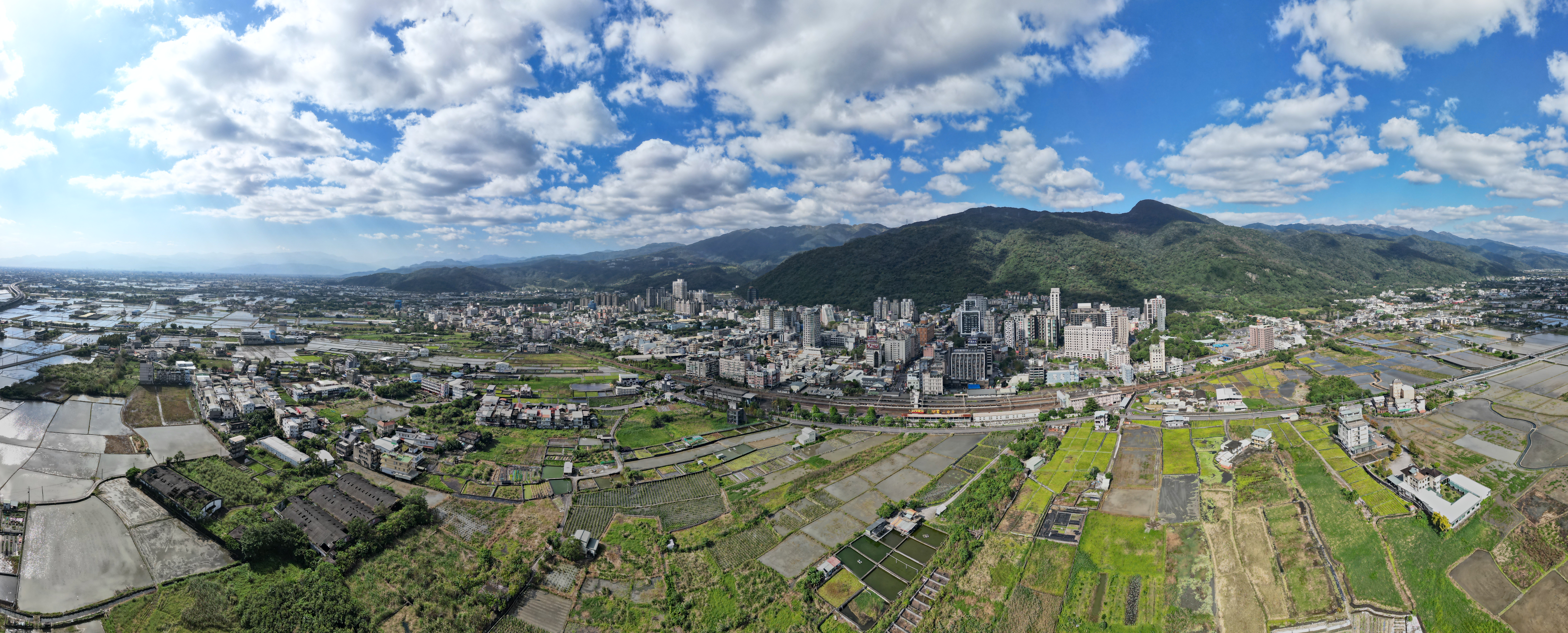
Yilan County, alternately spelled I-lan, is a County (Taiwan), county in northeastern Taiwan, Republic of China. Name The name ''Yilan'' derives from the Taiwanese indigenous peoples, indigenous Kavalan people. Other former names in reference to this area in the Yilan Plain include ''Kabalan'', ''Kavalan'', ''Kavaland'', ''kap-a-lan'', ''Yiland'' and ''Gilan''. Before 2009, the county's official name was transliterated as Ilan. History Early history Since early ages, many people have traveled from far places to Yilan. Taiwanese aborigines, Indigenous tribes that have settled in Yilan are Kavalan people and Atayal people. The Kavalan people came by the sea and lived by the river at Yilan Plain since around 1,000 years ago. They mostly speak the Austronesian languages. Their settlements consisted of small villages along rivers with around 40-50 communities scattered around the area with a total population of approximately 10,000 people. The Atayal people came by crossing ... [...More Info...] [...Related Items...] OR: [Wikipedia] [Google] [Baidu] |


