|
List Of Districts In Telangana By GDP
GDP of districts of Telangana Gross District Domestic Product of Telangana at current prices from 2018–19 to 2020–21 (in INR Crore). Details of 2018–19 are those of Third Revised Estimates (TRE), 2019–20 are of Second Revised Estimates (SRE), 2020–21 are of First Revised Estimates (FRE) according tTelangana Socio Economic Outlook 2023 List of erstwhile districts of Telangana, India by GDP in 2012–2013. * The tabulated figures provided below are outdated yet the only official information provided by the Government of India. This data was collected before the bifurcation of the state of Andhra Pradesh into the new state of Telangana with 10 districts. * The 10 districts below were further carved out in October 2018 to form 33 new districts of Telangana. * ''US Dollars (USD) adjusted with 2012 dollar to Indian National Rupee (INR) rates of 52.68 INR''. See also *Economy of Telangana *List of districts of Telangana * List of cities in Telangana by populatio ... [...More Info...] [...Related Items...] OR: [Wikipedia] [Google] [Baidu] |
Adilabad District
Adilabad district is a district located in the northern region of Telangana, India. It is known as the gateway district to South and Central India. The town of Adilabad is its headquarters. The district shares boundaries with Asifabad, Nirmal districts and with the state boundary of Maharashtra. As of 2022, the district is a part of the red corridor. History Historically, Adilabad was known as Edlabad during the rule of Qutub Shahis. The district was named for Ali Adil Shah, sultan of Bijapur. The heavily forested Godavari basin was inhabited during the Mesolithic and Paleolithic periods. Excavations have taken place in the surrounding areas of Luxettipet, Asifabad, Boath, Bhainsa, and Nirmal. The district was ruled at different times by different dynasties, including the Mauryas, Sathavahanas, Kakatiyas and Gond Rajas. Some Telugu inscriptions made during the time of the Kakatiya dynasty have been found in the Adilabad District, which indicates the historic ... [...More Info...] [...Related Items...] OR: [Wikipedia] [Google] [Baidu] |
Mulugu District
Mulugu district is a district in the Indian state of Telangana. Its headquarters is the town of Mulugu. Mulugu district is the least populated district with 2,94,671 in the state. Mulugu district has the fewest mandals in the state with nine mandals. It currently borders Warangal, Mahabubabad, Jayashankar and Bhadradri districts and with the state of Chhattisgarh. Government and politics Mulugu Major was constituted in 2011 and is classified as a ''second grade municipality''. The jurisdiction of the civic body is spread over an area of . Politics Mulugu district has one seat in State Assembly and is reserved for Scheduled Tribe. Seethakka (Danasari Anasuya) was elected as MLA Mulug (ST) (Assembly constituency) in the 2018 General Elections. Mulugu District falls under Mahabubabad (Lok Sabha constituency). Smt Kavitha Maloth was elected as MP in May 2019 General Elections. Weather Mulugu has a semi-tropical climate. During summers, the temperatures soar to more than ... [...More Info...] [...Related Items...] OR: [Wikipedia] [Google] [Baidu] |
Nagarkurnool District
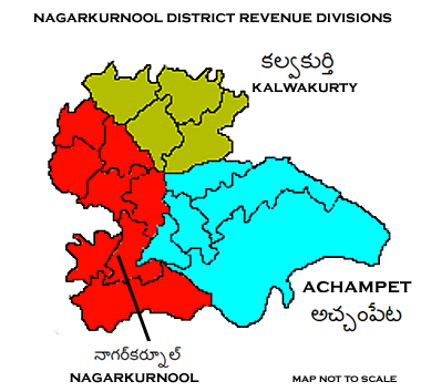
Nagarkurnool district is a district in the southern region of the Indian state of Telangana. The town of Nagarkurnool is the district headquarters. It was part of the Mahbubnagar district prior to re-organisation of districts in the state. The district shares boundaries with Nalgonda, Rangareddy, Mahabubnagar, Wanaparthy districts and with the state boundary of Andhra Pradesh with Nandyal, Palnadu and Prakasam Districts. History The Nagarkurnool district is historically, traditionally ruled by several empires in past. The evidences of monuments and inscriptions found near confluence of rivers Krishna River and Tungabhadra River reveals that it was an inhabited place since the Stone Age . Many places of this district have legendary history. The history of this district is divided into four periods, from the Badami Chalukya till the Muslim invasion. Gona Ganna Reddy was the ruled Nandi vardhamana puram by making capital.its near Village of Nagarkurnool. Gona Ganna R ... [...More Info...] [...Related Items...] OR: [Wikipedia] [Google] [Baidu] |
Mahabubnagar District
Mahabubnagar district is a district in the Indian state of Telangana. Mahabubnagar is the district headquarters which is popularly known as Palamoor. The district shares boundaries with Narayanapet, Vikarabad, Rangareddy, Nagarkurnool, Wanaparthy and Jogulamba Gadwal districts. The district was formed during the period of the 6th Nizam of Hyderabad State – Nawab Mir Mahbub Ali Khan and hence named after him. Etymology Mahabubnagar was formerly known as ''Palamoor'', meaning "land of milk" due to its milk production. The name was changed to Mahabubnagar on 4 December 1890, in honour of Mir Mahbub Ali Khan Asaf Jah VI, the Nizam of Hyderabad (1869–1911 AD). History The area that forms current Mahabubnagar district has held historic significance. It was under ''Janapada'' rule by 6th century BCE, and later was Maurya territory. The region was at the core of the Satavahana dynasty from 221 BCE to 218 CE, and also a large part of the Chalukya dynasty from the 5th to the 1 ... [...More Info...] [...Related Items...] OR: [Wikipedia] [Google] [Baidu] |
Narayanpet District
Narayanpet district is a district in the Indian state of Telangana. Narayanpet is the district headquarters. The district shares boundaries with Mahbubnagar, Vikarabad, Wanaparthy and Jogulamba Gadwal districts and with the Karnataka state. History Historically "Narayanapeta" has been in the Palamoor region by the 6th Century B.C Later Nandas, Mouryas, Sathavahanas, Ikshwakas, Vishnukundinas, Badami Chalukyas, Kanduri Chodas, Kakatiyas, Yadavas of Devagiri, Cheruku kings, Vavilala kings, Munusuri Dyanasty, Bahamani Sultans, Vijayanagara Kings, Recharla Padmanayakas, Kutubshahis, Mughals and Nizam of Hyderabad ruled this area as the part of their Kingdom, this region was known as the land of the Cholas Mahbub Ali Khan Asaf Jah VI, the Nizam of Hyderabad (1869-1911 AD) was changed the name of "Narayanapeta" to NARAYANPET on 4 December 1890. Narayanapeta was the headquarters of the district since 1883 AD. the Golconda diamonds also including the famous Kohinoor Diamond com ... [...More Info...] [...Related Items...] OR: [Wikipedia] [Google] [Baidu] |
Vikarabad District
Vikarabad district is a district in the Indian state of Telangana. Vikarabad is the headquarters of the district..The district shares boundaries with Sangareddy, Mahabubnagar, Narayanpet, Rangareddy districts and the state boundary of Karnataka. Geography The district is spread over an area of . This district is bounded by Sangareddy district in the north, Rangareddy district in the east, Mahbubnagar district in the south and Karnataka in the west. Demographics Census of India, the district has a population of 927,140. Administrative divisions The district will have two revenue divisions of Tandur and Vikarabad. It is sub-divided into 18 mandals.Smt Nikhila I.A.S. is the present collector of the district. Vikarabad Revenue Division formed with Marpalle, Mominpet, Nawabpet, Vikarabad, Pudur, Kulkacherla, Doma, Pargi, Dharur, Kotepally, Bantwaram mandals from Rangareddy District. Tandur Revenue Division formed with Basheerabad, Doulthabad, Tandur, Peddemul, Yelal ma ... [...More Info...] [...Related Items...] OR: [Wikipedia] [Google] [Baidu] |
Ranga Reddy District
Ranga Reddy district ( R. R. district) is a district in the Indian state of Telangana. The district headquarters is located at Lakdikapool, Hyderabad. The district was named after the former deputy chief minister of the United Andhra Pradesh, K. V. Ranga Reddy. The district shares boundaries with Nalgonda, Yadadri Bhuvanagiri, Hyderabad, Medchal–Malkajgiri, Nagarkurnool, Mahabubnagar, Sangareddy and Vikarabad districts. History The district was formed in 1978 when it was split from Hyderabad district. Originally named Hyderabad Rural district, it was renamed after Konda Venkata Ranga Reddy, a freedom fighter who fought for the independence of Telangana from the Nizams and who went on to become the deputy chief minister of Andhra Pradesh. In 2016, it was carved out during the district's reorganisation to create the new Vikarabad district and Medchal–Malkajgiri district. Geography Ranga Reddy District occupies an area of approximately . A freshwater reservoir, called ... [...More Info...] [...Related Items...] OR: [Wikipedia] [Google] [Baidu] |
Hyderabad District, India
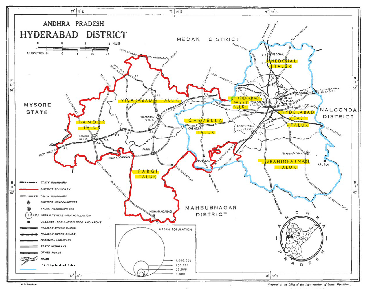
Hyderabad district is a most populous district in the state of Telangana in India that contains a part of the metropolitan area of Hyderabad. It is headed by a district collector who is drawn from the IAS cadre and is appointed by the state government. It is the smallest of all the districts in the state, but has the highest human density. Old MCH area, which is central region of Hyderabad city comes under this district.The district share boundaries with Rangareddy and Medhchal districts. History Hyderabad district was formed in 1948 after Operation Polo by merging Atraf-a-Balda District and Baghat District. Baghat was previously a Taluk in Atraf-e-Balda District, and was made a separate district in 1931–34 under the subedar of Medak division. After formation of Andhra Pradesh by merging Telugu speaking of Hyderabad state in 1956 Hyderabad district boundary was altered Tandur Taluka which is Telugu speaking region of Gulbarga district was merged in Hyderabad district and ... [...More Info...] [...Related Items...] OR: [Wikipedia] [Google] [Baidu] |
Medchal-Malkajgiri District
Medchal−Malkajgiri district is a district in the Indian state of Telangana. Shamirpet is the headquarter of the district. It is the second most populous district with a population of 25 lakh and also 91.40% urbanized district in the state of Telangana, standing next only to Hyderabad district which has a population of 40 lakhs. The district shares boundaries with Hyderabad, Medak, Sangareddy, Y. Bhuvanagiri, Siddipet and Rangareddy districts.The most part of the district consist of Hyderabad City (GHMC) Geography The district is spread over an area of .It is situated 505 metres above sea level. The landmark consists of rocky terrain and monolithic rocks in the outskirts of the city. Demographics census of India, the district is the second most populous district in the state with a population of 2,440,073. Administrative divisions The district will have two revenue divisions of Keesara and Malkajgiri. They are sub-divided into 15 mandals. Sri V. Venkateswarlu, IAS ... [...More Info...] [...Related Items...] OR: [Wikipedia] [Google] [Baidu] |
Yadadri Bhuvanagiri
Yadadri Bhuvanagiri District, is a district in the Indian state of Telangana. The administrative headquarters is located at Bhuvanagiri Town. The district shares boundaries with Suryapet, Nalgonda, Jangaon, Siddipet, Medchal-Malkajgiri and Rangareddy districts. It was carved out of Nalgonda district on 11 October 2016 during a large reorganization of the districts of Telangana. Geography The district is spread over an area of . Demographics Census of India, the district has a population of 726,465. According to the 2011 census, 90.54% of the district speaks Telugu, 4.97% Lambadi and 3.42% Urdu. Major Towns * Bhuvanagiri *Choutuppal *Alair *Mothkur Notable places in District *Bhuvanagiri Fort in Bhuvanagiri *Kolanupaka Temple in Alair - 33 km from Bhuvanagiri *Kunda Sathyanarayana Kala Dhamam-13 km from Bhuvanagiri *Yadagirigutta temple -16 km from Bhuvanagiri *Ramaneswaram temple in Nagireddypally-15 km from Bhuvanagiri Administrati ... [...More Info...] [...Related Items...] OR: [Wikipedia] [Google] [Baidu] |
Nalgonda District
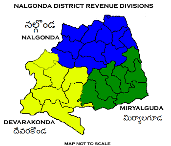
Nalgonda district is a district in the Telangana state of India. Nalgonda district has the highest number of mandals in the state with 31 mandals. The district shares boundaries with Suryapet, Rangareddy, Yadadri and Nagarkurnool districts and with the state boundary of Andhra Pradesh. Etymology Nalgonda is derived from two Telugu words Nalla (Black) & Konda (Hills) i.e. ''Black Hills''. History Nalgonda was earlier referred to as Neelagiri, the name given by some local rulers and the name was changed to ''Nallagonda'' only after its conquest by Allauddin Bahaman Shah, the founder of Bahmani Sultanate . The district had a major role in the Telangana Rebellion. Geography The district is spread over an area of . Demographics Census of India, the district has a population of 1,618,416. According to the 2011 census, 81.75% of the population spoke Telugu, 11.91% Lambadi and 5.51% Urdu as their first language. The Krishna River, Musi River, Aleru, Peddav ... [...More Info...] [...Related Items...] OR: [Wikipedia] [Google] [Baidu] |
Suryapet District
Suryapet is a city in the Indian state of Telangana. It is a municipality and the headquarters of its eponymous district. The Government of India announced Suryapet to be developed under the Atal Mission for Rejuvenation and Urban Transformation (AMRUT) scheme. Suryapet has been awarded the "Cleanest city" in South India by the Ministry of Urban development in Swachh Survekshan 2017. It is also known as "Gateway of Telangana". It is located about east of the state capital, Hyderabad and also it is located about West of Vijayawada. Etymology Previously Suryapet is known as Bhanupuri, which is modernized into the name Suryapet. People also call the town as Suryapeta. Geography Suryapet or Suriapet is located at . It has an area of . History Chalukyas, Kakatiyas, and Nizam dynasties ruled this region. Climate Under the Köppen climate classification, Suryapet experiences Tropical Wet and Dry Climate. The annual mean temperature is 36 °C. Monthly mean tempe ... [...More Info...] [...Related Items...] OR: [Wikipedia] [Google] [Baidu] |


