|
List Of Crossings Of The Rahway River
The Rahway River drainage basin encompasses approximately 41 square miles in Union, Essex, and Middlesex counties in the northeastern part of the U.S. state of New Jersey. The Rahway River consists of four separate branches that converge in Rahway, from whence it flows as a single waterway to its mouth at the Arthur Kill. The longest, or West Branch, courses for 24 miles from Verona. The East Branch rises in West Orange/ Montclair and joins the West Branch in Springfield, forming the main stem of the river. The South Branch, which originates in Woodbridge, and the Robinson's Branch, which begins in Scotch Plains, join the main stem in Rahway. The upper portion above Rahway consists of floodplains, woodlands and freshwater marshes; the lower portion includes saltwater marshes and tidal flats. The river is tidal for approximately five mies upstream. Many of the crossings of the river were built in the late 19th and early 20th century and are part of the Rahway River Parkway ... [...More Info...] [...Related Items...] OR: [Wikipedia] [Google] [Baidu] |
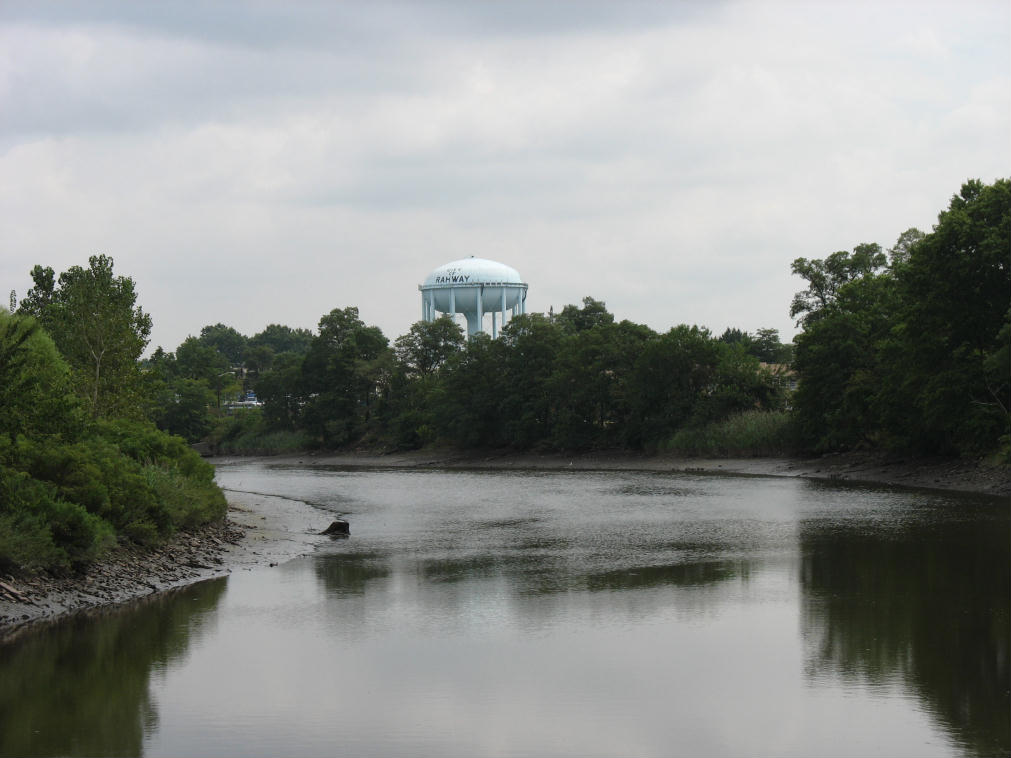
Rahway River And Water Tower
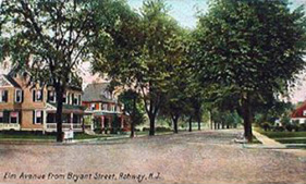
Rahway () is a city in southern Union County, in the U.S. state of New Jersey. A bedroom community of New York City, it is centrally located in the Rahway Valley region, in the New York metropolitan area. The city is southwest of Manhattan and west of Staten Island. Built on the navigable Rahway River, it was an industrial and artisanal craft city for much of its history. The city has increasingly reinvented itself in recent years as a diverse regional hub for the arts. As of the 2010 United States Census, the city's population was 27,346,DP-1 - Profile of General Population and Housing Characteristics: 2010 Demographic Profile Data for Rahway city, Union County, New Jersey< ... [...More Info...] [...Related Items...] OR: [Wikipedia] [Google] [Baidu] |
Scotch Plains, New Jersey
Scotch Plains is a township in Union County, New Jersey, United States. The township is located on a ridge in northern- central New Jersey, within the Raritan Valley and Rahway Valley regions in the New York metropolitan area. As of the 2010 Census, the township's population was 23,510, reflecting an increase of 778 (+3.4%) from the 22,732 counted in the 2000 Census, which had in turn increased by 1,572 (+7.4%) from the 21,160 counted in 1990. History The area known as Scotch Plains was first settled by Europeans, including many Scottish Quakers as early as 1684. The name is said to have come from George Scott, a leader of a group of Scottish settlers. It later served as a stop on the stage coach line between New York City and Philadelphia. The Ash Swamp in Scotch Plains was the scene of a key action in the Battle of Short Hills, on June 26, 1777, which included skirmishes as Washington's forces moved along Rahway Road in Scotch Plains toward the Watchung Mountains. An an ... [...More Info...] [...Related Items...] OR: [Wikipedia] [Google] [Baidu] |
I-95
Interstate 95 (I-95) is the main north–south Interstate Highway on the East Coast of the United States, running from US Route 1 (US 1) in Miami, Florida, to the Houlton–Woodstock Border Crossing between Maine and the Canadian province of New Brunswick. The highway largely parallels the Atlantic coast and US 1, except for the portion between Savannah, Georgia, and Washington DC and the portion between Portland and Houlton in Maine, both of which follow a more direct inland route. I-95 serves as the principal road link between the major cities of the Eastern Seaboard. Major metropolitan areas along its route include Miami, Jacksonville, Savannah, Florence, Fayetteville, and Richmond in the Southeast; Washington, Baltimore, Wilmington and Philadelphia, Newark, and New York City in the Mid-Atlantic; and New Haven, Providence, Boston, Portsmouth, and Portland in New England. The Charleston, Wilmington, and Norfolk–Virginia Beach metropolitan are ... [...More Info...] [...Related Items...] OR: [Wikipedia] [Google] [Baidu] |
Interstate 95
Interstate 95 (I-95) is the main north–south Interstate Highway on the East Coast of the United States, running from U.S. Route 1, US Route 1 (US 1) in Miami, Miami, Florida, to the Houlton–Woodstock Border Crossing between Maine and the Canada, Canadian province of New Brunswick. The highway largely parallels the Atlantic Ocean, Atlantic coast and US 1, except for the portion between Savannah, Georgia, and Washington DC and the portion between Portland, Maine, Portland and Houlton, Maine, Houlton in Maine, both of which follow a more direct inland route. I-95 serves as the principal road link between the major cities of the East Coast of the United States, Eastern Seaboard. Major metropolitan areas along its route include Miami metropolitan area, Miami, Jacksonville metropolitan area, Florida, Jacksonville, Savannah metropolitan area, Savannah, Florence, South Carolina metropolitan area, Florence, Fayetteville metropolitan area, North Carolina, Fayettevi ... [...More Info...] [...Related Items...] OR: [Wikipedia] [Google] [Baidu] |
New Jersey Turnpike
The New Jersey Turnpike (NJTP) is a system of controlled-access highways in the U.S. state of New Jersey. The turnpike is maintained by the New Jersey Turnpike Authority (NJTA).The Garden State Parkway, although maintained by NJTA, is not considered part of the turnpike. The mainline's southern terminus is at a complex interchange with Interstate 295 (Delaware–Pennsylvania), Interstate 295 (I-295), U.S. Route 40 in New Jersey, U.S. Route 40 (US 40), U.S. Route 130, US 130, and New Jersey Route 49, Route 49 near the border of Pennsville Township, New Jersey, Pennsville and Carneys Point Township, New Jersey, Carneys Point townships in Salem County, New Jersey, Salem County, east of the Delaware Memorial Bridge. Its original northern terminus was at an interchange with Interstate 80 in New Jersey , I-80 and U.S. Route 46, US 46 in Ridgefield Park, New Jersey, Ridgefield Park, Bergen County, New Jersey, Bergen County; the turnpike was later extended to t ... [...More Info...] [...Related Items...] OR: [Wikipedia] [Google] [Baidu] |
Carteret, New Jersey
Carteret is a borough in Middlesex County, New Jersey, United States. As of the 2020 United States Census, the borough's population was 25,326. History Carteret was originally created as the borough of Roosevelt on April 11, 1906, from portions of Woodbridge Township, based on the results of a referendum approved on May 22, 1906. The name was changed to Carteret as of November 7, 1922. The borough was also called Carteret during the period from December 19, 1921, to January 16, 1922.Snyder, John P''The Story of New Jersey's Civil Boundaries: 1606-1968'' Bureau of Geology and Topography; Trenton, New Jersey; 1969. p. 169. Accessed June 17, 2012. The borough was named after Sir George Carteret, one of the first proprietors of New Jersey, and his son Philip Carteret, the first royal governor of New Jersey. Geography According to the United States Census Bureau, the borough had a total area of 4.96 square miles (12.86 km2), including 4.39 square miles (11.37 km2) of lan ... [...More Info...] [...Related Items...] OR: [Wikipedia] [Google] [Baidu] |
Linden, New Jersey
Linden is a city in southeastern Union County, in the U.S. state of New Jersey. It is part of the New York Metropolitan Area, located about southwest of Manhattan and bordering Staten Island, a borough of New York City, across the Arthur Kill. As of the 2020 United States Census, the city's population was 43,738. Linden was originally formed as a township on March 4, 1861 from portions of Elizabeth, Rahway and Union Township. Portions of the township were taken to form Cranford (March 14, 1871), Linden Borough (March 30, 1882) and Roselle (December 20, 1894). Linden was incorporated as a city by an act of the New Jersey Legislature on January 1, 1925, replacing both Linden Township and Linden Borough, based on the results of a referendum held on November 8, 1923.Snyder, John P''The Story of New Jersey's Civil Boundaries: 1606-1968'' Bureau of Geology and Topography; Trenton, New Jersey; 1969. p. 239. Accessed July 23, 2012. The city's name derives from linden trees brought ... [...More Info...] [...Related Items...] OR: [Wikipedia] [Google] [Baidu] |
Chemical Coast
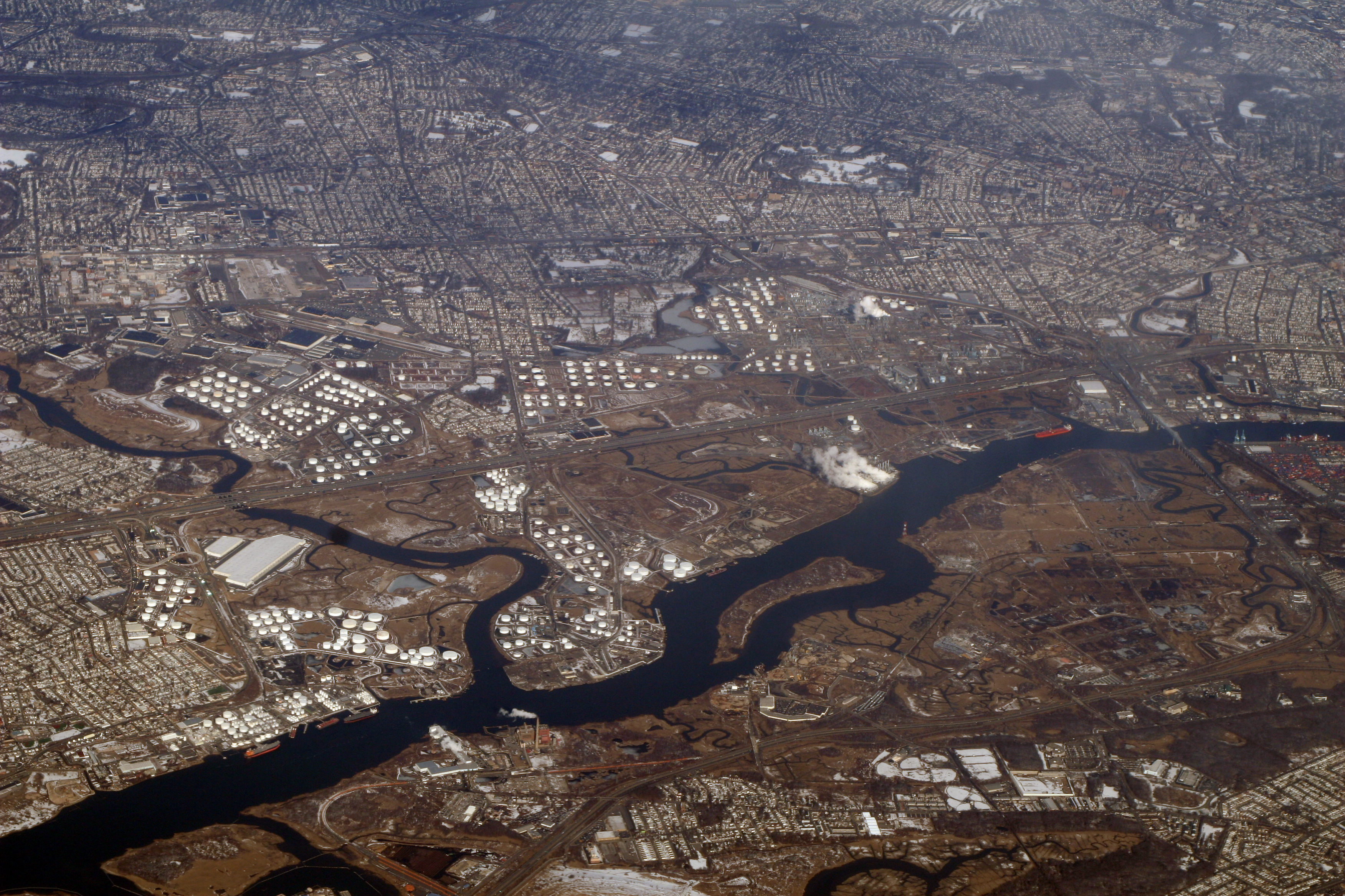
The Chemical Coast is a section of Union and Middlesex counties in New Jersey located along the shores of the Arthur Kill, across from Staten Island, New York. The name is taken from the Conrail Chemical Coast Line, an important component in the ExpressRail system serving marine terminals in the Port of New York and New Jersey. History The name was first used by Conrail to designate a freight railway line that served several chemical plants in the area. The rail line was started by the Perth Amboy and Elizabethport Railroad in 1871. However, the company ran out of capital during the panic of 1873 and was purchased by the Central Railroad of New Jersey (CNJ). The CNJ operated both freight and passenger service along the line into the twentieth century, referring to it as the Perth Amboy and Elizabethport Branch. Passenger trains to Bay Head Junction, Atlantic Highlands, Freehold and Atlantic City (including the Blue Comet) utilized the line. There were passenger stations a ... [...More Info...] [...Related Items...] OR: [Wikipedia] [Google] [Baidu] |
Conrail Shared Assets Operations
Conrail Shared Assets Operations (CSAO) is the commonly used name for modern-day Conrail (reporting mark CRCX), an American railroad company. It operates three networks, the North Jersey, South Jersey/Philadelphia, and Detroit Shared Assets Areas, where it serves as a contract local carrier and switching company for its owners, CSX Transportation and the Norfolk Southern Railway. When most of the former Conrail's track was split between these two railroads, the three shared assets areas (a total of about 1,200 miles of track) were kept separate to avoid giving one railroad an advantage in those areas. The company operates using its own employees and infrastructure but owns no equipment outside MOW equipment. North Jersey Shared Assets Area The North Jersey Shared Assets Area stretches from the North Bergen Yard in North Bergen, New Jersey south into Jersey City and Newark, and beyond to Manville ( Port Reading Junction) and Trenton, much of which is operated over Amtrak's ... [...More Info...] [...Related Items...] OR: [Wikipedia] [Google] [Baidu] |
Greenway (landscape)
A greenway is usually a shared-use path along a strip of undeveloped land, in an urban or rural area, set aside for recreational use or environmental protection. Greenways are frequently created out of disused railways, canal towpaths, utility or similar rights of way, or derelict industrial land. Greenways also can also be linear parks, and can serve as wildlife corridors. The path's surface may be paved and often serves multiple users: walkers, runners, bicyclists, skaters and hikers. A characteristic of greenways, as defined by the European Greenways Association, is "ease of passage": that is that they have "either low or zero gradient", so that they can be used by all "types of users, including mobility impaired people". In Southern England, the term also refers to ancient trackways or green lanes, especially those found on chalk downlands, like the Ridgeway. Definition Greenways are vegetated, linear, and multi-purpose. They incorporate a footpath and/or bikeway wit ... [...More Info...] [...Related Items...] OR: [Wikipedia] [Google] [Baidu] |
Rahway River Parkway
The Rahway River Parkway is a greenway of parkland along the banks the main stem Rahway River and its tributaries in Union County, New Jersey, United States. Created in the 1920s, it was one of the inaugural projects of the newly-created Union County Parks Commission. It was designed by the Olmsted Brothers firm, sons of landscape architect Frederick Law Olmsted. The Rahway River Greenway plan expands on the original design. Many of the crossings of the river are late 19th century or early 20th century bridges. The East Coast Greenway uses paths and roads along the parkway. The parkway intersects with the 7.3-mile main line of the abandoned Rahway Valley Railroad via abandoned rail trestle over the river, which some have advocated for converting to a pedestrian linear park and rail trail. History The idea for the Rahway River Parkway started in 1919 when Union County Sheriff, James E. Warner began a movement to "save" the river by writing to the local paper, ''The Cranford ... [...More Info...] [...Related Items...] OR: [Wikipedia] [Google] [Baidu] |
Tides
Tides are the rise and fall of sea levels caused by the combined effects of the gravitational forces exerted by the Moon (and to a much lesser extent, the Sun) and are also caused by the Earth and Moon orbiting one another. Tide tables can be used for any given locale to find the predicted times and amplitude (or "tidal range"). The predictions are influenced by many factors including the alignment of the Sun and Moon, the phase and amplitude of the tide (pattern of tides in the deep ocean), the amphidromic systems of the oceans, and the shape of the coastline and near-shore bathymetry (see '' Timing''). They are however only predictions, the actual time and height of the tide is affected by wind and atmospheric pressure. Many shorelines experience semi-diurnal tides—two nearly equal high and low tides each day. Other locations have a diurnal tide—one high and low tide each day. A "mixed tide"—two uneven magnitude tides a day—is a third regular category. Tides va ... [...More Info...] [...Related Items...] OR: [Wikipedia] [Google] [Baidu] |


