|
Linthal GL
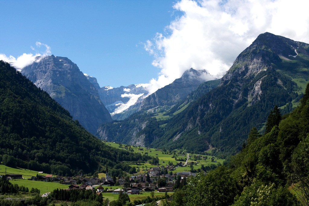
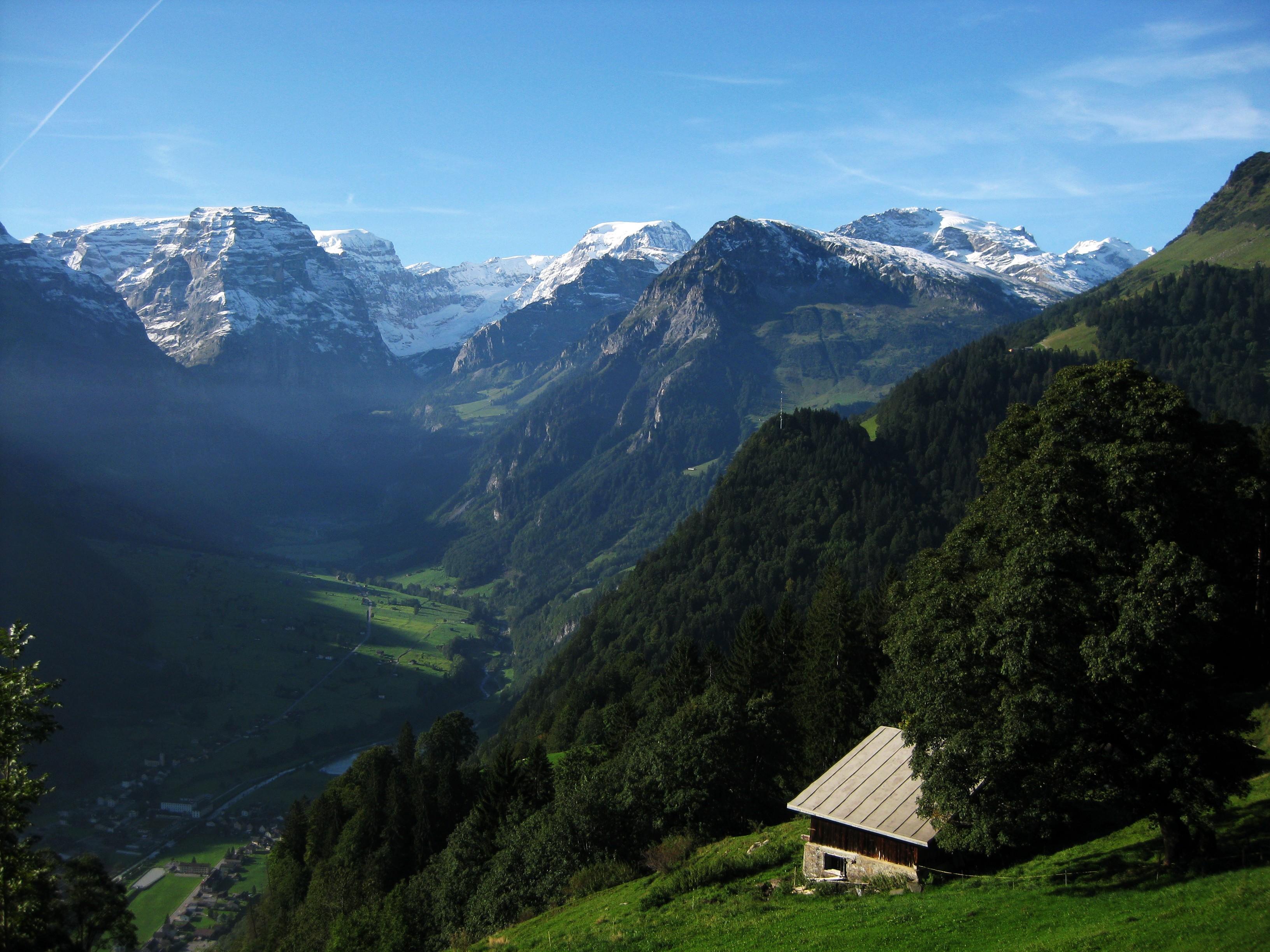
Linthal is a village, and former municipality, in the municipality of Glarus Süd and canton of Glarus in Switzerland. The village lies near the head of the valley of the Linth river, and at the foot of the Klausen Pass into the canton of Uri. It is the terminus of the railway line that traverses the length of Glarus. History Linthal is first mentioned in 1289 as ''Lintal''. In 1879, Linthal was connected to the Swiss railway network by the opening of the Swiss Northeastern Railway line from Weesen. The road over the Klausen Pass was built between 1895 and 1900. Construction of the Linth–Limmern hydro-electric power scheme, in the mountains above Linthal, commenced in 1957, and was fully operational by 1968. In 2011, the municipality of Linthal was merged into the new municipality of Glarus Süd. Geography The village Linthal lies at the head of the valley of the Linth river, at an altitude of approximately . It is surrounded by mountains, including Ortstock (), Clari ... [...More Info...] [...Related Items...] OR: [Wikipedia] [Google] [Baidu] |
Switzerland
). Swiss law does not designate a ''capital'' as such, but the federal parliament and government are installed in Bern, while other federal institutions, such as the federal courts, are in other cities (Bellinzona, Lausanne, Luzern, Neuchâtel, St. Gallen a.o.). , coordinates = , largest_city = Zürich , official_languages = , englishmotto = "One for all, all for one" , religion_year = 2020 , religion_ref = , religion = , demonym = , german: Schweizer/Schweizerin, french: Suisse/Suissesse, it, svizzero/svizzera or , rm, Svizzer/Svizra , government_type = Federalism, Federal assembly-independent Directorial system, directorial republic with elements of a direct democracy , leader_title1 = Federal Council (Switzerland), Federal Council , leader_name1 = , leader_title2 = , leader_name2 = Walter Thurnherr , legislature = Fe ... [...More Info...] [...Related Items...] OR: [Wikipedia] [Google] [Baidu] |
Bifertenstock
The Bifertenstock ( rm, Piz Durschin) is a mountain in the Glarus Alps, located at an elevation of on the border between the cantons of Glarus (north) and Graubünden (south), its peak, however, is located about 25 metres south of the border. It overlooks four valleys: the valley of the Biferten Glacier to the north-west, the Griess Glacier to the north-east, the Val Punteglias to the south, which leads down to Trun, and the Val Frisal on the south-east. Glaciers cover both sides of the mountain, but are smaller on the southern side. The mountain lies in the municipalities of Trun and Breil/Brigels, in the canton of Graubünden, and Glarus Süd Glarus Süd is a municipality in the Swiss canton of Glarus. It comprises the upper Linth valley, and the entire Sernf valley, and includes the villages of Betschwanden, Braunwald, Diesbach, Elm, Engi, Haslen, Hätzingen, Leuggelbach, Lin ..., in the canton of Glarus. The nearest settlements are the villages of Trun, to the so ... [...More Info...] [...Related Items...] OR: [Wikipedia] [Google] [Baidu] |
Limmerensee
Limmernsee (or Limmerensee) is a reservoir in the Canton of Glarus, Switzerland, between the peaks of Muttenchopf (2,482 m), Selbsanft (2,950 m) and Kistenstöckli (2,746 m). It may be reached by aerial tramway or by foot from Linthal. The Limmern dam was completed in 1963 and is the largest reservoir used by the Linth–Limmern Power Stations. The lake's surface area is . See also *List of lakes of Switzerland *List of mountain lakes of Switzerland This is a list of high-altitude lakes in Switzerland. It includes all significant lakes, natural or artificial, with an area over 4 hectares and a height over 800 metres above sea level. This height approximately corresponds to the transiti ... External links *Zukunft Wasserkraft – Linthal 2015 Kraftwerke Linth-Limmern Project for the expansion of the Muttsee/Limmernsee reservoirs. Reservoirs in Switzerland Lakes of the canton of Glarus LLimmernsee Limmern {{Glarus-lake-stub ... [...More Info...] [...Related Items...] OR: [Wikipedia] [Google] [Baidu] |
Biferten Glacier
The Biferten Glacier (german: Bifertenfirn) is a glacier (2005) situated in the Glarus Alps in the canton of Glarus in Switzerland. In 1973 it had an area of . The glacier is located east of the Tödi. See also *List of glaciers in Switzerland A ''list'' is any set of items in a row. List or lists may also refer to: People * List (surname) Organizations * List College, an undergraduate division of the Jewish Theological Seminary of America * SC Germania List, German rugby unio ... * Swiss Alps External linksSwiss glacier monitoring network Glaciers of Switzerland Glaciers of the Alps GBiferten {{Switzerland-glacier-stub ... [...More Info...] [...Related Items...] OR: [Wikipedia] [Google] [Baidu] |
Clariden Glacier
The Clariden is a mountain in the Glarus Alps, located at an elevation of between the Swiss cantons of Uri and Glarus. While on the north the Clariden overlooks the high Klausen Pass, the south side is covered by large glaciers. The Hüfifirn on the west is drained by the Chärstelenbach, a tributary of the Reuss that eventually flows into Lake Lucerne. The Claridenfirn on the east is drained by the Linth that eventually flows into Lake Zürich. The mountain lies in the municipalities of Silenen and Spiringen, in the canton of Schwyz, and Glarus Süd, in the canton of Glarus. The nearest settlements are the villages of Unterschächen Unterschächen is a municipality in the canton of Uri in Switzerland, situated in the upper Schächental. Geography Unterschächen has an area, , of . Of this area, 35.6% is used for agricultural purposes, while 9.4% is forested. Of the rest ... to the north-west, and Linthal to the north-east, which lie at each end of the Klausen Pass. ... [...More Info...] [...Related Items...] OR: [Wikipedia] [Google] [Baidu] |
Braunwald, Glarus
Braunwald is a car-free resort village in the municipality of Glarus Süd and canton of Glarus in Switzerland. History Braunwald is first mentioned in 1421 as ''Brunwald''. There is evidence of summer occupation between the 12th and 15th centuries and, by 1725, a few families were living there year-round. A school was first held in 1841, and moved into its own building in 1857. The Niederschlacht Inn, built in 1856, became a famous hotel. The opening of the Braunwald funicular in 1907 was followed by the opening of further hotels, including the Grand Hotel Bellevue (now the Märchenhotel Bellevue), the Alpina Hotel (now the Adrenalin Backpackers Hostel) and the Alpenblick Hotel (which was destroyed by fire in 2009). In the second half of the 20th century, several chair lifts and gondola lifts opened to provide access to the ski slopes above the village. Until 1939, the village of Braunwald formed part of the municipality of Rüti, but, in that year Braunwald split off to form it ... [...More Info...] [...Related Items...] OR: [Wikipedia] [Google] [Baidu] |
Rüti, Glarus
Rüti is a village, and former municipality, in the municipality of Glarus Süd and canton of Glarus in Switzerland. History Rüti is first mentioned about 1340. Agriculture was the main industry in Rüti until the 19th century. However, by the 17th century, manual cotton spinning was widespread. By 1770 this had declined and the resulting impoverishment ended only with the establishment of a cotton mill for mechanical spinning and weaving of cotton in 1847, and a second similar plant for weaving both wool and cotton in 1850. These factories attracted many foreign workers to Rüti, but their operations ceased in 2002. In 1879, Linthal was connected to the Swiss railway network by the opening of the Swiss Northeastern Railway line from Weesen to Linthal. Until 1939, the village of Braunwald formed part of the municipality of Rüti, but in that year it split off to form its own municipality. On 1 January 2011, both municipalities was reunited as part of the new municipality of ... [...More Info...] [...Related Items...] OR: [Wikipedia] [Google] [Baidu] |
Sernf River
The Sernftal or ''Kleintal'' is an alpine valley within Glarus Süd, in the canton of Glarus, Switzerland. It is formed by the Sernf, a right tributary of the Linth. Situated in the Sernftal are the villages of Elm (977 m) and Engi (812 m). The Panix Pass at 2407 m connects the Sernftal with the anterior Rhine valley in Grisons. Geography The valley is the site of an important geological feature of the Glarus Alps, the ''Glarner Hauptüberschiebung'', a notable fault in alpine geology. A scale model of the feature is on exhibit in the American Museum of Natural History. Name The name ''Sernf'' (earlier also ''Sernft'') is of pre-Germanic origin, either Celtic or an example of Old European hydronymy. It derives from a hypothetical ''*Sarnivos'', containing a PIE root ''*ser'' "to flow". The name of the Sernf river has received some attention in German online culture as the "fifth German word in ''-nf''", popularized by Bastian Sick in his Spiegel Online blog. [...More Info...] [...Related Items...] OR: [Wikipedia] [Google] [Baidu] |
Richetli Pass
The Richetli Pass (german: Richetlipass) is a high mountain pass in the Glarus Alps in the Swiss canton of Glarus. The pass crosses between the heads of the valleys of the Linth and the Sernf rivers, using the col between the Hausstock and Kärpf mountains, at an elevation of . The pass is traversed by a trail, which connects the village of Elm, at an elevation of with the village of Linthal, at an elevation of . The trail forms part of the Alpine Pass Route, a long-distance hiking trail across Switzerland between Sargans and Montreux. See also * List of mountain passes in Switzerland This is a list of mountain passes in Switzerland. They are generally situated in the Jura Mountains or in the Swiss Alps. Pass roads Trails Railway See also * List of highest road passes in Switzerland * List of highest paved roads in Sw ... References External links''Rechetli Pass''on Via Alpina web site''Richtlipass''on Hikr web site Mountain passes of the Alps Mountain ... [...More Info...] [...Related Items...] OR: [Wikipedia] [Google] [Baidu] |
Kärpf
The Kärpf (or Chärpf) is a mountain in the Glarus Alps, at an elevation of . The Kärpf is the highest point of the massif lying north of Richetli Pass (). This range separates the two main valleys of Glarus: the main Linth valley with the village of Linthal on the west and the Sernftal The Sernftal or ''Kleintal'' is an alpine valley within Glarus Süd, in the canton of Glarus, Switzerland. It is formed by the Sernf, a right tributary of the Linth. Situated in the Sernftal are the villages of Elm (977 m) and Engi (812 m). T ... with the village of Elm on the east. On the north side of the Kärpf is located a small valley, which is occupied by a lake, the Garichtisee. Administratively, the mountain lies in the municipality of Glarus Süd, in the canton of Glarus. References External links * Kärpf on Hikr Mountains of the Alps Mountains of Switzerland Mountains of the canton of Glarus Two-thousanders of Switzerland {{glarus-mountain-stub ... [...More Info...] [...Related Items...] OR: [Wikipedia] [Google] [Baidu] |


