|
Liberty Township, Porter County, Indiana
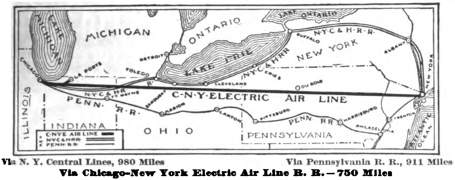
Liberty Township is one of twelve townships in Porter County, Indiana. As of the 2010 census, its population was 9,319. History Liberty Township was organized in 1836. Cities and towns The town of Chesterton has grown south from Westchester Township and has incorporated parts of Liberty Township along State Route 49 near the Indiana Toll Road. Otherwise, there are no incorporated communities within the township.Porter County, Indiana Sesquicentennial, 150, 1836-1986 Other locations Goodrum Junction was a rail junction in the township located east of the intersection of present-day County Road 950 North and Indiana State Road 49. The Goodrum station was the intersection of interurban feeder routes arriving from Valparaiso (the Valparaiso and Northern Railway) and Chesterton and the terminus of the only constructed section of the Chicago – New York Electric Air Line Railroad. The station connected the line to Gary and LaPorte with passengers from northern and southern po ... [...More Info...] [...Related Items...] OR: [Wikipedia] [Google] [Baidu] |
Township (United States)
A township in some states of the United States is a small geographic area. The term is used in three ways. #A survey township is simply a geographic reference used to define property location for deeds and grants as surveyed and platted by the General Land Office (GLO). A survey township is nominally six by six miles square, or 23,040 acres. #A civil township is a unit of local government, generally a civil division of a County (United States), county. Counties are the primary divisional entities in many U.S. states, states, thus the powers and organization of townships varies from state to state. Civil townships are generally given a name, sometimes written with the included abbreviation "Twp". #A charter township, found only in the state of Michigan, is similar to a civil township. Provided certain conditions are met, a charter township is mostly exempt from annexation to contiguous cities or villages, and carries additional rights and responsibilities of home rule. Survey towns ... [...More Info...] [...Related Items...] OR: [Wikipedia] [Google] [Baidu] |
Chesterton, Indiana
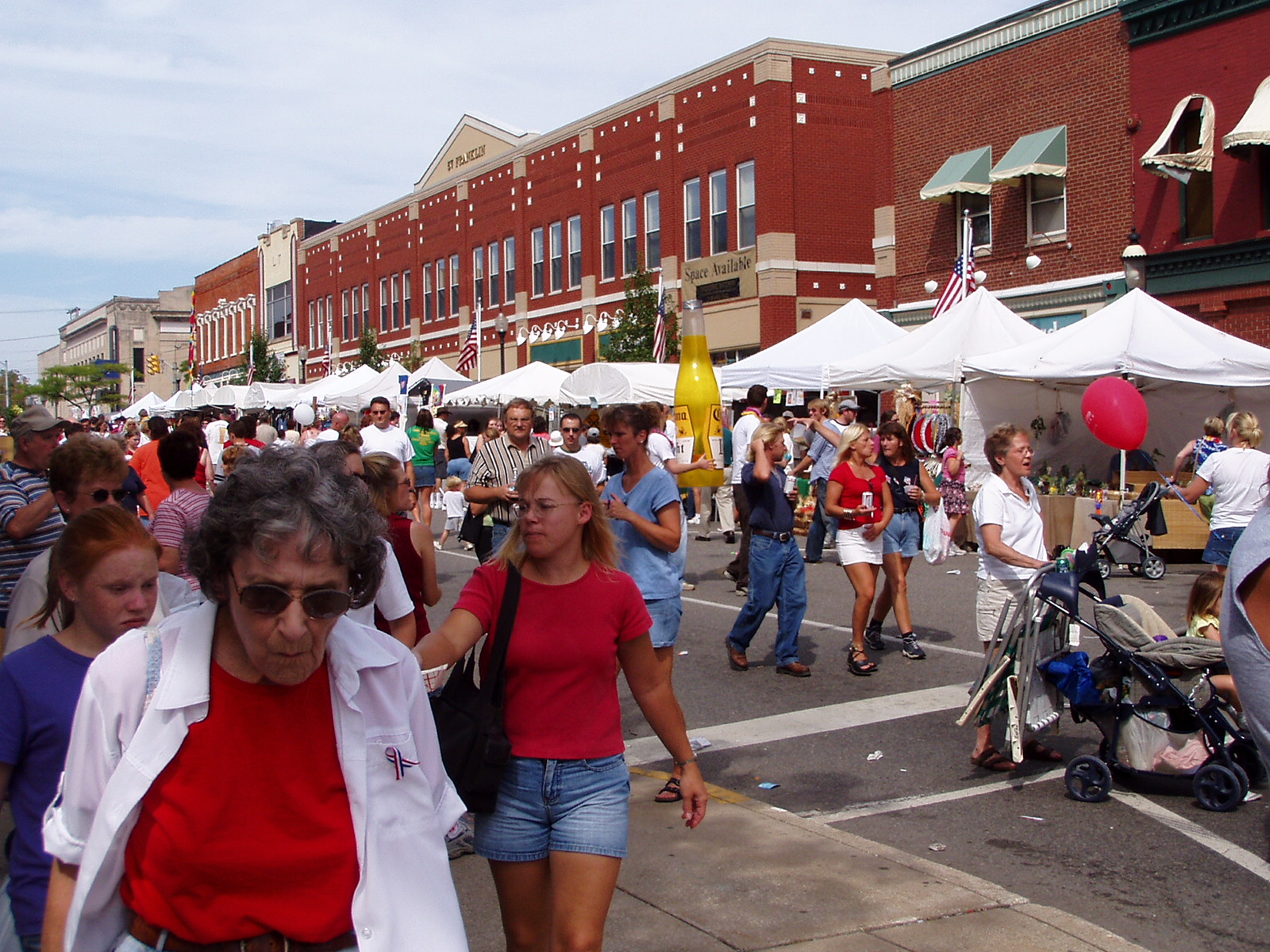
Chesterton is a town in Westchester, Jackson and Liberty townships in Porter County, in the U.S. state of Indiana. The population was 14,241 at the 2020 Census. The three towns of Chesterton, Burns Harbor, and Porter are known as the Duneland area. Etymology The name Chesterton comes from its township, with Chester deriving from Westchester and the -ton suffix denoting it as a town. History Chesterton was first settled under the name Coffee Creek in 1833, with its post office being established in 1835. The post office would eventually be renamed to Calumet in 1850, as which the town was platted when the railroad was extended to that point in 1852. Due to a town on the same railroad also being named Calumet, the name would finally be changed to Chesterton in 1870 and it was reincorporated as a town in 1899 after a failed incorporation in 1869, with its population of 788 being the second-largest in Porter County at the time. In 1933, a United Airlines NC13304 flight became the ... [...More Info...] [...Related Items...] OR: [Wikipedia] [Google] [Baidu] |
Chesterton High School
Chesterton High School is a public high school serving grades 9-12 located in Chesterton, Indiana. It is the only high school in the Duneland School Corporation. History In 1833, Jesse Morgan, the area's first postmaster, opened the first educational institution for Duneland locals. That school sufficed the community until William Thomas II donated land and offered to help build a two-room schoolhouse in 1840. When the building was finally finished in 1852, there were some local complaints of "its rickety conditions." Twenty-five years later, in 1877, $6,000 was spent on creating Chesterton's first high school. Within only a few years, overcrowding became a problem, and the school received a four-room addition in 1890. This building worked for some time, but complications such as a broken furnace, led to the school building being torn down in 1911. After some property disputes with a local church, it was replaced with a more spacious, two-story school. The community outgrew t ... [...More Info...] [...Related Items...] OR: [Wikipedia] [Google] [Baidu] |
Duneland School Corporation
The Duneland School Corporation is the school system that serves Jackson Township, Liberty Township, part of Pine Township, and Westchester Township, Porter County, Indiana, United States. Westchester Township has numerous small towns, including Chesterton, Porter, Dune Acres, and Burns Harbor. The corporation had 5,874 students in 9 schools as of the 2018–19 school year. Schools High Schools (9-12) * Chesterton High School Chesterton High School is a public high school serving grades 9-12 located in Chesterton, Indiana. It is the only high school in the Duneland School Corporation. History In 1833, Jesse Morgan, the area's first postmaster, opened the first educa ... Middle Schools (7-8) * Chesterton Middle School Intermediate Schools (5-6) * Liberty Intermediate School * Westchester Intermediate School Elementary Schools (K-4) * Bailly Elementary School * Brummitt Elementary School * Jackson Elementary School * Liberty Elementary School * Yost Elementary School Re ... [...More Info...] [...Related Items...] OR: [Wikipedia] [Google] [Baidu] |
LaPorte, Indiana
La Porte (French for "The Door") is a city in LaPorte County, Indiana, United States, of which it is the county seat. Its population was estimated to be 21,341 in 2022. It is one of the two principal cities of the Michigan City, Indiana, Michigan City-La Porte, Indiana Metropolitan Statistical Area, which is included in the Chicago–Naperville, Illinois, Naperville–Michigan City, Illinois–Indiana–Wisconsin Combined Statistical Area. La Porte is located in northwest Indiana, east of Gary, Indiana, Gary, and west of South Bend, Indiana, South Bend. It was first settled by European Americans in 1832. The city is twinned with Grangemouth in Scotland. History The settlement of La Porte was established in July 1832. Abraham P. Andrew, one of the purchasers of the site, constructed the first sawmill in that year. The first settler arrived in October, building a permanent cabin just north of what would become the courthouse square. After the US extinguished land claims by the ... [...More Info...] [...Related Items...] OR: [Wikipedia] [Google] [Baidu] |
Gary, Indiana
Gary is a city in Lake County, Indiana, United States. The city has been historically dominated by major industrial activity and is home to U.S. Steel's Gary Works, the largest steel mill complex in North America. Gary is located along the southern shore of Lake Michigan about east of downtown Chicago, Illinois. The city is adjacent to the Indiana Dunes National Park, and is within the Chicago metropolitan area. Gary was named after lawyer Elbert Henry Gary, who was the founding chairman of the United States Steel Corporation. U.S. Steel had established the city as a company town to serve its steel mills. Although initially a very diverse city, after white flight in the 1970s, the city of Gary held the nation's highest percentage of African Americans for several decades. As of the 2020 census the city's population was 70,093, making it Indiana's ninth-largest city. Like other Rust Belt cities, Gary's once thriving steel industry has been significantly affected by th ... [...More Info...] [...Related Items...] OR: [Wikipedia] [Google] [Baidu] |
Chicago – New York Electric Air Line Railroad
The Chicago – New York Electric Air Line Railroad (CNY) was a proposed high-speed electric air-line railroad between Chicago and New York City. At roughly it would have been over shorter than the two primary steam railroads on that route, the New York Central Railroad and Pennsylvania Railroad. The promoters' vision proved wildly optimistic and, in the end, only a short interurban route in the vicinity of Gary, Indiana was built and operated. It was the most ambitious of several such proposals at the dawn of electric railroading, all of which ended in failure. The trade magazine ''Railway Age'' critiqued the project at the time it was announced in July 1906 and gave this damning judgment: "Speaking seriously, for the moment, about this fraudulent investment scheme one is in doubt whether to wonder most at the gigantic effrontery of the perpetrators, the gullibility of the poor dupes who will flood the mails with their subscriptions, or the carelessness if not cupidity of the n ... [...More Info...] [...Related Items...] OR: [Wikipedia] [Google] [Baidu] |
Valparaiso, Indiana
Valparaiso ( ), colloquially Valpo, is a city and the county seat of Porter County, Indiana, United States. The population was 34,151 at the 2020 census. History The site of present-day Valparaiso was included in the purchase of land from the Potawatomi people by the U.S. Government in October 1832. Chiqua's town or Chipuaw was located a mile east of the current Courthouse along the Sauk Trail. Chiqua's town existed from or before 1830 until after 1832. The location is just north of the railroad crossing on State Route 2 and County Road 400 North. Located on the ancient Native American trail from Rock Island to Detroit, the town had its first log cabin in 1834. Established in 1836 as ''Portersville'', county seat of Porter County, it was renamed to Valparaiso (meaning "Vale of Paradise" in Old Spanish) in 1837 after Valparaíso, Chile, near which the county's namesake David Porter battled in the Battle of Valparaiso during the War of 1812. The city was once called the "City ... [...More Info...] [...Related Items...] OR: [Wikipedia] [Google] [Baidu] |
Indiana State Road 49
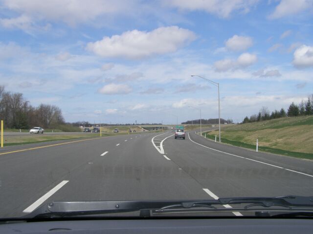
State Road 49 (SR 49) is a , north–south state highway in the northwestern part of the U.S. state of Indiana. Its northern terminus is at an intersection with U.S. Route 12 (Dunes Highway) in Porter near the entrance to Indiana Dunes State Park. The southern terminus is a rural intersection with State Road 14 in Barkley Township at Lewiston, northeast of Rensselaer. Route description The southern terminus of SR 49 is in Barkey Township at State Road 14 (SR 14), the site of the former town of Lewiston. SR 49 heads north, passing through Wheatfield and Kouts. At the southern border of Valparaiso, SR 49 becomes a four-lane divided highway and has interchanges with U.S. Route 30 and SR 2. Between Valparaiso and Chesterton, SR 49 has interchanges with U.S. Route 6 and Interstate 80/Interstate 90/Indiana Toll Road. In Chesterton, SR 49 has an interchange with Interstate 94 before passing into Porter, where it has an interchange with ... [...More Info...] [...Related Items...] OR: [Wikipedia] [Google] [Baidu] |
Indiana Toll Road
The Indiana Toll Road, officially the Indiana East–West Toll Road, is a tolled freeway that runs for east–west across northern Indiana from the Illinois state line to the Ohio state line. It has been advertised as the "Main Street of the Midwestern United States, Midwest". The entire toll road is designated as part of Interstate 90 (I-90), and the segment from Lake Station, Indiana, Lake Station east to the Ohio state line (which comprises over 85 percent of the route) is a concurrency (road), concurrency with Interstate 80, I-80. The toll road is owned by the Indiana Finance Authority and operated by the Indiana Toll Road Concession Company (ITRCC), which is owned by IFM Investors. Route description The Indiana Toll Road is part of the Interstate Highway System which runs through Indiana connecting the Chicago Skyway to the Ohio Turnpike. The toll road is signed with Interstate 90, I-90 for its entire length, as well as Interstate 80, I-80 east of Lake Station, aft ... [...More Info...] [...Related Items...] OR: [Wikipedia] [Google] [Baidu] |
Westchester Township, Porter County, Indiana
Westchester Township is one of twelve townships in Porter County, Indiana. It is included in the Calumet, Northwest Indiana, and Great Lakes regions. It is located on the southern shore of Lake Michigan, about southeast of Chicago. It stretches from the famous Indiana Dunes on its northern border, south to the Valparaiso Moraine, a ridge of rolling hills left by the last glacier to pass through the area. As of the 2010 census, its population was 19,396. Towns Westchester Township includes the communities of Chesterton, Porter, Dune Acres, and Burns Harbor. Former communities in the township include Baillytown, City West, and Tremont. Education Westchester Township is served by the Duneland School Corporation. Its high school is Chesterton High School, its middle school is Chesterton Middle School, its intermediate school is Westchester Intermediate School, and its elementary schools are Baily, Brummit, and Yost Elementary Schools. Westchester Township is served by the West ... [...More Info...] [...Related Items...] OR: [Wikipedia] [Google] [Baidu] |


.jpg)