|
Lesnewth (hundred)
Lesnewth Hundred is one of the former hundreds of Cornwall, Trigg was to the south-west and Stratton Hundred to the north-east. Tintagel, Camelford, Boscastle, and Altarnun were in the Hundred of Lesnewth as well as Lesnewth which is now a hamlet but in pre-Norman times was the seat of a Celtic chieftain who was said to rule the whole of Trigg. Maclean, John (1872–79) ''The Parochial History of the Deanery of Trigg Minor''. London: Nichols & Co. The division into hundreds is thought to date from the reign of King Athelstan and at the time of the Domesday Survey the internal order of manors in the Exeter Domesday Book for Cornwall is in most cases based on the hundreds to which they belonged (though the hundred names are not used). In the Geld Inquest of 1083 only seven hundreds are found, identified by the names of the chief manors: Connerton, Winnianton, Pawton, Tybesta, Stratton, Fawton and Rillaton. Here Stratton represents a single hundred including the later Stratto ... [...More Info...] [...Related Items...] OR: [Wikipedia] [Google] [Baidu] |
Lesnewth Lysnowydh
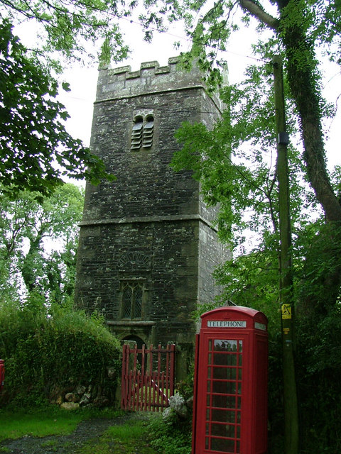
__NOTOC__ Lesnewth ( kw, Lysnowyth) is a civil parishes in England, civil parish and village in Cornwall, England, United Kingdom. It is about six miles east of Tintagel Head and two miles east of Boscastle. The parish is bounded on the north by St Juliot (where the 2011 census population is included.), on the east by St Juliot and Davidstow, on the south by Davidstow, and on the west by Minster, Cornwall. It is a small sparsely populated parish set in farmland with only a few houses, farms and a church. Lesnewth manor is mentioned in the Domesday Book, Domesday Survey of 1086, as Lisniwen. Lesnewth was also the name of one of ten ancient administrative shires of Cornwall: see Lesnewth (hundred). Lesnewth lies within the Cornwall Area of Outstanding Natural Beauty (AONB). Notable buildings The oldest buildings of Lesnewth include the Church, the Rectory, the Mill and Penpol, the latter of which is believed to be the original farmhouse to the surrounding north facing valley side. ... [...More Info...] [...Related Items...] OR: [Wikipedia] [Google] [Baidu] |
Stratton, Cornwall
Stratton ( kw, Strasnedh) is a market town in Cornwall, England situated near the coastal town of Bude and the market town of Holsworthy. It was also the name of one of ten ancient administrative hundreds of Cornwall. The Battle of Stratton during the Civil War took place here on 16 May 1643. Etymology The earliest form of the name in Old English is ''Strætneat'' deriving from the original Cornish "Strad-Neth", with ''Strad'' meaning "The flat-bottomed valley of the River" and ''Neth'' being the name of the river itself. In common with most hydronymy in Western Europe, the name ''Neth'' is known to be Celtic or Pre-Celtic; however, the etymology of the name remains uncertain. A meaning of ''shining'' or ''brilliant'' has been suggested, as has a link to the older Indo-European root ''*-nedi'' (simply meaning ''river''). Today, the river is commonly referred to as ''the Strat'' in English, from an erroneous back formation of Stratton ("town on the Strat"). The town likely sha ... [...More Info...] [...Related Items...] OR: [Wikipedia] [Google] [Baidu] |
Trevalga
Trevalga ( kw, Trevelgi) is a coastal civil parish and hamlet in north Cornwall, England, United Kingdom. The parish is bounded on the north by the Celtic Sea, on the southeast by Forrabury and Minster parish and on the west by Tintagel parish. Description Dating from the time of the Domesday Book (1086), the hamlet of Trevalga lies 500 metres (1,600 ft) from the coast on the seaward side of the road from Boscastle to Tintagel. Trevalga is mentioned in the song ''Black and Gold'' along with other places nearby. Unusually, much of the hamlet (The Manor of Trevalga) is part of an estate held in a trust (established 1961) by The Gerald Curgenven Will Trust with profits after maintenance going to Marlborough College, a public school in Wiltshire. The intent of this trust was ensure Trevalga’s preservation from development, and to have the Manor managed as much as possible in the way Curgenven had during his lifetime. People with families in the local area were prioritised, ... [...More Info...] [...Related Items...] OR: [Wikipedia] [Google] [Baidu] |
Treneglos
Treneglos ( kw, Treneglos) is a hamlet and a civil parish in north-east Cornwall, England, United Kingdom. It is in the Registration District of Launceston. Treneglos is described as a hamlet "where the old Cornish "trev" ettlementis no more than a triangular green beside a church and two or three houses". It is above a wooded valley, a choice place where ancient Celtic tribes sought shelter. Nearby, at Wilsey Down, is evidence of prehistoric tumulus. Now, it is not unusual to see sheep wandering along the country roads. History Treneglos, from "tre-an-eglos", means church, a particularly strong, solid church, or church town.Joseph Polsue. A complete parochial history of the county of Cornwall [ed. by J. Polsue].'. 1872 ited 16 September 2012 p. 241. The parish of Treneglos included Wilsey Down, on which were "four or five ancient barrows or tumuli".Joseph Polsue. A complete parochial history of the county of Cornwall [ed. by J. Polsue].'. 1872 ited 16 Sept ... [...More Info...] [...Related Items...] OR: [Wikipedia] [Google] [Baidu] |
Bossiney
Bossiney ( kw, Boskyny, meaning ''Cyni's dwelling'') is a village in north Cornwall, England, United Kingdom. It is north-east of the larger village of Tintagel which it adjoins: further north-east are the Rocky Valley and Trethevy. Until 1832 the village, with its neighbour Trevena, returned two MPs as a Rotten Borough, for the Bossiney constituency. The beach of Bossiney Haven is located nearby. Toponymy Bossiney, which in Domesday Book was 'Botcinnii', has been explained as Cornish: 'Bod-' dwelling and 'Cini' a man's name. The spelling varied in the past (Bossinney was at one time very common). Novelist John Galsworthy used 'Bosinney' as the surname of a character in the Forsyte Saga. History Bossiney was mentioned in Domesday Book as 'Botcinnii, a manor held by the Count of Mortain from St. Petroc's Church (i.e. Bodmin Monastery), the manor at this time including Trevena. From ca. 1552, two members were elected to the unreformed House of Commons by the burgesses of Bossin ... [...More Info...] [...Related Items...] OR: [Wikipedia] [Google] [Baidu] |
Poundstock
Poundstock ( kw, Tregorlann) is a civil parish and a hamlet on the north coast of Cornwall, England, United Kingdom. The hamlet is situated four miles (6.5 km) south of Bude half-a-mile west of the A39 trunk road about one mile from the coast. Poundstock civil parish is in the Registration District of Stratton. It is bounded to the west by the Atlantic Ocean; to the north by Marhamchurch parish, to the east by Week St Mary parish, and to the south by the parishes of Jacobstow and St Gennys. The population of the parish in the 2001 census was 805, increasing to 925 at the 2011 census. An electoral ward bearing the same name also exists with a population at the same census of 3,846. The manor of Poundstock was recorded in the Domesday Book (1086) when it was held by Jovin from Robert, Count of Mortain. Before 1066 it had been held by Gytha who paid tax for one virgate of land but there was one hide of land and land for 6 ploughs. There were 2 ploughs, 1 serf, 1 villein, 3 s ... [...More Info...] [...Related Items...] OR: [Wikipedia] [Google] [Baidu] |
Otterham
Otterham ( kw, Prasotri) is a village and a civil parish in north Cornwall, England, United Kingdom. The village is situated approximately south of Bude and north of Camelford.Ordnance Survey: Landranger map sheet 190 ''Bude & Clovelly'' Otterham Mill, Otterham Down and Otterham Station (''see below'') are neighbouring settlements to Otterham village; all take the name from the River Ottery which rises in the parish. The parish is in the Hundred of Lesnewth and Deanery of Trigg Major. It is in the Registration District of Camelford and belongs to the Boscastle group of Anglican parishes. Otterham parish is bounded to the north by St Gennys, to the east by Warbstow, to the south by Davidstow and to the west by St Juliot. The parish is rural with small hamlets and farmsteads spread fairly evenly across it: the population of the parish in the 2001 census was 228. The parish church of St Denis at is in Otterham village and has a 40 ft tower housing three bells. The church ... [...More Info...] [...Related Items...] OR: [Wikipedia] [Google] [Baidu] |
Michaelstow
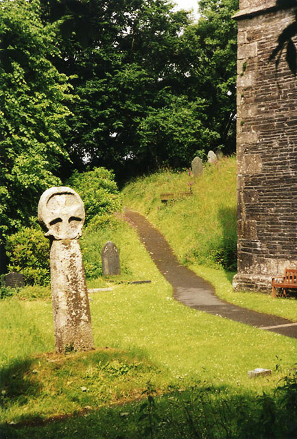
Michaelstow ( kw, Logmighal (village) and kw, Pluwvighal yn Trygordh (parish)) is a civil parish and village in north Cornwall, England, United Kingdom. The village is about south of Camelford. The hamlets of Fentonadle, Trevenning and Treveighan are in the parish. The civil parish of Michaelstow is in the deanery of Trigg Minor and Hundred of Lesnewth. It is named after 'St Michael's holy place' and the parish church is dedicated to St Michael and All Angels. There is fine, tall Cornish cross in the churchyard. Its original location is unknown; until it was removed in 1883 it formed part of a series of steps up to the churchyard. Three more crosses are at Trevenning. The River Camel runs along its eastern edge and the surrounding parishes are Lanteglos-by-Camelford to the north, St Breward to the east, St Tudy to the south and St Teath to the west. [...More Info...] [...Related Items...] OR: [Wikipedia] [Google] [Baidu] |
St Juliot
St Juliot is a civil parish in north-east Cornwall, England, United Kingdom. The parish is entirely rural and the settlements within it are the hamlets of Beeny and Tresparrett. - plus a part of the adjacent village of Marshgate. The parish population at the 2011 census was 328. History The manor of St Juliot was recorded in the Domesday Book (1086) when it was held by Thurstan from Robert, Count of Mortain. There was 1 virgate of land and land for 3 ploughs. There were half a plough, 2 serfs, 2 villeins, 30 acres of pasture and 2 cows. The value of the manor was 5 shillings though it had formerly been worth 7 shillings. Parish Church St Julitta's church is dedicated to St Julitta (Juliot) and stands in an isolated location above the valley of the River Valency at The parish church of Lanteglos by Camelford and the castle chapel at Tintagel are also dedicated to St Julitta. The chapel of St Julitta was acquired in 1238 by the canons of St Stephens by Launceston and before ... [...More Info...] [...Related Items...] OR: [Wikipedia] [Google] [Baidu] |
St Gennys
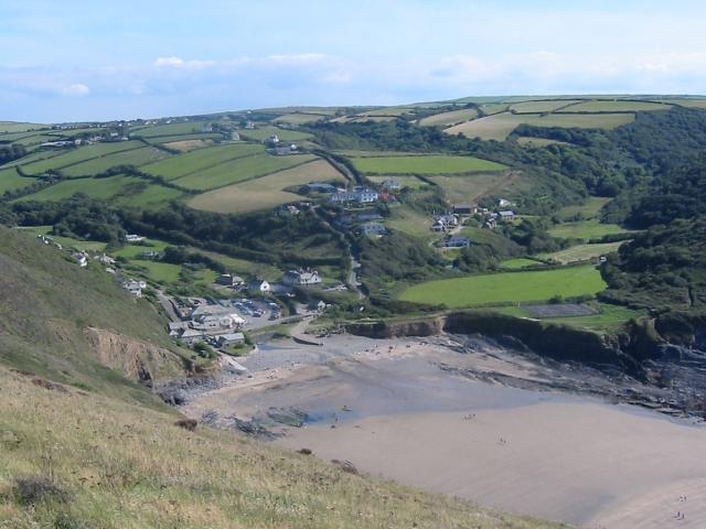
St Gennys ( kw, S. Gwynnas) is a coastal civil parish and small settlement in north Cornwall, England, United Kingdom. The hamlet of St Gennys is about seven miles (11.3 km) southwest of Bude.Ordnance Survey: Landranger map sheet 190 ''Bude & Clovelly'' It is on high ground half-a-mile north of the coastal village of Crackington Haven, the major settlement in the parish. The only other settlements of any size in the parish are Middle Crackington and Higher Crackington both of which are southeast of Crackington Haven, half-a-mile and one mile distant respectively. The population of the parish at the 2011 census was 873. History and geography The name St Gennys is generally thought to derive from 4th Century Christian martyr Saint Genesius although it has been suggested that the commemoration is to the Welsh Saint Gwynws. In either case the name is old and several places in the parish are mentioned in the Domesday Book including Crackington (as ''Crachemua''), Dizzard (a ... [...More Info...] [...Related Items...] OR: [Wikipedia] [Google] [Baidu] |


