|
Leschenault Estuary
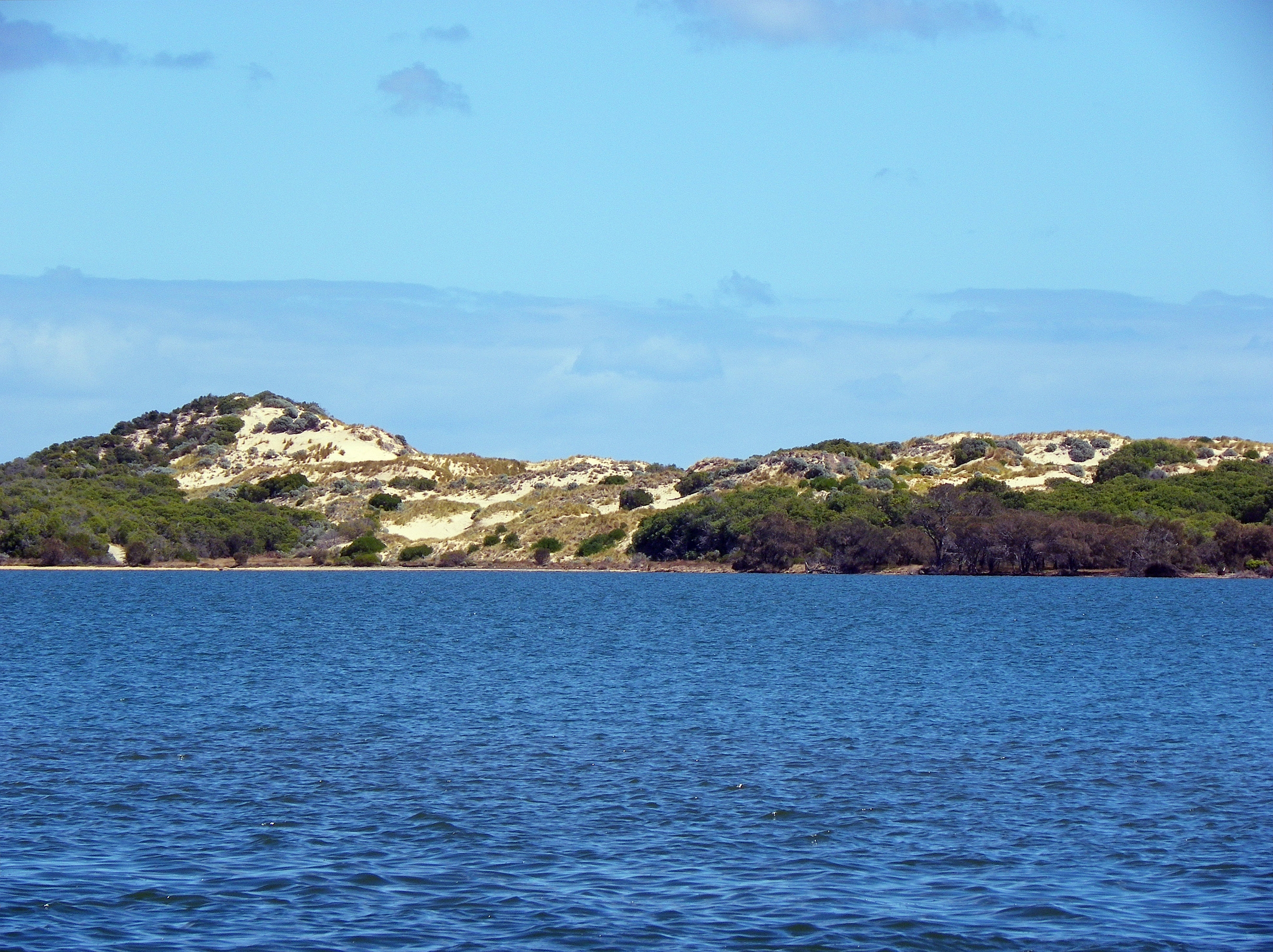
Leschenault Estuary is an estuarine lagoon that lies to the north of Bunbury, Western Australia. It had in the past met the Indian Ocean at the Leschenault Inlet, but that has been altered by harbour works for Bunbury, and the creation of The Cut north of the historical inlet location. The estuary is approximately in length and has a maximum width of approximately . The total area of the estuary is The lagoon is separated from the ocean by a thin peninsula of sand dunes called the Leschenault Peninsula. Catchment The catchment area below Wellington Dam for the estuary covers . The catchment includes part of the Swan Coastal Plain, the Darling Scarp and the Darling Plateau. The Collie and Preston Rivers are the main catchment rivers and enter the estuary from the southern end and with the catchment runoff discharging into the Indian ocean via the cut in the peninsula. Other rivers in the catchment area include the Brunswick River, Ferguson and Wellesley as well as numerous ... [...More Info...] [...Related Items...] OR: [Wikipedia] [Google] [Baidu] |
CSIRO ScienceImage 11539 Coastal Dunes
The Commonwealth Scientific and Industrial Research Organisation (CSIRO) is an Australian Government agency responsible for scientific research. CSIRO works with leading organisations around the world. From its headquarters in Canberra, CSIRO maintains more than 50 sites across Australia and in France, Chile and the United States, employing about 5,500 people. Federally funded scientific research began in Australia years ago. The Advisory Council of Science and Industry was established in 1916 but was hampered by insufficient available finance. In 1926 the research effort was reinvigorated by establishment of the Council for Scientific and Industrial Research (CSIR), which strengthened national science leadership and increased research funding. CSIR grew rapidly and achieved significant early successes. In 1949, further legislated changes included renaming the organisation as CSIRO. Notable developments by CSIRO have included the invention of atomic absorption spectroscopy, ... [...More Info...] [...Related Items...] OR: [Wikipedia] [Google] [Baidu] |
Vegetation
Vegetation is an assemblage of plant species and the ground cover they provide. It is a general term, without specific reference to particular taxa, life forms, structure, spatial extent, or any other specific botanical or geographic characteristics. It is broader than the term ''flora'' which refers to species composition. Perhaps the closest synonym is plant community, but ''vegetation'' can, and often does, refer to a wider range of spatial scales than that term does, including scales as large as the global. Primeval redwood forests, coastal mangrove stands, sphagnum bogs, desert soil crusts, roadside weed patches, wheat fields, cultivated gardens and lawns; all are encompassed by the term ''vegetation''. The vegetation type is defined by characteristic dominant species, or a common aspect of the assemblage, such as an elevation range or environmental commonality. The contemporary use of ''vegetation'' approximates that of ecologist Frederic Clements' term earth cover, a ... [...More Info...] [...Related Items...] OR: [Wikipedia] [Google] [Baidu] |
Leschenault, Western Australia
Leschenault is an outer suburb of Bunbury, Western Australia, Bunbury, Western Australia 16 km to the north-east. Its Local government areas of Western Australia, local government area is the Shire of Harvey. Leschenault is generally considered to be a higher socioeconomic area, with higher than average real estate prices. History The name ''Leschenault'' honours botanist Jean Baptiste Leschenault de la Tour, who was part of Nicolas Baudin's 1802–1803 voyage which visited the coast and explored the estuary and nearby rivers. However, the first reported sighting of the coast was by Captain A.P. Jonk in the Dutch East India Company, VOC ''Emeloort'', who sighted land at 33°12' (most likely opposite the estuary from Australind) on 24 February 1658 while looking for the Vergulde Draeck but did not land. Until the 1980s, the area was used only for low-level agriculture such as grazing, and some holiday homes were built along Cathedral Drive (formerly Scenic Drive) – as re ... [...More Info...] [...Related Items...] OR: [Wikipedia] [Google] [Baidu] |
Waterbird
A water bird, alternatively waterbird or aquatic bird, is a bird that lives on or around water. In some definitions, the term ''water bird'' is especially applied to birds in freshwater ecosystems, although others make no distinction from seabirds that inhabit marine environments. Some water birds (e.g. wading birds) are more terrestrial while others (e.g. waterfowls) are more aquatic, and their adaptations will vary depending on their environment. These adaptations include webbed feet, beaks, and legs adapted to feed in the water, and the ability to dive from the surface or the air to catch prey in water. The term ''aquatic bird'' is sometimes also used in this context. A related term that has a narrower meaning is waterfowl. Some piscivorous birds of prey, such as ospreys and sea eagles, hunt aquatic prey but do not stay in water for long and lives predominantly over dry land, and are not considered water birds. The term waterbird is also used in the context of conservation ... [...More Info...] [...Related Items...] OR: [Wikipedia] [Google] [Baidu] |
Avicennia Marina
''Avicennia marina'', commonly known as grey mangrove or white mangrove, is a species of mangrove tree classified in the plant family Acanthaceae (formerly in the Verbenaceae or Avicenniaceae). As with other mangroves, it occurs in the intertidal zones of estuarine areas. Description Grey mangroves grow as a shrub or tree to a height of , or up to in tropical regions. The habit is a gnarled arrangement of multiple branches. It has smooth light-grey bark made up of thin, stiff, brittle flakes. This may be whitish, a characteristic described in the common name. The leaves are thick, long, a bright, glossy green on the upper surface, and silvery-white, or grey, with very small matted hairs on the surface below. As with other ''Avicennia'' species, it has aerial roots (pneumatophores); these grow to a height of about , and a diameter of . These allow the plant to absorb oxygen, which is deficient in its habitat. These roots also anchor the plant during the frequent inundation o ... [...More Info...] [...Related Items...] OR: [Wikipedia] [Google] [Baidu] |
News Limited
News Corp Australia is an Australian media conglomerate and wholly owned subsidiary of the American News Corp. One of Australia's largest media conglomerates, News Corp Australia employs more than 8,000 staff nationwide and approximately 3,000 journalists. The group's interests span newspaper and magazine publishing, Internet, subscription television in the form of Foxtel, market research, DVD and film distribution, and film and television production trading assets. News Pty Limited (formerly News Limited) is the holding company of the group. News Corp Australia owns approximately 142 daily, Sunday, weekly, bi-weekly, and tri-weekly newspapers, of which 102 are suburban publications (including 16 in which News Corp Australia has a 50% interest). News Corp Australia publishes a nationally distributed newspaper in Australia, a metropolitan newspaper in each of the Australian cities of Adelaide, Brisbane, Darwin, Hobart, Melbourne, and Sydney, as well as groups of suburban n ... [...More Info...] [...Related Items...] OR: [Wikipedia] [Google] [Baidu] |
Forrest Highway
Forrest Highway is a highway in Western Australia's Peel and South West regions, extending Perth's Kwinana Freeway from east of Mandurah down to Bunbury. Old Coast Road was the original Mandurah–Bunbury route, dating back to the 1840s. Part of that road, and the Australind Bypass around Australind and Eaton, were subsumed by Forrest Highway. The highway begins at Kwinana Freeway's southern terminus in Ravenswood, continues around the Peel Inlet to Lake Clifton, and heads south to finish at Bunbury's Eelup Roundabout. There are a number of at-grade intersections with minor roads in the shires of Murray, Waroona, and Harvey including Greenlands Road and Old Bunbury Road, both of which connect to South Western Highway near Pinjarra. The settlement of Australind by the Western Australian Land Company in 1840–41 prompted the first real need for a good quality road to Perth. A coastal Australind–Mandurah route was completed by 2 November 1842. Though the road was reb ... [...More Info...] [...Related Items...] OR: [Wikipedia] [Google] [Baidu] |
Perth, Western Australia
Perth is the capital and largest city of the Australian state of Western Australia. It is the fourth most populous city in Australia and Oceania, with a population of 2.1 million (80% of the state) living in Greater Perth in 2020. Perth is part of the South West Land Division of Western Australia, with most of the metropolitan area on the Swan Coastal Plain between the Indian Ocean and the Darling Scarp. The city has expanded outward from the original British settlements on the Swan River, upon which the city's central business district and port of Fremantle are situated. Perth is located on the traditional lands of the Whadjuk Noongar people, where Aboriginal Australians have lived for at least 45,000 years. Captain James Stirling founded Perth in 1829 as the administrative centre of the Swan River Colony. It was named after the city of Perth in Scotland, due to the influence of Stirling's patron Sir George Murray, who had connections with the area. It gained city stat ... [...More Info...] [...Related Items...] OR: [Wikipedia] [Google] [Baidu] |
Gloucester Park, Perth
Gloucester Park is a harness racing course in Perth, Western Australia. In the suburb of East Perth, Western Australia, East Perth, the oval course is adjacent to the WACA Ground. The track is lit, and Friday night pacing events are popular. As of 2006 the Western Australian Trotting Association have used Gloucester Park for more than 70 years, starting with the first Inter Dominion Championship held in February 1936. Gloucester Park has also been used for Telstra Rally Australia. Between 1977 and 1979 Gloucester Park was used as a venue for World Series Cricket matches. Between September 2015 and April 2017, the drop-in wickets for Perth Stadium, Optus Stadium were built and maintained in the center of Gloucester Park. [...More Info...] [...Related Items...] OR: [Wikipedia] [Google] [Baidu] |
Lake Preston (Western Australia)
Preston Lake or Lake Preston may refer to: Settlements *Preston Lake Township, Minnesota, a township in Renville County, Minnesota, USA *Lake Preston, South Dakota Lakes * Preston Lake (Renville County, Minnesota), USA * Preston Lake (Ontario) Preston Lake is a community located in the town of Whitchurch–Stouffville in the Regional Municipality of York in Ontario, Canada. The community is centred on Preston Lake, a natural glacier kettle lake, immediately north-east of the intersectio ..., is a natural glacier kettle lake located in Whitchurch-Stouffville, Ontario, Canada * Lake Preston (South Dakota) References {{Geodis ... [...More Info...] [...Related Items...] OR: [Wikipedia] [Google] [Baidu] |
Limestone
Limestone ( calcium carbonate ) is a type of carbonate sedimentary rock which is the main source of the material lime. It is composed mostly of the minerals calcite and aragonite, which are different crystal forms of . Limestone forms when these minerals precipitate out of water containing dissolved calcium. This can take place through both biological and nonbiological processes, though biological processes, such as the accumulation of corals and shells in the sea, have likely been more important for the last 540 million years. Limestone often contains fossils which provide scientists with information on ancient environments and on the evolution of life. About 20% to 25% of sedimentary rock is carbonate rock, and most of this is limestone. The remaining carbonate rock is mostly dolomite, a closely related rock, which contains a high percentage of the mineral dolomite, . ''Magnesian limestone'' is an obsolete and poorly-defined term used variously for dolomite, for limes ... [...More Info...] [...Related Items...] OR: [Wikipedia] [Google] [Baidu] |


