|
Lennox Gardens
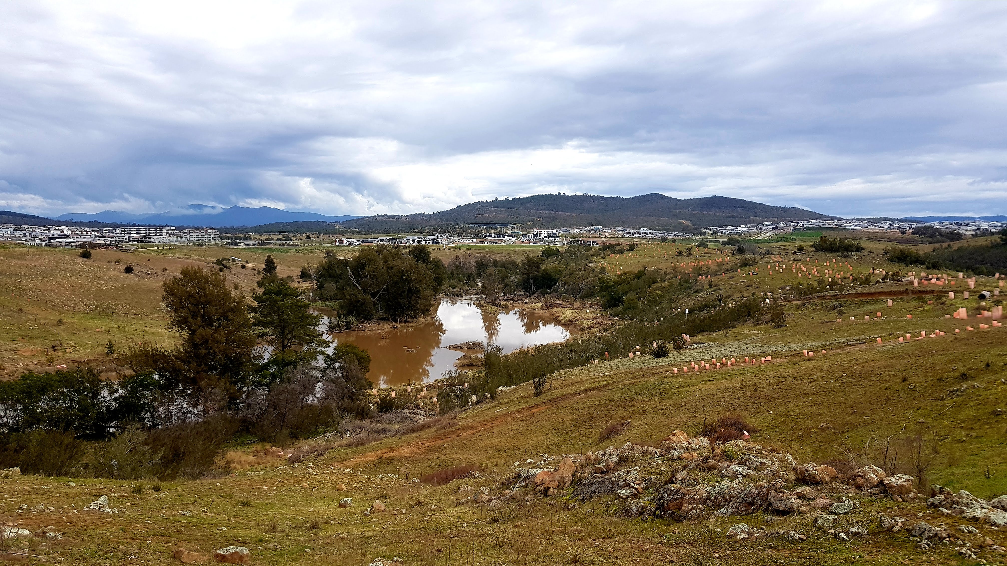
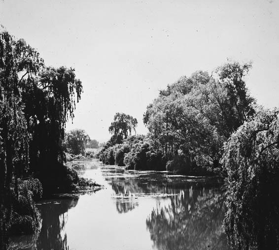
Lennox Gardens, a park in Canberra, Australia, lying on the south side of Lake Burley Griffin, close to Commonwealth Avenue Bridge and Albert Hall in the suburb of Yarralumla. Before the construction of Lake Burley Griffin a road ran through the present garden, this road being one of two main crossing points across the Molonglo River. The name of the road was ''Lennox Crossing'' from which the present garden takes its name. The northern segment of the road is still present on Acton peninsula. The garden was officially named in 1963. Lennox Crossing was named after David Lennox, an early bridge builder in NSW and Victoria. The park in its current condition was established with the filling of Lake Burley Griffin in the 1960s; however the park's history is much older, as it was part of the original Royal Canberra Golf course which is now underneath the lake. The part of the golf course which had not been flooded was named Lennox Gardens. It has a number of memorials and monumen ... [...More Info...] [...Related Items...] OR: [Wikipedia] [Google] [Baidu] |
Yarralumla, Australian Capital Territory
Yarralumla () is a large inner south suburb of Canberra, the capital city of Australia. Located approximately south-west of the city, Yarralumla extends along the south-west bank of Lake Burley Griffin from Scrivener Dam to Commonwealth Avenue. In 1828, Henry Donnison, a Sydney merchant, was granted a lease on the western side of Stirling Ridge. Donnison's land was named ''Yarralumla'' in a survey of the area conducted in 1834, apparently after the indigenous people's term for the area. It was also spelt ''Yarrolumla'' in other documents. In 1881, the estate was bought by Frederick Campbell, grandson of Robert Campbell who had built a house at nearby Duntroon. Frederick completed the construction of a large, gabled, brick house on his property in 1891 that now serves as the site of Government House, the official residence of the Governor-General of Australia. Campbell's house replaced an elegant, Georgian-style homestead, the main portions of which were erected from local s ... [...More Info...] [...Related Items...] OR: [Wikipedia] [Google] [Baidu] |
View From Lennox Gardens, Canberra (144533530)
A view is a sight or prospect or the ability to see or be seen from a particular place. View, views or Views may also refer to: Common meanings * View (Buddhism), a charged interpretation of experience which intensely shapes and affects thought, sensation, and action * Graphical projection in a technical drawing or schematic ** Multiview orthographic projection, standardizing 2D images to represent a 3D object * Opinion, a belief about subjective matters * Page view, a visit to a World Wide Web page * Panorama, a wide-angle view * Scenic viewpoint, an elevated location where people can view scenery * World view, the fundamental cognitive orientation of an individual or society encompassing the entirety of the individual or society's knowledge and point-of-view Places * View, Kentucky, an unincorporated community in Crittenden County * View, Texas, an unincorporated community in Taylor County Arts, entertainment, and media Music * ''View'' (album), the 2003 debut album by ... [...More Info...] [...Related Items...] OR: [Wikipedia] [Google] [Baidu] |
Canberra
Canberra ( ) is the capital city of Australia. Founded following the federation of the colonies of Australia as the seat of government for the new nation, it is Australia's largest inland city and the eighth-largest city overall. The city is located at the northern end of the Australian Capital Territory at the northern tip of the Australian Alps, the country's highest mountain range. As of June 2021, Canberra's estimated population was 453,558. The area chosen for the capital had been inhabited by Indigenous Australians for up to 21,000 years, with the principal group being the Ngunnawal people. European settlement commenced in the first half of the 19th century, as evidenced by surviving landmarks such as St John's Anglican Church and Blundells Cottage. On 1 January 1901, federation of the colonies of Australia was achieved. Following a long dispute over whether Sydney or Melbourne should be the national capital, a compromise was reached: the new capital would be buil ... [...More Info...] [...Related Items...] OR: [Wikipedia] [Google] [Baidu] |
Lake Burley Griffin
Lake Burley Griffin is an artificial lake in the centre of Canberra, the capital of Australia. It was completed in 1963 after the Molonglo River, which ran between the city centre and Parliamentary Triangle, was dammed. It is named after Walter Burley Griffin, the American architect who won the competition to design the city of Canberra. Griffin designed the lake with many geometric motifs, so that the axes of his design lined up with natural geographical landmarks in the area. However, government authorities changed his original plans, and no substantial work was completed before he left Australia in 1920. Griffin's proposal was further delayed by the Great Depression and World War II, and it was not until the 1950s that planning resumed. After political disputes and consideration of other proposed variations, excavation work began in 1960 with the energetic backing of Australian Prime Minister Robert Menzies. After the completion of the bridges and dams, the dams were locked ... [...More Info...] [...Related Items...] OR: [Wikipedia] [Google] [Baidu] |
Molonglo River
The Molonglo River, a perennial river that is part of the Murrumbidgee catchment within the Murray–Darling basin, is located in the Monaro and Capital Country regions of New South Wales and the Australian Capital Territory, in Australia. Location and features The river rises on the western side of the Great Dividing Range, in Tallaganda State Forest at and flows generally from south to north before turning northwest, through Carwoola and the outskirts of Queanbeyan, where it has confluence with its major tributary, the Queanbeyan River, and then continues through Canberra, where it has been dammed by the Scrivener Dam to form Lake Burley Griffin. The river then flows to its mouth with the Murrumbidgee River, near Uriarra Crossing. Over its course the Molonglo River alternates between long broad floodplains and narrow rocky gorges several times. One of these floodplains is called the Molonglo Plain. From source to mouth, the river is traversed by the Captains Flat Road at ... [...More Info...] [...Related Items...] OR: [Wikipedia] [Google] [Baidu] |
Acton, Australian Capital Territory
Acton is a suburb of Canberra, ACT, Australia. Acton covers an area west of the CBD, bordered by Black Mountain to the west and Lake Burley Griffin in the south. The Australian National University campus covers most of the suburb, though also located in Acton is the National Film and Sound Archive, a branch of the CSIRO and the National Museum of Australia. At the Acton had a population of 2,848 people, mostly students living at the Australian National University. History Acton was inhabited by Aboriginal Australian groups for thousands of years before European occupation. Part of this history is documented by the ANU Aboriginal and Torres Strait Islander Heritage Trail. Sullivans Creek, which flows through Acton, provided a culturally significant source of food and resources for Aboriginal people. According to historian Bill Gammage, part of the area now used as the South Oval was purposely deforested by Aboriginal people, to form a grassland area that may have been u ... [...More Info...] [...Related Items...] OR: [Wikipedia] [Google] [Baidu] |
David Lennox
David Lennox (1788 – 12 November 1873) was a Scottish-Australian bridge builder and master stonemason born in Ayr, Scotland. Personal details Trained as a stonemason, Lennox worked on Telford's Menai Suspension Bridge at Anglesey in Wales and on Over Bridge at Gloucester before emigrating to Australia following the death of his wife.Lennox Bridge – Lapstone Hill , Blue Mountains Info ' He arrived in August 1832 aboard the ship Florentia. Prior to this time, the young colony of had no skilled stonemasons, and so it was almost fate that a c ... [...More Info...] [...Related Items...] OR: [Wikipedia] [Google] [Baidu] |
Kasuga Stones
may refer to: Places * Kasuga, Fukuoka, a city in Fukuoka Prefecture, Japan ** Kasuga Station (Fukuoka), on the Kagoshima Main Line * Kasuga, Hyogo, a former town in Hyōgo Prefecture * Kasuga, Gifu, a former village in Gifu Prefecture * Kasuga Shrine, a major Shinto shrine in Nara * Kasugayama Castle, the primary fortress of warlord Uesugi Kenshin * Kasuga Station (Tokyo), on the Toei Subway Mita Line and Ōedo Line Ships * , also called ''Kasuga Maru'', a Japanese wooden paddle steamer warship of the Bakumatsu and early Meiji period * , an armored cruiser of the Imperial Japanese Navy during the Russo-Japanese War * ''Kasuga''-class cruiser, armored cruisers of the Imperial Japanese Navy, in commission 1904–1945 * , also called Japanese Pacific Ocean liner ''Kasuga Maru'', a ''Taiyō''-class escort carrier of the Imperial Japanese Navy during World War II People with the surname * Carlos Kasuga, Japanese-Mexican businessman * Hachiro Kasuga (1924–1991), Japanese singer * ... [...More Info...] [...Related Items...] OR: [Wikipedia] [Google] [Baidu] |
Japan
Japan ( ja, 日本, or , and formally , ''Nihonkoku'') is an island country in East Asia. It is situated in the northwest Pacific Ocean, and is bordered on the west by the Sea of Japan, while extending from the Sea of Okhotsk in the north toward the East China Sea, Philippine Sea, and Taiwan in the south. Japan is a part of the Ring of Fire, and spans Japanese archipelago, an archipelago of List of islands of Japan, 6852 islands covering ; the five main islands are Hokkaido, Honshu (the "mainland"), Shikoku, Kyushu, and Okinawa Island, Okinawa. Tokyo is the Capital of Japan, nation's capital and largest city, followed by Yokohama, Osaka, Nagoya, Sapporo, Fukuoka, Kobe, and Kyoto. Japan is the List of countries and dependencies by population, eleventh most populous country in the world, as well as one of the List of countries and dependencies by population density, most densely populated and Urbanization by country, urbanized. About three-fourths of Geography of Japan, the c ... [...More Info...] [...Related Items...] OR: [Wikipedia] [Google] [Baidu] |
Spanish Civil War
The Spanish Civil War ( es, Guerra Civil Española)) or The Revolution ( es, La Revolución, link=no) among Nationalists, the Fourth Carlist War ( es, Cuarta Guerra Carlista, link=no) among Carlists, and The Rebellion ( es, La Rebelión, link=no) or The Uprising ( es, La Sublevación, link=no) among Republicans. was a civil war in Spain fought from 1936 to 1939 between the Republicans and the Nationalists. Republicans were loyal to the left-leaning Popular Front government of the Second Spanish Republic, and consisted of various socialist, communist, separatist, anarchist, and republican parties, some of which had opposed the government in the pre-war period. The opposing Nationalists were an alliance of Falangists, monarchists, conservatives, and traditionalists led by a military junta among whom General Francisco Franco quickly achieved a preponderant role. Due to the international political climate at the time, the war had many facets and was variously viewed as cla ... [...More Info...] [...Related Items...] OR: [Wikipedia] [Google] [Baidu] |
Canberra Peace Park
The Canberra Peace Park or Peace Park is beside Lake Burley Griffin between the lake and the National Library of Australia, in Canberra, the national capital of Australia. It is not to be confused with the Canberra-Nara Peace Park nearby (see Lennox Gardens). It was built in 1986, the United Nations Year of Peace. The park has three bordered zones. The central zone has with a square granite plinth with a peace symbol in it, surrounded by a quartered plinth incised with the word Peace written in the official languages of the United Nations and also the language of the local Ngunnawal people, and a statement of dedication. This is bordered by a water way fountain, and a cobbled granite walk way, with formal gardens of lavender at each corner. The monument was unveiled by the Bill Hayden, the Governor General of Australia, on 24 October 1990. The monument's statement of dedication asks, "All who visit here are invited to commit themselves to peace and the elimination of weapo ... [...More Info...] [...Related Items...] OR: [Wikipedia] [Google] [Baidu] |
Nara, Japan
is a prefecture of Japan located in the Kansai region of Honshu. Nara Prefecture has a population of 1,321,805 and has a geographic area of . Nara Prefecture borders Kyoto Prefecture to the north, Osaka Prefecture to the northwest, Wakayama Prefecture to the southwest, and Mie Prefecture to the east. Nara is the capital and largest city of Nara Prefecture, with other major cities including Kashihara, Ikoma, and Yamatokōriyama. Nara Prefecture is located in the center of the Kii Peninsula on Japan's Pacific Ocean coast, and is one of only eight landlocked prefectures. Nara Prefecture has the distinction of having more UNESCO World Heritage listings than any other prefecture in Japan. History Nara Prefecture region is considered one of the oldest regions in Japan, having been in existence for thousands of years, and is widely viewed as the Japanese cradle of civilization. Like Kyoto, Nara was one of Imperial Japan's earliest capital cities. The current form of Nara Pre ... [...More Info...] [...Related Items...] OR: [Wikipedia] [Google] [Baidu] |
.jpg)


