|
Leighterton
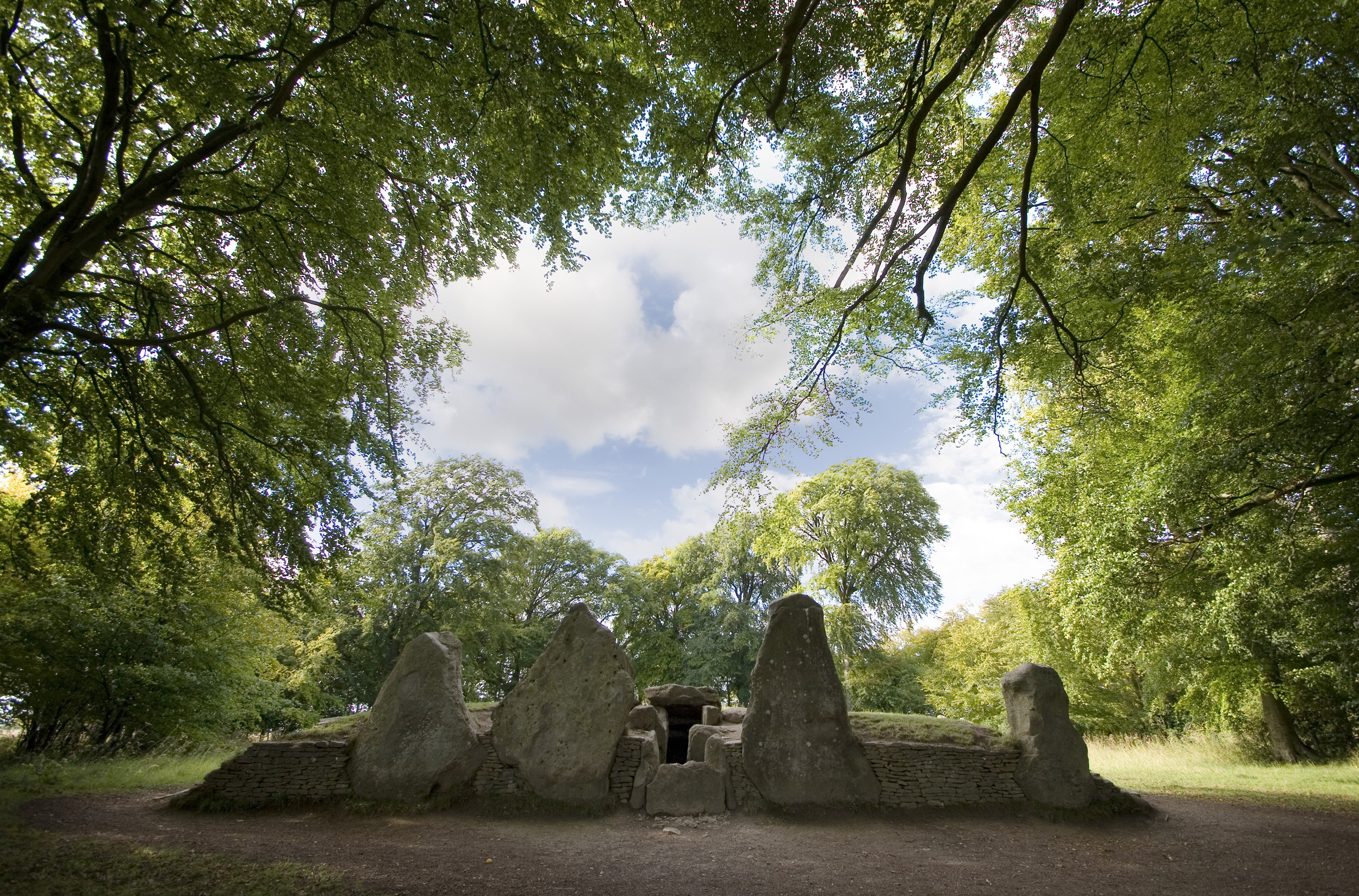
Leighterton is a village in rural Gloucestershire off the A46. It sits within the civil parish of Boxwell with Leighterton, 4.25 miles west-southwest of Tetbury, towards the southern end of the Cotswolds AONB. Situated in the Cotswold hills, it is 175 metres above sea level. Historically, it was situated within the hundred of Grumbald's Ash. The village's parish church, dedicated to St Andrew, is a Grade II* listed building. Originally built in the 13th century and with a porch dating from the 14th century, it underwent a restoration in 1877. The patronage of the church formerly belonged to Walsingham Priory and Gloucester Abbey, later passing to the Huntley family of Boxwell Court. There are over a dozen listed buildings within the village built with Cotswold limestone, including the 19th century Royal Oak pub and former village hall. A long barrow, located just outside the village, is listed as a scheduled monument. An example of a Cotswold-Severn megalithic chamber ... [...More Info...] [...Related Items...] OR: [Wikipedia] [Google] [Baidu] |
Boxwell With Leighterton
Boxwell with Leighterton is a civil parish in the Cotswold district of Gloucestershire, England. According to the 2001 census it had a population of 232, increasing to 306 at the 2011 census. The parish includes Boxwell and Leighterton. The adjoining parishes are: Ozleworth to the north-west; Kingscote to the north; Westonbirt with Lasborough to the east; Didmarton to the south; and Hillesley and Tresham to the west. The last is in the Stroud district; the others are in the Cotswold The Cotswolds (, ) is a region in central-southwest England, along a range of rolling hills that rise from the meadows of the upper Thames to an escarpment above the Severn Valley and Evesham Vale. The area is defined by the bedrock of Jura ... district. References Civil parishes in Gloucestershire Cotswold District {{Gloucestershire-geo-stub ... [...More Info...] [...Related Items...] OR: [Wikipedia] [Google] [Baidu] |
Boxwell Court
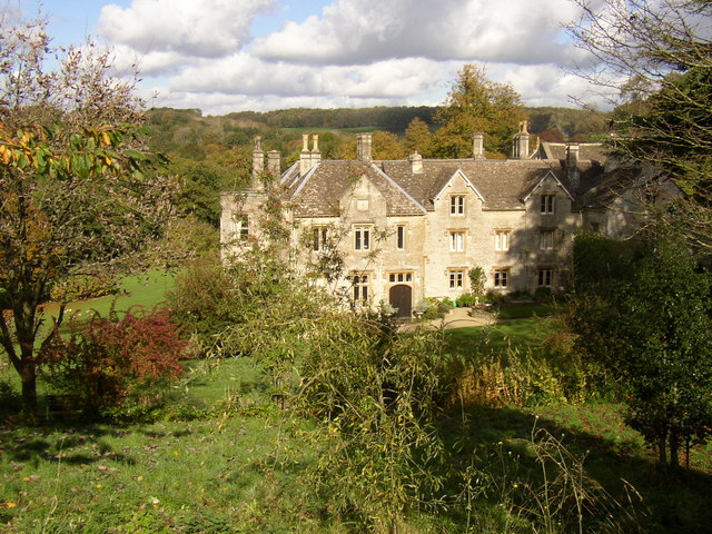
Boxwell Court is a country house near Leighterton in Gloucestershire, England, about 5 km or 3 miles east of Wotton-under-Edge, dating from the 15th and 16th centuries. It is a Grade II* listed building. History The house is thought to be the site of a former monastery, associated with Gloucester Abbey. Nothing remains of the monastery or nunnery except a holy well. The estate was given to the Huntley family following Henry VIII's dissolution of the monasteries. The House has been in the Huntley family continuously since that time; it is believed that the family have lived on the site for 600 years. The estate is approximately , which although large in today's terms, is small compared to the size of the Huntleys' former Gloucestershire estates which included Woodchester and Frocester. The estate is known for its box wood, which used to provide a very large income to the Huntleys. The house has been frequented by royalty; Prince Rupert stayed in the house on sev ... [...More Info...] [...Related Items...] OR: [Wikipedia] [Google] [Baidu] |
Cotswold-Severn Group
The Cotswold-Severn Group are a series of long barrows erected in an area of western Britain during the Early Neolithic. Around 200 known examples of long barrows are known from the Cotswold-Severn region, although an unknown number of others were likely destroyed prior to being recorded. Definition The concept of the "Cotswold-Severn group" was coined by 1937 by the archaeologist Glyn Daniel. They represent a regional grouping of long barrows, a broader architectural tradition found across Atlantic Europe. This tradition stretches from southeast Spain up to southern Sweden, taking in the British Isles to the west. Overall, about 40,000 long barrows are known to survive from the Early Neolithic across Europe. The long barrows are not the world's oldest known structures using stone—they are predated by Göbekli Tepe in modern Turkey—but they do represent the oldest widespread tradition of using stone in construction. The archaeologist Frances Lynch has described them as "the ol ... [...More Info...] [...Related Items...] OR: [Wikipedia] [Google] [Baidu] |
Grumbald's Ash Hundred
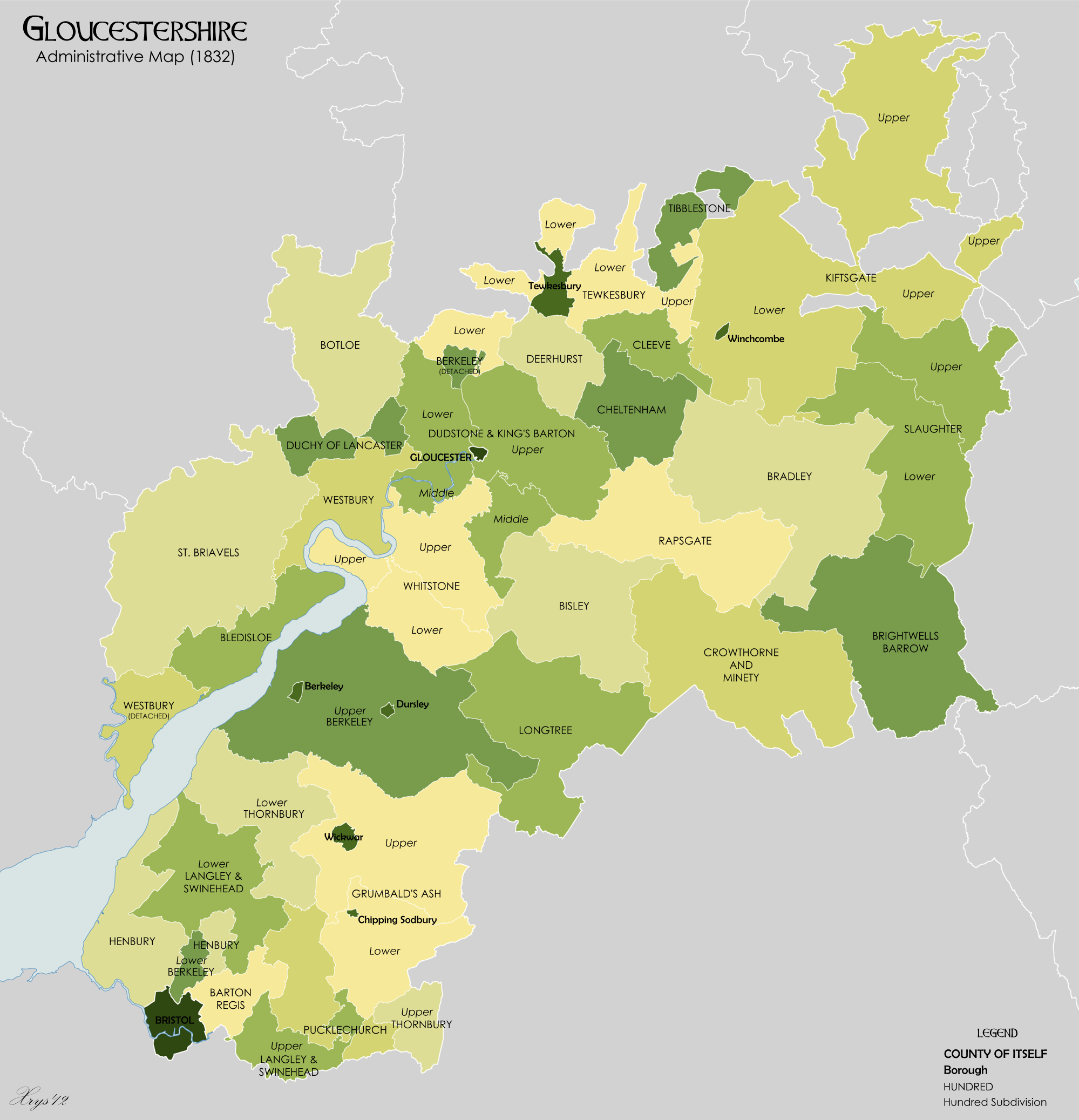
Grumbald's Ash Hundred (also spelled Grumbold's Ash) was a subdivision of the county of Gloucestershire, England. Hundreds originated in the late Saxon period and lasted as administrative divisions until the 19th century. It has been reported that the court was originally held under an Ash tree situated in Doddington parish, although this location would not be consistent with the previous split of hundred. Its name survives in the Grumbolds Ash with Avening electoral ward of Cotswold district council. The hundred was divided into Upper and Lower divisions and comprised a total of 20 ancient parishes in the southeastern corner of the county. The Lower division comprised Acton Turville, Chipping Sodbury, Little Sodbury, Old Sodbury, Tormarton, West Littleton, Dyrham & Hinton, Wapley & Codrington and Dodington; the Upper division comprised Alderley, Badminton, Boxwell & Leighterton, Charfield, Didmarton, Hawkesbury, Hillesley, Horton, Oldbury-on-the-Hill, Tortworth and Wickwar ... [...More Info...] [...Related Items...] OR: [Wikipedia] [Google] [Baidu] |
Gloucestershire
Gloucestershire ( abbreviated Glos) is a county in South West England. The county comprises part of the Cotswold Hills, part of the flat fertile valley of the River Severn and the entire Forest of Dean. The county town is the city of Gloucester and other principal towns and villages include Cheltenham, Cirencester, Kingswood, Bradley Stoke, Stroud, Thornbury, Yate, Tewkesbury, Bishop's Cleeve, Churchdown, Brockworth, Winchcombe, Dursley, Cam, Berkeley, Wotton-under-Edge, Tetbury, Moreton-in-Marsh, Fairford, Lechlade, Northleach, Stow-on-the-Wold, Chipping Campden, Bourton-on-the-Water, Stonehouse, Nailsworth, Minchinhampton, Painswick, Winterbourne, Frampton Cotterell, Coleford, Cinderford, Lydney and Rodborough and Cainscross that are within Stroud's urban area. Gloucestershire borders Herefordshire to the north-west, Worcestershire to the north, Warwickshire to the north-east, Oxfordshire to the east, Wiltshire to the south, Bristol and Somerset ... [...More Info...] [...Related Items...] OR: [Wikipedia] [Google] [Baidu] |
Scheduled Monument
In the United Kingdom, a scheduled monument is a nationally important archaeological site or historic building, given protection against unauthorised change. The various pieces of legislation that legally protect heritage assets from damage and destruction are grouped under the term "designation." The protection provided to scheduled monuments is given under the Ancient Monuments and Archaeological Areas Act 1979, which is a different law from that used for listed buildings (which fall within the town and country planning system). A heritage asset is a part of the historic environment that is valued because of its historic, archaeological, architectural or artistic interest. Only some of these are judged to be important enough to have extra legal protection through designation. There are about 20,000 scheduled monuments in England representing about 37,000 heritage assets. Of the tens of thousands of scheduled monuments in the UK, most are inconspicuous archaeological sites, but ... [...More Info...] [...Related Items...] OR: [Wikipedia] [Google] [Baidu] |
Gloucestershire County Council
Gloucestershire County Council is a county council which administers the most strategic local government services in the non-metropolitan county of Gloucestershire, in the South West of England. The council's principal functions are county roads and rights of way, social services, education and libraries, but it also provides many other local government services in the area it covers. This does not include South Gloucestershire, which is a unitary authority with all the functions of a county and a non-metropolitan district. Gloucestershire County Council's land area is 2,653.03 km2. Political control Since the foundation of the council in 1973 political control of the council has been held by the following parties: Cabinet Council Leader Mark Hawthorne appointed the following Cabinet as of May 2019. Notable members * Thomas Davies, later member of parliament for Cirencester and Tewkesbury * David Drew (born 1952), later member of parliament for Stroud * Sir Henry Elwe ... [...More Info...] [...Related Items...] OR: [Wikipedia] [Google] [Baidu] |
2021 Gloucestershire County Council Election
The 2021 Gloucestershire County Council election took place on 6 May 2021 alongside other local elections. All 53 seats to Gloucestershire County Council were up for election. The Conservatives retained their majority, albeit a smaller one than in 2017. Background and election campaign In the 2017 Gloucestershire County Council election, the Conservatives won overall control of the council. At the 2019 United Kingdom general election, the Labour Party lost their only parliamentary seat in Gloucestershire. Before the election, the council consisted of 28 Conservatives, 13 Liberal Democrats, 5 Labour (4 being Labour Co-op), 2 Green, 1 People Against Bureaucracy, 3 Independents and 1 vacant seat. There was some controversy over alleged delivery of election material and campaigning due to the ongoing COVID-19 pandemic in the United Kingdom. One candidate in the election was reported to the Gloucestershire Constabulary Gloucestershire Constabulary is the territorial pol ... [...More Info...] [...Related Items...] OR: [Wikipedia] [Google] [Baidu] |
Wards And Electoral Divisions Of The United Kingdom
The wards and electoral divisions in the United Kingdom are electoral districts at sub-national level, represented by one or more councillors. The ward is the primary unit of English electoral geography for civil parishes and borough and district councils, the electoral ward is the unit used by Welsh principal councils, while the electoral division is the unit used by English county councils and some unitary authorities. Each ward/division has an average electorate of about 5,500 people, but ward population counts can vary substantially. As of 2021 there are 8,694 electoral wards/divisions in the UK. England The London boroughs, metropolitan boroughs and non-metropolitan districts (including most unitary authorities) are divided into wards for local elections. However, county council elections (as well as those for several unitary councils which were formerly county councils, such as the Isle of Wight and Shropshire Councils) instead use the term ''electoral division''. In s ... [...More Info...] [...Related Items...] OR: [Wikipedia] [Google] [Baidu] |
Cotswold District Council
The Cotswolds (, ) is a region in central-southwest England, along a range of rolling hills that rise from the meadows of the upper River Thames, Thames to an escarpment above the Severn Valley and Evesham Vale. The area is defined by the bedrock of Jurassic limestone that creates a type of grassland habitat rare in the UK and that is quarried for the golden-coloured Cotswold stone. The predominantly rural landscape contains stone-built villages, towns, and stately homes and gardens featuring the local stone. Designated as an Area of Outstanding Natural Beauty (AONB) in 1966, the Cotswolds covers making it the largest AONB. It is the third largest protected landscape in England after the Lake District and Yorkshire Dales national parks. Its boundaries are roughly across and long, stretching southwest from just south of Stratford-upon-Avon to just south of Bath, Somerset, Bath near Radstock. It lies across the boundaries of several English counties; mainly Gloucestershire a ... [...More Info...] [...Related Items...] OR: [Wikipedia] [Google] [Baidu] |
2019 Cotswold District Council Election
The 2019 Cotswold District Council election took place on 2 May 2019 to elect all members of Cotswold District Council, as part of the United Kingdom local elections. The Conservatives had controlled the council since 2003 but lost ten seats. The Liberal Democrats won overall control of the council for the first time since local government reorganisation in 1973. Results Ward results Abbey Ward Blockley Ward Bourton Vale Ward Bourton Village Ward Campden and Vale Ward Chedworth and Churn Valley Ward Chesterton Ward Coln Valley Ward Ermin Ward Fairford North Ward Fosseridge Ward Four Acres Ward Grumbolds Ash with Avening Ward Kemble Ward Lechlade, Kempsford and Fairford South Ward Moreton East Ward Moreton West Ward New Mills Ward Northleach Ward Sandywell Ward Siddington and Cerney Rural Ward ... [...More Info...] [...Related Items...] OR: [Wikipedia] [Google] [Baidu] |
Little Sodbury Manor
Little Sodbury Manor is a 15th-century manor house in Little Sodbury, Gloucestershire, England. It is a Grade I listed building. History The lords of the manor in the 14th century were the Stanshaw family and one of them began the building of the wooden manor house. In the 15th century a new stone building was constructed incorporating some of the fabric from the earlier building. In the 16th century Little Sodbury Manor was the home of Sir John Walsh who employed William Tyndale as chaplain and tutor to his grandchildren in 1522–3; by tradition he began his translation of the Bible in his bedroom here. In 1556 the house was damaged by an electrical storm, which killed Sir John Walsh's son Maurice and his family. In 1608 it was sold to Thomas Stephens whose son demolished the southern gatehouse and some of the outbuildings. He also installed a new staircase and continued the remodelling of the interior. Robert Packer of Donnington Castle bought Little Sodbury Manor in 1728, ... [...More Info...] [...Related Items...] OR: [Wikipedia] [Google] [Baidu] |


