|
Laute
Laute is a river of Lower Saxony, Germany. It is a right tributary of the Innerste. The Laute rises in the vicinity of Hahnenklee in the Upper Harz and discharges about {{cvt, 6, km later into the Innerste in Lautenthal The formerly free mining town ('' Bergstadt'') of Lautenthal in Germany is a state-recognised, climatic spa with around 1,570 inhabitants and has been part of the borough of Langelsheim since 1972. Geography Lautenthal lies in the Innerste .... The source is at an elevation of about 540 m at the bottom of a mountain called ''Kuttelbacher Berg''. The Laute flows to the west parallel to road L 516 which is called ''Hahnenkleer Straße'' in Lautenthal. The name of the town means ''Laute Valley''. The mouth is at an elevation of about 300 m in the west of ''Wildemanner Strasse'', the high street of Lautenthal. In 1875 a railway bridge of the Innerste Valley Railway was built over the Laute close to its mouth. Although the railway line was ... [...More Info...] [...Related Items...] OR: [Wikipedia] [Google] [Baidu] |
Lautenthal
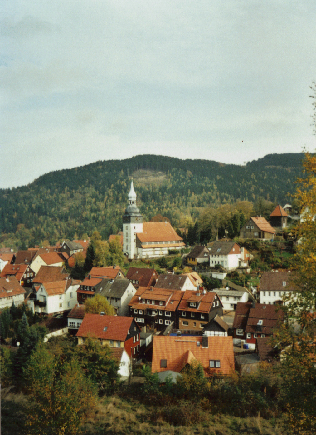
The formerly free mining town ('' Bergstadt'') of Lautenthal in Germany is a state-recognised, climatic spa with around 1,570 inhabitants and has been part of the borough of Langelsheim since 1972. Geography Lautenthal lies in the Innerste valley between Clausthal-Zellerfeld and Langelsheim in the northwestern Upper Harz. The town is located at a height of about in a valley bowl, the surrounding mountains being up to . The two rivers of the Innerste and the Laute flow through the town. Towards Langelsheim the Innerste is impounded by the Innerste Dam. History Mining of copper, lead and silver in the area around Lautenthal started about 1225. In the middle of the 14th century, however, the Harz was depopulated because of plague and mining came to an end. Mining in the Harz was started again in 1524. Lautenthal was founded in 1538 as a mining settlement on the river Laute, a small tributary of the Innerste, and had already been given the status of a town by 1580. Sixteen ... [...More Info...] [...Related Items...] OR: [Wikipedia] [Google] [Baidu] |
Innerste
The Innerste is a river in Lower Saxony, Germany. It is a right tributary of the Leine river and in length. Origin of the name The river name is not related to the German word ''innerste'' meaning innermost. ''Innerste'', in earlier times called the ''Inste'' (1805), ''Inderste'' (1567), ''Indistria'' (1313), ''Entrista'' (1065) and ''Indrista'' (1013), probably goes back to the Indo-Germanic root ''oid'' = ''turbulent, strong''. It may be the name referred to in the name of the battlefield of '' ''Idista''viso'' (16 A.D.). Course The river's source is in the Harz mountains, from the town of Clausthal-Zellerfeld to the southwest at an elevation of 615 m and is called ''Innerstesprung''. As a small brook, the Innerste flows west and passes a system of lakes, the first of which is called ''Entensumpf''. The next lakes are ''Oberer Nassenwieser Teich'', ''Bärenbrucher Teich'', ''Ziegenberger Teich'', and ''Sumpfteich''. The German word ''Teich'' means "pond". Having ... [...More Info...] [...Related Items...] OR: [Wikipedia] [Google] [Baidu] |
Innerste Valley Railway
The Innerste is a river in Lower Saxony, Germany. It is a right tributary of the Leine river and in length. Origin of the name The river name is not related to the German word ''innerste'' meaning innermost. ''Innerste'', in earlier times called the ''Inste'' (1805), ''Inderste'' (1567), ''Indistria'' (1313), ''Entrista'' (1065) and ''Indrista'' (1013), probably goes back to the Indo-Germanic root ''oid'' = ''turbulent, strong''. It may be the name referred to in the name of the battlefield of '' ''Idista''viso'' (16 A.D.). Course The river's source is in the Harz mountains, from the town of Clausthal-Zellerfeld to the southwest at an elevation of 615 m and is called ''Innerstesprung''. As a small brook, the Innerste flows west and passes a system of lakes, the first of which is called ''Entensumpf''. The next lakes are ''Oberer Nassenwieser Teich'', ''Bärenbrucher Teich'', ''Ziegenberger Teich'', and ''Sumpfteich''. The German word ''Teich'' means "pond". Having ... [...More Info...] [...Related Items...] OR: [Wikipedia] [Google] [Baidu] |
Upper Harz
The Upper Harz (german: Oberharz, ) refers to the northwestern and higher part of the Harz mountain range in Germany. The exact boundaries of this geographical region may be defined differently depending on the context. In its traditional sense, the term Upper Harz covers the area of the seven historical mining towns (''Bergstädte'') - Clausthal, Zellerfeld, Andreasberg, Altenau, Lautenthal, Wildemann and Grund - in the present-day German federal state of Lower Saxony. Orographically, it comprises the Harz catchment areas of the Söse, Innerste and Grane, Oker and Abzucht mountain streams, all part of the larger Weser watershed. Much of the Upper Harz area is up to above sea level. In a wider sense, it also comprises the adjacent High Harz (''Hochharz'') range in the east, climbing to over in the Brocken massif. Geography The region is centred on the geological structure of the region around the municipality of Clausthal-Zellerfeld, merged in 1924. From the Clausthal ''Ku ... [...More Info...] [...Related Items...] OR: [Wikipedia] [Google] [Baidu] |


