|
Latah County, Idaho
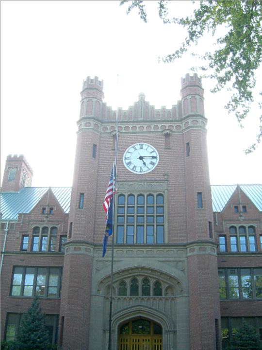
Latah County ( ) is a county located in the north central region of the U.S. state of Idaho. As of the 2020 census, the population was 39,517. The county seat and largest city is Moscow, the home of the University of Idaho, the state's flagship university. The county was created in 1888 and named for Latah Creek in its northwest corner. The name was derived from two words in the Nez Perce language to evoke the sense of "the place of pine trees and sestle." The tribe found shade under the white pine trees for doing their work and stones suitable for use in pulverizing camas roots to process as one of their food staples. Latah County comprises the Moscow, ID Micropolitan Statistical Area, which is included in the Pullman-Moscow, WA-ID Combined Statistical Area. The county comprises the majority of the eastern portion of the Palouse, famous for its rolling hills and rich agriculture. Latah County is the only county in the U.S. established by an act of Congress; it ... [...More Info...] [...Related Items...] OR: [Wikipedia] [Google] [Baidu] |
Moscow City Hall (Idaho)
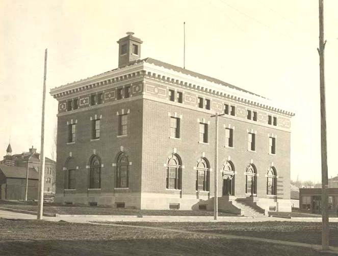
The City Hall of Moscow, Idaho, formerly known as the Moscow Post Office and Courthouse and Moscow Federal Building, was built in 1911. Its red brick with ivory terracotta trim reflects Late Victorian and Eclectic As a federal building, it served historically as a post office and a courthouse of the U.S. District Court for the District of Idaho. Listed on the National Register of Historic Places in 1973, it was vacated in 1974 when the new federal building opened two blocks south. Two years later, it was acquired by the city from the General Services Administration for $70,000, with half of that funded from the state historical society. At the time, the land alone was valued at $100,000. Rejected for use as a library in 1979, it became a community center in the early 1980s. A bond issue to fund a renovation was defeated in late 1986, it became the city hall of the municipality in the 1990s.Federal Judicial Center Historic Federal Courthouses page on the ... [...More Info...] [...Related Items...] OR: [Wikipedia] [Google] [Baidu] |
Palouse
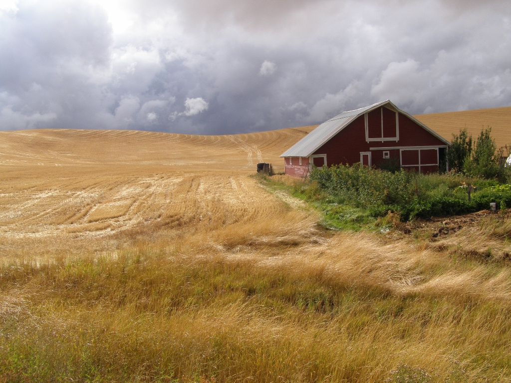
The Palouse ( ) is a geographic region of the northwestern United States, encompassing parts of North Central Idaho, north central Idaho, southeastern Washington (part of eastern Washington), and by some definitions, parts of northeast Oregon. It is a major Agriculture, agricultural area, primarily producing wheat and legumes. Situated about north of the Oregon Trail, the region experienced rapid growth in the late 19th century. The Palouse is home to two Land-grant university, land-grant universities: the University of Idaho in Moscow, Idaho, Moscow and Washington State University in Pullman, Washington, Pullman. Just apart, both universities opened in the early 1890s. Geography and history The origin of the name "Palouse" is unclear. One theory is that the name of the Palouse people, Palus tribe (spelled in early accounts variously as Palus, Palloatpallah, Pelusha, etc.) was converted by French-Canadian fur traders to the more familiar French word , meaning "land with shor ... [...More Info...] [...Related Items...] OR: [Wikipedia] [Google] [Baidu] |
ID-3
ID3 is a metadata format for MP3 audio files. ID3 or ID-3 may also refer to: * ID3 algorithm, an algorithm for constructing decision trees * ID3 (gene), a human protein * ID-3 format, a standard size for identification cards defined by ISO/IEC 7810 * ID3, a post-dubstep/glitch A glitch is a short-lived technical fault, such as a transient one that corrects itself, making it difficult to troubleshoot. The term is particularly common in the computing and electronics industries, in circuit bending, as well as among pl ... artist * Volkswagen ID.3, a battery electric car by the German manufacturer Volkswagen {{Letter-NumberCombDisambig ... [...More Info...] [...Related Items...] OR: [Wikipedia] [Google] [Baidu] |
US 95
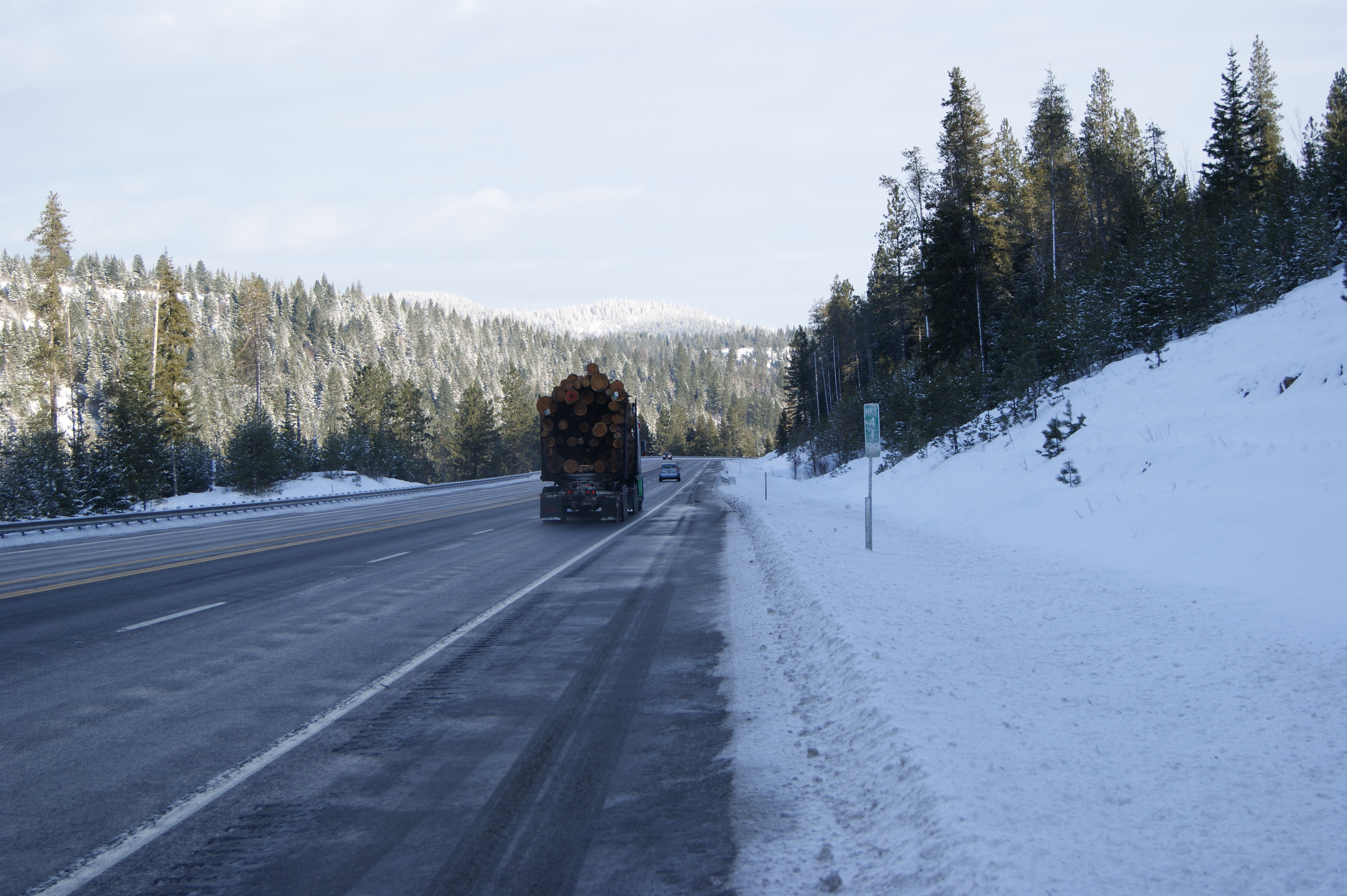
U.S. Route 95 (US 95) is a major north–south United States Highway in the western United States. It travels through the states of Arizona, California, Nevada, Oregon, and Idaho, staying inland from the Pacific Coast. US 95 begins in San Luis, Arizona, at the Mexican border, where Calle 1—a short spur—leads to Highway 2 in San Luis Río Colorado, Sonora. Its northern terminus is at the Canadian border in Eastport, Idaho, where the roadway continues north as British Columbia Highway 95.Endpoints of US highwaysU.S. Highway 95an/ref> Unlike many other US Highways, it has not seen deletion or replacement on most of its length by an encroaching Interstate Highway corridor, due to its mostly rural and mountainous course. Because of this, it still travels from border to border and is a primary north–south highway in both Nevada and Idaho. This is one of the few US Routes to cross from Mexico to Canada. Route description Arizona US ... [...More Info...] [...Related Items...] OR: [Wikipedia] [Google] [Baidu] |
Whitman County, Washington
Whitman County is a county located in the U.S. state of Washington. As of the 2020 census, the population was 47,973. The county seat is Colfax, and its largest city is Pullman. The county was formed from Stevens County in 1871. It is named after Marcus Whitman, a Presbyterian missionary who, with his wife Narcissa, was killed in 1847 by members of the Cayuse tribe. Whitman County comprises the Pullman, Washington Metropolitan Statistical Area. History The area delineated by the future Washington state boundary began to be colonized at the start of the nineteenth century, both by Americans and Canadians. However, the majority of Canadian exploration and interest in the land was due to the fur trade, whereas American settlers were principally seeking land for agriculture and cattle raising. The Treaty of 1818 provided for dual control of this area by US and Canadian government officials. During this period, the future Washington Territory was divided into two admini ... [...More Info...] [...Related Items...] OR: [Wikipedia] [Google] [Baidu] |
Clearwater County, Idaho
Clearwater County is a County (United States), county located in the U.S. state of Idaho. As of the 2020 United States census, 2020 census, the population was 8,734. The county seat is Orofino, Idaho, Orofino. Established in 1911, the county was named after the Clearwater River (Idaho), Clearwater River. The county is home to North Fork Clearwater River, North Fork of the Clearwater River, and a small portion of the South Fork and the main Clearwater. Also in the county are the Dworshak Reservoir, Dworshak State Park, Dworshak National Fish Hatchery, and the Dworshak Dam, third highest in the United States, U.S. The modest Bald Mountain Ski Area, Bald Mountain ski area is located between Orofino, Idaho, Orofino and Pierce, Idaho, Pierce. History The Clearwater River and Lolo Pass (Idaho), Lolo Pass, in the southeast corner of the county, were made famous by the exploration of Lewis and Clark in the early 19th century. Following an arduous trek through the Bitterroot Mountains, s ... [...More Info...] [...Related Items...] OR: [Wikipedia] [Google] [Baidu] |
Shoshone County, Idaho
Shoshone County is a county in the U.S. state of Idaho. As of the 2020 census, the population was 13,169. The county seat is Wallace and the largest city is Kellogg. The county was established in 1864, named for the Native American Shoshone tribe. Shoshone County is commonly referred to as the Silver Valley, due to its century-old mining history. The Silver Valley is famous nationwide for the vast amounts of silver, lead, and zinc mined from it. History Shoshone County was formed under the Territory of Washington on January 9, 1861. The territorial legislature established the county in anticipation of the gold rush that occurred after the discovery of gold at Pierce in October 1860. Their location of the northern boundary at a line drawn due east from the mouth of the Clearwater River, unknowingly placed the emerging mining settlement at Pierce outside of the county's boundaries while residents of the new Mormon settlement at Franklin were unknowingly within the est ... [...More Info...] [...Related Items...] OR: [Wikipedia] [Google] [Baidu] |
Benewah County, Idaho
Benewah County () is a county located in the northwest part of the U.S. state of Idaho. As of the 2020 United States census the county had a population of 9,530. The county seat and largest city is St. Maries, which has some area inside the Coeur d'Alene Reservation. The county was established on January 23, 1915, of land partitioned from Kootenai County. It was named for a chief of the Coeur d'Alene Tribe. The federally recognized Coeur d'Alene Tribe is based on the Coeur d'Alene Reservation in this and neighboring Kootenai County. Geography Benewah County lies on the west line of the state. Its west boundary line abuts the east boundary line of the state of Washington. The county has a total area of , of which is land and (0.9%) is water. It is the northern part of the Palouse, a wide and rolling prairie-like region of the middle Columbia basin. Adjacent counties * Spokane County, Washington – northwest * Kootenai County – north * Shoshone County – east * Lat ... [...More Info...] [...Related Items...] OR: [Wikipedia] [Google] [Baidu] |
Columbia River
The Columbia River (Upper Chinook language, Upper Chinook: ' or '; Sahaptin language, Sahaptin: ''Nch’i-Wàna'' or ''Nchi wana''; Sinixt dialect'' '') is the largest river in the Pacific Northwest region of North America. The river headwater, forms in the Rocky Mountains of British Columbia, Canada. It flows northwest and then south into the U.S. state of Washington, then turns west to form most of the border between Washington and the state of Oregon before emptying into the Pacific Ocean. The river is long, and its largest tributary is the Snake River. Columbia River drainage basin, Its drainage basin is roughly the size of France and extends into seven states of the United States and one Canadian province. The fourth-largest river in the United States by River flow, flow, the Columbia has the greatest flow of any river into the eastern Pacific. The Columbia and its tributaries have been central to the region's culture and economy for thousands of years. They have been use ... [...More Info...] [...Related Items...] OR: [Wikipedia] [Google] [Baidu] |
United States Census Bureau
The United States Census Bureau, officially the Bureau of the Census, is a principal agency of the Federal statistical system, U.S. federal statistical system, responsible for producing data about the American people and American economy, economy. The U.S. Census Bureau is part of the United States Department of Commerce, U.S. Department of Commerce and its Director of the United States Census Bureau, director is appointed by the president of the United States. Currently, Ron S. Jarmin is the acting director of the U.S. Census Bureau. The Census Bureau's primary mission is conducting the United States census, U.S. census every ten years, which allocates the seats of the United States House of Representatives, U.S. House of Representatives to the U.S. state, states based on their population. The bureau's various censuses and surveys help allocate over $675 billion in federal funds every year and it assists states, local communities, and businesses in making informed decisions. T ... [...More Info...] [...Related Items...] OR: [Wikipedia] [Google] [Baidu] |
Moscow Mountain
Moscow ( ) is a city and the county seat of Latah County, Idaho. Located in the North Central region of the state along the border with Washington, it had a population of 25,435 at the 2020 United States census. Moscow is the home of the University of Idaho, the state's land-grant institution and primary research university. It is the principal city in the Moscow, Idaho Micropolitan Statistical Area, which includes all of Latah County. The city contains over 60% of the county's population, and whilst the university is Moscow's dominant employer, the city also serves as an agricultural and commercial hub for the Palouse region. Along with the rest of the Idaho Panhandle, Moscow is in the Pacific Time Zone. The elevation of its city center is above sea level. Two major highways serve the city, passing through the city center: US-95 (north-south) and ID-8 (east-west). The Pullman–Moscow Regional Airport, west, provides limited commercial air service. The local newspaper i ... [...More Info...] [...Related Items...] OR: [Wikipedia] [Google] [Baidu] |
Fred Dubois
Fred Thomas Dubois (May 29, 1851February 14, 1930) was an American politician from Idaho who served two terms in the United States Senate. He was best known for his opposition to the gold standard and his efforts to disenfranchise Mormon voters. Early life and career Dubois was of part French-Canadian descent. His paternal grandfather, Toussaint Dubois, was an immigrant who distinguished himself at the Battle of Tippecanoe. His surname was pronounced "''deh-bwah''" and he was said to have "hated it" when people pronounced the "-bois" suffix as "''boys''," which he found "insufferable." Dubois' father, Jesse Kilgore Dubois, was an official at the U.S. Land Office in Palestine, Illinois, a former judge and state legislator, an early supporter of the Republican Party, and a close friend of fellow Illinois Republican Abraham Lincoln. In 1856 the elder Dubois was elected Illinois state auditor and moved the family to the state capital, Springfield. Fred Dubois studied at Yale Coll ... [...More Info...] [...Related Items...] OR: [Wikipedia] [Google] [Baidu] |


