|
Lastau
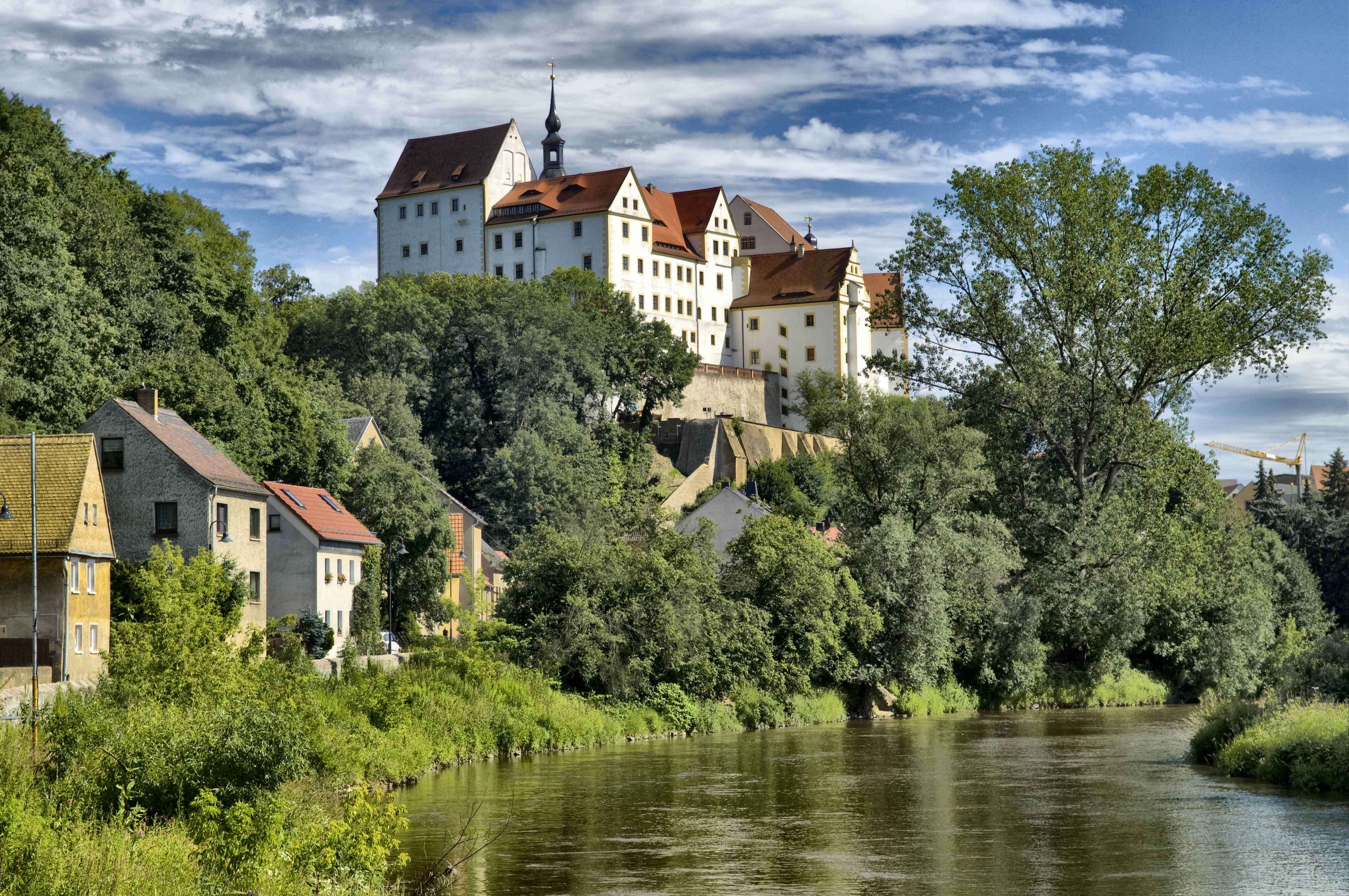
Lastau is a village in Landkreis Leipzig, Saxony, Germany with approx. 222 inhabitants (2012). On 1 January 1994 it was incorporated into the town Colditz. Geography Lastau is located south-east of Colditz on the right bank of Zwickauer Mulde and on the south bank of its tributary Auenbach. Only a small part named ''Aue'' including the former station actually lies in the valley and is subject to occasional flooding. The greater part of Lastau is situated several metres higher at the edge of the hilly forelands of the Ore mountains. ''Burgberg'', a hill west of the village, rises to 224 m a.s.l. History Lastau was first mentioned as ''Lostatawa'' in Thietmar of Merseburg's chronicle of 981. In 1220 it passed into the hands of Margrave Dietrich the Oppressed and in 1221, after the family of the former owners gave up all rights to the village, to Buch Abbey near Leisnig. A contract dated 1265 gave permission to erect a water mill and stipulated that no further mill should be b ... [...More Info...] [...Related Items...] OR: [Wikipedia] [Google] [Baidu] |
Lastau Muehle
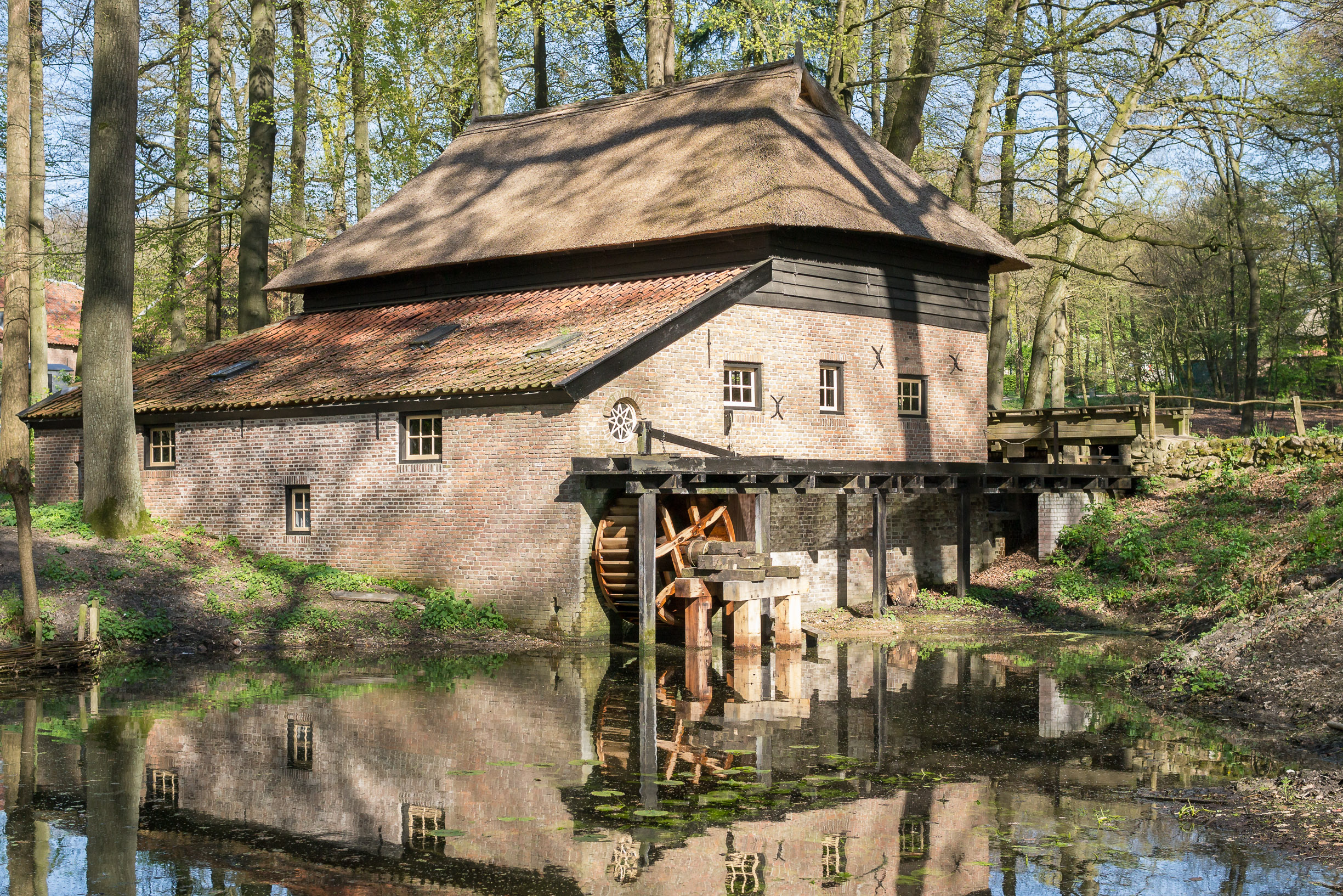
Lastau is a village in Landkreis Leipzig, Saxony, Germany with approx. 222 inhabitants (2012). On 1 January 1994 it was incorporated into the town Colditz. Geography Lastau is located south-east of Colditz on the right bank of Zwickauer Mulde and on the south bank of its tributary Auenbach. Only a small part named ''Aue'' including the former station actually lies in the valley and is subject to occasional flooding. The greater part of Lastau is situated several metres higher at the edge of the hilly forelands of the Ore mountains. ''Burgberg'', a hill west of the village, rises to 224 m a.s.l. History Lastau was first mentioned as ''Lostatawa'' in Thietmar of Merseburg's chronicle of 981. In 1220 it passed into the hands of Margrave Dietrich the Oppressed and in 1221, after the family of the former owners gave up all rights to the village, to Buch Abbey near Leisnig. A contract dated 1265 gave permission to erect a water mill and stipulated that no further mill should be ... [...More Info...] [...Related Items...] OR: [Wikipedia] [Google] [Baidu] |
Glauchau–Wurzen Railway
The Glauchau–Wurzen railway is a secondary railway line in Saxony. It follows the valleys of Zwickauer Mulde and Mulde from Glauchau via Rochlitz and Grimma to Wurzen and is hence also known as ''Muldentalbahn'' (Mulde valley railway). Regular traffic on the line ended in the early 2000s. The section between Glauchau and Großbothen has been leased by ''Deutsche Regionaleisenbahn'' since 2005 and has been protected as a cultural monument since 2016, the remainder has been decommissioned. History Already in 1860, a committee formed in Penig with the aim of constructing a railway from Glauchau to Wurzen. In 1864 the Saxon parliament permitted the construction of a railway from Leipzig along the Mulde valley to Chemnitz. Since no private entrepreneur could be found for this project, permission was granted instead in 1868 for a railway from Glauchau via Wurzen to the border with Prussia. The private ''Muldenthal-Eisenbahngesellschaft'' was awarded the concession for the constructi ... [...More Info...] [...Related Items...] OR: [Wikipedia] [Google] [Baidu] |
Colditz
Colditz () is a small town in the district of Leipzig, in Saxony, Germany. It is best known for Colditz Castle, the site of the Oflag IV-C POW camp for officers in World War II. Geography Colditz is situated in the Leipzig Bay, southeast of the city of Leipzig. The town centre is located on the banks of Zwickau Mulde river, south of its confluence with the Freiberg Mulde. The municipality had a population of 8,374 in 2020. The town Colditz consists of Colditz proper and the ''Ortsteile'' (divisions) Bockwitz, Collmen, Commichau, Erlbach, Erlln, Hausdorf, Hohnbach, Kaltenborn, Koltzschen, Lastau, Leisenau, Maaschwitz, Meuselwitz, Möseln, Podelwitz, Raschütz, Schönbach, Sermuth, Skoplau, Tanndorf, Terpitzsch, Zollwitz, Zschadraß, Zschetzsch and Zschirla. History The first record of a burgward on the Mulde river, called ''Cholidistcha'', dates to the year 1046, when Emperor Henry III dedicated it to his consort Agnes of Poitou. The name is possibly of Slavic origin. In 1083 ... [...More Info...] [...Related Items...] OR: [Wikipedia] [Google] [Baidu] |
Landkreis Leipzig
Leipzig (official name: ''Landkreis Leipzig'') is a district ('' Kreis'') in the Free State of Saxony, Germany. It is named after the city Leipzig, which is partly surrounded by the district, but not part of it. It borders (from the west and clockwise) the state Saxony-Anhalt, the urban district Leipzig, the districts Nordsachsen and Mittelsachsen, and the state Thuringia. Geography The district is located in the Leipzig Bay and is rather flat. Individual hills are found in the north (Hohburg Hills) and south of the district. Its larger rivers are the Mulde, Pleiße and White Elster. Also worth mentioning are the many lakes of the Leipzig Neuseenland in the west of the county, that were formed by flooding old brown coal pits. History The district was established by merging the former districts Muldentalkreis and Leipziger Land as part of the district reform of August 2008. Geography The district is located in the lowlands around Leipzig. The main rivers of the district are ... [...More Info...] [...Related Items...] OR: [Wikipedia] [Google] [Baidu] |
John, Elector Of Saxony
Johann (30 June 146816 August 1532), known as Johann the Steadfast or Johann the Constant (''Johann, der Beständige''), was Prince-elector, Elector of Saxony from 1525 until 1532 from the Wettin (dynasty), House of Wettin. He is notable for organising the Lutheran Church in the Electorate of Saxony from a state and administrative level. In that, he was aided by Martin Luther, whose "Saxon model" of a Lutheran church was also soon to be implemented beyond Saxony, in other territories of the Holy Roman Empire. Luther turned to the Elector for secular leadership and funds on behalf of a church largely shorn of its assets and income after the break with Rome.Brecht, 2:260–63, 67; Mullett, 184–86. He played a part in the Protestation at Speyer. Biography Born in Meissen, John was the fifth of the seven children of Ernest, Elector of Saxony and Elisabeth of Bavaria, Electress of Saxony, Elisabeth of Bavaria. From 1486 onward he was the heir presumptive of his childless brother ... [...More Info...] [...Related Items...] OR: [Wikipedia] [Google] [Baidu] |
Rochlitz
Rochlitz (; hsb, Rochlica) is a major district town (Große Kreisstadt) in the district of Mittelsachsen, in Saxony, Germany. Rochlitz is the head of the "municipal partnership Rochlitz" (Verwaltungsgemeinschaft Rochlitz) with its other members being the municipalities of Königsfeld, Seelitz and Zettlitz. Geography Location The town is situated on a bend of the river Zwickauer Mulde and at the foot of Rochlitzer Berg, 26 km northwest of Chemnitz and 45 km from Leipzig or Zwickau. Geology Rochlitz is situated in the Natural Region ''Sächsisches Lössgefilde'' ("Saxon Loess country") and its sub-region ''Mulde-Lösshügelland'' ("Mulde Loess hill country"). Rochlitzer Berg (ca. 349 m ( NHN)) is of Rotliegend volcanic origin (latest Carboniferous to Guadalupian) and consists to a large extent of so-called ''Rochlitzer Porphyr'', a rhyolitic tuff or ignimbrite. Due to its colour and structure, this rock is used in representative buildings in the wider region like ... [...More Info...] [...Related Items...] OR: [Wikipedia] [Google] [Baidu] |
Döhlen (Seelitz)
Döhlen is a village in ''Landkreis'' Mittelsachsen in the Free State of Saxony, Germany. It is part of the municipality of Seelitz. Geography Döhlen is situated in the valley of Aubach brook, about 2 km east of Rochlitz in the Saxon Loess country. The lowest point is at the bridge of Bundesstraße 175 across Aubach at about 160 m a.s.l. The terrain rises above 200 m a.s.l. to the north and the south of the village, reaching 229 m on Gölprigberg near Köttern and 227 m on Eselsberg near Gröblitz, both outside Döhlen. The village, originally an irregular manor settlement with block-shaped land parcels, forms a contiguous settlement with Neutaubenheim, a former manor east of it. Neighbouring villages are Köttern in the north, Neuwerder in the northeast, Sachsendorf in the east, Gröblitz in the south, and Stöbnig in the west. The hamlet of Neudörfchen is situated between Döhlen and Köttern. Bundesstraße 175 passes through the western part of the village, climbing ... [...More Info...] [...Related Items...] OR: [Wikipedia] [Google] [Baidu] |
Bundesstraße
''Bundesstraße'' (German for "federal highway"), abbreviated ''B'', is the denotation for German and Austrian national highways. Germany Germany's ''Bundesstraßen'' network has a total length of about 40,000 km. German ''Bundesstraßen'' are labelled with rectangular yellow signs with black numerals, as opposed to the white-on-blue markers of the ''Autobahn'' controlled-access highways. ''Bundesstraßen'', like autobahns, are maintained by the federal agency of the Transport Ministry. In the German highway system they rank below autobahns, but above the ''Landesstraßen'' and ''Kreisstraßen'' maintained by the federal states and the districts respectively. The numbering was implemented by law in 1932 and has overall been retained up to today, except for those roads located in the former eastern territories of Germany. One distinguishing characteristic between German ''Bundesstraßen'' and ''Autobahnen'' is that there usually is a general 100 km/h (62 mph) s ... [...More Info...] [...Related Items...] OR: [Wikipedia] [Google] [Baidu] |
Kreisstraße
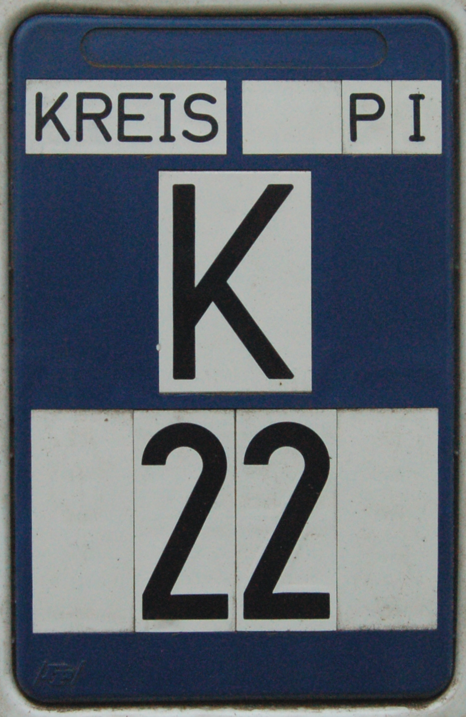
A Kreisstraße (literally: "district road" or "county road") is a class of road in Germany. It carries traffic between the towns and villages within a '' Kreis'' or district or between two neighbouring districts. In importance, the ''Kreisstraße'' ranks below a ''Landesstraße'' (or, in Bavaria and Saxony, a ''Staatstraße'', i.e. a state road), but above a ''Gemeindestraße'' or "local road". ''Kreisstraßen'' are usually the responsibility of the respective rural district (''Landkreis'') or urban district (''Kreisfreie Stadt''), with the exception of high streets through larger towns and villages. Kreisstraßen are usually dual-lane roads but, in a few cases, can be built as limited-access dual carriageways in densely populated areas. Numbering Unlike local roads (''Gemeindestraßen'') the ''Kreisstraßen'' are invariably numbered, but their numbering is not shown on signs. The abbreviation is a prefixed capital letter K followed by a serial number. In most states the car n ... [...More Info...] [...Related Items...] OR: [Wikipedia] [Google] [Baidu] |
Wallpaper
Wallpaper is a material used in interior decoration to decorate the interior walls of domestic and public buildings. It is usually sold in rolls and is applied onto a wall using wallpaper paste. Wallpapers can come plain as "lining paper" (so that it can be painted or used to help cover uneven surfaces and minor wall defects thus giving a better surface), textured (such as Anaglypta), with a regular repeating pattern design, or, much less commonly today, with a single non-repeating large design carried over a set of sheets. The smallest rectangle that can be tiled to form the whole pattern is known as the pattern repeat. Wallpaper printing techniques include surface printing, gravure printing, silk screen-printing, rotary printing, and digital printing. Wallpaper is made in long rolls which are hung vertically on a wall. Patterned wallpapers are designed so that the pattern "repeats", and thus pieces cut from the same roll can be hung next to each other so as to continue the ... [...More Info...] [...Related Items...] OR: [Wikipedia] [Google] [Baidu] |
Hydroelectricity
Hydroelectricity, or hydroelectric power, is Electricity generation, electricity generated from hydropower (water power). Hydropower supplies one sixth of the world's electricity, almost 4500 TWh in 2020, which is more than all other Renewable energy, renewable sources combined and also more than nuclear power. Hydropower can provide large amounts of Low-carbon power, low-carbon electricity on demand, making it a key element for creating secure and clean electricity supply systems. A hydroelectric power station that has a dam and reservoir is a flexible source, since the amount of electricity produced can be increased or decreased in seconds or minutes in response to varying electricity demand. Once a hydroelectric complex is constructed, it produces no direct waste, and almost always emits considerably less greenhouse gas than fossil fuel-powered energy plants. [...More Info...] [...Related Items...] OR: [Wikipedia] [Google] [Baidu] |
Paper Mill
A paper mill is a factory devoted to making paper from vegetable fibres such as wood pulp, old rags, and other ingredients. Prior to the invention and adoption of the Fourdrinier machine and other types of paper machine that use an endless belt, all paper in a paper mill was made by hand, one sheet at a time, by specialized laborers. History Historical investigations into the origin of the paper mill are complicated by differing definitions and loose terminology from modern authors: Many modern scholars use the term to refer indiscriminately to all kinds of mills, whether powered by humans, by animals or by water. Their propensity to refer to any ancient paper manufacturing center as a "mill", without further specifying its exact power source, has increased the difficulty of identifying the particularly efficient and historically important water-powered type. Human and animal-powered mills The use of human and animal powered mills was known to Muslim and Chinese paperma ... [...More Info...] [...Related Items...] OR: [Wikipedia] [Google] [Baidu] |


