|
Landing Masonry Bridge
The Landing Masonry Bridge, also designated Bridge 44.53, is a stone structure built in 1907 by the Delaware, Lackawanna and Western Railroad in Landing, New Jersey, United States. Located 44.53 miles up the rail line from Hoboken Terminal, the bridge carries the two-lane Morris County Route 631 (Landing Road) over the Morristown Line and Montclair-Boonton Line railroad tracks maintained by New Jersey Transit, and sits several hundred feet north of NJT's Lake Hopatcong Station. By 2009, it was deteriorated and structurally deficient, and plans were announced for it to be replaced with a four-lane bridge by NJT and the New Jersey Department of Transportation. More than a decade passed before the work actually began, with demolition of several nearby buildings in June 2023. History In the late 1800s, a pony truss bridge carried Landing Road over the Morris Canal (eastern span) and the DL&W mainline (western span). The steel, cable-stayed structure had two towers to support it, ... [...More Info...] [...Related Items...] OR: [Wikipedia] [Google] [Baidu] |
Lake Hopatcong (NJT Station)
Lake Hopatcong is a commuter railroad station for New Jersey Transit. The station, located in the community of Landing in Roxbury Township, Morris County, New Jersey, United States, serves trains for the Montclair-Boonton Line and Morristown Line at peak hours and on holiday weekends. Service from Lake Hopatcong provides to/from Hackettstown to New York Penn Station and Hoboken Terminal. The stop is located on the tracks below Landing Road ( Morris County Route 631) next to the eponymous Lake Hopatcong. The station consists of one active and one abandoned side platform, along with a shelter on the active platform. There is no accessibility for handicapped persons under the Americans with Disabilities Act of 1990. Service through the Landing area began on January 16, 1854, for the Morris and Essex Railroad, but there was no stop at the shore of Lake Hopatcong. People who wanted to visit the lake had to get off at nearby Drakesville station and traverse from there to t ... [...More Info...] [...Related Items...] OR: [Wikipedia] [Google] [Baidu] |
Morris County Traction Company
The Morris County Traction Company began trolley service in downtown Dover, New Jersey in July 1904. It was expanded over the years until the system was completed in 1914 to Newark, New Jersey. Service lasted until 1928. Routes and service According to records, service was provided to: Bertrand Island Amusement Park at Lake Hopatcong, Ledgewood, Succasunna, Kenvil, Mine Hill, Dover, Wharton, Rockaway Borough, Denville, Mountain Lakes, Boonton, Morris Plains (including Greystone Park Psychiatric Hospital), Morristown, Madison, Chatham, Summit, Irvington, Elizabeth, and Newark, a distance of about 75 miles. The line ran on both exclusive right-of-way streets and on city streets, some of which, such as Broad Street in Summit, were designed and built to accommodate the trolley line. The power house for the trolley was located along the Passaic River in Summit, on the border of Chatham, New Jersey. Between 1926 and 1928, after private automobiles became more promin ... [...More Info...] [...Related Items...] OR: [Wikipedia] [Google] [Baidu] |
NJ Transit Rail Operations
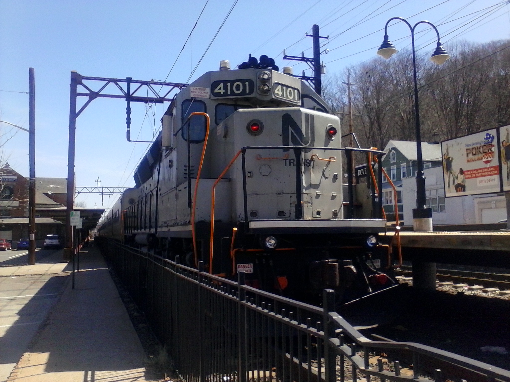
NJ Transit Rail Operations is the rail division of NJ Transit. It operates commuter rail service in New Jersey, with most service centered on transportation to and from New York City, Hoboken, and Newark. NJ Transit also operates rail service in Orange and Rockland counties in New York under contract to Metro-North Railroad. The commuter rail lines saw riders in , making it the second-busiest commuter railroad in North America as well as the longest by route length. This does not include NJ Transit's light rail operations. Network and infrastructure The lines operated by NJ Transit were formerly operated by the Pennsylvania Railroad, Central Railroad of New Jersey, New York and Long Branch Railroad and Erie Lackawanna Railroad, most of which date from the mid-19th century. From the 1960s onward, the New Jersey Department of Transportation began subsidizing the commuter lines. By 1976, the lines were all operated by Conrail under contract to NJDOT. The system took its curr ... [...More Info...] [...Related Items...] OR: [Wikipedia] [Google] [Baidu] |
Lake Hopatcong
Lake Hopatcong is the largest freshwater body in New Jersey, United States, about in area. Located from the Delaware River and from Manhattan, New York City, the lake forms part of the border between Sussex and Morris counties in the state's northern highlands region. Lake Hopatcong was produced by damming and flooding of two ponds, known as the Great Pond and Little Pond, and the Musconetcong River, its natural outlet. Historically known as a resort lake for vacationing New Yorkers, it is now a mostly suburban residential lake. Name The exact origin of the name Hopatcong is unknown, though it is most commonly attributed to the Lenape Indian word for "stone water," or "stone over water". Some linguists believe "Hopatcong" to be a derivative of the Lenape word ''hapakonoesson'', meaning "pipe stone". One explanation of the origin of the word ''Hopatcong'' is that it was a derivation from the Lenni Lenape word ''Huppakong'' meaning "honey waters of many coves," but this wording ... [...More Info...] [...Related Items...] OR: [Wikipedia] [Google] [Baidu] |
Right-of-way (transportation)
A right-of-way (ROW) is a right to make a way over a piece of land, usually to and from another piece of land. A right of way is a type of easement granted or reserved over the land for transportation purposes, such as a highway, public footpath, rail transport, canal, as well as electrical transmission lines, oil and gas pipelines. In the case of an easement, it may revert to its original owners if the facility is abandoned. This American English term is also used to denote the land itself. A right of way is granted or reserved over the land for transportation purposes, usually for private access to private land and, historically for a highway, public footpath, rail transport, canal, as well as electrical transmission lines, oil and gas pipelines.Henry Campbell Black: ''Right-of-way.'' In''A law dictionary containing definitions of the terms and phrases of American and English jurisprudence, ancient and modern: and including the principal terms of international, constitutio ... [...More Info...] [...Related Items...] OR: [Wikipedia] [Google] [Baidu] |
New Jersey Turnpike Authority
The New Jersey Turnpike Authority (NJTA) is a state agency responsible for maintaining the New Jersey Turnpike and the Garden State Parkway, which are two toll roads in the U.S. state of New Jersey. The agency is headquartered in Woodbridge Township, New Jersey. The NJTA was created in 1949 to oversee construction and maintenance of the New Jersey Turnpike. In 2003, the authority assumed control of the Garden State Parkway, which had previously been maintained by an agency known as the New Jersey Highway Authority (NJHA). Board of Commissioners The New Jersey Turnpike Authority is governed by an eight-person Board of Commissioners (with one current vacant seat). The members of the commission, along with the chairman, are appointed by the Governor of New Jersey. , the commissioners are: *Diane Gutierrez-Scaccetti – Chair *Ronald Gravino – Vice Chairman *Michael R. DuPont – Treasurer *Raymond M. Pocino – Commissioner *Ulises E. Diaz – Commissioner *John D. Minella – Co ... [...More Info...] [...Related Items...] OR: [Wikipedia] [Google] [Baidu] |
Morris County, New Jersey
Morris County is a County (United States), county located in the U.S. state of New Jersey, about west of New York City. According to the 2020 United States census, 2020 census, the county's population was enumerated at 509,285,QuickFacts Morris County, New Jersey United States Census Bureau. Accessed June 24, 2022. an increase of 17,009 (3.5%) from the 492,276 counted at the 2010 United States census, 2010 census,DP1 – Profile of General Population and Housing Characteristics: 2010 D ... [...More Info...] [...Related Items...] OR: [Wikipedia] [Google] [Baidu] |
United States Department Of Transportation
The United States Department of Transportation (USDOT or DOT) is one of the executive departments of the U.S. federal government. It is headed by the secretary of transportation, who reports directly to the President of the United States and is a member of the president's Cabinet. The department's mission is "to develop and coordinate policies that will provide an efficient and economical national transportation system, with due regard for need, the environment, and the national defense." History Prior to the creation of the Department of Transportation, its functions were administered by the under secretary of commerce for transportation. In 1965, Najeeb Halaby, administrator of the Federal Aviation Agency (predecessor to the Federal Aviation Administration, FAA), suggested to President Lyndon B. Johnson that transportation be elevated to a cabinet-level post, and that the FAA be folded into the DOT. It was established by Congress in the Department of Transportation Act ... [...More Info...] [...Related Items...] OR: [Wikipedia] [Google] [Baidu] |
Sussex County, New Jersey
Sussex County is the northernmost county in the State of New Jersey. Its county seat is Newton.New Jersey County Map New Jersey Department of State. Accessed July 10, 2017. It is part of the and is part of New Jersey's Skylands Region. As of the , the county's population wa ... [...More Info...] [...Related Items...] OR: [Wikipedia] [Google] [Baidu] |
Interstate 80 In New Jersey
Interstate 80 (I-80) is a major Interstate Highway in the United States, running from San Francisco, California, eastward to the New York metropolitan area. In New Jersey, I-80 runs for from the Delaware Water Gap Toll Bridge at the Pennsylvania state line to its eastern terminus at Interstate 95 in New Jersey, I-95 in Teaneck, New Jersey, Teaneck, Bergen County, New Jersey, Bergen County. I-95 continues from the end of I-80 to the George Washington Bridge for access to New York City. The highway runs parallel to U.S. Route 46, US Route 46 (US 46) through rural areas of Warren County, New Jersey, Warren and Sussex County, New Jersey, Sussex counties before heading into more suburban surroundings in Morris County, New Jersey, Morris County. As the road continues into Passaic County, New Jersey, Passaic and Bergen counties, it heads into more urban areas. The New Jersey Department of Transportation (NJDOT) identifies I-80 within the state as the Christopher Co ... [...More Info...] [...Related Items...] OR: [Wikipedia] [Google] [Baidu] |
Landing Road Bridge Closeup
Landing is the last part of a flight, where a flying animal, aircraft, or spacecraft returns to the ground. When the flying object returns to water, the process is called alighting, although it is commonly called "landing", "touchdown" or " splashdown" as well. A normal aircraft flight would include several parts of flight including taxi, takeoff, climb, cruise, descent and landing. Aircraft Aircraft usually land at an airport on a firm runway or helicopter landing pad, generally constructed of asphalt concrete, concrete, gravel or grass. Aircraft equipped with pontoons (floatplane) or with a boat hull-shaped fuselage (a flying boat) are able to land on water. Aircraft also sometimes use skis to land on snow or ice. To land, the airspeed and the rate of descent are reduced such that the object descends at a low enough rate to allow for a gentle touch down. Landing is accomplished by slowing down and descending to the runway. This speed reduction is accomplishe ... [...More Info...] [...Related Items...] OR: [Wikipedia] [Google] [Baidu] |


