|
Lancefield
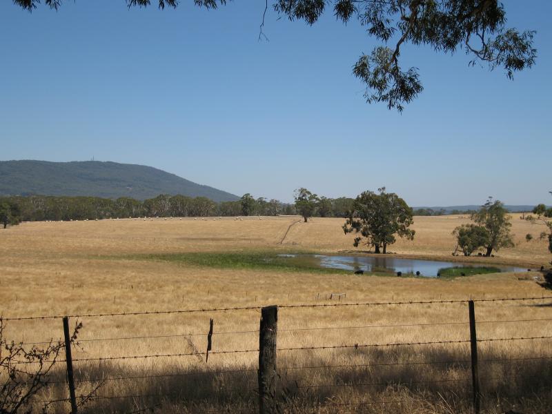
Lancefield is a town in the Shire of Macedon Ranges local government area in Victoria, Australia north of the state capital, Melbourne and had a population of 2,743 at the 2021 census. History The area was used by the indigenous aboriginal people as a quarry site for the manufacture of stone axes and was first settled by European squatters in 1837. The main source of these stone tools was at Mount William, to the north east of Lancefield. A Lancefield Post Office opened on 16 January 1858 in the Romsey/Five Mile Creek area, to the south. In 1860 this was renamed Five Mile Creek when Lancefield Post Office opened in the present township. Lancefield's elevation and climate made it a popular summer resort in the 1880s. In recent years, many local wineries have been established in the area. The town has a connection to the Kelly Gang; for it was here that Constable Fitzpatrick, the instigator of the Kelly Outbreak in 1878 was finally found by the Victorian police to be n ... [...More Info...] [...Related Items...] OR: [Wikipedia] [Google] [Baidu] |
Riddell District Football League
The Riddell District Football Netball League (RDFNL) is an Australian rules football and netball league in Victoria, Australia. The RDFNL covers towns in the Macedon Ranges and an area from Rockbank in the south to Broadford in the north. The league also runs junior competitions from Under 10 to Under 18 age groups. Brief history 1970s This decade saw Hesket club go into recess and the introduction of new clubs Craigieburn, Melton and Melton South. In 1975 the league went two divisional, With eight teams in First Division and six clubs in Second Division. Numbers were boosted by the return of Trentham and Hesket clubs. 1977 saw Broadford and a second team from Sunbury join the league. Diggers Rest joined in 1978. 1980s 1985 saw the league return to one division with twelve clubs. In 1987 the league went two divisional again as clubs were admitted from the Panton Hill Football League and North Fawkner from the disbanded YCW league the league had nineteen clubs. 1990s By ... [...More Info...] [...Related Items...] OR: [Wikipedia] [Google] [Baidu] |
Lancefield Swamp
The Lancefield Swamp is a rich fossil deposit from the Pleistocene epoch was discovered in the 19th century near Lancefield, Victoria, Australia. Description The site consists of a bone bed lying directly atop a layer of fluvial gravel between layers of clay.Gillespie R. et al. "Lancefield Swamp and the Extinction of the Australian Megafauna", ''Science'' 200, 1978, 1044-8. The layer of bones is estimated to contain the remains of perhaps 10,000 individual Pleistocene animals. A total of at least six megafauna species are represented, although the majority of bones are from the eastern grey kangaroo ('' Macropus giganteus'') or the extinct ''Macropus titan'', which was closely related to the eastern grey. Human artefacts were found in the bone bed and in the overlying clay, but evidence of reworking by water flow has been noted. Thus it appears possible such artefacts are intrusions. The Lancefield Swamp fossil site is important in the debate over the time of and causes of the ex ... [...More Info...] [...Related Items...] OR: [Wikipedia] [Google] [Baidu] |
Lancefield Football Club
The Lancefield Football Netball Club, nicknamed the Tigers, is an Australian rules football club located 61 km north of Melbourne in the town of Lancefield. It is affiliated with the Riddell District Football League. Premierships *Riddell District Football League **1923, 1924, 1932, 1946, 1949, 1952, 1958, 1966, 1995, 1996, 2004, 2009, * Assorted District competitions **1888, 1890, 1894, 1895, 1899, 1903, 1904, 1907, 1911 VFL/AFL players *Harvey Gibson - *Alexander "Ike" Johnston - *Silver Kane - *Jack McCormack - *Mark Bennetts - References Books History of Football in the Bendigo District - John Stoward - Lancefield Football Club The Lancefield Football Netball Club, nicknamed the Tigers, is an Australian rules football club located 61 km north of Melbourne in the town of Lancefield. It is affiliated with the Riddell District Football League. Premierships *Rid ... 1872 establishments in Australia Australian rules football clubs established ... [...More Info...] [...Related Items...] OR: [Wikipedia] [Google] [Baidu] |
Romsey, Victoria
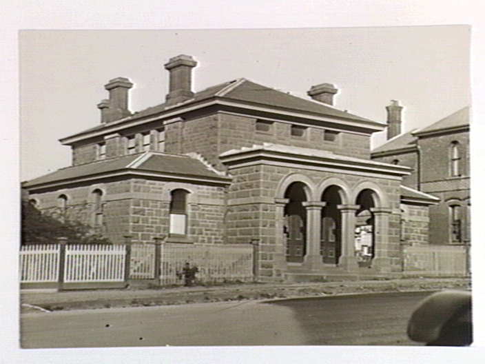
Romsey is a town in the local government area of the Shire of Macedon Ranges in the state of Victoria, Australia. The town is north of Melbourne. At the , Romsey had a population of 4,412. History The original location for the settlement known as Five Mile Creek was approximately north of the present township. The restored Royal Mail Hotel still stands on this site although it is now a private residence. The Post Office opened on 16 January 1858, in the Royal Mail Hotel (then the Drovers and Carriers Arms), but was named Lancefield until 19 January 1860 and Five Mile Creek until March 1860. The Post Office was moved closer to the centre of the present township in 1864. The area was serviced by three local newspapers. The former Romsey station was a significant stopping point on the now dismantled Clarkefield-Lancefield railway between 1881 and 1956. The Romsey Court of Petty Sessions closed on 1 January 1967, with the former courthouse subsequently sold to the Country ... [...More Info...] [...Related Items...] OR: [Wikipedia] [Google] [Baidu] |
Rochford, Victoria
Rochford is a locality in the Shire of Macedon Ranges, Macedon Ranges Shire, in Victoria (Australia), Victoria, Australia, on the Lancefield-Woodend Road (now signposted as the Rochford Road). The district once contained a number of public and religious buildings, all of which now appear to have been removed or demolished. These included a Public Hall, Anglican Church, Presbyterian Church, and tennis courts. Rochford Post Office opened on 10 March 1863 and closed in 1965. The 1857 red brick building & former 1870 principal's residence of the former Rochford North School (State School 540) is still standing and is now a privately owned luxury holiday rental. References Towns in Victoria (Australia) Shire of Macedon Ranges 1863 establishments in Australia {{Mallee-geo-stub ... [...More Info...] [...Related Items...] OR: [Wikipedia] [Google] [Baidu] |
Shire Of Macedon Ranges
The Shire of Macedon Ranges is a region in Central Victoria, Australia, best known for its expansive native forests, iconic geographical attraction Hanging Rock, and thriving artisan food and wine industries. The region covers an area of . It is located in between the cities of Bendigo and Melbourne. In June 2018 the shire had a population of 49,388. It includes the towns of Gisborne, Gisborne South, Kyneton, Lancefield, Macedon Macedonia (; grc-gre, Μακεδονία), also called Macedon (), was an ancient kingdom on the periphery of Archaic and Classical Greece, and later the dominant state of Hellenistic Greece. The kingdom was founded and initially ruled by ..., Malmsbury, Victoria, Malmsbury, Mount Macedon, Victoria, Mount Macedon, New Gisborne, Victoria, New Gisborne, Riddells Creek, Victoria, Riddells Creek, Romsey, Victoria, Romsey and Woodend, Victoria, Woodend. The Shire is named after the region's major geographical feature, the Macedon Ranges. It has be ... [...More Info...] [...Related Items...] OR: [Wikipedia] [Google] [Baidu] |
Newham, Victoria
Newham () is a town in the Shire of Macedon Ranges in Victoria, Australia. It is situated between the towns of Kyneton, Woodend and Lancefield. At the 2006 census, the surrounding area had a population of 570. At the 2016 census, Newham and the surrounding area had a population of 506. History The township of Newham was occupied as a station in 1847 by settlers named Peters and Dryden and called Dryden's Rock; The district of Newham and Woodend was created in December 1861; it became the Shire of Newham and Woodend in January 1905. Newham Post Office opened on 16 September 1861 and closed in 1971. Possible origins of the name In 1848 it may have been named Newham after Rev. Newham, an Anglican priest. Around the 1850s, Newham was known variously as ''Hieland Town'' or ''Isle of Skye'', perhaps indicating a Scottish heritage of the early settlers. It would appear that these names were colloquial terms rather than official names. While it is likely that the town was named ... [...More Info...] [...Related Items...] OR: [Wikipedia] [Google] [Baidu] |
Kilmore, Victoria
Kilmore () is a town in the Australian state of Victoria. Located north of Melbourne, it is the oldest inland town in Victoria by the combination of age and physical occupation, and because it had unique agricultural attributes to drive that earliest settlement. It grew very rapidly to become four times bigger than its nearest inland rival by 1851. Its spectacular growth continued to match that of the major gold mining towns of Ballarat, Bendigo and Beechworth until at least 1861. History The traditional owners of Kilmore and the Kilmore Plains are the Taungurung people, a part of the Kulin nation that inhabited a large portion of central Victoria including Port Phillip Bay and its surrounds. The Tommy McRae artwork held by the National Gallery of Australia depicts the "Kilmore Tribe Holding Corobboree", and a child pioneer of Kilmore, James Hamilton, describes in detail just such a corroboree at Kilmore in 1845. The area was known to the Taungurung as ''Mumillinuck''. Kilmor ... [...More Info...] [...Related Items...] OR: [Wikipedia] [Google] [Baidu] |
Mia Mia, Victoria
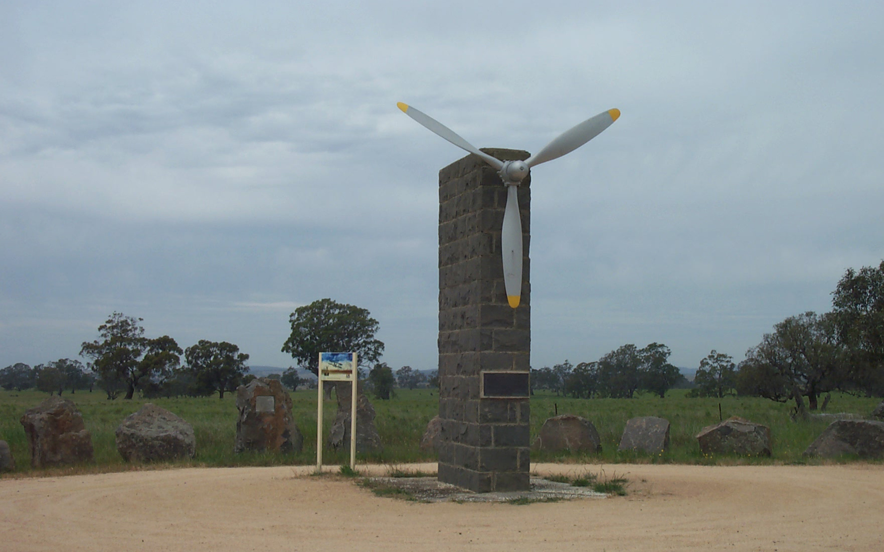
Mia Mia is a locality of Central Victoria, Australia, north of Melbourne and south of Bendigo. It is largely an area of broadacre farms raising cattle and sheep. It is a part of the Heathcote wine region Wine District and a number of vineyards have been established in the area, most notably producing Shiraz grapes. Its local government areas are the City of Greater Bendigo and Shire of Mitchell, Mia Mia is part of the Federal Electorates of Bendigo and McEwen and it is in the state electorate of Euroa. In 2011, it had a population of 265. History The Post Office opened on 22 November 1861, closing in 1970. Mia Mia is notable for being the home of John Duigan and brother Reginald Duigan who built and flew the first Australian made aeroplane in 1910 on their property named Spring Plains. A monument to their endeavours was constructed out of local bluestone and unveiled in 1960. Mia Mia’s western boundary is on the Campaspe River which is crossed by an iron bridge ... [...More Info...] [...Related Items...] OR: [Wikipedia] [Google] [Baidu] |
Wallan, Victoria
Wallan , traditionally known as Wallan Wallan (large circular place of water), is a town in Victoria, north of Melbourne's Central Business District. The town sits at the southern end of the large and diverse Shire of Mitchell which extends from the northern fringes of Melbourne into the farming country of north-central Victoria and the lower Goulburn Valley. The township flanks the Hume Freeway and is set against the backdrop of the Great Dividing Range. At the , Wallan had a population of 8,520. Overview The fastest growing town and now largest town in the shire, Wallan is a link between the city and rural towns such as Kilmore, Broadford and Seymour. 15 kilometres to the north is a turnoff to Strath Creek which leads through the Valley of a Thousand Hills. History A Wallan Wallan Post Office opened on 1 April 1858. A Wallan Railway Station Post Office opened on 1 October 1873, later renamed as Wallan Wallan East and closing in 1992. The first and only surviving st ... [...More Info...] [...Related Items...] OR: [Wikipedia] [Google] [Baidu] |
Pyalong, Victoria
Pyalong is a town in central Victoria, Australia. The town is located on the Northern Highway, in the Shire of Mitchell local government area, from the state capital, Melbourne. At the , Pyalong had a population of 459. In 2016 the population had reached 660. The traditional owners of Pyalong are the Taungurung people, a part of the Kulin nation that inhabited a large portion of central Victoria including Port Phillip Bay and its surrounds. The first Europeans to settle in the area were Captain George Brunswick Smyth and Lieutenant Alfred Miller Mundy who were operating the Pyalong station by August 1838, and William Hamilton who occupied the adjacent Glenaroua run at the same time. They were followed by Alexander Mollison who initially took up the Coliban station in December 1838 then added the ''Pyalong'' station lease in 1839. The town itself was surveyed and proclaimed in 1854, and was sufficiently populated for the Post Office to open on 1 November 1858. Pyalong was co ... [...More Info...] [...Related Items...] OR: [Wikipedia] [Google] [Baidu] |
Burke And Wills
The Burke and Wills expedition was organised by the Royal Society of Victoria in Australia in 1860–61. It consisted of 19 men led by Robert O'Hara Burke and William John Wills, with the objective of crossing Australia from Melbourne in the south, to the Gulf of Carpentaria in the north, a distance of around 3,250 kilometres (approximately 2,000 miles). At that time most of the inland of Australia had not been explored by non-Indigenous people and was largely unknown to the European settlers. The expedition left Melbourne in winter. Very bad weather, poor roads and broken-down horse wagons meant they made slow progress at first. After dividing the party at Menindee on the Darling River Burke made good progress, reaching Cooper Creek at the beginning of summer. The expedition established a depot camp at the Cooper, and Burke, Wills and two other men pushed on to the north coast (although swampland stopped them from reaching the northern coastline). The return journey was plagu ... [...More Info...] [...Related Items...] OR: [Wikipedia] [Google] [Baidu] |


