|
Lakshwadeep
Lakshadweep (), also known as Laccadives (), is a union territory of India. It is an archipelago of 36 islands in the Arabian sea, located off the Malabar Coast. The name ''Lakshadweep'' means "one lakh islands" in Sanskrit, though the Laccadive Islands are just one part of the archipelago of no more than a hundred islands. Malayalam is the primary as well as the widely spoken native language in the territory. The islands form the smallest union territory of India and their total surface area is just . The lagoon area covers about , the territorial waters area and the exclusive economic zone area . The region forms a single Indian district with 10 subdivisions. Kavaratti serves as the capital of the Union Territory and the region comes under the jurisdiction of Kerala High Court. The islands are the northernmost of the Lakshadweep–Maldives–Chagos group of islands, which are the tops of a vast undersea mountain range, the Chagos-Lakshadweep Ridge. The Lakshadweep ori ... [...More Info...] [...Related Items...] OR: [Wikipedia] [Google] [Baidu] |
Agatti Island
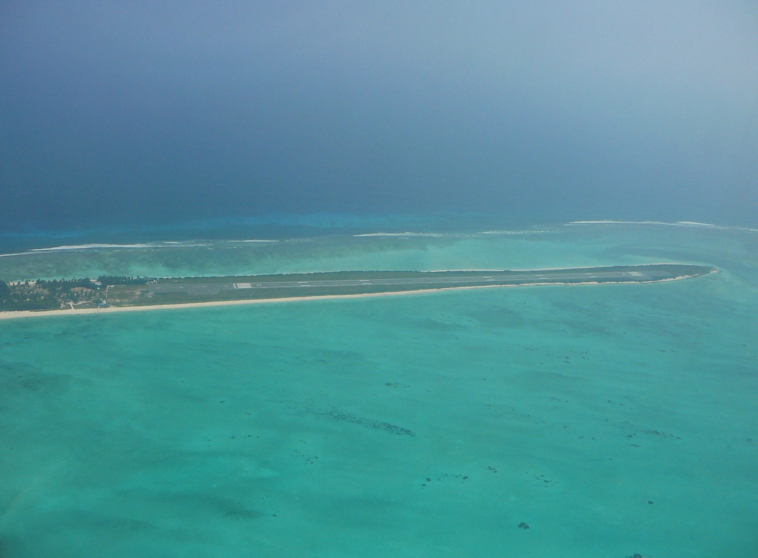
Agatti Island is a 7.6 km long island, situated on a coral atoll called Agatti atoll in the Union Territory of Lakshadweep, India. It is west of the city of Kochi. Geography Agatti is located about 364 km off Kannur, 394 km off Kozhikode, and 459 km (285 mi) off Kochi in the mainland and 7 km to the southwest of Bangaram, the nearest island. Agatti is 531 km away from Kollam (Quilon) and 529 km away from Kollam Port. Kavaratti, the closest inhabited island, lies 54 km to the SE and Suheli Par atoll 76 km to the south. Agatti Atoll's total land area is (of it, The main island and the small Kalpatti Island has . Kalpatti is located at the southern end on the same reef. The lagoon area is . Climate Population Its population in the 2011 census was 7,560, and Islam is the main religion of the islanders. Islamic religion is said to have been brought by Arab traveller Ibn Batuta. Most people speak Malayalam, English and Tamil. Aga ... [...More Info...] [...Related Items...] OR: [Wikipedia] [Google] [Baidu] |
Agatti Airport
Agatti Airport is a regional airport serving Agatti Island, in the union territory of Lakshadweep, India. It is located at the southern end of the island, and is the sole airstrip in the archipelago, which lies off the west coast of mainland India. History The airstrip was constructed during 1987−88 for operation of Dornier 228 type of aircraft and was inaugurated on 16 April 1988. Initially, the terminal was housed in a small temporary structure. Construction of Terminal Building, Air Traffic Control Tower and related structures commenced in 2006. However, the construction of the Terminal Building was stopped midway due to the proposed extension of Runway & Basic strip. Air India Regional began services with ATR-42 aircraft on 24 September 2010 connecting Agatti with Kochi. The resurfacing of the runway was completed in November 2010. Alliance Air now operates ATR-72-600 aircraft on Bangalore-Cochin-Agatti sector Structure Agatti airport is spread over . It has one asphalt ... [...More Info...] [...Related Items...] OR: [Wikipedia] [Google] [Baidu] |
Kadmat Island
Kadmat Island, also known as Cardamom Island, is a coral island belonging to the Amindivi subgroup of islands of the Lakshadweep archipelago in India. Measuring in length, the island has a lagoon with a width of covering an area of . The ecological feature of the island is of coral reef with seagrass, and marine turtles which nestle here. The Ministry of Environment and Forests (India) has notified the island as a marine protected area for ensuring conservation of the island's animal, plant, or other type of organism, and other resources. The only inhabited village on the island is Kadmat, which had a population of 5,389 according to 2011 census. Fisheries is the main economic activity on the island with agriculture limited to 5% of the land area. Tourism is allowed even for non-Indians and the attractions are kayaking, snorkeling and leisure trips by a glass-bottomed boat for scuba diving. Geography and climate Kadmat Island, which belongs to the township of Kadmat Island o ... [...More Info...] [...Related Items...] OR: [Wikipedia] [Google] [Baidu] |
Strobilanthes Kunthiana
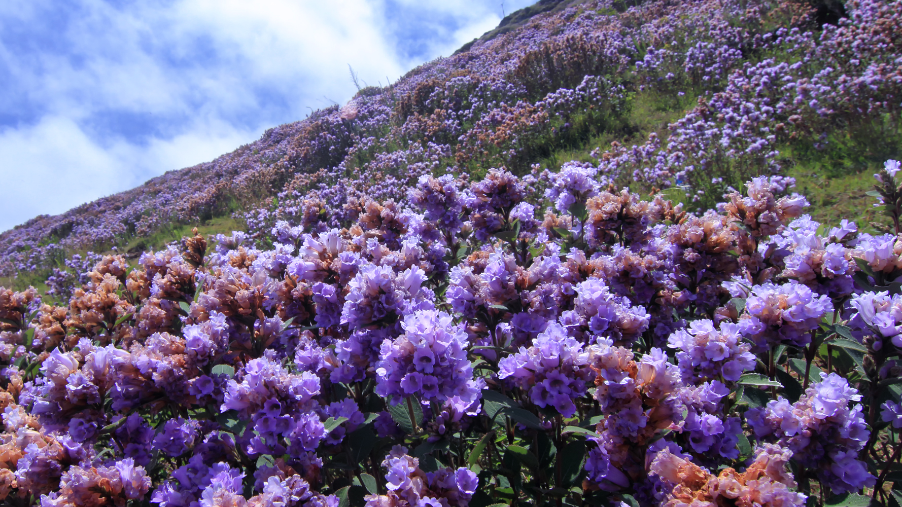
''Strobilanthes kunthiana'', known as Kurinji or Neelakurinji in Malayalam and Tamil and Gurige in Kannada is a shrub that is found in the shola forests of the Western Ghats in Kerala, Karnataka and Tamil Nadu. The purplish blue flower blossoms only once in 12 years, and gave the Nilgiri Mountains range its name, from the Tamil language ''Kurinji'' (flower). a small shrub, blooms once in twelve years, covering the hillsides with bluish flowers, giving the Nilgiris its name.''Strobilanthes kunthiana'' is the most rigorously demonstrated, with documented bloomings in 1838, 1850, 1862, 1874, 1886, 1898, 1910, 1922, 1934, 1946, 1958, 1970, 1982, 1994, 2006 and 2018, these have no match to Solar cycles. The Paliyan tribal people living in Tamil Nadu used it as a reference to calculate their age. This plant flowers during September–October. Description Kurinji grows at an altitude of 1300 to 2400 metres. The plant is usually 30 to 60 cm high. They can, however, grow well beyon ... [...More Info...] [...Related Items...] OR: [Wikipedia] [Google] [Baidu] |
Arabian Sea
The Arabian Sea ( ar, اَلْبَحرْ ٱلْعَرَبِيُّ, Al-Bahr al-ˁArabī) is a region of the northern Indian Ocean bounded on the north by Pakistan, Iran and the Gulf of Oman, on the west by the Gulf of Aden, Guardafui Channel and the Arabian Peninsula, on the southeast by the Laccadive Sea and the Maldives, on the southwest by Somalia, and on the east by India. Its total area is 3,862,000 km2 (1,491,000 sq mi) and its maximum depth is 4,652 meters (15,262 ft). The Gulf of Aden in the west connects the Arabian Sea to the Red Sea through the strait of Bab-el-Mandeb, and the Gulf of Oman is in the northwest, connecting it to the Persian Gulf. Name The sea is named after Arabia, the historic name of the region to the west of the sea. The Arabian Sea's name in Arabic is ; in Persian it is دریای عرب; in Urdu it is بحیرہ عرب; in Hindi it is अरब सागर; in Gujarati it is અરબી સમુદ્ર; in Marathi it is ... [...More Info...] [...Related Items...] OR: [Wikipedia] [Google] [Baidu] |
9th Parallel North
The 9th parallel north is a circle of latitude that is 9 degrees north of the Earth's equatorial plane. It crosses Africa, the Indian Ocean, South Asia, Southeast Asia, the Pacific Ocean, Central America, South America and the Atlantic Ocean. Around the world Starting at the Prime Meridian A prime meridian is an arbitrary meridian (a line of longitude) in a geographic coordinate system at which longitude is defined to be 0°. Together, a prime meridian and its anti-meridian (the 180th meridian in a 360°-system) form a great c ... and heading eastwards, the parallel 9° north passes through: : See also * 8th parallel north * 10th parallel north {{geographical coordinates, state=collapsed n09 ... [...More Info...] [...Related Items...] OR: [Wikipedia] [Google] [Baidu] |
Nine Degree Channel
The Nine Degree Channel is a channel in the Indian Ocean between the Laccadive Islands of Kalpeni and Suheli Par, and Maliku Atoll (Minicoy Island). These two subgroups of islands, together with the Amindivi Subgroup, form the Indian Union Territory (UT) of Lakshadweep. The Channel is approximately 200 km wide with a depth of 2597 metres. The Investigator Bank is located in the southern region of the channel. It is so named as it lies on the 9-degree line of Latitude, north of the equator. Sea Lane of Strategic Importance The 200 kilometres of the Nine Degree Channel separating Kalpeni and Suheli Par from Minicoy sees the passage of nearly all merchant shipping between Europe, the Middle-East and Western Asia with South-East Asia and the Far-East. See also ; Geostrategic context * Andaman Sea * Bay of Bengal * Arabian Sea * Exclusive economic zone of India India has the 18th-largest exclusive economic zone (EEZ) with a total size of . It includes the Lakshadwe ... [...More Info...] [...Related Items...] OR: [Wikipedia] [Google] [Baidu] |
Minicoy
Minicoy, locally known as Maliku (), is an island in Lakshadweep, India. Along with Viringili, it is on ''Maliku atoll'', the southernmost atoll of Lakshadweep archipelago. Administratively, it is a census town in the Indian union territory of Lakshadweep. The island is situated 425 km west of Trivandrum, the capital city of Kerala. Etymology Minicoy is known as ''Maliku'' in the local language, Dhivehi, which is also the national and official language of the Republic of Maldives. The language is a descendant of Elu Prakrit and is closely related to the Sinhala language, but not mutually intelligible with it. However, the Lakhshadweep Administration refers to Dhivehi as Mahl. This is due to a misunderstanding on the part of a British civil servant who came to Minicoy in the 1900s during the time of the British Raj. The official asked a local what his language was and he replied "Dhivehi-bas". The official looked confused as he had never heard of this language. Noticing th ... [...More Info...] [...Related Items...] OR: [Wikipedia] [Google] [Baidu] |
11th Parallel North
The 11th parallel north is a circle of latitude that is 11 degrees north of the Earth's equatorial plane. It crosses Africa, the Indian Ocean, South Asia, Southeast Asia, the Pacific Ocean, Central America, South America and the Atlantic Ocean. At this latitude the sun is visible for 12 hours, 46 minutes during the summer solstice and 11 hours, 29 minutes during the winter solstice. In Thailand, a 1966 cabinet resolution restricts the rights of non-Thai companies to conduct mineral exploration or mining operations north of this parallel. Around the world Starting at the Prime Meridian and heading eastwards, the parallel 11° north passes through: : As a border The border between Ghana and what was then French Upper Volta (now Burkina Faso) was fixed by treaty between the French and British at the Conference of Paris in 1898, to be the 11th parallel. The border does not follow the boundary exactly, but follows it approximately, crossing over it several times. References ... [...More Info...] [...Related Items...] OR: [Wikipedia] [Google] [Baidu] |
Amindivi Islands
The Aminidivi Islands, are one of the three island subgroups in the Union Territory of Lakshadweep, India. It is the northern group of the Lakshadweep, separated from the Laccadive Islands subgroup roughly by the 11th parallel north. The total land area of the group is 9.26 km². Formerly the Union Territory was known as Laccadive, Minicoy, and Amindivi Islands, a name that was changed to Lakshadweep by an act of Parliament in 1973. The Aminidivi group forms a taluka or subdivision. The islands of Amini, Kiltan, Chetlat, Kadmat and Bitra are inhabited. The population numbered 18,876 at the 2001 census and Islam is the main religion of the islanders. Aminidivi has the highest recorded rainfall in India in a 24-hour period, at 1,168 mm on 2004-05-06. Geography Aminidivi consists of atolls with islands, three reefs or atolls with only unvegetated sand cays above the high water mark, and four submerged banks. In addition, there is the island that gives its name to the ... [...More Info...] [...Related Items...] OR: [Wikipedia] [Google] [Baidu] |
Laccadive Islands
The Laccadive or Cannanore Islands are one of the three island subgroups in the Union Territory of Lakshadweep, India. It is the central subgroup of the Lakshadweep, separated from the Amindivi Islands subgroup roughly by the 11th parallel north and from the atoll of Minicoy (Maliku)—far to the south—by the 9 Degree or Mamala Channel. Formerly the Union Territory of Lakshadweep was known as Laccadive, Minicoy, and Amindivi Islands, a name that was changed to Lakshadweep by an act of Parliament in 1973. The Laccadive subgroup had been known earlier as the "Cannanore Islands" after the coastal town of Cannanore (Kannur). The name originated in the fact that while the northern group of Amindivi had stopped in 1784 being a vassal state of the Kannur Kingdom (Arakkal) in exchange for fealty to Tippu Sultan's Kingdom of Mysore, the southern group remained loyal to Kannur. Geography The Laccadive subgroup includes the island of Agatti, with Agatti Aerodrome, the only airp ... [...More Info...] [...Related Items...] OR: [Wikipedia] [Google] [Baidu] |
Bangaram Atoll
Bangaram is an atoll in the Union Territory of Lakshadweep, India. Geography The atoll has a roughly rectangular shape and is 8.1 km in length with a maximum width of 4.2 km. and with a lagoon area of . It is located over off Kannur, off Kozhikode, off Kochi, and from Kollam Kollam Port, Port in the Indian Ocean. Bangaram atoll is about northeast of the island of Agatti and to the southeast of Perumal Par, in the western Lakshadweep archipelago at . Bangaram atoll is connected to the reef of Agatti through a shallow submarine ridge. Islands *Bangaram Island, the largest island in the atoll, with a land surface of is located at . There is a long brackish pond in the center of the island fringed by screwpine and coconut palms. *South Bangaram Cay, the smallest island in the atoll, with a land surface of is located at . It is a small sand cay. *Thinnakara, another large island in the atoll, has a land surface of . It is located East-Northeast of Bangaram isla ... [...More Info...] [...Related Items...] OR: [Wikipedia] [Google] [Baidu] |


