|
Lakefront, Syracuse
Lakefront is one of the 26 officially recognized neighborhoods of Syracuse, New York. It borders five other Syracuse neighborhoods, with Washington Square and Near Northeast to the east, Downtown Syracuse to the southeast, and Westside and Far Westside to the south. Lakefront includes the Franklin Square, Syracuse and Inner Harbor, Syracuse areas. O.M. Edwards Building was listed on the National Register of Historic Places The National Register of Historic Places (NRHP) is the United States federal government's official list of districts, sites, buildings, structures and objects deemed worthy of preservation for their historical significance or "great artistic ... in 2001. References External links City of Syracuse (Official Site) Neighborhoods Neighborhoods in Syracuse, New York {{OnondagaCountyNY-geo-stub ... [...More Info...] [...Related Items...] OR: [Wikipedia] [Google] [Baidu] |
Syracuse, New York
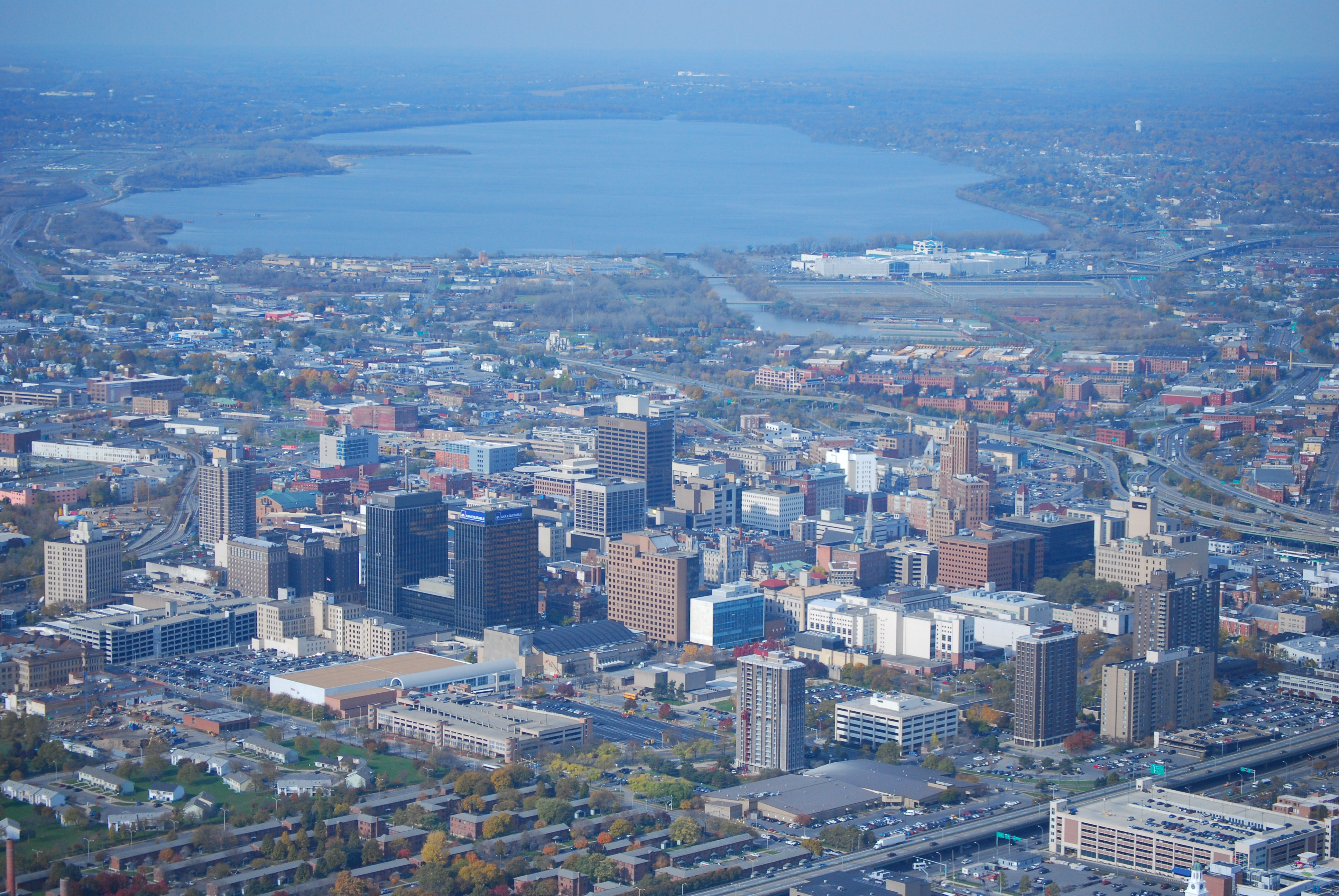
Syracuse ( ) is a City (New York), city in and the county seat of Onondaga County, New York, Onondaga County, New York, United States. It is the fifth-most populous city in the state of New York following New York City, Buffalo, New York, Buffalo, Yonkers, New York, Yonkers, and Rochester, New York, Rochester. At the United States Census 2020, 2020 census, the city's population was 148,620 and its Syracuse metropolitan area, metropolitan area had a population of 662,057. It is the economic and educational hub of Central New York, a region with over one million inhabitants. Syracuse is also well-provided with convention sites, with a Oncenter, downtown convention complex. Syracuse was named after the classical Greek city Syracuse, Sicily, Syracuse (''Siracusa'' in Italian), a city on the eastern coast of the Italian island of Sicily. Historically, the city has functioned as a major Crossroads (culture), crossroads over the last two centuries, first between the Erie Canal and its ... [...More Info...] [...Related Items...] OR: [Wikipedia] [Google] [Baidu] |
Washington Square, Syracuse
Washington Square is one of the 26 officially recognized neighborhoods of Syracuse, New York. Description Washington Square encompasses what used to be the old Village of Salina which has a concentration of two, three, and four- family structures, and larger apartments surrounded by single-family homes. The neighborhood contains mixed-use buildings along the North Salina Street corridor. Washington Square has the most historic rooming/boarding houses out of all the city's neighborhoods. Historic multiple residences ranked second highest, and apartment buildings ranked seventh. Almost 50 percent of Washington Square's mixed-use buildings have historic significance. The North Salina Street Historic District runs from the 500 Block (where Prospect Street meets N. Salina Street), to the end of the 900 block at Union Place. The City of Syracuse hired a consultant to initiate a streetscape enhancement plan, which includes improved sidewalks, new street furniture, improved parking, ... [...More Info...] [...Related Items...] OR: [Wikipedia] [Google] [Baidu] |
Near Northeast, Syracuse
Near Northeast is a Syracuse, New York neighborhood, located northeast of the city's downtown. It corresponds to Onondaga County Census Tract 15, 16, 23, and 24. Borders Northwestern * Butternut Street Northern * South Carbon Street * Farmer Street Northeastern * Dewitt Street * Sedgwick Street Eastern * Elm Street Southern * Interstate 690 Southwestern * Interstate 81 Streets The Near Northeast is bisected by James Street. Other major roads in the neighborhood include State Street, Butternut Street, Lodi Street, and Burnet Avenue. Education The Near Northeast is home to Dr. Weeks Elementary School. Retail The section of State Street located in the Near Northeast is the main retail street of Syracuse's Little Italy, with dozens of shops and eateries. As this neighborhood is fairly urban, there is retail scattered throughout it. Characteristics The Near Northeast is an urban working-class neighborhood. As of the 2000 Census, 8,792 people lived in there. 66.5% were Whit ... [...More Info...] [...Related Items...] OR: [Wikipedia] [Google] [Baidu] |
Downtown Syracuse
Downtown Syracuse is the economic center of Syracuse, New York, and Central New York, employing over 30,000 people, and housing over 4,300. It is also one of the 26 officially recognized neighborhoods of Syracuse. History Downtown Syracuse, as the rest of the city, grew as a result of the city's salt industry and its location on the Erie Canal. For over a century, it was also the retail and entertainment center of Central New York, with large department stores such as Chappell's, The Addis Co., Flah's, E.W. Edwards, Woolworth's, Grant's, Lincoln Stores, The Mohican, David's, Kresge's, Clark Music Co., Dey Brothers, and Sibley's. This attribute began to fade with development of large suburban malls, with the final blow in 1992 when the combined Addis & Dey's department store became the last major store to leave downtown. South Salina Street South Salina Street between Erie Boulevard and West Onondaga Street was the main north-south artery of Downtown Syracuse and was amo ... [...More Info...] [...Related Items...] OR: [Wikipedia] [Google] [Baidu] |
Westside, Syracuse
Westside is a Syracuse, New York neighborhood, directly west of Downtown Syracuse. It corresponds to Onondaga County Census Tracts 21 and 22. It is made up of three parts, near West side, far west side and the West side Located between Interstate 690, and West Street, Syracuse’s Westside neighborhood consists of a mix of commercial, residential, and mostly-abandoned industrial units. The residential portion, centered on Park Avenue, is to the south of “Historic Automobile Row,” with its over twenty car dealerships. To the south of the neighborhood’s residences, is a former industrial section, still apparent, with its many, mostly-empty warehouses, and overgrown spur railroad tracks. Along Erie Boulevard, the southern boundary-road, much of the former industrial presence has been replaced with modern commercial office buildings. Leavenworth Park and Frazer Park are the two largest parks of the neighborhood. Its western portion has traditionally been a Polish neighborhood. ... [...More Info...] [...Related Items...] OR: [Wikipedia] [Google] [Baidu] |
Far Westside, Syracuse
The Syracuse Far Westside is one of 26 neighborhoods recognized by the City of Syracuse, New York. Until this area joined the city in 1886 it was known as the Village of Geddes. History The Syracuse Far Westside is bounded by Erie Blvd West on the northeast, South Geddes Street on the lower east and Rowland Street on the south. The western border runs from Velasko Road in the south, to South Avery Avenue, Salisbury Road, Myrtle Street and parallel to Charles Avenue in Westvale, a section of Geddes ending at Willis Avenue just south of Onondaga Lake at the railroad tracks. Annexation In 1886 the village of Geddes was the largest community in the town of Geddes with many homes and businesses. Geddes officially became a town in 1848. "It then included the west side of Syracuse to Geddes Street, which was the eastern boundary of the town." Local residents voted to join the city because Syracuse had a paid professional police department, a paid professional fire departmen ... [...More Info...] [...Related Items...] OR: [Wikipedia] [Google] [Baidu] |
Franklin Square, Syracuse
Franklin Square is a former industrial neighborhood, turned residential and commercial, in Syracuse, New York. Officially it is part of the larger Lakefront neighborhood, which in turn is one of Syracuse's 26 officially recognized neighborhoods. History The neighborhood sprang up as a result of the salt industry in Syracuse. From 1797 to 1904 around 12 million tons of salt were produced in the area. After the Civil War, with the salt industry on the decline, Franklin Square became an automobile production area. The H. H. Franklin Manufacturing Company, from which the neighborhood's name comes from, produced cars in this area from 1902 to 1934. Transmission producer New Process Gear had a factory on Franklin Square before they closed it and moved to the Syracuse suburb of DeWitt in 1961. Franklin Square also held manufacturing of handbags, textiles, telephone booths, and dried milk. Redevelopment By the 1980s nearly all of Franklin Square's industry had vanished. The Pyramid C ... [...More Info...] [...Related Items...] OR: [Wikipedia] [Google] [Baidu] |
Inner Harbor, Syracuse
The Inner Harbor is a former industrial quarter of Syracuse, New York, Syracuse, New York, situated at the center of a larger district long colloquially known as Oil City, and since 1989 rebranded as the Lakefront, Syracuse, New York, Lakefront. The waterfront zone was originally considered to be limited to just that area bounded by West Kirkpatrick, Solar, West Bear, and Van Rensselaer streets, but it has been gradually enlarged by the process of familiarity and promotion to include the opposite sides of some of those streets. The water at Inner Harbor's center can be variously viewed as the outlet of Onondaga Creek, or as a human-made extension southeasterly of Onondaga Lake, or as a small, seldom-utilized part of the modern Erie Canal. It has been the scene of more than three decades of development or redevelopment proposals, sponsored by the State of New York or the City of Syracuse, some of which has come online in the late 2010's. Chronology of development The central w ... [...More Info...] [...Related Items...] OR: [Wikipedia] [Google] [Baidu] |
National Register Of Historic Places
The National Register of Historic Places (NRHP) is the United States federal government's official list of districts, sites, buildings, structures and objects deemed worthy of preservation for their historical significance or "great artistic value". A property listed in the National Register, or located within a National Register Historic District, may qualify for tax incentives derived from the total value of expenses incurred in preserving the property. The passage of the National Historic Preservation Act (NHPA) in 1966 established the National Register and the process for adding properties to it. Of the more than one and a half million properties on the National Register, 95,000 are listed individually. The remainder are contributing resources within historic districts. For most of its history, the National Register has been administered by the National Park Service (NPS), an agency within the U.S. Department of the Interior. Its goals are to help property owners and inte ... [...More Info...] [...Related Items...] OR: [Wikipedia] [Google] [Baidu] |


