|
Lake Ōnuma (Wakkanai)
is a low-lying lake in Wakkanai, Hokkaido, Wakkanai, Hokkaidō, Japan. Its surface area of makes it, by this metric, the twentieth largest on the island. Located a short distance inland from , with the city centre to the west and Wakkanai Airport to the east, Ōnuma provides a resting point in the autumn for swans from Siberia on their way to their winter grounds, and again in spring upon their return. See also * Cape Sōya * Koetoi River * Wakkanai Park References Lakes of Hokkaido, Onuma Wakkanai {{Hokkaido-geo-stub ... [...More Info...] [...Related Items...] OR: [Wikipedia] [Google] [Baidu] |
Sōya Misaki Wind Farm
is a wind farm in the Sōya Hills near the eponymous Cape Sōya in Wakkanai, Hokkaido, Wakkanai, Hokkaidō, Japan. With fifty-seven Wind turbine, turbines each with a capacity of one Watt#Megawatt, megawatt, when completed in 2005 it became Japan's largest wind farm, capable of powering approximately 41,000 households and with a theoretical annual Greenhouse gas#Direct greenhouse gas emissions, emissions reduction of 120,000 tons of carbon dioxide, CO2 relative to an Fossil fuel power station#Oil, oil-fired power station of equal capacity. It is one of a complementary network of wind power generation facilities in Wakkanai which together, eight-four turbines in all with a combined total capacity of 106,355 Watt#Kilowatt, kilowatts, generate approximately 120% of the city's electricity demands. In 2019, with the operator planning to replace the fifty-seven one megawatt turbines with fifteen four megawatt turbines, the Ministry of the Environment (Japan), Ministry of the Environment ... [...More Info...] [...Related Items...] OR: [Wikipedia] [Google] [Baidu] |
Wakkanai, Hokkaido
' meaning "cold water river" is a city located in Sōya Subprefecture, Hokkaido, Japan. It is the capital of Sōya Subprefecture. It contains Japan's northernmost point, Cape Sōya, from which the Russian island of Sakhalin can be seen. As of 1 June 1975, the city has an estimated population of 55,465 and a population density of 72.8 persons per km2 (189 persons per mi2). The total area is . Wakkanai is also home to Japan's first nursing home built inside the central train station of its city, a novel approach to caring for Japan's growing elderly population that has since been imitated in several other cities. History Wakkanai was originally home to an Ainu population. The first Japanese settlement was established in 1685. *1879: The village of Wakkanai was founded. *1897: Sōya Subprefecture established. *1901: Wakkanai village became Wakkanai town. *1949: Wakkanai town became Wakkanai city. *1955: Soya village was merged into Wakkanai city. *1959: Wakkanai Airport opened. ... [...More Info...] [...Related Items...] OR: [Wikipedia] [Google] [Baidu] |
Hokkaidō
is Japan's second largest island and comprises the largest and northernmost prefecture, making up its own region. The Tsugaru Strait separates Hokkaidō from Honshu; the two islands are connected by the undersea railway Seikan Tunnel. The largest city on Hokkaidō is its capital, Sapporo, which is also its only ordinance-designated city. Sakhalin lies about 43 kilometers (26 mi) to the north of Hokkaidō, and to the east and northeast are the Kuril Islands, which are administered by Russia, though the four most southerly are claimed by Japan. Hokkaidō was formerly known as ''Ezo'', ''Yezo'', ''Yeso'', or ''Yesso''. Nussbaum, Louis-Frédéric. (2005). "Hokkaidō" in Although there were Japanese settlers who ruled the southern tip of the island since the 16th century, Hokkaido was considered foreign territory that was inhabited by the indigenous people of the island, known as the Ainu people. While geographers such as Mogami Tokunai and Mamiya Rinzō explored the isla ... [...More Info...] [...Related Items...] OR: [Wikipedia] [Google] [Baidu] |
Koetoi River
is a river in Hokkaidō, Japan Japan ( ja, 日本, or , and formally , ''Nihonkoku'') is an island country in East Asia. It is situated in the northwest Pacific Ocean, and is bordered on the west by the Sea of Japan, while extending from the Sea of Okhotsk in the north .... Rivers of Hokkaido Rivers of Japan {{Japan-river-stub ... [...More Info...] [...Related Items...] OR: [Wikipedia] [Google] [Baidu] |
Sōya Bay
is a bay on the north coast of Hokkaidō, Japan. It is demarcated by Cape Sōya to the east and Cape Noshappu to the west, with Wakkanai ' meaning "cold water river" is a city located in Sōya Subprefecture, Hokkaido, Japan. It is the capital of Sōya Subprefecture. It contains Japan's northernmost point, Cape Sōya, from which the Russian island of Sakhalin can be seen. As of ... Port to the southwest, and the Sōya Straits to the north. The Koetoi is the main river that flows into the bay. In the middle of the bay mouth, the water is approximately deep, while the bed is of rock or sand. See also * Cape Bakkai * Sōya Hills References Wakkanai Bays of Japan Landforms of Hokkaido {{Hokkaido-geo-stub ... [...More Info...] [...Related Items...] OR: [Wikipedia] [Google] [Baidu] |
Wakkanai Airport
is an airport located east southeast of Wakkanai, Hokkaidō, Japan. Wakkanai is the northernmost airport in Japan that is capable of handling jet aircraft; due to its small size, it is susceptible to closures during the coldest winter months, in which case incoming aircraft are often diverted to Asahikawa Airport. It has one jet bridge, one apron gate for mid-sized jet aircraft, and two apron gates for commuter aircraft. History Wakkanai Airport opened to passenger traffic in 1960, initially on an irregular basis. Air Nippon began scheduled service to Okadama Airport and Rishiri Airport in 1974, followed by Rebun Airport in 1978 and New Chitose Airport in 1980. Air Nippon discontinued the short Rebun and Rishiri commuter flights in 2003 due to poor load factors. In 1987, the 1,200 m main runway was extended to 1,800 m, allowing All Nippon Airways to begin jet service to Tokyo. The flight was initially seasonal and did not become a year-round service until 1997. The city of Wa ... [...More Info...] [...Related Items...] OR: [Wikipedia] [Google] [Baidu] |
Geospatial Information Authority Of Japan
The , or GSI, is the national institution responsible for surveying and mapping the national land of Japan. The former name of the organization from 1949 until March 2010 was Geographical Survey Institute; despite the rename, it retains the same initials. It is an extraordinary organ of the Ministry of Land, Infrastructure, Transport and Tourism. Its main offices are situated in Tsukuba City of Ibaraki Prefecture. It also runs a museum, situated in Tsukuba, the Science Museum of Map and Survey. Earthquake Precursor Prediction Research Stationary MT monitoring systems have been installed in Japan since April 1996, providing a continuous recording of MT signals at the Mizusawa Geodetic Observatory and the Esashi Station of the GSI. These stations measure fluctuations in the earth's electromagnetic field that correspond with seismic activity. The raw geophysical time-series data from these monitoring stations is freely available to the scientific community, enabling further study ... [...More Info...] [...Related Items...] OR: [Wikipedia] [Google] [Baidu] |
Cape Sōya
is the northernmost point of the island of Hokkaidō, Japan. It is situated in Wakkanai, Sōya Subprefecture. The is at the cape, although the true northernmost point under Japanese control is a small deserted island called Bentenjima, northwest. Since the cape is just away across La Perouse Strait from Cape Crillon, Sakhalin Island, Russia, it is possible to catch a glimpse of the island of Sakhalin on a clear day. There are more than ten monuments at Cape Sōya, including the Monument of the northernmost Point of Japan, the Tower of Prayer (a memorial to Korean Air Lines Flight 007, shot down in 1983), a statue of Mamiya Rinzō, the Monument of Peace (a memorial to the sunken submarine , and others). Sōya Misaki settlement, east of the cape, has many facilities known to be "the northernmost in Japan", such as the northernmost lighthouse ( Cape Sōya Lighthouse), the northernmost filling station (Idemitsu Cape Sōya SS), the northernmost elementary school (Ōmisaki Element ... [...More Info...] [...Related Items...] OR: [Wikipedia] [Google] [Baidu] |
Wakkanai Park
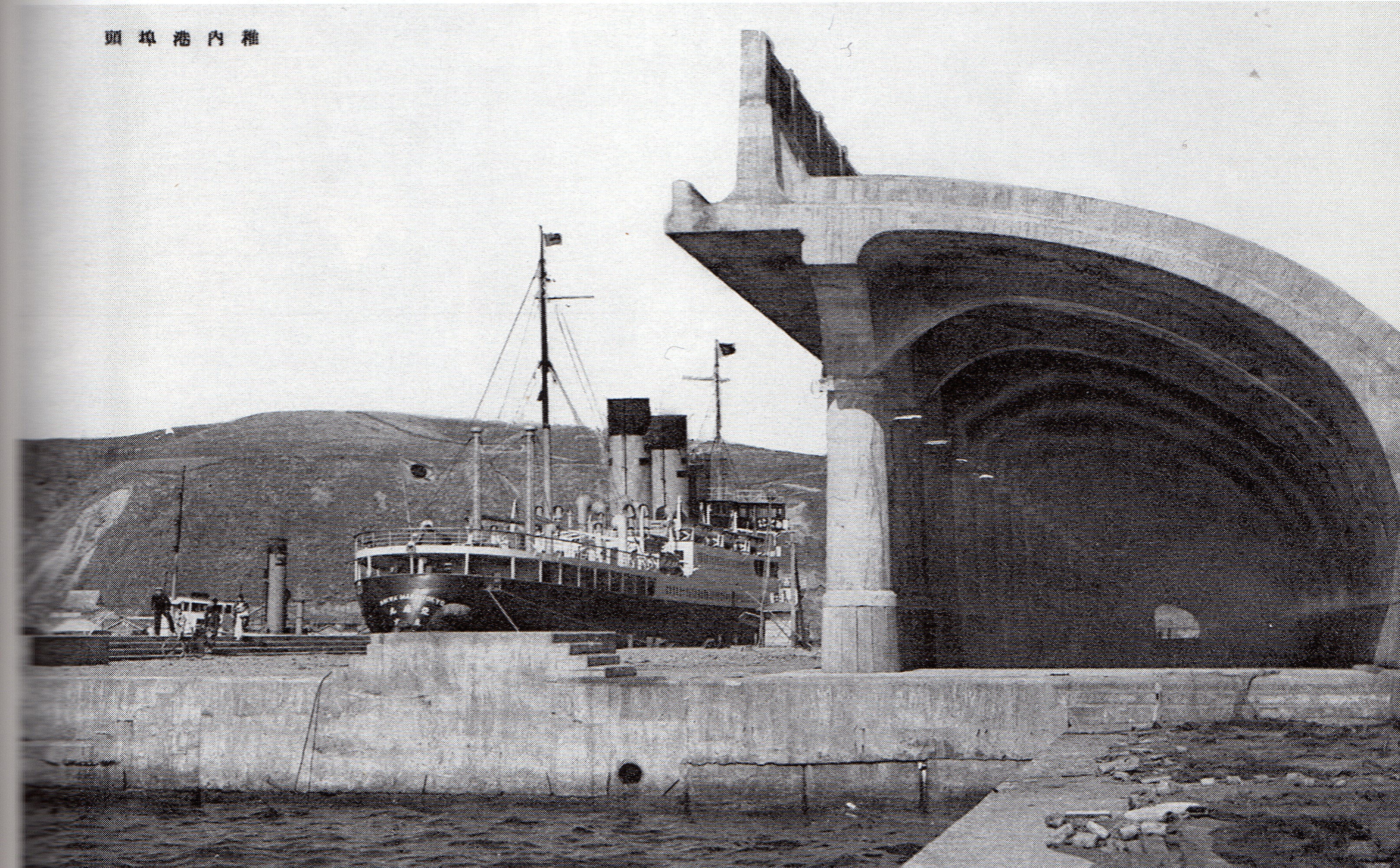
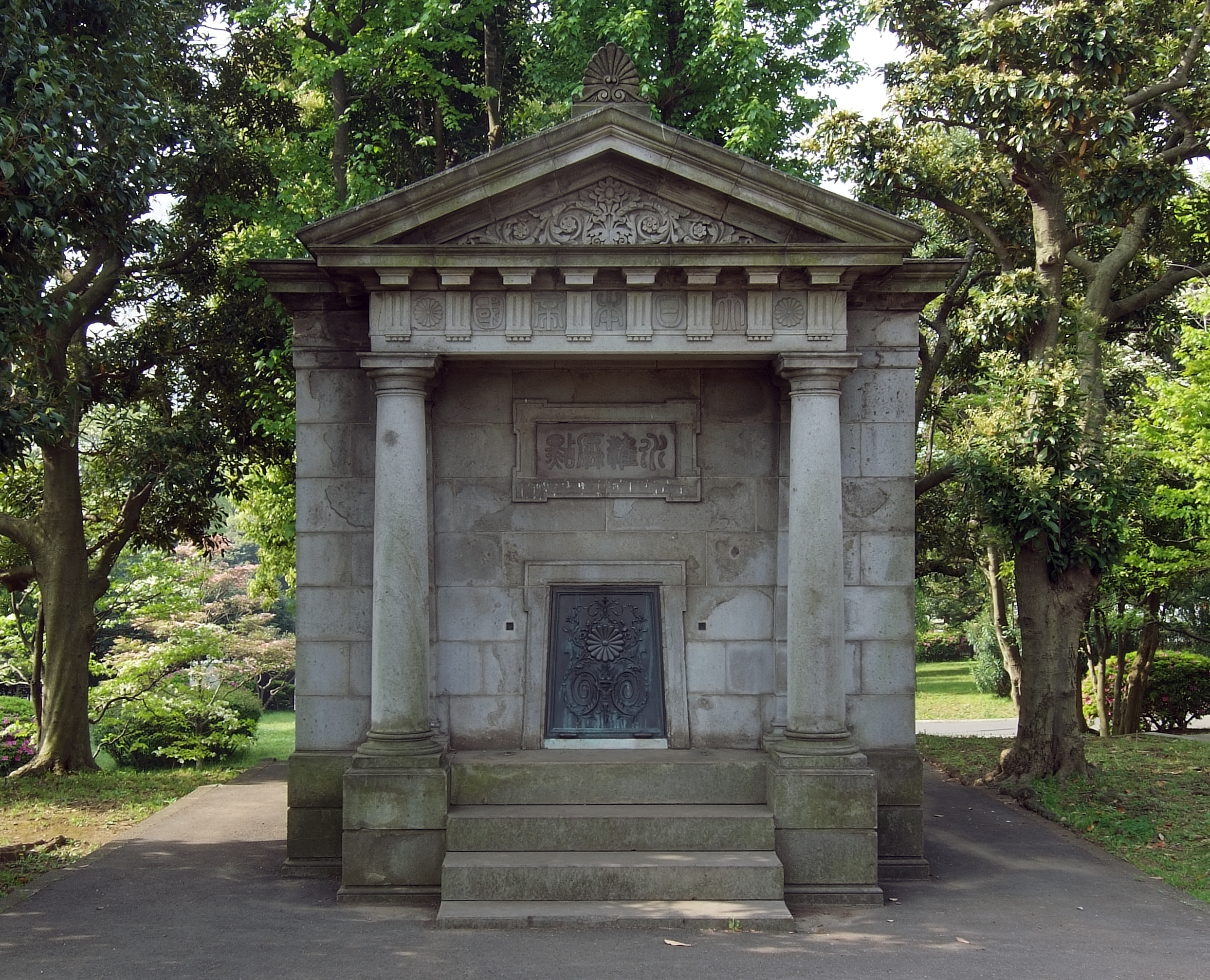
was established in Wakkanai, Hokkaido, Wakkanai, Hokkaidō, Japan in 1961. Covering some , when combined with the adjacent Forest Park, there is total area of approximately for "citizens to relax". Located on a hillside overlooking the La Pérouse Strait, Sōya Straits, within the park there are a number of memorials that, along with those of Cape Sōya, that to the Chihaku ferry near the North Breakwater Dome, the Centennial Memorial Tower and Northern Memorial Museum, Northern Memorial Museum inside the park, and the Wakkanai Karafuto Museum, together help give Wakkanai the greatest density of "proxy" Karafuto ''Les Lieux de Mémoire, lieux de mémoire'' in Hokkaidō. Monuments The is a memorial to those who died in Karafuto. At its centre is a statue of a woman with a look of pain and anguish, her face to the heavens and hands to the earth, her back to Sakhalin. An inscription explains that the monument expresses "grief at the loss of everything held dear". The memorial was ... [...More Info...] [...Related Items...] OR: [Wikipedia] [Google] [Baidu] |
Lakes Of Hokkaido
A lake is an area filled with water, localized in a basin, surrounded by land, and distinct from any river or other outlet that serves to feed or drain the lake. Lakes lie on land and are not part of the ocean, although, like the much larger oceans, they do form part of the Earth's water cycle. Lakes are distinct from lagoons, which are generally coastal parts of the ocean. Lakes are typically larger and deeper than ponds, which also lie on land, though there are no official or scientific definitions. Lakes can be contrasted with rivers or streams, which usually flow in a channel on land. Most lakes are fed and drained by rivers and streams. Natural lakes are generally found in mountainous areas, rift zones, and areas with ongoing glaciation. Other lakes are found in endorheic basins or along the courses of mature rivers, where a river channel has widened into a basin. Some parts of the world have many lakes formed by the chaotic drainage patterns left over from the last ice ... [...More Info...] [...Related Items...] OR: [Wikipedia] [Google] [Baidu] |


