|
Lake Stymfalia
Lake Stymphalia ( Greek: Λίμνη Στυμφαλία - ''Límnē Stymphalía'') is located in the north-eastern part of the Peloponnese, in Corinthia, southern Greece. It is a closed karst basin with a wetland area and an agrarian area. The lake is an important stopover for migratory birds. The size of the lake varies, depending on the season. Usually this area around the lake is fairly dry underfoot. In certain weather conditions thousands of small green frogs hide in the damp grass from the aquatic snakes. These frogs are invisible in the grass until you almost step on them, at which they jump out of the way, usually landing on another frog which also jumps. The effect is of ripples of frogs travelling outwards with every step. The area is rich in birds, amphibians and plant life. Other wildlife, such as weasels, can also be seen. The area is also mentioned in Greek Mythology, due to the Stymphalian birds, which infested the Arcadian woods near the lake. Heracles' sixth labo ... [...More Info...] [...Related Items...] OR: [Wikipedia] [Google] [Baidu] |
Corinthia
Corinthia ( el, Κορινθία ''Korinthía'') is one of the regional units of Greece. It is part of the region of Peloponnese. It is situated around the city of Corinth, in the north-eastern part of the Peloponnese peninsula. Geography Corinthia borders on Achaea to the west and southwest, the Gulf of Corinth and Attica to the north, the Saronic Gulf to the east, Argolis to the south and Arcadia to the southwest. The Corinth Canal, carrying ship traffic between the Ionian and the Aegean seas, is about east of Corinth, cutting through the Isthmus of Corinth. Corinthia is increasingly seen as part of the wider metropolitan area of Athens, with municipalities, such as Agioi Theodoroi in the easternmost part of the regional unit, being considered suburbs of Athens. The area around Corinth and the western Saronic including the southeastern part are made up of fault lines including the Corinth Fault, the Poseidon Fault and a fault running from Perahcora to Agioi Theodoroi. M ... [...More Info...] [...Related Items...] OR: [Wikipedia] [Google] [Baidu] |
Greek Language
Greek ( el, label=Modern Greek, Ελληνικά, Elliniká, ; grc, Ἑλληνική, Hellēnikḗ) is an independent branch of the Indo-European family of languages, native to Greece, Cyprus, southern Italy (Calabria and Salento), southern Albania, and other regions of the Balkans, the Black Sea coast, Asia Minor, and the Eastern Mediterranean. It has the longest documented history of any Indo-European language, spanning at least 3,400 years of written records. Its writing system is the Greek alphabet, which has been used for approximately 2,800 years; previously, Greek was recorded in writing systems such as Linear B and the Cypriot syllabary. The alphabet arose from the Phoenician script and was in turn the basis of the Latin, Cyrillic, Armenian, Coptic, Gothic, and many other writing systems. The Greek language holds a very important place in the history of the Western world. Beginning with the epics of Homer, ancient Greek literature includes many works of lasting impo ... [...More Info...] [...Related Items...] OR: [Wikipedia] [Google] [Baidu] |
Peloponnese
The Peloponnese (), Peloponnesus (; el, Πελοπόννησος, Pelopónnēsos,(), or Morea is a peninsula and geographic regions of Greece, geographic region in southern Greece. It is connected to the central part of the country by the Isthmus of Corinth land bridge which separates the Gulf of Corinth from the Saronic Gulf. From the late Middle Ages until the 19th century the peninsula was known as the Morea ( grc-x-byzant, Μωρέας), (Morèas) a name still in colloquial use in its demotic Greek, demotic form ( el, Μωριάς, links=no), (Moriàs). The peninsula is divided among three administrative regions of Greece, administrative regions: most belongs to the Peloponnese (region), Peloponnese region, with smaller parts belonging to the West Greece and Attica (region), Attica regions. Geography The Peloponnese is a peninsula located at the southern tip of the mainland, in area, and constitutes the southernmost part of mainland Greece. It is connected to the mainlan ... [...More Info...] [...Related Items...] OR: [Wikipedia] [Google] [Baidu] |
Greece
Greece,, or , romanized: ', officially the Hellenic Republic, is a country in Southeast Europe. It is situated on the southern tip of the Balkans, and is located at the crossroads of Europe, Asia, and Africa. Greece shares land borders with Albania to the northwest, North Macedonia and Bulgaria to the north, and Turkey to the northeast. The Aegean Sea lies to the east of the Geography of Greece, mainland, the Ionian Sea to the west, and the Sea of Crete and the Mediterranean Sea to the south. Greece has the longest coastline on the Mediterranean Basin, featuring List of islands of Greece, thousands of islands. The country consists of nine Geographic regions of Greece, traditional geographic regions, and has a population of approximately 10.4 million. Athens is the nation's capital and List of cities and towns in Greece, largest city, followed by Thessaloniki and Patras. Greece is considered the cradle of Western culture, Western civilization, being the birthplace of Athenian ... [...More Info...] [...Related Items...] OR: [Wikipedia] [Google] [Baidu] |
Karst
Karst is a topography formed from the dissolution of soluble rocks such as limestone, dolomite, and gypsum. It is characterized by underground drainage systems with sinkholes and caves. It has also been documented for more weathering-resistant rocks, such as quartzite, given the right conditions. Subterranean drainage may limit surface water, with few to no rivers or lakes. However, in regions where the dissolved bedrock is covered (perhaps by debris) or confined by one or more superimposed non-soluble rock strata, distinctive karst features may occur only at subsurface levels and can be totally missing above ground. The study of ''paleokarst'' (buried karst in the stratigraphic column) is important in petroleum geology because as much as 50% of the world's hydrocarbon reserves are hosted in carbonate rock, and much of this is found in porous karst systems. Etymology The English word ''karst'' was borrowed from German in the late 19th century, which entered German much earlier ... [...More Info...] [...Related Items...] OR: [Wikipedia] [Google] [Baidu] |
Frog
A frog is any member of a diverse and largely Carnivore, carnivorous group of short-bodied, tailless amphibians composing the order (biology), order Anura (ανοὐρά, literally ''without tail'' in Ancient Greek). The oldest fossil "proto-frog" ''Triadobatrachus'' is known from the Early Triassic of Madagascar, but molecular clock, molecular clock dating suggests their split from other amphibians may extend further back to the Permian, 265 Myr, million years ago. Frogs are widely distributed, ranging from the tropics to subarctic regions, but the greatest concentration of species diversity is in tropical rainforest. Frogs account for around 88% of extant amphibian species. They are also one of the five most diverse vertebrate orders. Warty frog species tend to be called toads, but the distinction between frogs and toads is informal, not from Taxonomy (biology), taxonomy or evolutionary history. An adult frog has a stout body, protruding eyes, anteriorly-attached tongue, limb ... [...More Info...] [...Related Items...] OR: [Wikipedia] [Google] [Baidu] |
Greek Mythology
A major branch of classical mythology, Greek mythology is the body of myths originally told by the Ancient Greece, ancient Greeks, and a genre of Ancient Greek folklore. These stories concern the Cosmogony, origin and Cosmology#Metaphysical cosmology, nature of the world, the lives and activities of List of Greek mythological figures, deities, Greek hero cult, heroes, and List of Greek mythological creatures, mythological creatures, and the origins and significance of the ancient Greeks' own cult (religious practice), cult and ritual practices. Modern scholars study the myths to shed light on the religious and political institutions of ancient Greece, and to better understand the nature of myth-making itself. The Greek myths were initially propagated in an oral tradition, oral-poetic tradition most likely by Minoan civilization, Minoan and Mycenaean Greece, Mycenaean singers starting in the 18th century BC; eventually the myths of the heroes of the Trojan War and its after ... [...More Info...] [...Related Items...] OR: [Wikipedia] [Google] [Baidu] |
Heracles
Heracles ( ; grc-gre, Ἡρακλῆς, , glory/fame of Hera), born Alcaeus (, ''Alkaios'') or Alcides (, ''Alkeidēs''), was a divine hero in Greek mythology, the son of Zeus and Alcmene, and the foster son of Amphitryon.By his adoptive descent through Amphitryon, Heracles receives the epithet Alcides, as "of the line of Alcaeus", father of Amphitryon. Amphitryon's own, mortal son was Iphicles. He was a great-grandson and half-brother (as they are both sired by the god Zeus) of Perseus, and similarly a half-brother of Dionysus. He was the greatest of the Greek heroes, the ancestor of royal clans who claimed to be Heracleidae (), and a champion of the Olympian order against chthonic monsters. In Rome and the modern West, he is known as Hercules, with whom the later Roman emperors, in particular Commodus and Maximian, often identified themselves. The Romans adopted the Greek version of his life and works essentially unchanged, but added anecdotal detail of their own, so ... [...More Info...] [...Related Items...] OR: [Wikipedia] [Google] [Baidu] |
Mount Kyllini
Mount Kyllini or Mount Cyllene (; grc, Κυλλήνη , ; sometimes , ), is a mountain on the Peloponnese in Greece famous for its association with the god Hermes. It rises to above sea level, making it the second highest point on the peninsula. It is located near the border between the historic regions of Arcadia (ancient region), Arcadia and Achaea—in the northeast of Arcadia, and entirely within modern Corinthia. It is located west of Corinth, northwest of Stymfalia, north of Tripoli, Greece, Tripoli, and south of Derveni, Corinthia, Derveni. Several modern places are also named ''Kyllini (other), Kyllini''. Description Much of the mountain is barren and rocky, although the area below is largely forested. There is an observatory at , at 22.67 east longitude and 37.97 north latitude. From the top a large portion of northeastern Peloponnesus is visible, including the eastern part of Achaia and Chelmos, the Gulf of Corinth and most of Corinthia, the southern par ... [...More Info...] [...Related Items...] OR: [Wikipedia] [Google] [Baidu] |
NASA WorldWind
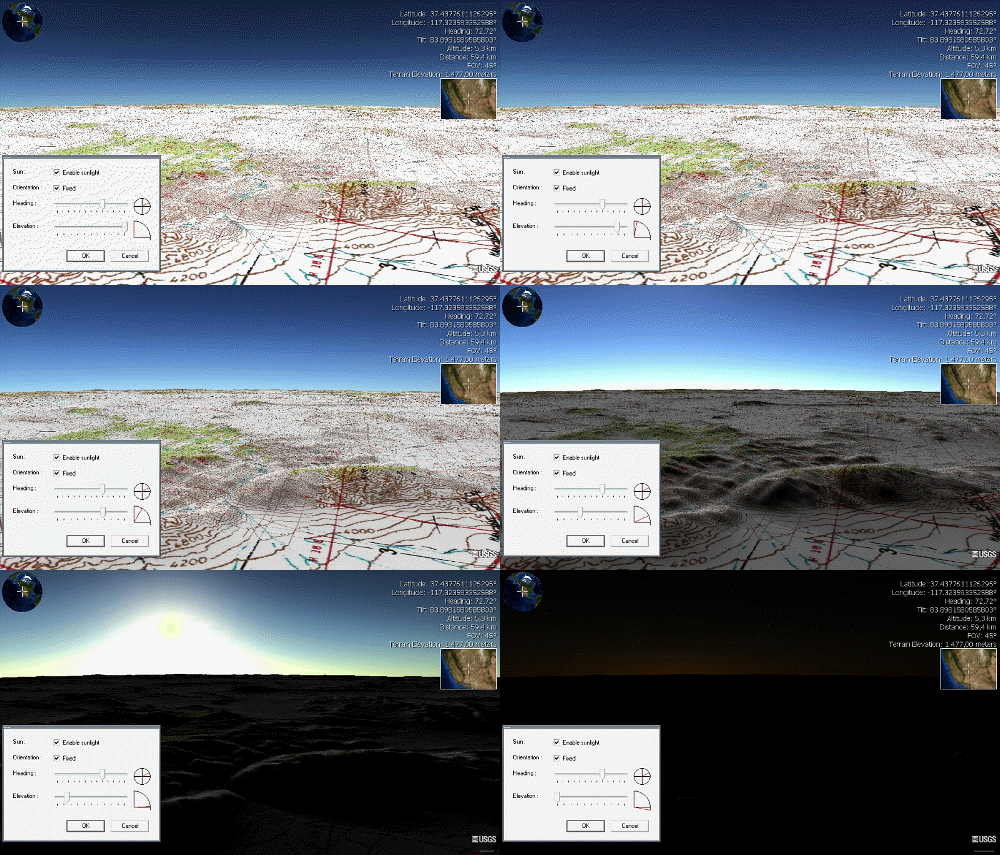
NASA WorldWind is an open-source (released under the NOSA license and the Apache 2.0 license) virtual globe. According to the website (https://worldwind.arc.nasa.gov/), "WorldWind is an open source virtual globe API. WorldWind allows developers to quickly and easily create interactive visualizations of 3D globe, map and geographical information. Organizations around the world use WorldWind to monitor weather patterns, visualize cities and terrain, track vehicle movement, analyze geospatial data and educate humanity about the Earth." It was first developed by NASA in 2003 for use on personal computers and then further developed in concert with the open source community since 2004. As of 2017, a web-based version of WorldWind is available online. An Android version is also available. The original version relied on .NET Framework, which ran only on Microsoft Windows. The more recent Java version, WorldWind Java, is cross platform, a software development kit (SDK) aimed ... [...More Info...] [...Related Items...] OR: [Wikipedia] [Google] [Baidu] |
Stymphalus (Arcadia)
Stymphalus or Stymphalos ( gr, Στύμφαλος), or Stymphelus or Stymphelos (Στύμφηλος), or Stymphelum or Stymphelon (Στύμφηλον), or Stymphalum, or Stymphala, was a town in the northeast of ancient Arcadia. Location The territory of Stymphalus is a plain, about in length, bounded by Achaea on the north, Sicyonia and Phliasia on the east, the territory of Mantineia on the south, and that of Orchomenus and Pheneus on the west. This plain is shut in on all sides by mountains. On the north rises the gigantic mass of Cyllene (possibly the mythical ‘rock of Scylla’), from which a projecting spur, called Mount Stymphalus (Στυμφαλος ὄρος), descends into the plain. The mountain at the southern end of the plain, opposite Cyllene, was called Apelaurum (τὸ Ἀπέλαυρον), and at its foot is the subterranean outlet of the lake of Stymphalus (ἡ Στυμφαλὶς λίμνη or ἡ Στυμφηλίη λίμνη). This lake is formed partly ... [...More Info...] [...Related Items...] OR: [Wikipedia] [Google] [Baidu] |


.jpg)
_Ranomafana.jpg)


