|
Lake Grace System
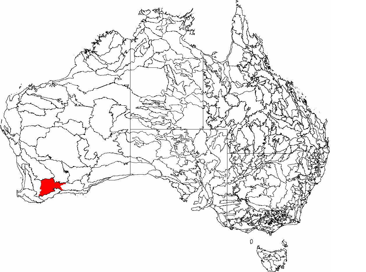
Lake Grace System is a DIWA-listed wetland in Western Australia. Located on the border of the Shires of Lake Grace and Kent, it consists of four lakes, Lake Grace North, Lake Grace South, Lake Altham and Cemetery Lake. It has an area of about . Biogeographically, it is part of the Western Mallee subregion of the Mallee region of the South West Botanic Province. It is part of a saline drainage system that extends from near Ongerup, Western Australia, ultimately draining into Salt River. It is a major breeding area for the banded stilt The banded stilt (''Cladorhynchus leucocephalus'') is a nomadic wader of the stilt and avocet family, Recurvirostridae, native to Australia. It belongs to the monotypic genus ''Cladorhynchus''. It gets its name from the red-brown breast band fo ... (''Cladorhynchus leucocephalus''). References Grace System, Lake Grace System, Lake Grace System, Lake {{WesternAustralia-geo-stub ... [...More Info...] [...Related Items...] OR: [Wikipedia] [Google] [Baidu] |
A Directory Of Important Wetlands In Australia
A Directory of Important Wetlands in Australia (DIWA) is a list of wetlands of national importance to Australia published by the governmental agency Environment Australia. Intended to augment the list of wetlands of international importance under the Ramsar Convention, it was formerly published in report form, but is now essentially an online publication. Wetlands that appear in the ''Directory'' are commonly referred to as "DIWA wetlands" or "Directory wetlands". Criteria for determining wetland importance Using criteria agreed in 1994, a wetland can be considered “nationally important” if it satisfies at least one of the following criteria: # It is a good example of a wetland type occurring within a biogeographic region in Australia. # It is a wetland which plays an important ecological or hydrological role in the natural functioning of a major wetland system/complex. # It is a wetland which is important as the habitat for animal taxa at a vulnerable stage in their life cycle ... [...More Info...] [...Related Items...] OR: [Wikipedia] [Google] [Baidu] |
Mallee (biogeographic Region)
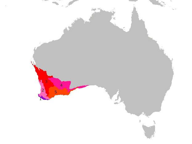
Mallee, also known as Roe Botanical District, is a biogeographic region in southern Western Australia. Located between the Esperance Plains, Avon Wheatbelt and Coolgardie bioregions, it has a low, gently undulating topography, a semi-arid mediterranean climate, and extensive ''Eucalyptus'' mallee vegetation. It has an area of . About half of the region has been cleared for intensive agriculture. Recognised as a region under the Interim Biogeographic Regionalisation for Australia (IBRA), it was first defined by John Stanley Beard in 1980. Geography and geology The Mallee region has a complex shape with tortuous boundaries, but may be roughly approximated as the triangular area south of a line from Bruce Rock to Eyre, but not within 40 kilometres (25 mi) of the south coast, except at its eastern limits. It has an area of about 79000 square kilometres (31000 mi²), making it about a quarter of the South West Botanic Province, 3% of the state, and 1% of Australia. It ... [...More Info...] [...Related Items...] OR: [Wikipedia] [Google] [Baidu] |
Banded Stilt
The banded stilt (''Cladorhynchus leucocephalus'') is a nomadic wader of the stilt and avocet family, Recurvirostridae, native to Australia. It belongs to the monotypic genus ''Cladorhynchus''. It gets its name from the red-brown breast band found on breeding adults, though this is mottled or entirely absent in non-breeding adults and juveniles. Its remaining plumage is pied and the eyes are dark brown. Nestling banded stilts have white down, unlike any other species of wader. Breeding is triggered by the filling of inland salt lakes by rainfall, creating large shallow lakes rich in tiny shrimp on which the birds feed. Banded stilts migrate to these lakes in large numbers and assemble in large breeding colonies. The female lays three to four brown- or black-splotched whitish eggs on a scrape. If conditions are favourable, a second brood might be laid, though if the lakes dry up prematurely the breeding colonies may be abandoned. The banded stilt is considered to be a species o ... [...More Info...] [...Related Items...] OR: [Wikipedia] [Google] [Baidu] |
Salt River (Western Australia)
Salt River is a river in the Wheatbelt region of Western Australia. It is a tributary of the Avon River, taking water from two of the Avon's sub-catchments, the Yilgarn River and the Lockhart River, from their junction where it passes through a hydrological-topographical pinch-point at Caroline Gap. From here it flows south-west past Quairading, about before discharging into the Yenyening Lakes northeast of Brookton. These in turn discharge into the Avon River, which discharges into the Swan River and its estuary, which discharges into the Indian Ocean. Salt River, and all its tributaries, is a saline river system comprising a chain of salt lakes. Its southern, Lockhart tributaries arise in the vicinity of Lake Grace, Newdegate and Lake King, whilst its Yilgarn tributaries arise north and east of Southern Cross Crux () is a constellation of the southern sky that is centred on four bright stars in a cross-shaped asterism commonly known as the Southern Cross. It ... [...More Info...] [...Related Items...] OR: [Wikipedia] [Google] [Baidu] |
Ongerup, Western Australia
Ongerup is a town south-east of Perth and east of Gnowangerup in the Great Southern region of Western Australia. At the 2016 census Ongerup had a population of 93. History The name Ongerup means "place of the male kangaroo" in the local Noongar language. The area around Ongerup was explored by Surveyor General John Septimus Roe who passed through in 1848. In the 1870s the Moir family moved to the area and began grazing sheep along the Warperup Creek. In 1910 the land was surveyed into blocks priced at 10 shillings per acre before the townsite was gazetted in 1912. A local newspaper, ''The Gnowangerup Star and Tambellup-Ongerup Gazette'', was launched on 21 August 1915 with the final edition being printed in 2003. The first Ongerup Public Hall was built in 1927 but was replaced by the current building in 1953. During the Great Depression of the 1930s, kangaroo hunters and mallee bark strippers came to the area. The bark was sent to Germany for use in tanning. In 1936 t ... [...More Info...] [...Related Items...] OR: [Wikipedia] [Google] [Baidu] |
Department Of Conservation And Land Management
The Department of Conservation and Land Management (CALM) was a department of the Government of Western Australia that was responsible for implementing the state's conservation and environment legislation and regulations. It was created by the ''Conservation and Land Management Act 1984'', also known as the ''CALM Act'', which is still in force . The Department of Conservation and Land Management was responsible from 22 March 1985 to 30 June 2006 for protecting and conserving the State of Western Australia’s environment; this included managing the state's national parks, marine parks, conservation parks, state forests, timber reserves and nature reserves. The Conservation Commission of Western Australia, responsible for assessing and auditing the performance of the department, was also created by the ''CALM Act''. Now ( renamed the Conservation and Parks Commission), its functions have broadened, with its purpose stated as "to act as an independent and trusted community stew ... [...More Info...] [...Related Items...] OR: [Wikipedia] [Google] [Baidu] |
South West Botanic Province
Southwest Australia is a biogeographic region in Western Australia. It includes the Mediterranean-climate area of southwestern Australia, which is home to a diverse and distinctive flora and fauna. The region is also known as the Southwest Australia Global Diversity Hotspot, as well as Kwongan. Geography The region includes the Mediterranean forests, woodlands, and scrub ecoregions of Western Australia. The region covers 356,717 km2, consisting of a broad coastal plain 20-120 kilometres wide, transitioning to gently undulating uplands made up of weathered granite, gneiss and laterite. Bluff Knoll in the Stirling Range is the highest peak in the region, at 1,099 metres (3,606 ft) elevation. Desert and xeric shrublands lie to the north and east across the centre of Australia, separating Southwest Australia from the other Mediterranean and humid-climate regions of the continent. Climate The region has a wet-winter, dry-summer Mediterranean climate, one of five such re ... [...More Info...] [...Related Items...] OR: [Wikipedia] [Google] [Baidu] |
Western Mallee
Western Mallee is an Interim Biogeographic Regionalisation for Australia (IBRA) subregion in southern Western Australia. It is a sparsely populated subregion with an area of about 47,000 square kilometres, roughly centred on the town of Newdegate. Largely cleared for intensive agriculture, it still retains patches of native vegetation, but these are under environmental stress from threats such as rising salinity, and are poorly managed. Geography Western Mallee is roughly defined as the western half of the Mallee biogeographic region. It has an area of 47,636 square kilometres, which is only lightly populated. The main towns are Hyden, Gnowangerup and Lake Grace; lesser towns include Kulin, Ongerup, Duggan, Newdegate, Lake King and Kondinin. The subregion contains a number of ecologically important freshwater wetlands, including the Lake Bryde-East Lake Bryde wetlands, a DIWA Wetland of National Significance and habitat for a critically endangered threatened ecological ... [...More Info...] [...Related Items...] OR: [Wikipedia] [Google] [Baidu] |
Wetland
A wetland is a distinct ecosystem that is flooded or saturated by water, either permanently (for years or decades) or seasonally (for weeks or months). Flooding results in oxygen-free (anoxic) processes prevailing, especially in the soils. The primary factor that distinguishes wetlands from terrestrial land forms or Body of water, water bodies is the characteristic vegetation of aquatic plants, adapted to the unique anoxic hydric soils. Wetlands are considered among the most biologically diverse of all ecosystems, serving as home to a wide range of plant and animal species. Methods for assessing wetland functions, wetland ecological health, and general wetland condition have been developed for many regions of the world. These methods have contributed to wetland conservation partly by raising public awareness of the functions some wetlands provide. Wetlands occur naturally on every continent. The water in wetlands is either freshwater, brackish or seawater, saltwater. The main w ... [...More Info...] [...Related Items...] OR: [Wikipedia] [Google] [Baidu] |
Biogeography
Biogeography is the study of the distribution of species and ecosystems in geographic space and through geological time. Organisms and biological communities often vary in a regular fashion along geographic gradients of latitude, elevation, isolation and habitat area.Brown University, "Biogeography." Accessed February 24, 2014. . Phytogeography is the branch of biogeography that studies the distribution of plants. Zoogeography is the branch that studies distribution of animals. Mycogeography is the branch that studies distribution of fungi, such as mushrooms. Knowledge of spatial variation in the numbers and types of organisms is as vital to us today as it was to our early human ancestors, as we adapt to heterogeneous but geographically predictable environments. Biogeography is an integrative field of inquiry that unites concepts and information from ecology, evolutionary biology, taxonomy, geology, physical geography, palaeontology, and climatology.Dansereau, Pierre. 1957 ... [...More Info...] [...Related Items...] OR: [Wikipedia] [Google] [Baidu] |
Lake Altham
Lake Altham, part of the Lake Grace System, is a wetland located in the Great Southern region of Western Australia. Situated in the Shire of Kent, the lake is part of the Western Mallee subregion of the Mallee region. It has an area of about and is one of four lakes in the area comprising a DIWA-listed wetland of national importance. See also * List of lakes of Western Australia The following lists of lakes of Western Australia are arranged alphabetically: * List of lakes of Western Australia, A–C (plus numerals) * List of lakes of Western Australia, D–K * List of lakes of Western Australia, L–P * List of lakes of ... References {{reflist Altham, Lake DIWA-listed wetlands Altham ... [...More Info...] [...Related Items...] OR: [Wikipedia] [Google] [Baidu] |


