|
Lake Abrau
Abrau (Russian: Абрау; from the Abkhaz word for "sinkhole") is a karst lake in Russia, the largest in Krasnodar Krai. It lies at 84 metres above sea level, among the foothills of the Forecaucasus, about 14 kilometres from the Black Sea port of Novorossiysk Novorossiysk ( rus, Новоросси́йск, p=nəvərɐˈsʲijsk; ady, ЦIэмэз, translit=Chəməz, p=t͡sʼɜmɜz) is a city in Krasnodar Krai, Russia. It is one of the largest ports on the Black Sea. It is one of the few cities hono .... The lake is approximately 2,600 metres long and 600 metres wide. In the early 20th century, the lake was reported to be 35 metres deep; today the deepest point is at 20 metres. Lake Abrau has no outlet. The basin of the lake is a major wine-growing region; there are numerous wineries in the lakeside village of Abrau-Dyurso. External linksOrigin of the lake [...More Info...] [...Related Items...] OR: [Wikipedia] [Google] [Baidu] |
Krasnodar Krai
Krasnodar Krai (russian: Краснода́рский край, r=Krasnodarsky kray, p=krəsnɐˈdarskʲɪj kraj) is a federal subject of Russia (a krai), located in the North Caucasus region in Southern Russia and administratively a part of the Southern Federal District. Its administrative center is the city of Krasnodar. The third most populous federal subject, the krai had a population of 5,226,647 as of the 2010 Census. Krasnodar Krai is formally and informally referred to as Kuban (russian: Кубань), a term denoting the historical region of Kuban situated between the Sea of Azov and the Kuban River which is mostly composed of the krai's territory. It is bordered by Rostov Oblast to the north, Stavropol Krai to the east, Karachay-Cherkessia to the south-east, and Adygea is an enclave entirely within the krai. Krasnodar Krai shares an international border with the disputed region of Georgia, Abkhazia, to the south, and borders annexed Crimea to the west, acr ... [...More Info...] [...Related Items...] OR: [Wikipedia] [Google] [Baidu] |
Karst
Karst is a topography formed from the dissolution of soluble rocks such as limestone, dolomite, and gypsum. It is characterized by underground drainage systems with sinkholes and caves. It has also been documented for more weathering-resistant rocks, such as quartzite, given the right conditions. Subterranean drainage may limit surface water, with few to no rivers or lakes. However, in regions where the dissolved bedrock is covered (perhaps by debris) or confined by one or more superimposed non-soluble rock strata, distinctive karst features may occur only at subsurface levels and can be totally missing above ground. The study of ''paleokarst'' (buried karst in the stratigraphic column) is important in petroleum geology because as much as 50% of the world's hydrocarbon reserves are hosted in carbonate rock, and much of this is found in porous karst systems. Etymology The English word ''karst'' was borrowed from German in the late 19th century, which entered German much earlier ... [...More Info...] [...Related Items...] OR: [Wikipedia] [Google] [Baidu] |
Abrau-Dyurso
Abrau-Dyurso or Abrau-Durso (russian: Абрау-Дюрсо) is a rural locality (a '' selo'') under the administrative jurisdiction of the City of Novorossiysk in Krasnodar Krai, Russia. It is located on the shore of Lake Abrau, west of Novorossiysk. It should not be confused with the '' khutor'' of Dyurso,Resolution #2741-P of the Legislative Assembly of Krasnodar Krai of December 19, 2006 ''On Establishing the Borders of the City of Novorossiysk of Krasnodar Krai and of the Administrative-Territorial Units Under Its Jurisdiction''. Items 4.8 (Abrau-Dyurso) and 4.10 (Dyurso). () which is located to the south, where the Dyurso River enters the Black Sea, and which is sometimes incorrectly considered to be a part of Abrau-Dyurso.Idisuda.ru Population: History The settlement was founded on November 25, 1870 as ...[...More Info...] [...Related Items...] OR: [Wikipedia] [Google] [Baidu] |
Abkhaz Language
Abkhaz ( ; ), sometimes spelled Abxaz and also known as Abkhazian, is a Northwest Caucasian language most closely related to Abaza. It is spoken mostly by the Abkhaz people. It is one of the official languages of Abkhazia, where around 100,000 people speak it. Furthermore, it is spoken by thousands of members of the Abkhazian diaspora in Turkey, Georgia's autonomous republic of Adjara, Syria, Jordan, and several Western countries. 27 October is the day of the Abkhazian language in Georgia. Classification Abkhaz is a Northwest Caucasian language and is thus related to Adyghe. The language of Abkhaz is especially close to Abaza, and they are sometimes considered dialects of the same language,''B. G. Hewitt Abkhaz 1979;'' page 1. Abazgi, of which the literary dialects of Abkhaz and Abaza are simply two ends of a dialect continuum. Grammatically, the two are very similar; however, the differences in phonology are substantial, it also contains elements characteristic of Kabar ... [...More Info...] [...Related Items...] OR: [Wikipedia] [Google] [Baidu] |
Karst Lake
Karst lakes are formed as the result of a collapse of caves, especially in water-soluble rocks such as limestone, gypsum and dolomite. This process is known as karstification. They can cover areas of several 100 square kilometres. Their shallow lakebed is usually an insoluble layer of sediment so that water is impounded, leading to the formation of lakes. Many karst lakes only exist periodically, but return regularly after heavy rainfall. Distribution Karst lakes are found in the area around the Harz Mountains of Germany (e. g. the Juessee and the Bauerngraben in the South Harz Karst Landscape Biosphere Reserve, an episodic karst lake on the Karst Trail), in South Germany (e.g. the Eichener See), in France in the region of Quercy, in Estonia the Tudre and the region of Salajõe, in Slovenia (e. g. the Cerkniško jezero), in Montenegro and Albania (e.g., Lake Skadar), in Ireland the so-called turloughs (there is also a turlough in Wales: Pant-y-llyn near Llandeilo), ... [...More Info...] [...Related Items...] OR: [Wikipedia] [Google] [Baidu] |
Russia
Russia (, , ), or the Russian Federation, is a List of transcontinental countries, transcontinental country spanning Eastern Europe and North Asia, Northern Asia. It is the List of countries and dependencies by area, largest country in the world, with its internationally recognised territory covering , and encompassing one-eighth of Earth's inhabitable landmass. Russia extends across Time in Russia, eleven time zones and shares Borders of Russia, land boundaries with fourteen countries, more than List of countries and territories by land borders, any other country but China. It is the List of countries and dependencies by population, world's ninth-most populous country and List of European countries by population, Europe's most populous country, with a population of 146 million people. The country's capital and List of cities and towns in Russia by population, largest city is Moscow, the List of European cities by population within city limits, largest city entirely within E ... [...More Info...] [...Related Items...] OR: [Wikipedia] [Google] [Baidu] |
Forecaucasus
The North Caucasus, ( ady, Темыр Къафкъас, Temır Qafqas; kbd, Ишхъэрэ Къаукъаз, İṩxhərə Qauqaz; ce, Къилбаседа Кавказ, Q̇ilbaseda Kavkaz; , os, Цӕгат Кавказ, Cægat Kavkaz, inh, Даькъасте, Däq̇aste, krc, Шимал Кавказ, Şimal Kavkaz, russian: Северный Кавказ, r=Severnyy Kavkaz, p=ˈsʲevʲɪrnɨj kɐfˈkas) or Ciscaucasia (russian: Предкавказье, Predkavkazye), is a subregion of Eastern Europe in the Eurasian continent. It is the northern part of the wider Caucasus region, and is entirely a part of Russia, sandwiched between the Sea of Azov and Black Sea to the west, and the Caspian Sea to the east. The region shares land borders with Georgia and Azerbaijan to the south. Krasnodar is the largest city within the North Caucasus. Politically, the North Caucasus is made up of Russian republics and krais. It lies north of the Main Caucasian Range, which separ ... [...More Info...] [...Related Items...] OR: [Wikipedia] [Google] [Baidu] |
Black Sea
The Black Sea is a marginal mediterranean sea of the Atlantic Ocean lying between Europe and Asia, east of the Balkans, south of the East European Plain, west of the Caucasus, and north of Anatolia. It is bounded by Bulgaria, Georgia, Romania, Russia, Turkey, and Ukraine. The Black Sea is supplied by major rivers, principally the Danube, Dnieper, and Don. Consequently, while six countries have a coastline on the sea, its drainage basin includes parts of 24 countries in Europe. The Black Sea covers (not including the Sea of Azov), has a maximum depth of , and a volume of . Most of its coasts ascend rapidly. These rises are the Pontic Mountains to the south, bar the southwest-facing peninsulas, the Caucasus Mountains to the east, and the Crimean Mountains to the mid-north. In the west, the coast is generally small floodplains below foothills such as the Strandzha; Cape Emine, a dwindling of the east end of the Balkan Mountains; and the Dobruja Plateau considerably farth ... [...More Info...] [...Related Items...] OR: [Wikipedia] [Google] [Baidu] |
Novorossiysk
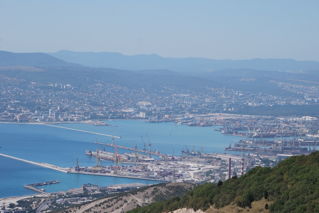
Novorossiysk ( rus, Новоросси́йск, p=nəvərɐˈsʲijsk; ady, ЦIэмэз, translit=Chəməz, p=t͡sʼɜmɜz) is a city in Krasnodar Krai, Russia. It is one of the largest ports on the Black Sea. It is one of the few cities honored with the title of the Hero City. Population: History In antiquity, the shores of the Tsemes Bay were the site of Bata ( el, Μπάτα), an ancient Greek colony that specialized in the grain trade. It is mentioned in the works of Strabo and Ptolemy, among others. Following brief periods of Roman and Khazar control, from the 9th century onwards, the area was part of the Byzantine θέμα Χερσῶνος ''Thema Khersonos'' (Province of Cherson). During the 11th century, the area was overrun and controlled by nomads from the Eurasian steppe, led by the Cumans. Later that century, the Byzantine emperor Ἀλέξιος Κομνηνός Alexios I Komnenos ( r. 1081–1118) was approached by Anglo-Saxon refugees, who had left En ... [...More Info...] [...Related Items...] OR: [Wikipedia] [Google] [Baidu] |
Mountain Lakes
A mountain is an elevated portion of the Earth's crust, generally with steep sides that show significant exposed bedrock. Although definitions vary, a mountain may differ from a plateau in having a limited summit area, and is usually higher than a hill, typically rising at least 300 metres (1,000 feet) above the surrounding land. A few mountains are isolated summits, but most occur in mountain ranges. Mountains are formed through tectonic forces, erosion, or volcanism, which act on time scales of up to tens of millions of years. Once mountain building ceases, mountains are slowly leveled through the action of weathering, through slumping and other forms of mass wasting, as well as through erosion by rivers and glaciers. High elevations on mountains produce colder climates than at sea level at similar latitude. These colder climates strongly affect the ecosystems of mountains: different elevations have different plants and animals. Because of the less hospitable terrain ... [...More Info...] [...Related Items...] OR: [Wikipedia] [Google] [Baidu] |
Lakes Of The Caucasus
A lake is an area filled with water, localized in a basin, surrounded by land, and distinct from any river or other outlet that serves to feed or drain the lake. Lakes lie on land and are not part of the ocean, although, like the much larger oceans, they do form part of the Earth's water cycle. Lakes are distinct from lagoons, which are generally coastal parts of the ocean. Lakes are typically larger and deeper than ponds, which also lie on land, though there are no official or scientific definitions. Lakes can be contrasted with rivers or streams, which usually flow in a channel on land. Most lakes are fed and drained by rivers and streams. Natural lakes are generally found in mountainous areas, rift zones, and areas with ongoing glaciation. Other lakes are found in endorheic basins or along the courses of mature rivers, where a river channel has widened into a basin. Some parts of the world have many lakes formed by the chaotic drainage patterns left over from the ... [...More Info...] [...Related Items...] OR: [Wikipedia] [Google] [Baidu] |
.jpg)


