|
Lone Rock (other)
Lone Rock may refer to the following places: Canada * Lone Rock, Saskatchewan United States * Lone Rock, Iowa * Lone Rock (Glen Canyon National Recreation Area) * Lone Rock, Washington * Lone Rock, Wisconsin, a village * Lone Rock, Juneau County, Wisconsin, an unincorporated community {{geodis ... [...More Info...] [...Related Items...] OR: [Wikipedia] [Google] [Baidu] |
Lone Rock, Saskatchewan
Lone Rock is a hamlet (place), hamlet in the west central region of the Provinces and territories of Canada, Canadian province of Saskatchewan. It is about south of Lloydminster and accessed from Saskatchewan Highway 688, Highway 688. Demographics In the 2021 Canadian census, 2021 Census of Population conducted by Statistics Canada, Lone Rock had a population of 50 living in 18 of its 19 total private dwellings, a change of from its 2016 population of 76. With a land area of , it had a population density of in 2021. References Designated places in Saskatchewan Organized hamlets in Saskatchewan Wilton No. 472, Saskatchewan Division No. 17, Saskatchewan {{SKDivision17-geo-stub ... [...More Info...] [...Related Items...] OR: [Wikipedia] [Google] [Baidu] |
Lone Rock, Iowa
Lone Rock is a city in Kossuth County, Iowa, United States. The population was 146 at the time of the 2020 census. The city is named after a large boulder. Lone Rock calls itself "The Neatest Little Town in Iowa." History Long before any settlement took place here, the unusual (175 ton) boulder was used as a landmark for travelers. Lone Rock was platted in 1899 when the railroad was being built through the neighborhood. In 1970, the lone rock was moved to the new location by blasting it into four pieces and reconstructing the pieces inside the community. Geography Lone Rock is located at (43.221359, -94.325090). According to the United States Census Bureau, the city has a total area of , all land. Lone Rock is north of Iowa Highway B19 and west of U.S. Route 169. Demographics 2010 census As of the census of 2010, there were 146 people, 75 households, and 47 families living in the city. The population density was . There were 82 housing units at an average density of . ... [...More Info...] [...Related Items...] OR: [Wikipedia] [Google] [Baidu] |
Lone Rock (Glen Canyon National Recreation Area)
Lone Rock is a solitary rock in Wahweap Bay in Lake Powell in Glen Canyon Recreation Area less than from Glen Canyon Dam. It is located within Kane County, Utah, Kane County, Utah, United States. Facing Lone Rock is the Lone Rock Campground accessed from Route 89. The beach is one of the few places in Glen Canyon Recreation Area where people can drive right to the water's edge. It was used as a filming location for the ''Doctor Who'' story "The Impossible Astronaut", the first episode of the sixth series, broadcast in April 2011 in the United Kingdom, the United States, Canada, and Australia. References External links Lone Rock, Wahweap. Riverlakes HostLone Rock. Aerial Photography {{coord, 37.027215, N, 111.534366, W, region:US-UT_type:landmark_source:gnis, display=title Landmarks in Utah Landforms of Kane County, Utah Rock formations of Utah ... [...More Info...] [...Related Items...] OR: [Wikipedia] [Google] [Baidu] |
Lone Rock, Washington
Lone Rock is an unincorporated community on the coast of the Hood Canal in Kitsap County, Washington. It gets its name from the glacial erratic boulder on the tidal flat about 400 feet off shore. Lone Rock is one of a small collection of historic rural communities in the western part of Kitsap County, which includes Seabeck, Holly, Camp Union, Crosby Crosby may refer to: Places ;Canada *Crosby, Ontario, part of the township of Rideau Lakes, Ontario *Crosby, Ontario, a neighbourhood in the city of Markham, Ontario ;England *Crosby, Cumbria *Crosby, Lincolnshire *Crosby, Merseyside ** Crosby (U ... and Hintzville. The Lone Rock community club defines Lone Rock as running along the coast from Seabeck to Olympic View and inland to Willamette Meridian Road and Newberry Hill Road. Little Beef Creek is widely regarded as the dividing line between Lone Rock and Seabeck. In this view, Lone Rock includes the Big Beef and Little Anderson Creeks and spans the smaller communities of Warr ... [...More Info...] [...Related Items...] OR: [Wikipedia] [Google] [Baidu] |
Lone Rock, Wisconsin
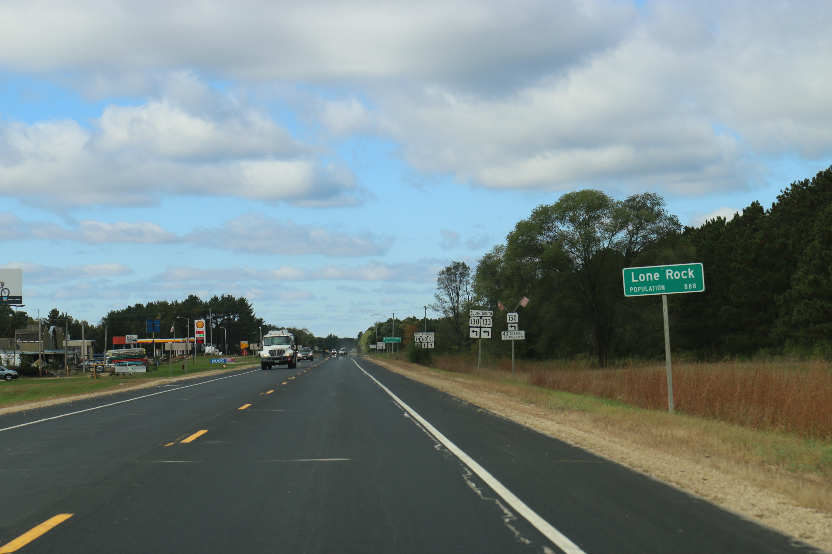
Lone Rock is a village in Richland County, Wisconsin, United States. The population was 888 at the 2010 census. The village is named after a sandstone outcrop. History According to a sign near the site, "The Lone Rock - At one time a massive piece of sandstone stood a short distance from the north bank of the Wisconsin River. The rock became a landmark for early river raftsmen and was known as 'Lone Rock' from which the town took its name. The rock was cut and used for basements and foundations in the village. What is left of the rock is located west of Highway 130 across from Brace Park." The community was founded in 1856 and incorporated as a village in 1866. Among its best-known residents is Bertha E. Reynolds, or "Dr. Bertha," the physician who served the community in the early twentieth century. A park and street in Lone Rock honor Reynolds. Geography Lone Rock is located at (43.184165, -90.198384). According to the United States Census Bureau, the village has a t ... [...More Info...] [...Related Items...] OR: [Wikipedia] [Google] [Baidu] |

