|
List Of Public Elementary Schools In New York City
This is a list of public elementary schools in New York City. They are typically referred to as "PS number" (e.g. "PS 46"). Many PS numbers are ambiguous, being used by more than one school. The sections correspond to New York City DOE Regions. Some charter schools are included throughout this list; others may be added to the charter schools section at the end of the list. Manhattan Older classifications Region 1: The Bronx Region 2: The Bronx Region 3: Queens Region 4: Queens Region 5: Brooklyn, Queens Region 6: Brooklyn Region 7: Staten Island, Brooklyn Region 8: Brooklyn Region 9: Manhattan, the Bronx Region 10: Manhattan, the Bronx Empowerment Schools: citywide Special Education District 75: citywide Charter schools: citywide Glossary In some of the literature issued by the New York City Board of Education there may be a letter or a string of two letters which may be before or after the School Number. Boroughs: The City of New York comprises ... [...More Info...] [...Related Items...] OR: [Wikipedia] [Google] [Baidu] |
New York City DOE Regions
The New York City Department of Education (NYCDOE) is the department of the government of New York City that manages the city's public school system. The City School District of the City of New York (or the New York City Public Schools) is the largest school system in the United States (and the world), with over 1.1 million students taught in more than 1,800 separate schools. The department covers all five boroughs of New York City, and has an annual budget of $38 billion. The department is run by the Panel for Educational Policy and New York City Schools Chancellor. The current chancellor is David C. Banks. History The New York State legislature established the New York City Board of Education in 1842. Beginning in the late 1960s, schools were grouped into ''districts''. Elementary schools and middle schools were grouped into 32 community school districts, and high schools were grouped into five geographically larger districts. One each for Manhattan, the Bronx, Queen ... [...More Info...] [...Related Items...] OR: [Wikipedia] [Google] [Baidu] |
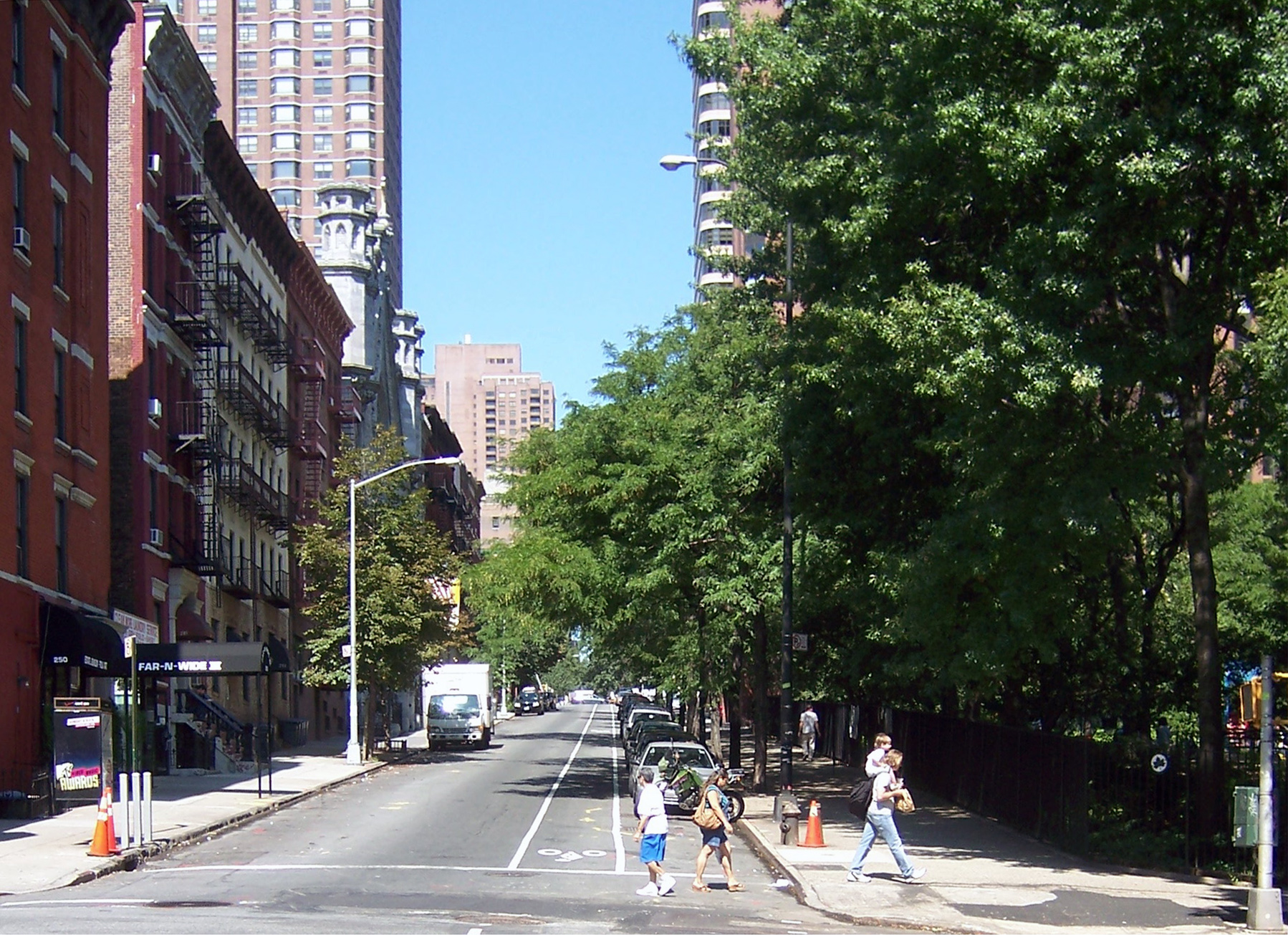
Kips Bay, Manhattan
Kips Bay, or Kip's Bay, is a neighborhood on the east side of the New York City borough of Manhattan. It is roughly bounded by East 34th Street to the north, the East River to the east, East 27th and/or 23rd Streets to the south, and Third Avenue to the west. Kips Bay is part of Manhattan Community District 6, and its primary ZIP Codes are 10010 and 10016. It is patrolled by the 13th and 17th Precincts of the New York City Police Department. Geography According to ''The Encyclopedia of New York City'' and the New York City Department of City Planning, Kips Bay proper is generally bounded by East 34th Street to the north, the East River to the east, East 27th Street to the south, and Third Avenue to the west. City documents have also used New York City census tract 70 (from 29th to 34th Streets, First to Third Avenues) as an approximation for Kips Bay, and referred to tract 66, immediately below it, as "Bellevue South."See alsDraft Scoping Document for an Environmental Im ... [...More Info...] [...Related Items...] OR: [Wikipedia] [Google] [Baidu] |
Bronx
The Bronx () is a borough of New York City, coextensive with Bronx County, in the state of New York. It is south of Westchester County; north and east of the New York City borough of Manhattan, across the Harlem River; and north of the New York City borough of Queens, across the East River. The Bronx has a land area of and a population of 1,472,654 in the 2020 census. If each borough were ranked as a city, the Bronx would rank as the ninth-most-populous in the U.S. Of the five boroughs, it has the fourth-largest area, fourth-highest population, and third-highest population density.New York State Department of Health''Population, Land Area, and Population Density by County, New York State – 2010'' retrieved on August 8, 2015. It is the only borough of New York City not primarily on an island. With a population that is 54.8% Hispanic as of 2020, it is the only majority-Hispanic county in the Northeastern United States and the fourth-most-populous nationwide. The Bronx ... [...More Info...] [...Related Items...] OR: [Wikipedia] [Google] [Baidu] |
Yorkville, Manhattan
Yorkville is a neighborhood in the Upper East Side of Manhattan, New York City. Its southern boundary is East 72nd Street, its northern East 96th Street, its western Third Avenue, and its eastern the East River. Yorkville is among the city's most affluent neighborhoods. Yorkville is part of Manhattan Community District 8, and its primary ZIP Codes are 10028, 10075, and 10128. It is patrolled by the 19th Precinct of the New York City Police Department. History Early history Pre-colonization, Yorkville was an undeveloped area of forests and streams. In August 1776, George Washington stationed half of his Continental Army in Manhattan and the other half in Brooklyn. Many troops in the Yorkville area on Manhattan's Upper East Side were in defensive positions along the East River to protect a possible retreat off Long Island, and to inflict damage on invading land and sea British forces. Following their August 27 defeat in the Battle of Long Island, the Continentals implement ... [...More Info...] [...Related Items...] OR: [Wikipedia] [Google] [Baidu] |
Upper West Side
The Upper West Side (UWS) is a neighborhood in the borough of Manhattan in New York City. It is bounded by Central Park on the east, the Hudson River on the west, West 59th Street to the south, and West 110th Street to the north. The Upper West Side is adjacent to the neighborhoods of Hell's Kitchen to the south, Columbus Circle to the southeast, and Morningside Heights to the north. Like the Upper East Side opposite Central Park, the Upper West Side is an affluent, primarily residential area with many of its residents working in commercial areas of Midtown and Lower Manhattan. Similarly to the Museum Mile district on the Upper East Side, the Upper West Side is considered one of Manhattan's cultural and intellectual hubs, with Columbia University and Barnard College located just to the north of the neighborhood, the American Museum of Natural History located near its center, and Lincoln Center for the Performing Arts and Fiorello H. LaGuardia High School located at the sout ... [...More Info...] [...Related Items...] OR: [Wikipedia] [Google] [Baidu] |
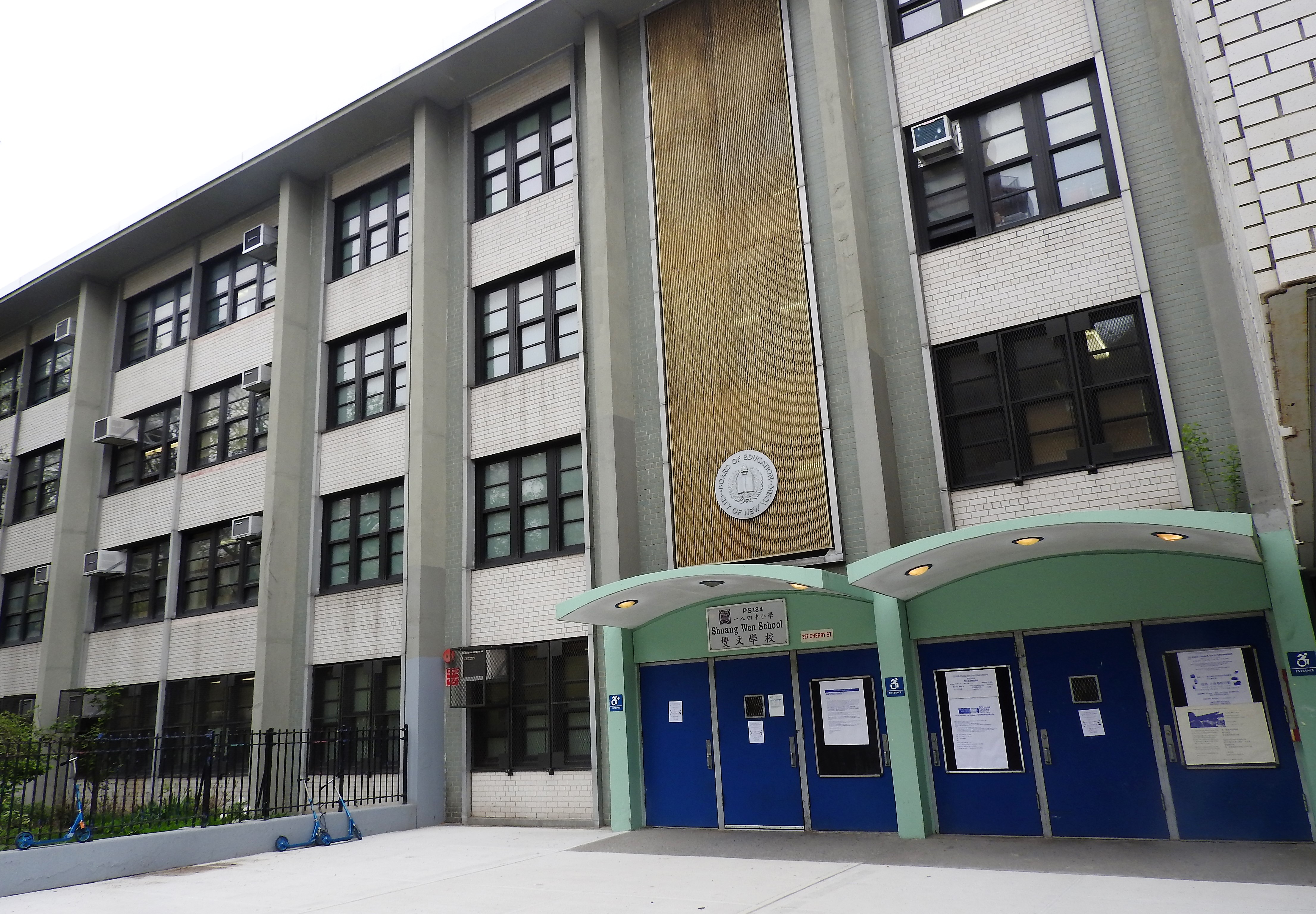
Shuang Wen School
PS 184M Shuang Wen School (), a public school in New York City also known as PS 184 (), is a Dual Language elementary and middle school located in Manhattan's Chinatown. The school teaches students from Pre-Kindergarten to 8th grade. It is a part of the New York City Department of Education and located in Manhattan District 1 which also includes the Lower East Side and East Village. A major $1.7 million renovation of the school playground and soccer field was completed in 2019 by the Trust for Public Land and DEP. In the elementary school, the school teaches in Traditional Chinese and utilizes the zhuyin phonetic system popular in Taiwan. During the typical school day, one day is taught in English and other day is in Mandarin. As a Dual Language school, classes in both languages are a mandatory part of the curriculum. History Upon opening in 1998, the school was described as a new type of school, and one of the first English-Mandarin bilingual schools in the country. Be ... [...More Info...] [...Related Items...] OR: [Wikipedia] [Google] [Baidu] |
Upper East Side
The Upper East Side, sometimes abbreviated UES, is a neighborhood in the borough of Manhattan in New York City, bounded by 96th Street to the north, the East River to the east, 59th Street to the south, and Central Park/Fifth Avenue to the west. The area incorporates several smaller neighborhoods, including Lenox Hill, Carnegie Hill, and Yorkville. Once known as the Silk Stocking District,The City Review Upper East Side, the Silk Stocking District it has long been the most affluent neighborhood in New York City. The Upper East Side is part of Manhattan Community District 8, and its primary ZIP Codes are 10021, 10028, 10065, 10075, and 10128 ... [...More Info...] [...Related Items...] OR: [Wikipedia] [Google] [Baidu] |
PS 166 (Manhattan)
Public School 166, the Richard Rodgers School of Arts & Technology, is a Public school (government funded)#United States, public school administered by the New York City Department of Education and located in the New York City, city's Upper West Side, Manhattan, Upper West Side neighborhood of the borough of Manhattan. An elementary school, it serves about 600 pupils in kindergarten through fifth grade. The building, located on West 89th Street between Columbus and Amsterdam avenues, was designed by C. B. J. Snyder and opened in September 1899. It was completely renovated and modernized in 1995 and designated a New York City Landmarks Preservation Commission, New York City landmark in 2000. Although the school is still referred to as PS 166, it was formally renamed in honor of former student Richard Rodgers in 2003. Notable alumni * Graham Diamond – Satire, fantasy, fiction and nonfiction author * Joey Diaz – Comedian and actor * Ronnie Eldridge – former New York City co ... [...More Info...] [...Related Items...] OR: [Wikipedia] [Google] [Baidu] |
List Of Neighborhoods In Harlem
This is a list of all neighborhoods in the section of Harlem, in the New York City borough of Manhattan. Central Harlem *Astor Row *Strivers' Row *Le Petit Senegal East Harlem *Spanish Harlem West Harlem *Hamilton Heights *Manhattanville *Morningside Heights *Sugar Hill, Manhattan Sugar Hill is a National Historic District in the Harlem and Hamilton Heights neighborhoods of Manhattan, New York City, bounded by West 155th Street to the north, West 145th Street to the south, Edgecombe Avenue to the east, and Amsterdam Av ... {{Harlem, state=collapsed Harlem Lists of neighborhoods in U.S. cities ... [...More Info...] [...Related Items...] OR: [Wikipedia] [Google] [Baidu] |
Upper East Side, Manhattan
The Upper East Side, sometimes abbreviated UES, is a neighborhood in the borough of Manhattan in New York City, bounded by 96th Street to the north, the East River to the east, 59th Street to the south, and Central Park/ Fifth Avenue to the west. The area incorporates several smaller neighborhoods, including Lenox Hill, Carnegie Hill, and Yorkville. Once known as the Silk Stocking District,The City Review Upper East Side, the Silk Stocking District it has long been the most affluent neighborhood in New York City. The Upper East Side is part of Manhattan Community District 8, and its primary ZIP Codes are 10021, 10028, 10065, 10075, and 101 ... [...More Info...] [...Related Items...] OR: [Wikipedia] [Google] [Baidu] |
Hamilton Heights
Hamilton Heights is a neighborhood in the northern part of Manhattan in New York City. It is the northernmost part of the West Harlem area, along with Manhattanville and Morningside Heights to its south, and it contains the sub-neighborhood and historic district of Sugar Hill. Washington Heights lies to Hamilton Heights' north, and to its east is Central Harlem. Hamilton Heights is bounded by 135th Street to the south, Riverside Drive to the west, 155th Street to the north, and Edgecombe Avenue and Saint Nicholas Avenue to the east. The community derives its name from Founding Father Alexander Hamilton, who lived the last two years of his life in what is now the Hamilton Grange National Memorial, back when Upper Manhattan was mostly farmland. Hamilton Heights is part of Manhattan Community District 9, and its primary ZIP Codes are 10031, 10032, and 10039. It is patrolled by the 30th Precinct of the New York City Police Department. Demographics Based on data from the 20 ... [...More Info...] [...Related Items...] OR: [Wikipedia] [Google] [Baidu] |
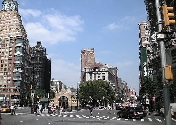
Tribeca
Tribeca (), originally written as TriBeCa, is a neighborhood in Lower Manhattan in New York City. Its name is a syllabic abbreviation of "Triangle Below Canal Street". The "triangle" (more accurately a quadrilateral) is bounded by Canal Street, West Street, Broadway, and Chambers Street. By the 2010s, a common marketing tactic was to extend Tribeca's southern boundary to either Vesey or Murray streets to increase the appeal of property listings. The neighborhood began as farmland, then was a residential neighborhood in the early 19th century, before becoming a mercantile area centered on produce, dry goods, and textiles, and then transitioning to artists and then actors, models, entrepreneurs and other celebrities. The neighborhood is home to the Tribeca Festival, which was created in response to the September 11 attacks, to reinvigorate the neighborhood and downtown after the destruction caused by the terrorist attacks. Tribeca is part of Manhattan Community District 1, ... [...More Info...] [...Related Items...] OR: [Wikipedia] [Google] [Baidu] |


.jpg)


.jpg)