|
List Of Post Towns In The United Kingdom
This is a list of post towns in the United Kingdom and Crown Dependencies, sorted by the postcode area (the first part of the outward code of a postcode). For more information, see the post town article. Footnotes References * * {{UK postal system Post towns, List Post Post or POST commonly refers to: *Mail, the postal system, especially in Commonwealth of Nations countries **An Post, the Irish national postal service **Canada Post, Canadian postal service **Deutsche Post, German postal service **Iraqi Post, Ira ... Postcodes in the United Kingdom ... [...More Info...] [...Related Items...] OR: [Wikipedia] [Google] [Baidu] |
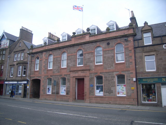
Inverurie
Inverurie (Scottish Gaelic: ''Inbhir Uraidh'' or ''Inbhir Uaraidh'', 'mouth of the River Ury') is a town in Aberdeenshire, Scotland at the confluence of the rivers Ury and Don, about north-west of Aberdeen. Geography Inverurie is in the valley of the River Don at the centre of Aberdeenshire and is known locally as the Heart of the Garioch. It sits between the River Don and the River Ury and is only from the imposing hill of Bennachie. The town centre is triangular and is dominated by Inverurie Town Hall built in 1863. In the middle of the 'square' (as it is known locally) is the Inverurie and District War Memorial, capped by a lone Gordon Highlander looking out over the town. The main shopping areas include the Market Place and West High Street which branches off from the centre towards the more residential part of the town. South of the River Don is the village of Port Elphinstone, which is part of the Royal Burgh of Inverurie and is so called due to the proximity of the ... [...More Info...] [...Related Items...] OR: [Wikipedia] [Google] [Baidu] |
Hatfield, Hertfordshire
Hatfield is a town and civil parish in Hertfordshire, England, in the borough of Welwyn Hatfield. It had a population of 29,616 in 2001, and 39,201 at the 2011 Census. The settlement is of Saxon origin. Hatfield House, home of the Marquess of Salisbury, forms the nucleus of the old town. From the 1930s when de Havilland opened a factory until the 1990s when British Aerospace closed it, aircraft design and manufacture employed more people there than any other industry. Hatfield was one of the post-war New Towns built around London and has much modernist architecture from the period. The University of Hertfordshire is based there. Hatfield lies north of London beside the A1(M) motorway and has direct trains to London King's Cross railway station, Finsbury Park and Moorgate. There has been a strong increase in commuters who work in London moving into the area. In 2022, TV property expert Phil Spencer named Hatfield as the second best place to live for regular commuters to Lo ... [...More Info...] [...Related Items...] OR: [Wikipedia] [Google] [Baidu] |
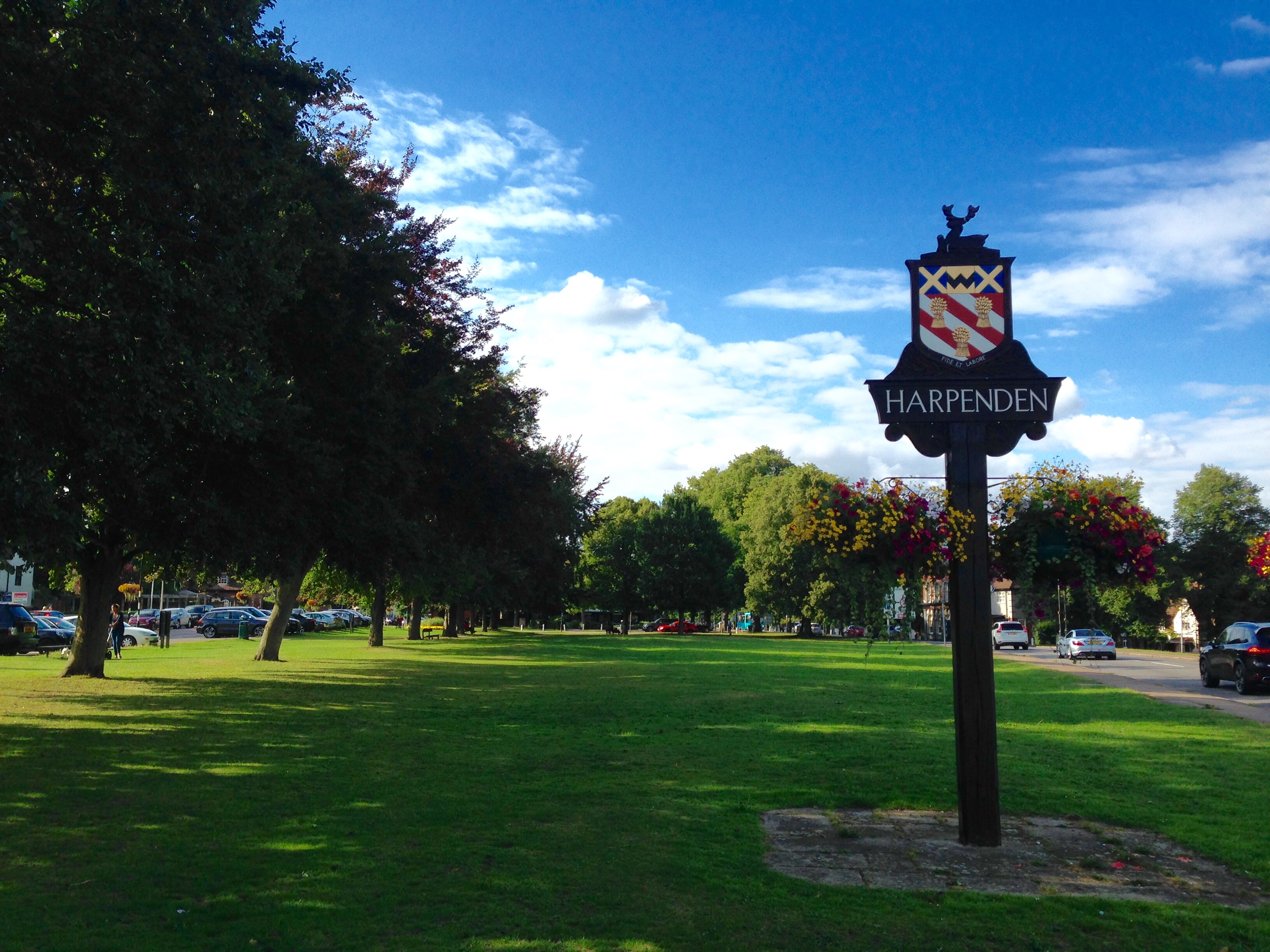
Harpenden
Harpenden () is a town and civil parish in the City and District of St Albans in the county of Hertfordshire, England. The population of the built-up area was 30,240 in the 2011 census, whilst the population of the civil parish was 29,448. Harpenden is a commuter town, with a direct rail connection through Central London and property prices well over triple the national average. History There is evidence of pre-Roman Belgic farmers in the area. In 1867 several items were found including a bronze escutcheon, rams-head shaped mounts, and a bronze bowl. There are Roman remains in land around Harpenden, for instance the site of a mausoleum in the park at Rothamsted. A tumulus near the river Lea was opened in the 1820s and it contained a stone sarcophagus of Romano-Celtic origin. Five objects dating from around 150 AD, were inside including a glass jug with a Mediterranean stamp and samian ware dishes used for libations. Up to the 13th century the area of the parish cons ... [...More Info...] [...Related Items...] OR: [Wikipedia] [Google] [Baidu] |
AL Postcode Area
The AL postcode area, also known as the St Albans postcode area,Royal Mail, ''Address Management Guide'', (2004) is a group of ten postcode districts in England, within five post towns. These cover central Hertfordshire, including St Albans, Harpenden, Welwyn, Welwyn Garden City and Hatfield. Mail for this area is processed at the Home Counties North Mail Centre in Hemel Hempstead, and is delivered from offices at St Albans (Brick Knoll Park AL1), Harpenden (Station Road AL5), and Hatfield (Town Centre AL10). The area covered includes most of the St Albans and Welwyn Hatfield districts, plus the northeastern part of the Dacorum district and very small parts of the Hertsmere, North Hertfordshire and East Hertfordshire districts. __TOC__ Coverage The approximate coverage of the postcode districts: , - ! AL1 , ST ALBANS , St Albans , St Albans , - ! AL2 , ST ALBANS , St Albans, Bricket Wood, Colney Street, Frogmore, London Colney, Napsbury, Park Street, Potters ... [...More Info...] [...Related Items...] OR: [Wikipedia] [Google] [Baidu] |
Westhill, Aberdeenshire
Westhill is a suburban town in Aberdeenshire, Scotland, located west of the city of Aberdeen. Size of Westhill The town of Westhill covers the area that was the Western Kinmundy and Blackhills Farming areas. Demographics The population in 2006 was 10,392.Westhill Profile Aberdeenshire Council As of June 2016, the population grew to an estimated 12,040 City Population people, 65.3% being aged from 18-64. Origin The creation of Westhill just outside Aberdeen was the idea of local solicitor Ronald Fraser Dean in 1963. With the backing of the f ...[...More Info...] [...Related Items...] OR: [Wikipedia] [Google] [Baidu] |
Turriff
Turriff () is a town and civil parish in Aberdeenshire in Scotland. It lies on the River Deveron, about above sea level, and has a population of 5,708. In everyday speech it is often referred to by its Scots name ''Turra'', which is derived from the Scottish Gaelic pronunciation. Services and amenities There are four churches in Turriff: St Ninian's (Church of Scotland, 1794), St Andrew's (Church of Scotland), St Congan's (Episcopal Church, 1862), and a Baptist church. Turriff has a primary school, Turriff Primary School, and a secondary school, Turriff Academy. Turriff Primary School is a new build which replaced the old Markethill Primary School and opened to pupils on 22 August 2017. People from the surrounding areas, including the villages of Cuminestown, Fyvie and King Edward, attend the secondary school. Bank of Scotland, Santander UK (formerly Alliance & Leicester), Clydesdale Bank and TSB have branches in the town. The main supermarket chains are Tesco (whose prem ... [...More Info...] [...Related Items...] OR: [Wikipedia] [Google] [Baidu] |
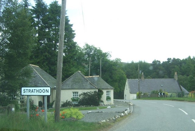
Strathdon
Strathdon (; Gaelic: ''Srath Dheathain'') is an area in Aberdeenshire, Scotland. It is situated in the strath of the River Don, 45 miles west of Aberdeen in the Highlands. The main village in the strath is also called Strathdon, although it was originally called Invernochty due to its location at the confluence of the River Don and the Water of Nochty. Also included within the area of Strathdon is the settlement of Bellabeg which has many of the local community's main facilities. Strathdon is an informal geographical area. This means that there are no precise boundaries in terms of where it begins or ends. It is the founding place of the Lonach Highland and Friendly Society, and the Lonach Highland Gathering. This is a traditional Highland Gathering with the heavy sport events such as tossing the caber, hammer etc., and it also hosts a competition of Highland dancing. Dances include the noted 'Highland Fling', 'Sword Dance', 'Seann Triubhas' and 'Reel of Tulloch'. Notable figur ... [...More Info...] [...Related Items...] OR: [Wikipedia] [Google] [Baidu] |
Stonehaven
Stonehaven ( , ) is a town in Scotland. It lies on Scotland's northeast coast and had a population of 11,602 at the 2011 Census. After the demise of the town of Kincardine, which was gradually abandoned after the destruction of its royal castle in the Wars of Independence, the Scottish Parliament made Stonehaven the successor county town of Kincardineshire. It is currently administered as part of the unitary authority of Aberdeenshire. Stonehaven had grown around an Iron Age fishing village, now the "Auld Toon" ("old town"), and expanded inland from the seaside. As late as the 16th century, old maps indicate the town was called ''Stonehyve'', ''Stonehive'', Timothy Pont also adding the alternative ''Duniness''. It is known informally to locals as ''Stoney''. Pre-history and archaeology Stonehaven is the site of prehistoric events evidenced by finds at Fetteresso Castle and Neolithic pottery excavations from the Spurryhillock area. In 2004, archaeological work by CFA Archa ... [...More Info...] [...Related Items...] OR: [Wikipedia] [Google] [Baidu] |
Peterhead
Peterhead (; gd, Ceann Phàdraig, sco, Peterheid ) is a town in Aberdeenshire, Scotland. It is Aberdeenshire's biggest settlement (the city of Aberdeen itself not being a part of the district), with a population of 18,537 at the 2011 Census. It is the biggest fishing port in the United Kingdom for total landings by UK vessels, according to a 2019 survey."Brexit trade deal: What does it mean for fishing?" - BBC News, December 2020 Peterhead sits at the easternmost point in mainland Scotland. It is often referred to as ''The Blue Toun'' (locally spelled "The Bloo Toon") and its natives are known as ''Bloo Touners''. They are also referred to as ''blue mogganers'' (locally spelled "bloomogganners"), supposedly from the blue |
Peterculter
Peterculter ( sco, Petercouter), also known as Culter (Scots: ''Couter''), is a suburb of Aberdeen, Scotland, about inland from Aberdeen city centre. Peterculter is on the northern banks of the River Dee, near the confluences with Crynoch Burn and Leuchar Burn. Following the 1996 Scottish council boundary changes it became part of the City of Aberdeen's Lower Deeside ward. The latter part of the name is said to come from the Gaelic compound word "Cul-tir", which signifies the "back part" of the country. History About south west of the Peterculter is the site of the Roman marching camp at Normandykes. King William the Lion bestowed the church of Kulter, "iuxta Abirdene", upon the Abbey and monks of St Mary of Kelso, about 1165–1199. The gift was afterwards confirmed by Mathew, Bishop of Aberdeen, within whose diocese the church sat. Alan of Soltre, chaplain, who had probably been an ecclesiastic of the hospital, or monastery of Soutra, in Lothian, was presented ... [...More Info...] [...Related Items...] OR: [Wikipedia] [Google] [Baidu] |
Milltimber
Milltimber is a suburb of Aberdeen, Scotland, around west of Aberdeen city centre. From 1854 to 1937 the area was served by Milltimber railway station on the Aberdeen suburban railway. Along with the nearby settlements of Cults and Bieldside, it is home to some of the wealthiest residents of Aberdeen. Facilities in Milltimber are somewhat lacking, with the nearest shop situated in neighbouring Bieldside. However, it is home to a highly rated primary school, a church, and a community building which is used for private functions as well as Boy Scout and Girl Guide troops and similar. Kippie Lodge is a sports and social club, with a 9-hole golf course, swimming pool, sports complex, creche and restaurant. Next to the lodge are the playing fields of the independent Albyn School. In 2009, property website Zoopla ZPG Ltd. is a British real estate company based in London, England, owned by Silver Lake Partners. Its brands include the property website Zoopla, price comparison ser ... [...More Info...] [...Related Items...] OR: [Wikipedia] [Google] [Baidu] |

.jpg)

