|
List Of Places In Stirling (district)
This article is a list of any town, village, hamlet and settlements in the Stirling council area of Scotland. A * Abbey Craig * Aberfoyle * Ardchyle * Ardeonaig * Arnprior * Ashfield * Auchlyne B * Balfron, * Balmaha * Bannockburn, * Ben Ledi * Blair Drummond, * Blairlogie * Blanefield * Boquhan * Boreland * Braeval * Brig o' Turk * Bridge of Allan * Broomridge * Buchlyvie C * Callander, * Cambusbarron * Cambuskenneth, * Campsie Fells * Carbeth * Carse of Lecropt * Cauldhame * Cobleland * Cornton, * Cowie * Craigdownings * Craighat * Craigruie * Crianlarich * Croftamie D * Dalmary * Deanston * Doune, Doune Castle * Drymen * Dumgoyne * Dumyat * Dunblane, * Dykehead F * Fallin *Falls of Dochart * Falls of Lochay *Fintry, *Flanders Moss G * Garbh Uisge * Gargunnock, * Gartachoil * Gartmore * Gartness * Glen Dochart * Glengoyne Distillery I * Inchmahome, * Inchtalla * Inversnaid K * Killearn * Killin * Kinbuck * Kinlochard * Kippen L * Lake of ... [...More Info...] [...Related Items...] OR: [Wikipedia] [Google] [Baidu] |
Town
A town is a human settlement. Towns are generally larger than villages and smaller than cities, though the criteria to distinguish between them vary considerably in different parts of the world. Origin and use The word "town" shares an origin with the German word , the Dutch word , and the Old Norse . The original Proto-Germanic word, *''tūnan'', is thought to be an early borrowing from Proto-Celtic *''dūnom'' (cf. Old Irish , Welsh ). The original sense of the word in both Germanic and Celtic was that of a fortress or an enclosure. Cognates of ''town'' in many modern Germanic languages designate a fence or a hedge. In English and Dutch, the meaning of the word took on the sense of the space which these fences enclosed, and through which a track must run. In England, a town was a small community that could not afford or was not allowed to build walls or other larger fortifications, and built a palisade or stockade instead. In the Netherlands, this space was a garden, mor ... [...More Info...] [...Related Items...] OR: [Wikipedia] [Google] [Baidu] |
Blair Drummond
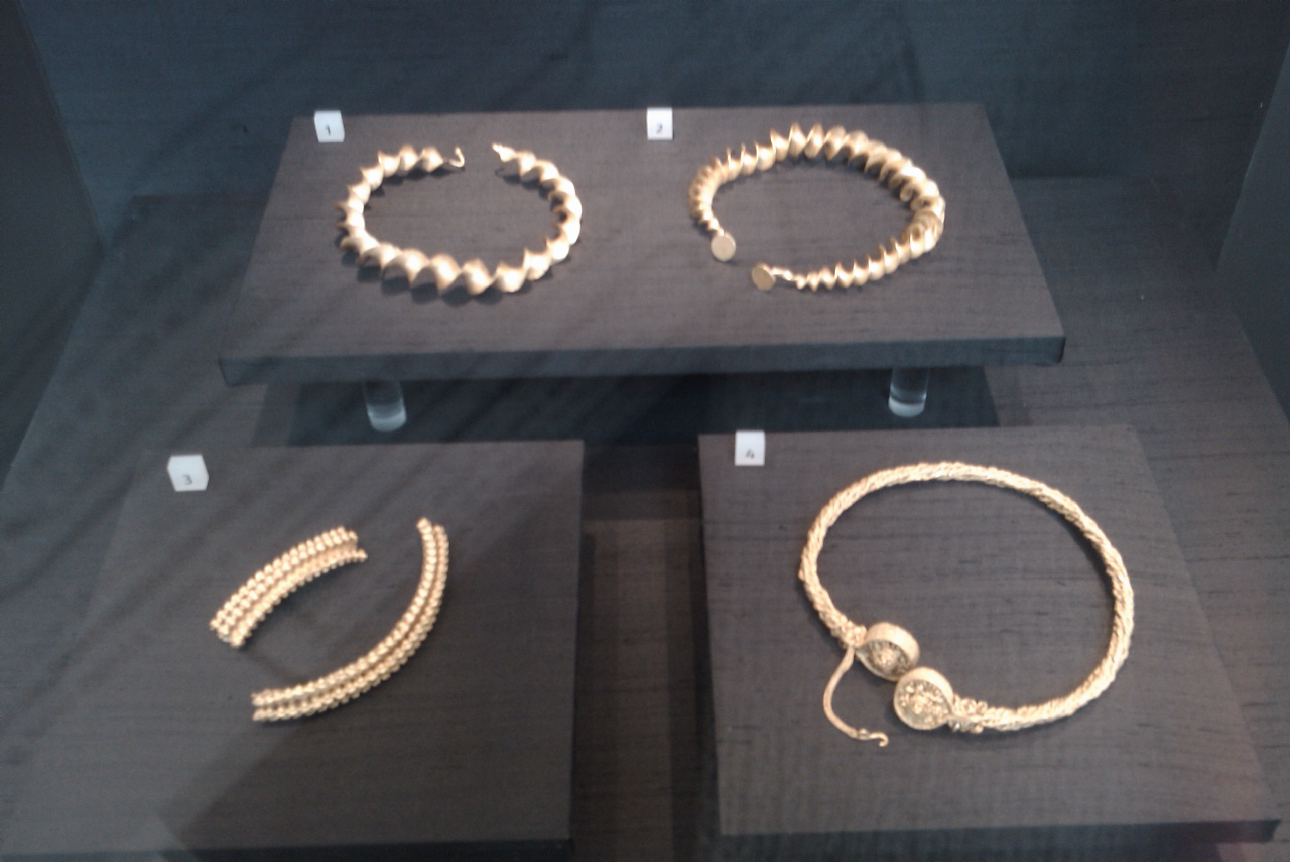
Blair Drummond is a small rural community northwest of Stirling in the Stirling district of Scotland, predominantly located along the A84 road. Lying to the north of the River Forth, the community is within the registration county of Perthshire and the civil parish of Kincardine History A former resident of Blairdrummond House was enlightenment thinker Lord Kames whose wife inherited the house in 1766. Lord Kames began the transformation of the carse area of Blair Drummond; turning it from an often water-laden moss into productive agricultural land, which brought him an income of almost £2000 per year. Blair Drummond House was entirely rebuilt in 1868-72 by James Campbell Walker (under instruction from George Stirling Home Drummond FRSE) and again by James Bow Dunn after a fire in 1921-23 and is now a home for adults with learning disabilities run by the Camphill Movement. Four gold Iron Age torcs, known as the Stirling torcs, were found in Blair Drummond in 2009 and ... [...More Info...] [...Related Items...] OR: [Wikipedia] [Google] [Baidu] |
Ben Ledi
Ben Ledi (Beinn Leitir in Scottish Gaelic) is a mountain in Stirling (council area), Stirling, Scotland. It is high, and is therefore classified as a Corbett (hill), Corbett. It lies about northwest of Callander, near the village of Kilmahog. It is situated in the Trossachs, an area often regarded as having some of the most romantic scenery in the Scottish Highlands, Highlands. History Ben Ledi is particularly well known through Walter Scott's poem ''Lady of the Lake''. Supposedly in ancient times, Beltane rites were observed on the summit. There are what is thought to be possible references to these Beltane rights in some of the Gaelic names on the mountain: Creag Ghorn; "Rock of Embers" and Creag Loisgte; "Burned Rock". In 1791 the Rev Doctor James Robertson, being minister of the parish at the time, was required to write a description of the parish for the First Statistical Account of Scotland. In his report he mistakenly (due to the similarity to ''le dia'') took the name B ... [...More Info...] [...Related Items...] OR: [Wikipedia] [Google] [Baidu] |
Bannockburn
Bannockburn (Scottish Gaelic ''Allt a' Bhonnaich'') is an area immediately south of the centre of Stirling in Scotland. It is part of the City of Stirling. It is named after the Bannock Burn, a stream running through the town before flowing into the River Forth. History Land in the vicinity of Bannockburn town, probably between the Pelstream and Bannock burns (hence Bannockburn), was the site of the Battle of Bannockburn fought in 1314—one of the pivotal battles of the 13th/14th century Wars of Independence between the kingdoms of Scotland and England. A large monument and visitor centre is located near the site of the battle. In previous generations tourists came to visit the site and look at the Borestone. The dignity of the barony of Bannockburn is currently held by Hope Vere Anderson, a descendant of the Sandilands and Vere families of Sandilands and Lesmahagow, Lanarkshire who were the original Barons of Bannockburn in the 14th century. In the year of 1746, after the B ... [...More Info...] [...Related Items...] OR: [Wikipedia] [Google] [Baidu] |
Balmaha
Balmaha (Gaelic: ''Baile Mo Thatha'') is a village on the eastern shore of Loch Lomond in the council area of Stirling, Scotland. The village is a popular tourist destination for picnickers and day trippers from Glasgow as well as walkers on the West Highland Way. The only road passing through the village is the B837. Boat trips leave from Balmaha for the town of Balloch and the village of Luss as well as nearby Inchcailloch Island. Balmaha sits at the westerly foot of Conic Hill, and is roughly along the West Highland Way if coming from Milngavie. Etymology The name Balmaha derives from the Gaelic ''Bealach Mo-Cha'', 'the pass of Saint Mo-Cha'. The pass referred to is now named The Pass of Balmaha, a narrow route between hills at the north end of the village, carrying the road north along Loch Lomond. The saint referred to is Kentigerna, patron saint of the parish who was revered especially on the nearby island of Inchcailloch ('Island of Nuns'). Mo-Cha is a 'hypocoristic' ... [...More Info...] [...Related Items...] OR: [Wikipedia] [Google] [Baidu] |
Balfron
Balfron ( gd, Both Fron) is a village in the Stirling council area of Scotland. It is situated near Endrick Water on the A875 road, 18 miles (29 km) west of Stirling and 16 miles (26 km) north of Glasgow. Although a rural settlement, it lies within commuting distance of Glasgow, and serves as a dormitory settlement. History The name means 'cottage of mourning' in Gaelic. This originates from a legend that the village was attacked by wolves, which stole children out of their homes. The first documented evidence of a settlement at the site dates from 1303, when it was referred to as "Buthbren".Balfron's history ''Balfron Heritage Group'' Balfron has an ancient oak – The Clachan Oak – where |
Auchlyne
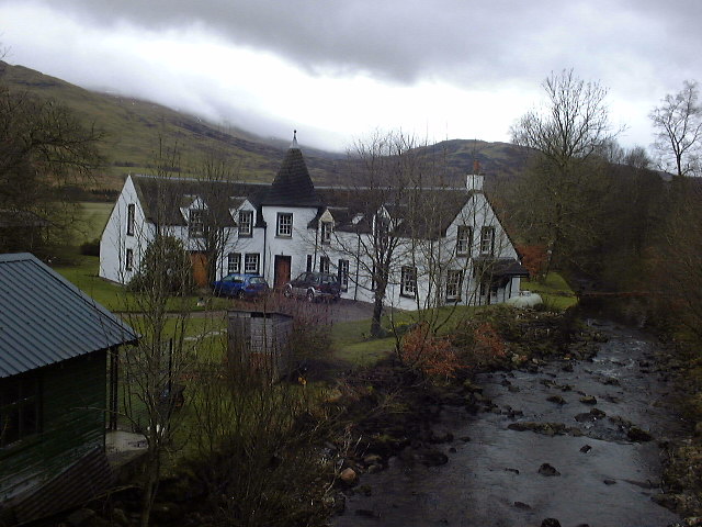
Auchlyne (Scottish Gaelic: ''Achadh Loinne'') is a small hamlet in Stirling, Scotland. It is located approximately five miles west of Killin on Loch Tay, off the main A85 road that runs from Perth to Oban. It consists of 3 houses, a large mansion house (complete with adjoining servants quarters, walled garden and kennels) and a farm, and has 10 permanent residents. There is also an Auchlyne in Guyana. It is unknown if there is any direct link. It is likely that Auchlyne, Guyana was named by a Scot, since Auchlyne is a typical Gaelic-derived name. There is also an Auchlyne Estate, which is governed by the Scottish Congregational Church. Toponymy The name "Auchlyne" comes from the Gaelic ''Achadh Loinne''. ''Achadh'' means "field", whereas ''Loinne'' may mean "stack-yard" (in Perthshire Gaelic) or "in good condition / appearance". Historically, the name may have been "Achline" or "Auchlin". Location Auchlyne is located on the North side of Glen Dochart where the flat river p ... [...More Info...] [...Related Items...] OR: [Wikipedia] [Google] [Baidu] |
Ashfield, Stirling
Ashfield ( gd, Achadh an Uinnsinn) is a small village in the Registration county of Perth and the local government district of Stirling, Scotland. It lies between the Allan Water and the Stirling-Perth Railway line. It is two miles north of Dunblane Dunblane (, gd, Dùn Bhlàthain) is a small town in the council area of Stirling in central Scotland, and inside the historic boundaries of the county of Perthshire. It is a commuter town, with many residents making use of good transport links ..., and was designated a conservation village in 1976. It was originally built to house workers at a nearby silk-dyeing mill. Prior to this, a mill, Millash or Mill of Ash, existed, as did an extensive house or farm. Ashfield has four residential streets (Ochilview, Allanview, The Steading and The Cottages), a residential block (The Clachan) and also a square, named after the former prime minister William Gladstone, called Gladstone Square. There are various annual activities based in the ... [...More Info...] [...Related Items...] OR: [Wikipedia] [Google] [Baidu] |
Arnprior, Stirling
Arnprior is a hamlet in the Stirling council area of Scotland on the A811 about 12 miles west of Stirling and is one of the smallest community council districts in the region. The hamlet is next to the Flanders Moss National Nature Reserve and close to the east boundary of the Loch Lomond and Trossachs National Park, which includes the Lake of Menteith. Until 1996, the hamlet had a primary school. Due to a lack of pupils, it was shut down along with Croftamie Primary School and Kinbuck Primary School. Part of the school has since been converted into a nursery. Pupils were transferred to Buchlyvie Primary School. Etymology The name is from the Gaelic 'earrann' meaning a division of land. Walter Comyn, the Earl of Menteith, founded Inchmahome Priory in 1238 and it is thought the name of the hamlet could date from then. There are other ‘Arns’ in the area, some of which indicate size (e.g. Arnmore) and others indicate previous owners (e.g. Arnfinlay). The town of Arnprior, Ont ... [...More Info...] [...Related Items...] OR: [Wikipedia] [Google] [Baidu] |
Ardeonaig
Ardeonaig (Gaelic: ''Aird Eòdhanaig'') is a hamlet on the southern shore of Loch Tay in the Stirling Council area of Scotland. It is approximately 7 miles east of Killin and lies at the mouth of the Ardeonaig Burn where it enters Loch Tay. When boats ran on the loch they stopped at Ardeonaig, where coal was delivered and passengers could disembark. Now, fishing trips on Loch Tay stop at the Ardeonaig Hotel jetty to disembark for lunch before continuing down the Loch. There must have been a ferry service because the minister came by boat to conduct church services. At Ardeonaig there is an outdoor centre, run by the Abernethy Trust Abernethy, formerly known as the Abernethy Trust (founded in 1971) is a non-profit organization. It runs four outdoor activities centres and a bunkhouse in Scotland, providing outdoor instruction and residential facilities. History Abernethy wa .... References External links Vision of Britain - Ardeonaig [...More Info...] [...Related Items...] OR: [Wikipedia] [Google] [Baidu] |
Ardchyle
Ardchyle is a small hamlet in Stirling, Scotland. The Glendhu viaduct, just south of Ardchyle, was built for the now disused section of the Callander and Oban Railway The Callander and Oban Railway company was established with the intention of linking the sea port of Oban to the railway network. This involved a long line from Callander through wild and thinly populated terrain, and shortage of money meant th ... which closed in 1965 after a landslide. External links Canmore - Mill, Ardchyle, Glen Dochart site record Hamlets in Stirling (council area) {{Stirling-geo-stub ... [...More Info...] [...Related Items...] OR: [Wikipedia] [Google] [Baidu] |

.jpg)


