|
List Of Museums In South Dakota
This list of museums in South Dakota encompasses museums defined for this context as institutions (including nonprofit organizations, government entities, and private businesses) that collect and care for objects of cultural, artistic, scientific, or historical interest and make their collections or related exhibits available for public viewing. Museums that exist only in cyberspace (i.e., virtual museums) are not included. Museums Defunct museums * McCook County Museum, Salem * Performance Auto Museum, Sioux Falls and Deadwood * Soukup and Thomas International Balloon and Airship Museum, Mitchell, closed in 2000 See also * Nature Centers in South Dakota References ResourcesAssociation of South Dakota Museums {{DEFAULTSORT:List Of Museums In South Dakota * Museums South Dakota Museums A museum ( ; plural museums or, rarely, musea) is a building or institution that cares for and displays a collection of artifacts and other objects of artistic, cultural, h ... [...More Info...] [...Related Items...] OR: [Wikipedia] [Google] [Baidu] |
South Dakota
South Dakota (; Sioux: , ) is a U.S. state in the North Central region of the United States. It is also part of the Great Plains. South Dakota is named after the Lakota and Dakota Sioux Native American tribes, who comprise a large portion of the population with nine reservations currently in the state and have historically dominated the territory. South Dakota is the seventeenth largest by area, but the 5th least populous, and the 5th least densely populated of the 50 United States. As the southern part of the former Dakota Territory, South Dakota became a state on November 2, 1889, simultaneously with North Dakota. They are the 39th and 40th states admitted to the union; President Benjamin Harrison shuffled the statehood papers before signing them so that no one could tell which became a state first. Pierre is the state capital, and Sioux Falls, with a population of about 192,200, is South Dakota's largest city. South Dakota is bordered by the states of North D ... [...More Info...] [...Related Items...] OR: [Wikipedia] [Google] [Baidu] |
Akta Lakota Museum
The Aktá Lakota Museum & Cultural Center is a private, non-profit educational and cultural outreach program of St. Joseph's Indian School, Chamberlain, South Dakota, United States. The museum was established in May 1991 to honor and preserve the Lakota culture for the students at St. Joseph’s Indian School and to foster among people who visit an appreciation of the culture. The mission of the Aktá Lakota Museum is to promote the knowledge and understanding of the cultures of Northern Plains Native Americans through the preservation of historical and contemporary works of art. The Aktá Lakota Museum has one of South Dakota’s most comprehensive collections of Northern Plains Native American artwork and historical artifacts. History In May 1991, the museum opened its doors, housed in an octagon-shaped building featuring of exhibition space, which was originally constructed in 1968 as classroom space for St. Joseph's Indian School. The museum is influenced by Lakota phi ... [...More Info...] [...Related Items...] OR: [Wikipedia] [Google] [Baidu] |
Vermillion, South Dakota
Vermillion ( lkt, Waséoyuze; "The Place Where Vermilion is Obtained") is a city in and the county seat of Clay County. It is in the southeastern corner of South Dakota, United States, and is the state's 12th-largest city. According to the 2020 Census, the population was 11,695. The city lies atop a bluff near the Missouri River. The area has been home to Native American tribes for centuries. French fur traders first visited in the late 18th century. Vermillion was founded in 1859 and incorporated in 1873. The name refers to the Lakota name: ''wa sa wak pa'la'' (red stream). Home to the University of South Dakota, Vermillion has a mixed academic and rural character: the university is a major academic institution for the state, with its only law and medical schools and its only AACSB-accredited business school. Major farm products include corn, soybeans, and alfalfa. History Lewis and Clark camped at the mouth of the Vermillion River near the present-day town on August 24, 1 ... [...More Info...] [...Related Items...] OR: [Wikipedia] [Google] [Baidu] |
Aurora County, South Dakota
Aurora County is a county in the U.S. state of South Dakota. As of the 2020 census, the population was 2,747. The county was created in 1879, and was organized in 1881. History Aurora County, named for Aurora, the Roman goddess of the dawn, was created by the Dakota Territory on 1 October 1879. It was organized on August 29, 1881, when three county commissioners were appointed. The county had been established from the combination of former counties Cragin and Wetmore, which had both been formed in 1873. The three county commissioners met on 29 August 1881, and named Plankinton the county seat, an act which was ratified by voters in November 1882. The northern portion of Aurora County was partitioned off on April 17, 1883, and established as Jerauld County. Geography The terrain of Aurora County consists of low rolling hills, partially devoted to agriculture. It is dotted with small lakes and ponds. The highest point is the upper west boundary line, and the terrain slopes eas ... [...More Info...] [...Related Items...] OR: [Wikipedia] [Google] [Baidu] |
Plankinton, South Dakota
Plankinton is a city in and county seat of Aurora County, South Dakota, United States. The population was 781 at the 2020 census. History Plankinton sprang up with the arrival of the Chicago, Milwaukee, St. Paul and Pacific Railroad to the area in 1880. The town was named for Milwaukee-based meatpacker and railroad official John Plankinton. The voters approved the incorporation of Plankinton as a village in an election on September 7, 1882. The first officials were elected on September 22, 1882. The first village trustees were C. Thompson, C.C. Irons, T.C. Granger, W.H. Ferguson. On 7 October 1897, the girls' dormitory at the State Industrial School in town burned, killing seven people. Plankinton was home to an annual wheat palace, which became a successful regional attraction and inspired the Corn Palace in nearby Mitchell. The first Grain Palace in South Dakota opened in Plankinton on September 29, 1891, while the last closed in October 1892.Evans, Rod (2009). Palaces on th ... [...More Info...] [...Related Items...] OR: [Wikipedia] [Google] [Baidu] |
Minnehaha County, South Dakota
Minnehaha County is a County (United States), county on the eastern border of the U.S. state, state of South Dakota. As of the 2020 United States census, 2020 census, the population was 197,214, making it the state's most populous county. It contains over 20% of the state's population. Its county seat is Sioux Falls, South Dakota, Sioux Falls, South Dakota's largest city. The county was created in 1862 and organized in 1868. Its name was derived from the Sioux language, Sioux word ''Mnihaha,'' meaning "rapid water," or "waterfall" (often incorrectly translated as "laughing water"). Minnehaha County is part of the Sioux Falls Sioux Falls metropolitan area, Metropolitan Statistical Area, the state's largest. Geography Minnehaha County lies on the east side of South Dakota. Its eastern boundary abuts Minnesota as well as the northern and western boundaries of Iowa. The Big Sioux River flows south-southeast through the east central part of the county. Its terrain consists of roll ... [...More Info...] [...Related Items...] OR: [Wikipedia] [Google] [Baidu] |
Sioux Falls, South Dakota
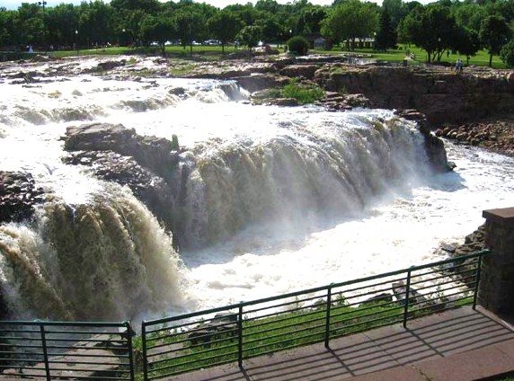
Sioux Falls () is the most populous city in the U.S. state of South Dakota and the 130th-most populous city in the United States. It is the county seat of Minnehaha County and also extends into Lincoln County to the south, which continues up to the Iowa state line. As of 2020, Sioux Falls had a population of 192,517, which was estimated in 2022 to have increased to 202,600. The Sioux Falls metro area accounts for more than 30% of the state's population. Chartered in 1856 on the banks of the Big Sioux River, the city is situated in the rolling hills at the junction of interstates 29 and 90. History The history of Sioux Falls revolves around the cascades of the Big Sioux River. The falls were created about 14,000 years ago during the last ice age. The lure of the falls has been a powerful influence. Ho-Chunk, Ioway, Otoe, Missouri, Omaha (and Ponca at the time), Quapaw, Kansa, Osage, Arikira, Dakota, and Cheyenne people inhabited and settled the region previous to Europea ... [...More Info...] [...Related Items...] OR: [Wikipedia] [Google] [Baidu] |
Augustana College (South Dakota)
Augustana University is a private Lutheran university in Sioux Falls, South Dakota. The university identifies 1860 as the year of its founding, the same as its Rock Island, Illinois Swedish-heritage sister school, Augustana College. It derives its name from the ''Confessio Augustana'', or Augsburg Confession, a foundational document of Lutheranism. Prior to September 2015, the university was known as Augustana College. It is the largest private university in the state and offers Bachelor of Arts degrees in more than 50 major fields of study. Students also participate in a variety of extracurricular activities, including musical ensembles and NCAA athletic programs. History The institution traces its origin to 1835, when Scandinavian immigrants established the Hillsboro Academy in Hillsboro, Illinois. In 1846, the Academy became the Literary and Theological Institute of the Lutheran Church of the Far West before moving to Springfield, Illinois, under the name Illinois Stat ... [...More Info...] [...Related Items...] OR: [Wikipedia] [Google] [Baidu] |
Pennington County, South Dakota
Pennington County is a county in the U.S. state of South Dakota. As of the 2020 census, the population was 109,222, making it the second-most populous county in South Dakota. Its county seat is Rapid City. The county was created in 1875, and was organized in 1877. It is named for John L. Pennington, fifth Governor of Dakota Territory, who held office in 1875 when the county was formed. Pennington County is included in the Rapid City metropolitan statistical area. It is also the location of Mount Rushmore. History In 1874, US Army commander George A. Custer led a group into the Black Hills area. He and some of his officers climbed the crest now called Black Elk Peak, and made a toast to US General William S. Harney. They named the peak for Harney, and this name was used until 2016. This expedition reported that gold could be found in the Black Hills, which spurred a gold rush into the future county area. The mining settlements that sprang up were in violation of a treaty sig ... [...More Info...] [...Related Items...] OR: [Wikipedia] [Google] [Baidu] |
Wasta, South Dakota
Wasta ''( lkt, link=no, wašté)'' is a town in Pennington County, South Dakota, United States, situated along the Cheyenne River. It had a population of 65 at the 2020 census. History A post office called Wasta has been in operation since 1907. Wasta is a name derived from the Dakota word "wašté", meaning "good". Geography Wasta is located at (44.068638, -102.445108). It sits along Interstate 90 in the western part of South Dakota. According to the United States Census Bureau, the town has a total area of , all land. Wasta has been assigned the ZIP code 57791 and the FIPS place code 69140. Climate Demographics 2010 census As of the census of 2010, there were 80 people, 36 households, and 20 families living in the town. The population density was . There were 46 housing units at an average density of . The racial makeup of the town was 100.0% White. Hispanic or Latino of any race were 1.3% of the population. There were 36 households, of which 25.0% had children unde ... [...More Info...] [...Related Items...] OR: [Wikipedia] [Google] [Baidu] |
Plains Indians
Plains Indians or Indigenous peoples of the Great Plains and Canadian Prairies are the Native American tribes and First Nation band governments who have historically lived on the Interior Plains (the Great Plains and Canadian Prairies) of North America. While hunting-farming cultures have lived on the Great Plains for centuries prior to European contact, the region is known for the horse cultures that flourished from the 17th century through the late 19th century. Their historic nomadism and armed resistance to domination by the government and military forces of Canada and the United States have made the Plains Indian culture groups an archetype in literature and art for Native Americans everywhere. The Plains tribes are usually divided into two broad classifications which overlap to some degree. The first group became a fully nomadic horse culture during the 18th and 19th centuries, following the vast herds of American bison, although some tribes occasionally engaged in ... [...More Info...] [...Related Items...] OR: [Wikipedia] [Google] [Baidu] |


