|
List Of Mountain Peaks Of Himachal Pradesh
References https://www.indmount.org/IMF/getPeaks https://hpgeneralstudies.com/mountain-peaks-himachal-pradesh/ {{DEFAULTSORT:Mountain peaks of Himachal Pradesh * Himachal Pradesh Himachal Pradesh (; ; "Snow-laden Mountain Province") is a state in the northern part of India. Situated in the Western Himalayas, it is one of the thirteen mountain states and is characterized by an extreme landscape featuring several peaks ... Himachal Pradesh-related lists ... [...More Info...] [...Related Items...] OR: [Wikipedia] [Google] [Baidu] |
Kangla Tarbo 1
Kangla Tarbo 1 (height 6315 m) is a mountain in the Himalayas, in the Lahaul and Spiti district of Himachal Pradesh, India. It was first climbed in 2000 by an expedition from the Irish Mountaineering Club The Irish Mountaineering Club (in Irish language, Irish, ''Cumann Sléibhteoireachta na hÉireann'', usually called "The IMC") is a mountaineering club whose activities include climbing. The club has over 200 members. History The IMC was founded .... References Mountains of Himachal Pradesh Himalayas Geography of Lahaul and Spiti district {{HimachalPradesh-geo-stub ... [...More Info...] [...Related Items...] OR: [Wikipedia] [Google] [Baidu] |
Barot (Himachal Pradesh)
Barot, a village originally developed in 1920s for Shanan Hydel Project, is now a tourist location in Mandi district in the Indian state of Himachal Pradesh. Barot was difficult to access until 1975, when a road was opened. It is situated 40 km from Jogindernagar and 65 km from Mandi, the District Headquarter. The road to Barot branches off at Jogindernagar-Mandi Highway and from Jogindernagar the distance is 40 km. It is sometimes possible to use the funicular trolley from Jogindernagar which reduces the distance to 12 km. The road route includes terraced fields and thick cedar forests, rising to Jhatingri at the hilltop. The remains of the summer palace of the former rulers of Mandi are located here. Through the little village of Tikkan, the road carries on to Barot. The town has a range of outdoor activities, including a trout breeding centre, from where fish are released into the Uhl river. A 30 km section of the river is used for angling. Barot al ... [...More Info...] [...Related Items...] OR: [Wikipedia] [Google] [Baidu] |
Shimla
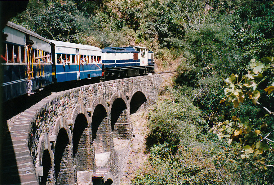
Shimla (; ; also known as Simla, List of renamed Indian cities and states#Himachal Pradesh, the official name until 1972) is the capital and the largest city of the States and union territories of India, northern Indian state of Himachal Pradesh. In 1864, Shimla was declared as the summer capital of British Raj, British India. After Indian independence movement, independence, the city became the capital of East Punjab and was later made the capital city of Himachal Pradesh. It is the principal commercial, cultural and educational centre of the state. Small hamlets were recorded before 1815 when British forces took control of the area. The climatic conditions attracted the British to establish the city in the dense forests of the Himalayas. As the summer capital, Shimla hosted many important political meetings including the Simla Accord (1914), Simla Accord of 1914 and the Simla Conference of 1945. After independence, the state of Himachal Pradesh came into being in 1948 as a re ... [...More Info...] [...Related Items...] OR: [Wikipedia] [Google] [Baidu] |
Shimla District
Shimla is a District (India), district in the state of Himachal Pradesh in northern India. Its headquarters is the state capital of Shimla. Neighbouring districts are Mandi District, Mandi and Kullu in the north, Kinnaur in the east, Uttarakhand in the southeast, Solan to the southwest and Sirmaur District, Sirmaur in the south. The elevation of the district ranges from to . As of 2011 it is the third most populous district of Himachal Pradesh (out of List of districts of Himachal Pradesh, 12), after Kangra district, Kangra and Mandi district, Mandi. It is the most urbanized district of Himachal Pradesh. Administrative structure Access By road Shimla is connected by road to all the major towns. Distance between the major towns and Shimla: * Kalka - 80 km * Patiala - 172 km * Chandigarh - 119 km * Ambala - 166 km * Delhi - 380 km * Agra - 568 km * Amritsar - 342 km * Jammu (via Pathankot) - 482 km * Srinagar - 787 km * Ja ... [...More Info...] [...Related Items...] OR: [Wikipedia] [Google] [Baidu] |
Chamba, Himachal Pradesh
Chamba is a town in the Chamba district in the Indian state of Himachal Pradesh. According to the 2001 Indian census, Chamba has a population of 20,312 people. Located at an altitude of above mean sea level, the town is situated on the banks of the Ravi River (a major tributary of the Trans- Himalayan Indus River), at its confluence with the Sal River. Though historical records date the history of the Chamba region to the Kolian tribes in the 2nd century BC, the area was formally ruled by the Maru dynasty, starting with the Raju Maru from around 500 AD, ruling from the ancient capital of Bharmour, which is located from the town of Chamba.Sharma & Sethi (1997), p.34 In 920, Raja Sahil Varman (or Raja Sahil Verman) shifted the capital of the kingdom to Chamba, following the specific request of his daughter Champavati (Chamba was named after her). From the time of Raju Maru, 67 Rajas of this dynasty ruled over Chamba until it finally merged with the Indian Union in April 194 ... [...More Info...] [...Related Items...] OR: [Wikipedia] [Google] [Baidu] |
Kangra, Himachal Pradesh
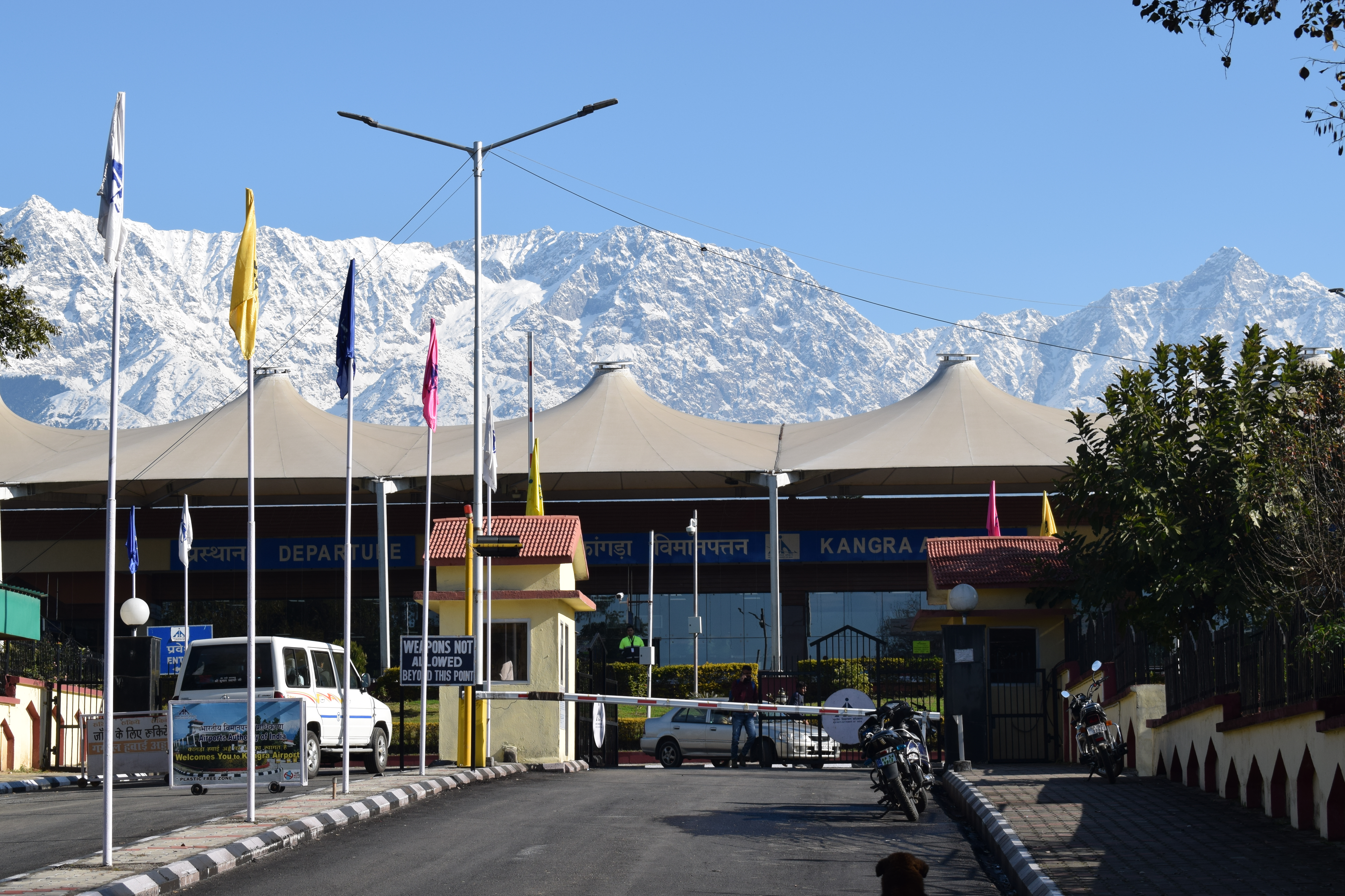
Kangra is a city and a municipal council in Kangra district in the Indian state of Himachal Pradesh. It is also known as ''Nagarkot''. Meaning of Kangra Kangri word in Ladakh/Lahaul means snow on top of mountain. Since snow capped mountains are visible from the city of Kangra, therefore it is named Kangra (town of snow laden peaks). History Historically known as Kiraj and Trigarta,Blankinship, Khalid Y, "The End of Jihad State ", pp132 the town of Kangra was founded by Katoch Kshatriya Rajputs of Chandervanshi Lineage. The Katoch Rajas had a stronghold here, with a fort and lavish temples. Another ancient name of the city is Bhimagar and it was supposedly founded by Raja Bhim, younger brother of Kuru Emperor Yudhishthira of Indraprastha (now Delhi). The temple of Devi Vajreshwari was one of the oldest and wealthiest in northern India. It was destroyed, together with the fort and the town, by 1905 Kangra earthquake on 4 April 1905, when 1339 people died in this place alo ... [...More Info...] [...Related Items...] OR: [Wikipedia] [Google] [Baidu] |
Hanuman Tibba
Hanuman Tibba is the highest mountain peak in Kangra district and lies on Dhauladhar Range in Himachal Pradesh, with an altitude of above sea level. It lies to the Northwest of Manali and to the East of Solang. To the north of Hamuman Tibba, lies the Taintuka Pass and to the south lies Manali Pass. These Passes form the district boundary between the kangra District and Kullu District Kullu is a district in Himachal Pradesh, India. It borders Rampur district to the south, Mandi and Kangra districts to the west, and the Lahaul and Spiti district to the north and east. The largest valley in this mountainous district is the .... It is a well known local peak, partly due to it resembling a steep pyramid, with its noted feature of steep vertical rise from its base camp site. Its west face has been a recent site to many attempts to climb through the “west spur”, a steep, technical, sustained rocky feature often exposed to winds and gnarly ice flutings. The Diretissima throu ... [...More Info...] [...Related Items...] OR: [Wikipedia] [Google] [Baidu] |
Deo Tibba
Deo Tibba is a mountain located in Kullu District, Himachal Pradesh, India at a height of 5,985 metres. It is situated in the Pir Panjal Range The Pir Panjal Range (Kashmiri: ) is a group of mountains in the Lesser Himalayan region, running from east-southeast (ESE) to west-northwest (WNW) across the Indian territories of Himachal Pradesh and Jammu and Kashmir and then Pakistan's ... of mountains. It lies to the southwest of Manali above Jagatsukh village. The first reconnaissance of Deo Tibba was made by General Bruce's guide, Furrer, who reported that one of its ridges looked climbable from the Hamta ''nala''. The route to the summit of this peak has a challenging terrain- a climber has to cross over steep ice passes, glaciers with crevasses, rock fall area and moraine. The peak is exceptional in a way that the summit is not a pointed ridge but a snow dome just like an ice cap, with a flat summit plateau. It requires a load ferry, crossing technical terrain difficulti ... [...More Info...] [...Related Items...] OR: [Wikipedia] [Google] [Baidu] |
Shilla (mountain)
Shilla is a mountain peak close to Spiti Valley, part of the Himalaya mountains. Its peak is above sea level. It is in Himachal Pradesh in Northern India North India is a loosely defined region consisting of the northern part of India. The dominant geographical features of North India are the Indo-Gangetic Plain and the Himalayas, which demarcate the region from the Tibetan Plateau and Central .... The name may be derived from: Shi = death, Shi-la = range or peak death. Other meanings locally offered are 'a place of monastery' or 'a gateway to heaven’. The Shilla peak is on the divide between Lingti and Shilla Nullah/nala. Climbing history Notes References Bibliography * {{Authority control Mountains of Himachal Pradesh Geography of Lahaul and Spiti district Six-thousanders of the Himalayas ... [...More Info...] [...Related Items...] OR: [Wikipedia] [Google] [Baidu] |
Ramabang
Ramabang is a mountain in the Himalayas, in the Lahaul and Spiti district of Himachal Pradesh, India. It was first climbed and named in June 2008 by a team of Irish climbers, members of the Irish Mountaineering Club The Irish Mountaineering Club (in Irish language, Irish, ''Cumann Sléibhteoireachta na hÉireann'', usually called "The IMC") is a mountaineering club whose activities include climbing. The club has over 200 members. History The IMC was founded .... The first-ascent route was via the south-west ridge, about AD grade. References External links irishmountaineeringclub.org- Report from Gerry Galligan mountaineering.ie- Report from Darach Ó Murchú Mountains of Himachal Pradesh Geography of Lahaul and Spiti district {{HimachalPradesh-geo-stub ... [...More Info...] [...Related Items...] OR: [Wikipedia] [Google] [Baidu] |


