|
List Of Lighthouses In The United States By Height
The height of existing lighthouses is expressed in two measures: the height of the tower itself, and the distance from the focal plane (that is, the center) of the light source to the water. The latter can be much greater than the former if the light stands on a promontory. Several structures which have functioned as lighthouses exceed the height of any entry in this list, among them the Statue of Liberty at and Perry's Victory and International Peace Memorial at . These are not listed because they were not constructed as lighthouses ''per se''. Tallest Lighthouses Highest focal plane # 462 feet (141 m) - Old Point Loma lighthouse, California # 422 feet (129 m) - Cape Mendocino Light, California # 420 feet (128 m) - Makapuu Point Light, Hawaii # 395 feet (120 m) - Navassa Island Light, Navassa Island # 358 feet (109 m) - Farallon Island Light, California # 294 feet (90 m) - Point Reyes Light, California # 278 feet (76 m) - Marcus Hook Range Rear Light, Delaware # 277 f ... [...More Info...] [...Related Items...] OR: [Wikipedia] [Google] [Baidu] |
Lighthouse
A lighthouse is a tower, building, or other type of physical structure designed to emit light from a system of lamps and lenses and to serve as a beacon for navigational aid, for maritime pilots at sea or on inland waterways. Lighthouses mark dangerous coastlines, hazardous shoals, reefs, rocks, and safe entries to harbors; they also assist in aerial navigation. Once widely used, the number of operational lighthouses has declined due to the expense of maintenance and has become uneconomical since the advent of much cheaper, more sophisticated and effective electronic navigational systems. History Ancient lighthouses Before the development of clearly defined ports, mariners were guided by fires built on hilltops. Since elevating the fire would improve the visibility, placing the fire on a platform became a practice that led to the development of the lighthouse. In antiquity, the lighthouse functioned more as an entrance marker to ports than as a warning signal for reefs a ... [...More Info...] [...Related Items...] OR: [Wikipedia] [Google] [Baidu] |
Cape Henry Light
The Cape Henry Lighthouses are a pair of lighthouses at Cape Henry, the landform marking the southern entrance to Chesapeake Bay in the U.S. state of Virginia. The location has long been important for the large amount of ocean-going shipping traffic for the harbors, its rivers, and shipping headed to ports on the bay. The original lighthouse was the first authorized by the U.S. government, dating from 1792. It was also the first federal construction project under the Constitution, for an original contract amount of $15,200 (an additional $2,500 was required to finish the lighthouse). A second lighthouse was built and completed in 1881 a short distance away after concern arose about the stability of the first. Both towers of the light station were designated a National Historic Landmark in 1970. History The first work of the new U.S. Federal government, the first Cape Henry lighthouse was built of Aquia and Rappahannock sandstone by John McComb Jr. and was completed in October ... [...More Info...] [...Related Items...] OR: [Wikipedia] [Google] [Baidu] |
Oak Island Light
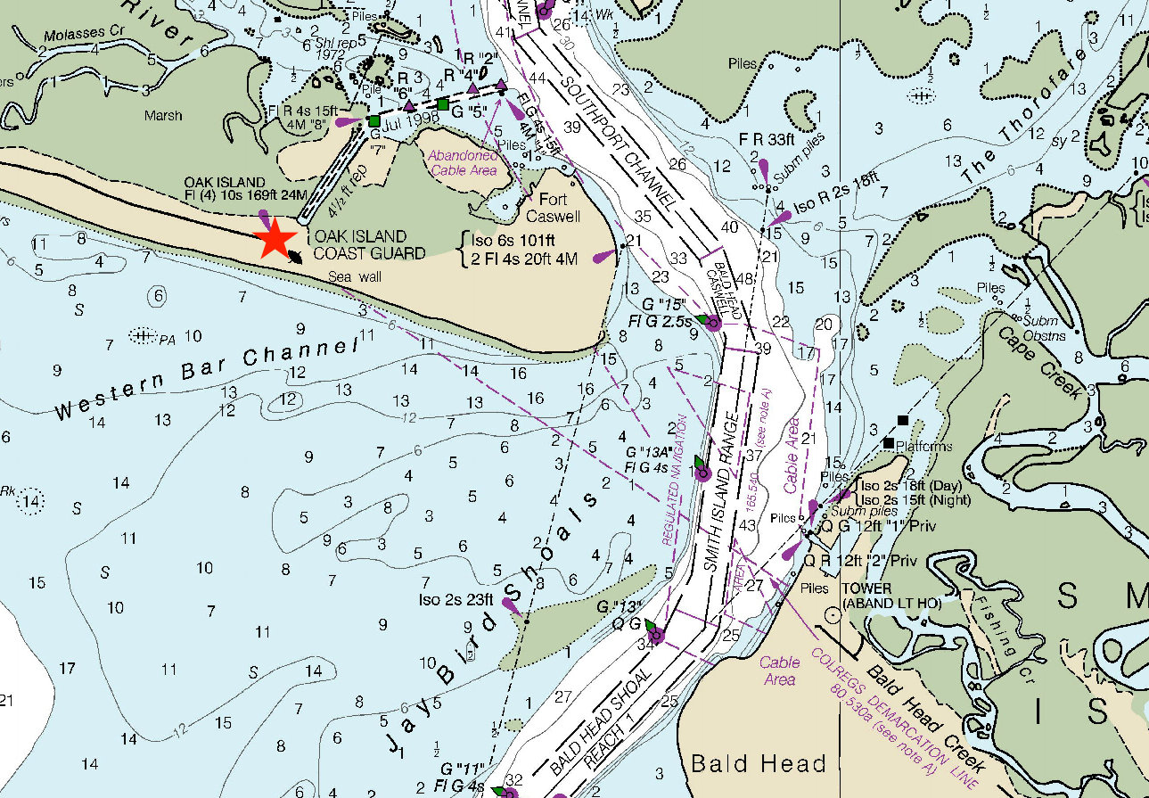
The Oak Island Lighthouse is located in the Town of Caswell Beach near the mouth of the Cape Fear River in Southeastern North Carolina. It sits next to the Oak Island Coast Guard Station on the east end of Oak Island in Brunswick County looking south out at the Atlantic Ocean. Featuring 16 LED lights which produce four, one-second bursts of light every 10 seconds, it has a luminous range of 20.5 nautical miles. Owned by the town since 2004, it is managed by a citizens group (Friends of Oak Island Lighthouse). History In May 1958, the Oak Island Lighthouse replaced the Cape Fear Light, a steel skeleton structure on Bald Head Island which was demolished that same year. The Cape Fear Light began operation in 1903 and was then a functional replacement for the still standing and now popular tourist attraction, the 1817 Bald Head Light (Old Baldy). During the period 1958–1962, the Oak Island Light was the brightest in the US (the Charleston Light in South Carolina now holds t ... [...More Info...] [...Related Items...] OR: [Wikipedia] [Google] [Baidu] |
Cape Romain Lighthouses
The Cape Romain Lighthouses are a pair of brick lighthouses on Lighthouse Island southeast of McClellanville, South Carolina. The lighthouses are on the Cape Romain National Wildlife Refuge. The lighthouses were named to the National Register of Historic Places The National Register of Historic Places (NRHP) is the United States federal government's official list of districts, sites, buildings, structures and objects deemed worthy of preservation for their historical significance or "great artistic v ... in 1981. Building of the lighthouses Need During the times of Spanish exploration, Cape Romain was known as Cape Roman, and then briefly, Cape Carteret. The Cape's shoals were treacherous, extending seven to nine miles off the coast. In the days before lighthouses, many vessels and people died when ships ventured onto the shoals, and wind and waves claimed them for the sea. First building When lighthouses were built to warn mariners away from the shoals, they saved many ... [...More Info...] [...Related Items...] OR: [Wikipedia] [Google] [Baidu] |
Pensacola Light
The Pensacola Light is a lighthouse at Pensacola Bay, in Florida. It is the third iteration of what was originally a lightship, the ''Aurora Borealis,'' and remains an aid to navigation. History The first Pensacola Light was the lightship ''Aurora Borealis''. It was moved to Pensacola in 1823 from its previous post at the mouth of the Mississippi River after a lighthouse had been completed there. Because of frequent rough seas, the lightship had to be anchored inside the bay entrance, behind Santa Rosa Island, and could not reliably be seen from ships outside the bay. Tower In 1825 a tower was built on a bluff at the south entrance to Pensacola Bay. This light was also partially obscured by trees close to the tower and on Santa Rosa Island. In 1858 a new tower was built on the north side of the bay entrance, and was lit on January 1, 1859. The new, and current, tower is tall, and also sits on a bluff located on the Pensacola Naval Air Station, placing the light above s ... [...More Info...] [...Related Items...] OR: [Wikipedia] [Google] [Baidu] |
Cape Canaveral Light
The Cape Canaveral Light is a historic lighthouse on the east coast of the U.S. state of Florida. The light was established in 1848 to warn ships of the dangerous shoals that lie off its coast. It is located inside the Cape Canaveral Space Force Station and managed by the Space Launch Delta 45 of the U.S. Space Force with the assistance of the Cape Canaveral Lighthouse Foundation. It is the only fully operational lighthouse owned by the United States Space Force. The current lighthouse tower was first erected and lit in 1868 then relocated further inland between 1893-1894. It was originally equipped with a first-order Fresnel lens that was automated in 1967 and then retired from the tower in 1993.(2003-01-03)"Inventory of Historic Light Stations, Florida Lighthouses - Cape Canaveral Light" National Park Service. Retrieved on 2012-11-13. History The Cape Canaveral lighthouse was erected to warn mariners of the outlying shoals off its coast. Broken ground and shoals extend nor ... [...More Info...] [...Related Items...] OR: [Wikipedia] [Google] [Baidu] |
Dry Tortugas Light
The Dry Tortugas Light is a lighthouse located on Loggerhead Key, three miles west of Fort Jefferson, Florida. It was taken out of operation in 2015. It has also been called the Loggerhead Lighthouse. It has been said to be "a greater distance from the mainland than any other light in the world." History In 1856, Capt. Daniel Phineas Woodbury supervised construction of the lighthouse, based on an 1855 design by Capt. Horatio Wright, and it became operational in 1858. When originally constructed the walls of the tower were left its natural, yellowish-red brick color. The lens was a first order Fresnel lens which was manufactured by the French firm of L. Sautter and Company. In addition to the tower, the light station included a brick two-story dwelling with Greek Revival features, a brick two-story kitchen (still standing), and oil house, wash house, outhouses and cisterns. Forty-one year old Benjamin H. Kerr was appointed head keeper and received a salary of $600 per year. He ... [...More Info...] [...Related Items...] OR: [Wikipedia] [Google] [Baidu] |
Cape May Light
The Cape May Lighthouse is a lighthouse located in the U.S. state of New Jersey at the tip of Cape May, in Lower Township's Cape May Point State Park. It was built in 1859 under the supervision of U.S. Army engineer William F. Raynolds, was automated in 1946, and continues operation to this day. Cape May Lighthouse is the third fully documented lighthouse to be built at Cape May Point. The first was built in 1823 and the second in 1847. The exact locations of the first two lighthouses are now underwater due to erosion. There are 199 steps to the top of the Lighthouse. The view from the top extends to Cape May City and Wildwood to the north, Cape May Point to the south, and, on a clear day, Cape Henlopen, Delaware, to the west. Within immediate view are Cape May Cove and Battery 223, a harbor defense battery originally built during World War II. Cape May Lighthouse was added to the National Register of Historic Places on November 12, 1973. With The Cape May Light is located ... [...More Info...] [...Related Items...] OR: [Wikipedia] [Google] [Baidu] |
Bodie Island Light
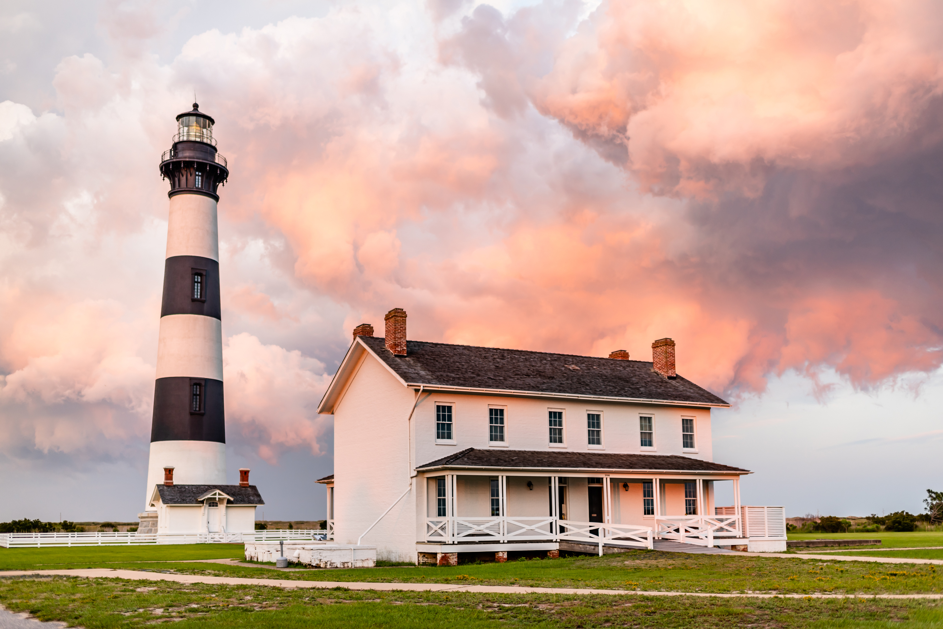
The current Bodie Island Lighthouse (pronounced “body island”) is the third that has stood in this vicinity of Bodie Island on the Outer Banks in North Carolina and was built in 1872. It stands tall and is located on the Roanoke Sound side of a portion of a peninsula that is the first part of the Cape Hatteras National Seashore. The lighthouse is just south of Nags Head, a few miles before Oregon Inlet. It was renovated from August 2009 to March 2013, and was made climbable by the public. There are 214 steps that spiral to the top. The 170-foot structure is one of only a dozen remaining tall, brick tower lighthouses in the United States — and one of the few with an original first-order Fresnel lens to cast its light. History The preceding Bodie Island lighthouses actually stood south of Oregon Inlet on Pea Island in an area that is now under water due to the southward migration of the inlet. The first was built in 1847 and then abandoned in 1859 due to a poor foundation. ... [...More Info...] [...Related Items...] OR: [Wikipedia] [Google] [Baidu] |
Currituck Beach Light
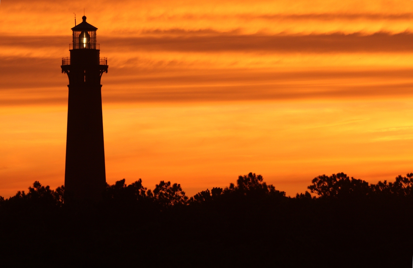
The Currituck Beach Light () , from the North Carolina Collection's website at the University of North Carolina at Chapel Hill. Retrieved 2013-02-05. is a lighthouse located on the Outer Banks in Corolla, North Carolina, Corolla, North Carolina. The Currituck Beach Light was added to the National Register of Historic Places on October 15, 1973. History  On December 1, 1875, the Currituck Beach Light was completed, located between Cape Henry Light and Bodie Island Lighthouse, Bodie Island. Unlike its fellows, Currituck Beach Light was not painted, leaving its brick facade visible. In 1939, the lightho ...
[...More Info...] [...Related Items...] OR: [Wikipedia] [Google] [Baidu] |
South Carolina
)''Animis opibusque parati'' ( for, , Latin, Prepared in mind and resources, links=no) , anthem = " Carolina";" South Carolina On My Mind" , Former = Province of South Carolina , seat = Columbia , LargestCity = Charleston , LargestMetro = Greenville (combined and metro) Columbia (urban) , BorderingStates = Georgia, North Carolina , OfficialLang = English , population_demonym = South Carolinian , Governor = , Lieutenant Governor = , Legislature = General Assembly , Upperhouse = Senate , Lowerhouse = House of Representatives , Judiciary = South Carolina Supreme Court , Senators = , Representative = 6 Republicans1 Democrat , postal_code = SC , TradAbbreviation = S.C. , area_rank = 40th , area_total_sq_mi = 32,020 , area_total_km2 = 82,932 , area_land_sq_mi = 30,109 , area_land_km2 = 77,982 , area_water_sq_mi = 1,911 , area_water_km2 = 4,949 , area_water_percent = 6 , population_rank = 23rd , population_as_of = 2022 , 2010Pop = 5282634 , population ... [...More Info...] [...Related Items...] OR: [Wikipedia] [Google] [Baidu] |
Morris Island Light
Morris Island Light is a lighthouse on Morris Island in South Carolina. The light stands on the southern side of the entrance to Charleston Harbor, north of the City of Folly Beach. At 161 ft (49 m), it is the tallest lighthouse in South Carolina.US Lighthouses, Lighthouse Listing by Tower Height Retrieved Apr. 29, 2021. The lighthouse was named to the in 1982. Although the lighthouse now stands several hundred feet offshore, it was originally inside a much larger island. When constructed in 1876, the light was approximately from the water's edge. However, the construc ... [...More Info...] [...Related Items...] OR: [Wikipedia] [Google] [Baidu] |


%2C_South_Carolina._Ruins_of_Charleston_lighthouse.jpg)