|
List Of Districts In Kingston Upon Thames
This is a list of districts in the Royal Borough of Kingston upon Thames: * Berrylands * Canbury * Chessington * Coombe * Kingston upon Thames * Kingston Vale * Malden Rushett * Motspur Park (part) * New Malden * Norbiton * Old Malden * Surbiton * Tolworth * Worcester Park (part) {{DEFAULTSORT:Kingston upon Thames Kingston upon Thames Kingston upon Thames (hyphenated until 1965, colloquially known as Kingston) is a town in the Royal Borough of Kingston upon Thames, southwest London, England. It is situated on the River Thames and southwest of Charing Cross. It is notable as ... ... [...More Info...] [...Related Items...] OR: [Wikipedia] [Google] [Baidu] |
Royal Borough Of Kingston Upon Thames
The Royal Borough of Kingston upon Thames is a borough in southwest London. The main town is Kingston upon Thames and it includes Surbiton, Chessington, Malden Rushett, New Malden and Tolworth. It is the oldest of the four royal boroughs in England. The others are Kensington and Chelsea and Greenwich also in London, and Windsor and Maidenhead. The local authority is Kingston upon Thames London Borough Council. Districts in the borough * Berrylands * Canbury * Chessington * Coombe * Hook * Kingston upon Thames * Kingston Vale * Malden Rushett * Motspur Park * New Malden * Norbiton * Old Malden * Surbiton * Tolworth Adjacent local government districts * Elmbridge * Epsom and Ewell * Merton * Mole Valley * Richmond upon Thames * Sutton * Wandsworth History Kingston upon Thames, on the south bank of the River Thames has existed for many hundreds of years. Many Roman relics have been found in the surrounding areas. A church has stood on the site of All Saints' Church, in the c ... [...More Info...] [...Related Items...] OR: [Wikipedia] [Google] [Baidu] |
Berrylands
Berrylands is a residential neighbourhood in Surbiton, London, originally forming part of the Municipal Borough of Surbiton, and since 1965 part of the Royal Borough of Kingston upon Thames. It is a suburban development situated south west of Charing Cross. Nearby places include Surbiton, New Malden, Old Malden, Tolworth and Chessington. Berrylands railway station is 24 minutes from London Waterloo by train. History Berrylands is a settlement of Anglo-Saxon origin that is close to the Thames. Berrylands originally formed part of the Municipal Borough of Surbiton, however in 1965 it was incorporated as part of the Royal Borough of Kingston upon Thames. Most of the present housing development took place in the 1930s on the former Berrylands Farm. Old Maps from the 1860s show the western Banks of the Hogsmill River and everything around them to be mostly empty apart from a few small trails and farm buildings with no evidence of real human settlement. In addition the area had abso ... [...More Info...] [...Related Items...] OR: [Wikipedia] [Google] [Baidu] |
Canbury
Canbury is a district of the northern part of Kingston upon Thames that takes its name from the historic manor that covered the area. Modern Canbury comprises two electoral wards in the constituency of Richmond Park; Canbury Ward to the south and Tudor Ward to the north. History There is evidence of prehistoric occupation from at least the Mesolithic along the river margins at Kingston, although most of the evidence tends to consist of scattered residual artefacts. Despite numerous archaeological investigations in the area of Kingston since the 1960s there have been few ''in-situ'' archaeological finds and features dating to the Roman period. The few finds in Kingston come from Canbury; a burial ground excavated in the 19th century, not far from the river and railway line, excavations at Skerne Road in 2005, and the Sopwith Way and Skerne Road areas in 2007. These have revealed evidence of small-scale and agricultural Roman settlements. Manor Despite Kingston's Saxon heritag ... [...More Info...] [...Related Items...] OR: [Wikipedia] [Google] [Baidu] |
Chessington
Chessington is an area in the Royal Borough of Kingston upon Thames within Greater London. Historically part of Surrey, today it is the largest salient of Greater London into that county. At the 2011 census it had a population of 18,973. The Bonesgate Stream, a tributary of the Hogsmill River, runs through it. The popular theme park resort Chessington World of Adventures, which incorporates Chessington Zoo, is located in the south-west of the area. Neighbouring settlements include Tolworth, Ewell, Surbiton, Claygate, Epsom, Oxshott, Leatherhead, Esher, Kingston upon Thames and Worcester Park. History Its name came from Anglo-Saxon ''Cissan dūn'' = "hill belonging to man namedCissa". Chessington appears in the Domesday Book as ''Cisedune'' and ''Cisendone''. It was held partly by Robert de Wateville and partly by Milo (Miles) Crispin. Its Domesday assets were: 1½ hides; part of a mill worth 2s, 4 ploughs, woodland worth 30 hogs. It rendered £7. The mansion at ... [...More Info...] [...Related Items...] OR: [Wikipedia] [Google] [Baidu] |
Coombe, Kingston Upon Thames
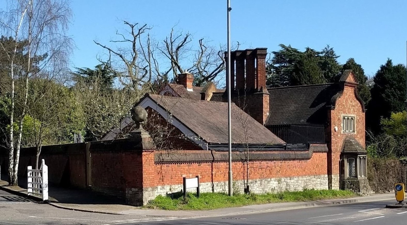
Coombe is a historic neighbourhood in the Royal Borough of Kingston upon Thames in south west London, England. It sits on high ground, east of Norbiton. Most of the area was part of the former Municipal Borough of Malden and Coombe before local government re-organisation in 1965. It now shares borders with the boroughs of London Borough of Merton, Merton and London Borough of Sutton, Sutton with, to the north, the small, inter-related neighbourhoods of Kingston Vale, Kingston Hill and Kingston Vale, beyond which is Richmond Park in London Borough of Richmond upon Thames, Richmond; and Roehampton/Putney Vale in London Borough of Wandsworth, Wandsworth. To the east are public playing fields and Wimbledon Common. History Coombe centres on what was originally Coombe House, a large residence built in the 1750s. The house, now demolished, was located at the southwest corner of the junction of Coombe Lane (A238) and Traps Lane. Its red brick boundary walls can still be seen on the west ... [...More Info...] [...Related Items...] OR: [Wikipedia] [Google] [Baidu] |
Kingston Upon Thames
Kingston upon Thames (hyphenated until 1965, colloquially known as Kingston) is a town in the Royal Borough of Kingston upon Thames, southwest London, England. It is situated on the River Thames and southwest of Charing Cross. It is notable as the ancient market town in which Saxon kings were crowned and today is the administrative centre of the Royal Borough. Historically in the county of Surrey, the ancient parish of Kingston became absorbed in the Municipal Borough of Kingston-upon-Thames, reformed in 1835. From 1893 to 2021 it was the location of Surrey County Council, extraterritorially in terms of local government administration since 1965, when Kingston became a part of Greater London. Today, most of the town centre is part of the KT1 postcode area, but some areas north of Kingston railway station are within KT2. The United Kingdom Census 2011 recorded the population of the town (comprising the four wards of Canbury, Grove, Norbiton and Tudor) as 43,013, while ... [...More Info...] [...Related Items...] OR: [Wikipedia] [Google] [Baidu] |
Kingston Vale
Kingston Vale with Kingston Hill is a district in the Royal Borough of Kingston upon Thames in south-west London. It is a residential area between Richmond Park, the much smaller Putney Vale, Wimbledon Common, Coombe/Coombe Hill and the Norbiton part of the very old borough. The main road is the A308 (also called Kingston Vale and Kingston Hill) which is a through route for traffic passing to and from Kingston Hill to the A3 trunk road (locally known as the ''Kingston By-pass''). Many of the branch roads are cul-de-sacs. It includes, toward the east and in the Vale, the only part of Kingston which drains eastward, that is, into Beverley Brook. The hill expanse, shared with Coombe and a golf course, has a hotel, some tall blocks overlooking Kingston, the edge of Kingston Hospital, the main campus of Kingston University London and faint remnants of dense woodland. History An inn, the Bald-Faced Stag, stood on the site of the present day Asda from around 1650 into the 19th ce ... [...More Info...] [...Related Items...] OR: [Wikipedia] [Google] [Baidu] |
Malden Rushett
Malden Rushett is a small village in the Royal Borough of Kingston upon Thames, London. It is located at the southernmost tip of the Royal Borough, surrounded by woodland and farmland, and between the larger suburban villages and towns of Claygate, Chessington, Epsom, Ashtead, Leatherhead and Oxshott. History Rushett was a detached part of the parish of Malden, located approximately 5 miles southwest of the main parish. On 24 March 1884 it was transferred to the parish of Chessington. Facilities Malden Rushett sits on the crossroads of the A243 road from Kingston upon Thames to Leatherhead and the B280 from Oxshott to Epsom. It consists of a few houses, two pubs and a petrol station incorporating an M&S Simply Food shop. It is two miles from Junction 9 on the M25 motorway. The area also houses the Explorer Gate (south entrance and car park) of Chessington World of Adventures & Zoo Resort. Rushett Common South of Malden Rushett is Rushett Common, consisting of two strips of woo ... [...More Info...] [...Related Items...] OR: [Wikipedia] [Google] [Baidu] |
Motspur Park
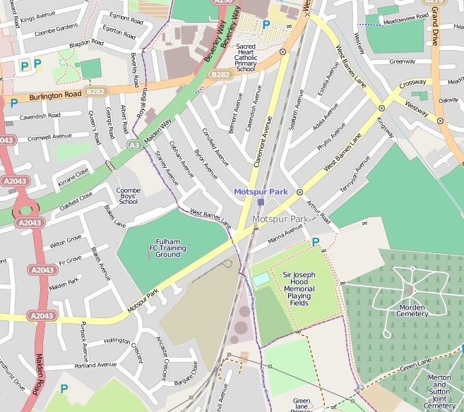
Motspur Park, also known locally as West Barnes, is a residential suburb in south-west London, in the New Malden district. It straddles the boroughs of Kingston upon Thames and Merton. Motspur Park owes its identity to the railway station of the same name, opened in 1925, which has six trains an hour to London Waterloo, and to the adjacent parade of small shops. Three prominent gas holders, which were used to store the consumer gas supply for south-west London, stand just south of the shopping parade and can be seen from a wide area. Two of London's minor natural watercourses flow through Motspur Park: Beverley Brook runs south to north through the centre and its tributary the Pyl Brook runs parallel to the east in shallow depressions in the land. The Motspur Park athletics stadium was built by the University of London in 1928 and achieved fame when the world mile record was set there in 1938. It was sold to Fulham Football Club as their training ground in 1999. Name The M ... [...More Info...] [...Related Items...] OR: [Wikipedia] [Google] [Baidu] |
New Malden
New Malden is an area in South West London, England. It is located mainly within the Royal Borough of Kingston upon Thames and the London Borough of Merton, and is from Charing Cross. Neighbouring localities include Kingston, Norbiton, Raynes Park, Surbiton, Tolworth, Wimbledon and Worcester Park. Prior to the creation of Greater London in 1965, New Malden was in the administrative county of Surrey. History New Malden was established entirely as a result of the arrival of the railway, when what is now called New Malden railway station was opened on 1 December 1846 on the main line from London Waterloo. Building started slowly in the area just to the north of the station, gathering pace in the late nineteenth and early twentieth centuries with two- and three-bedroom terraced houses. Further out towards Coombe Hill are larger detached and semi-detached houses from the 1930s. The name of the road which leads up the hill to Coombe, Traps Lane, is thought to derive from a farm ... [...More Info...] [...Related Items...] OR: [Wikipedia] [Google] [Baidu] |
Norbiton
Norbiton is an area within the Royal Borough of Kingston upon Thames, London. It lies approximately east of Kingston upon Thames town centre, and from Charing Cross. Its main landmarks include Kingston Hospital, Kingsmeadow football stadium, Kingston Cemetery and St Peter's Anglican parish church which serves the area. Norbiton was part of the Municipal Borough of Kingston-upon-Thames from its creation in 1835, and became part of the larger Royal Borough of Kingston upon Thames in 1965. History Its name was originally Norberton(e) and it was named in a similar way to Surbiton on the opposite side of the Hogsmill River. The origin of the place-name is from the Old English words ''north'', ''bere'' and ''tun'' (meaning northern grange or outlying farm). The area was originally a part of the parish of All Saints Church, Kingston upon Thames. In 1840 a separate Norbiton parish was created, with St Peter's Church built between 1840 and 1842 to a design of Gilbert Scott and W ... [...More Info...] [...Related Items...] OR: [Wikipedia] [Google] [Baidu] |
Old Malden
Old Malden is a ward of the Royal Borough of Kingston upon Thames in southwest London, south west of Charing Cross. Malden Manor is an alternative name for part of Old Malden, popularised by the railway company that made up this name for its station here. History The area has a long history as the ancient parish of Malden, derived from the Old English ''mæl duna'', meaning 'the cross on the hill'. Malden appears in ''Domesday Book'' of 1086 as ''Meldone'', held partly by William de Wateville and partly by Robert de Wateville. Its domesday assets were: 4 hides and 3 virgates; 1 chapel, 1 mill worth 12s, 6½ ploughs, of meadow, woodland worth 1 hog out of 7 hogs. It rendered £7 12s 0d. St John the Baptist Church, close to the Hogsmill, is a Grade II listed building. The medieval church was built by Walter de Merton, Bishop of Rochester. It comprised nave, chancel and west tower. The flint south and east walls of the chancel survive. In 1611 the chancel's old flint walls w ... [...More Info...] [...Related Items...] OR: [Wikipedia] [Google] [Baidu] |
.jpg)


