|
List Of Churches In Orkney
A List of churches in Orkney, Scotland: The islands have an estimated 27 active churches for 21,500 inhabitants, a ratio of one church to every 796 people. The islands were originally divided into 21 civil parishes: Birsay and Harray, Cross and Burness (on Sanday), Eday, Evie and Rendall, Firth, Holm, Hoy and Graemsay, Kirkwall and St Ola, Lady (on Sanday), Orphir, Papa Westray, Rousay and Egilsay, Sandwick, Shapinsay, South Ronaldsay, St Andrews and Deerness, Stenness, Stromness, Stronsay, South Walls & Flotta, and Westray. Defunct churches Citations References * Graham-Campbell, James and Batey, Colleen E. (1998) ''Vikings in Scotland: An Archaeological Survey''. Edinburgh University Press. * Omand, Donald (ed.) (2003) ''The Orkney Book''. Edinburgh. Birlinn. Further reading * External links (contains photographs of several churches) {{Lists of churches in Scotland Churches in Orkney Orkney Orkney (; sco, Orkney; on, Orkneyjar; nrn, Orknøjar) ... [...More Info...] [...Related Items...] OR: [Wikipedia] [Google] [Baidu] |
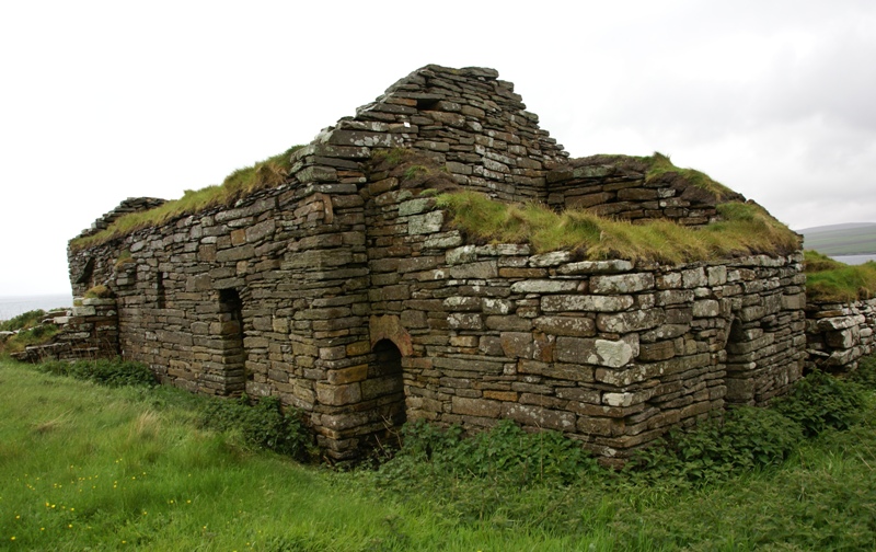
Eynhallow Church 20110526 From Northwest
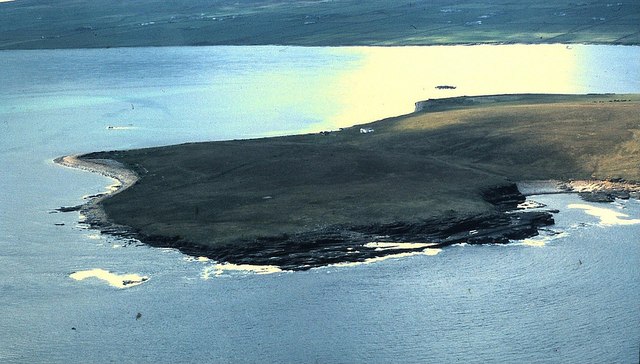
Eynhallow ( sco, Eynhallow; non, Eyinhelga; nrn, Øjinhellig) is a small, presently uninhabited island, part of Orkney, off the north coast of mainland Scotland. Geography Eynhallow lies in Eynhallow Sound between Mainland, Orkney The Mainland, also known as Hrossey and Pomona, is the main island of Orkney, Scotland. Both of Orkney's burghs, Kirkwall and Stromness, lie on the island, which is also the heart of Orkney's ferry and air connections. Seventy-five per cent of ... and Rousay. It is in area. An unnamed skerry is situated approximately to the north-east of the island, separated by Fint Sound. Sheep Skerry adjoins the southern end of the island. There is no ferry to the island, although Orkney Heritage Society organises a trip each July. Otherwise, visitors have to arrange their own transport to the island by private local boat hire. Access can be problematic, as there are strong tidal surges in the surrounding strait, squeezed between Mainland of Orkney and Rou ... [...More Info...] [...Related Items...] OR: [Wikipedia] [Google] [Baidu] |
Egilsay
Egilsay (, sco, Egilsay) is one of the Orkney Islands in Scotland, lying east of Rousay. The island is largely farmland and is known for its corncrakes and St Magnus Church, dedicated or re-dedicated to Saint Magnus, who was killed on the island in 1117 by an axe blow to the head. For hundreds of years the story of St. Magnus, part of the Orkneyinga saga, was considered just a legend until a skull with a large crack in it, such as it had been stricken by an axe, was found in the walls of St. Magnus Cathedral in Kirkwall. Etymology Unusually for the Northern Isles, it has been suggested that Egilsay may have a partly Gaelic name. While at first sight, it appears to be Egil's island, "Egil" being a Norse personal name, the Gaelic ''eaglais'' (Celtic "eccles") meaning church, may be part of the root, as the island is dominated by a church of pre-Norse foundation. The island of Kili Holm just to the north, may represent ''cille'', a monastic cell. Present day The island's ... [...More Info...] [...Related Items...] OR: [Wikipedia] [Google] [Baidu] |
North Ronaldsay
North Ronaldsay (, also , sco, North Ronalshee) is the northernmost island in the Orkney archipelago of Scotland. With an area of , it is the fourteenth-largest.Haswell-Smith (2004) p. 334 It is mentioned in the '' Orkneyinga saga''; in modern times it is known for its historic lighthouse, migratory bird life and unusual breed of sheep. Name The name comes from the Norse ''Rinansey'', meaning the island of St Ninian. By the 1300s the name was being confused with ''Rognvaldsey'', the island of St Ronald, in the south of Orkney that they were named North Ronaldsay and South Ronaldsay to distinguish them from the other. Geography North Ronaldsay lies around north of its nearest neighbour, Sanday, at . It is around long and is defined by two large sandy bays; Linklet Bay on the eastern shoreline and South Bay at the south. The west of the island is very rocky, with many skerries. North Ronaldsay is low-lying and exposed; its climate is extremely changeable and frequently ... [...More Info...] [...Related Items...] OR: [Wikipedia] [Google] [Baidu] |
Church Of Scotland
The Church of Scotland ( sco, The Kirk o Scotland; gd, Eaglais na h-Alba) is the national church in Scotland. The Church of Scotland was principally shaped by John Knox, in the Scottish Reformation, Reformation of 1560, when it split from the Catholic Church and established itself as a church in the reformed tradition. The church is Calvinist Presbyterian, having no head of faith or leadership group and believing that God invited the church's adherents to worship Jesus. The annual meeting of its general assembly is chaired by the Moderator of the General Assembly of the Church of Scotland. The Church of Scotland celebrates two sacraments, Baptism and the Lord's Supper in Reformed theology, Lord's Supper, as well as five other Rite (Christianity), rites, such as Confirmation and Christian views on marriage, Matrimony. The church adheres to the Bible and the Westminster Confession of Faith, and is a member of the World Communion of Reformed Churches. History Presbyterian tra ... [...More Info...] [...Related Items...] OR: [Wikipedia] [Google] [Baidu] |
Westray
Westray (, sco, Westree) is one of the Orkney Islands in Scotland, with a usual resident population of just under 600 people. Its main village is Pierowall, with a heritage centre, the 15th-century Lady Kirk church and pedestrian ferry service to nearby Papa Westray island. Westray has a number of archeological sites dating from 3500 BC, and remains of several Norse-Viking settlements. The spectacular sea cliffs around Noup Head are home to thousands of seabirds. Geography and geology Westray has an area of , making it the sixth largest of the Orkney Islands. The underlying geology is Rousay type Middle Old Red Sandstone, the flagstones of which make excellent building materials. There is very little peat and the soil is noted for its fertility. History At the time of the earliest known settlements, c. 3500 BC, in Westray and neighbouring Papa Westray, it is believed that the two islands were joined.Keay, J. & Keay, J. (1994) ''Collins Encyclopaedia of Scotland''. London ... [...More Info...] [...Related Items...] OR: [Wikipedia] [Google] [Baidu] |
Flotta
Flotta () is a small island in Orkney, Scotland, lying in Scapa Flow. The island is known for its large oil terminal and is linked by Orkney Ferries to Houton on the Orkney Mainland, Lyness on Hoy and Longhope on South Walls. The island has a population of 80. History At the turn of the 20th century, the island was a quiet rural community like many other small islands of Orkney, but its sheltered location led to three major upheavals in the island in the century. Until 1914, Flotta was a quiet farming community. In 1910, a population of 431 included two blacksmiths, four carpenters and three dressmakers. World Wars Everything changed with the arrival of the Royal Navy in Scapa Flow at the start of the First World War. There is a photograph held by the Imperial War Museum in London that shows a boxing match taking place on Flotta in front of a wartime audience of 10,000 people. During the First World War, the island was home to a naval base. The dreadnought HMS ''Vanguar ... [...More Info...] [...Related Items...] OR: [Wikipedia] [Google] [Baidu] |
South Walls
South Walls ( sco, Sooth Waas), often referred to as Walls, is an inhabited island adjacent to Hoy in Orkney, Scotland. The name is a corruption of "Sooth Was", which means the "southern voes" – as with Kirkwall, it was assumed that it was a mispronunciation of "walls". South Walls forms the southern side of the harbour of Longhope. It was a tidal island until a narrow causeway, was constructed over the sandbank in 1912, which was known as the Ayre, although this name has become transferred to the causeway itself. Although sometimes considered to be a peninsula, it is an island in all but name. South Walls is a popular stopping off place for barnacle geese. Geography and geology The island, like most of the Orkney archipelago, is made up of old red sandstone with the Rousay Flagstone Group predominating. The island is more or less oval in shape, but there is a small promontory, called Cantick Head in the south east, which is created by Kirk Hope (Church Bay). It is separat ... [...More Info...] [...Related Items...] OR: [Wikipedia] [Google] [Baidu] |
Stronsay
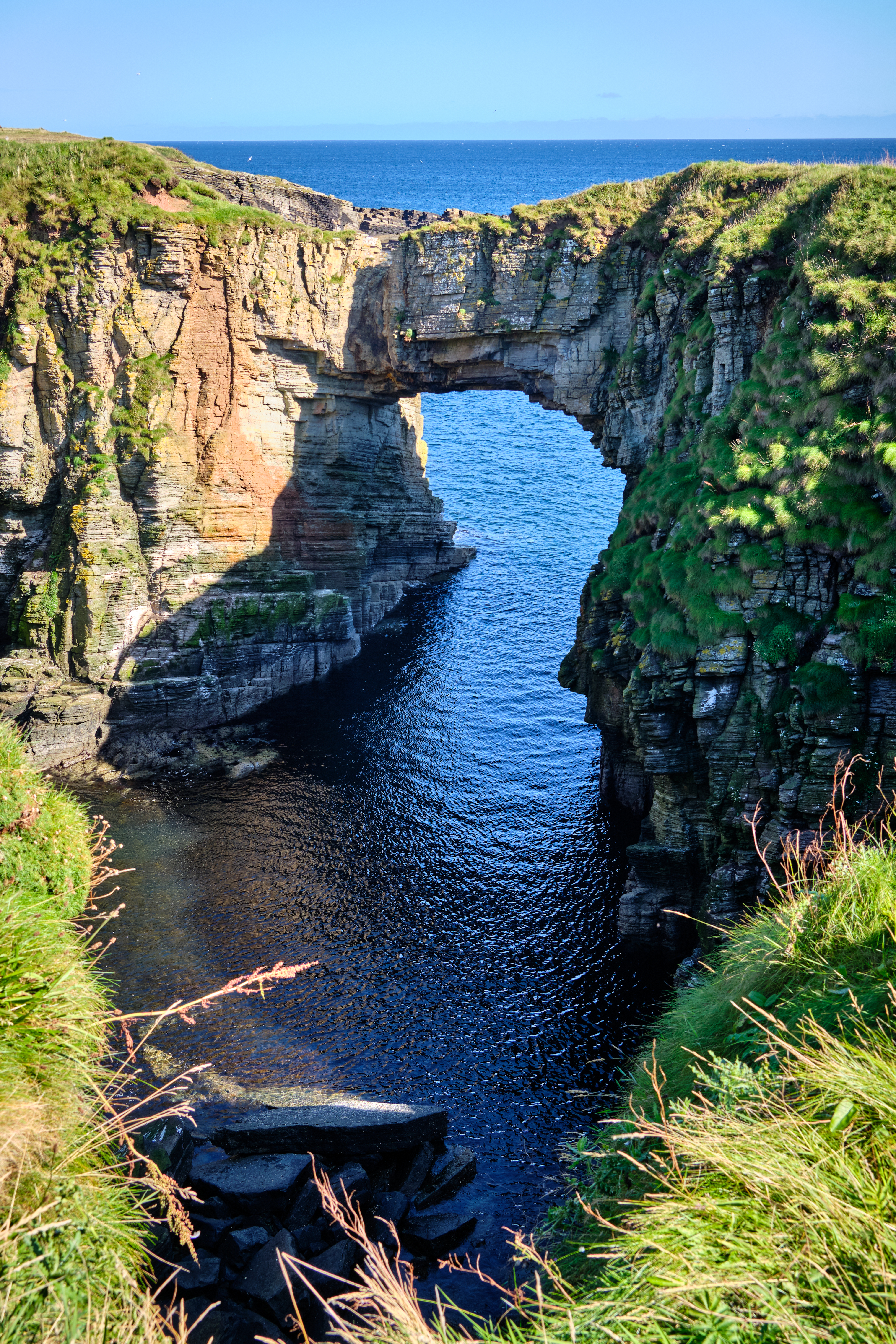
Stronsay () is an island in Orkney, Scotland. It is known as Orkney's 'Island of Bays', owing to an irregular shape with miles of coastline, with three large bays separated by two isthmuses: St Catherine's Bay to the west, the Bay of Holland to the south and Mill Bay to the east. Stronsay is in area, and in altitude at its highest point. It has a usually resident population of 349. The main village is Whitehall, home to a heritage centre. Sights on the island include the Vat of Kirbister, a natural arch described as the "finest in Orkney", white sand beaches in the three bays, and various seabirds amongst which are Arctic terns. Geography and geology As with most of Orkney, Stronsay is made up of Old Red Sandstone which has produced a fine soil in many places. It is generally low-lying. On the eastern coast, spectacular rock formations include the Vat of Kirbister – Stronsay's famous natural rock arch, often described as the finest in Orkney. The coast around Odiness Bay fe ... [...More Info...] [...Related Items...] OR: [Wikipedia] [Google] [Baidu] |
Stromness
Stromness (, non, Straumnes; nrn, Stromnes) is the second-most populous town in Orkney, Scotland. It is in the southwestern part of Mainland Orkney. It is a burgh with a parish around the outside with the town of Stromness as its capital. Etymology The name "Stromness" comes from the Norse ''Straumnes''. ''Straumr'' refers to the strong tides that rip past the Point of Ness through Hoy Sound to the south of the town. ''Nes'' means "headland". Stromness thus means "headland protruding into the tidal stream". In Viking times the anchorage where Stromness now stands was called Hamnavoe. Town A long-established seaport, Stromness has a population of approximately 2,190 residents. The old town is clustered along the characterful and winding main street, flanked by houses and shops built from local stone, with narrow lanes and alleys branching off it. There is a ferry link from Stromness to Scrabster on the north coast of mainland Scotland. First recorded as the site of an inn ... [...More Info...] [...Related Items...] OR: [Wikipedia] [Google] [Baidu] |
Stenness
Stenness (pronounced ) ( non, Steinnes; nrn, Stennes) is a village and parish on the Orkney Mainland in Scotland. It contains several notable prehistoric monuments including the Standing Stones of Stenness and the Ring of Brodgar. Geography Stenness parish adjoins the southern extremity of the Loch of Stenness, and also some notable standing stones. It is bounded on the west by the efflux of the loch, and a branch of Hoy Sound, and has been politically merged with Firth. History In Old Norse: ''Steinnes''Pedersen, Roy (January 1992) ''Orkneyjar ok Katanes'' (map, Inverness, Nevis Print) or ''Steinsnes'' means headland/peninsula of the stone. The area has been inhabited for a considerable time. Near the village are several notable prehistoric monuments including the Stones of Stenness and the Ring of Brodgar The Ring of Brodgar (or Brogar, or Ring o' Brodgar) is a Neolithic henge and stone circle about 6 miles north-east of Stromness on Mainland, the largest island in ... [...More Info...] [...Related Items...] OR: [Wikipedia] [Google] [Baidu] |
Deerness
Deerness (, , Old Norse: ''Dyrnes'') is a ''quoad sacra'' parish (i.e. one created and functioning for ecclesiastical purposes only) and peninsula in Mainland, Orkney, Scotland. It is about south east of Kirkwall. Deerness forms a part of the civil parish of St. Andrews and Deerness. There is a shop/post office and a community centre and the Deerness Distillery. Deerness is connected to the rest of the Orkney Mainland by a narrow isthmus, known as Dingieshowe. Deerness parish consists chiefly of the peninsula, but also takes in its surrounding islets of Copinsay, the Horse of Copinsay and Corn Holm. The Brough of Deerness is the site of an early Christian monastery near the north eastern tip of the peninsula. The Gloup is a sea-cave approximately long and deep just south of the Brough. The Crown of London shipwreck The Covenanter's Memorial at Deerness, commemorating the loss in a shipwreck of 200 Covenanters en route to the New World of America (as a punishment), was la ... [...More Info...] [...Related Items...] OR: [Wikipedia] [Google] [Baidu] |
St Andrews, Orkney
St Andrews is a parish on Mainland, Orkney in Scotland. It is located east of the town of Kirkwall and the parish of St Ola and lies north of Holm and west of Deerness. ''The Orcadian''. Retrieved 19 April 2008. The settlements of , Toab and Foubister are in the parish, as is Kirkwall Airport
Kirkwall Airport is the main airport serving Orkney in Scotland. It is located southeast of Kirkwall a ...
[...More Info...] [...Related Items...] OR: [Wikipedia] [Google] [Baidu] |


.jpg)
.png)


