|
List Of Raised And Transitional Bogs Of Switzerland
This is a list of raised and transitional bogs of Switzerland. It is based on the ''Federal Inventory of Raised and Transitional Bogs of National Importance''. The inventory is part of a 1991 Ordinance of the Swiss Federal Council implementing the Federal Law on the Protection of Nature and Cultural Heritage. Inventory of raised and transitional bogs of national importance See also * Nature parks in Switzerland Switzerland has eighteen official natural parks (and three candidate parks) classified in three categories (national parks, regional nature parks and nature experience parks). [...More Info...] [...Related Items...] OR: [Wikipedia] [Google] [Baidu] |
Municipalities Of Switzerland
Municipalities (german: Gemeinden, ' or '; french: communes; it , comuni; rm, vischnancas) are the lowest level of administrative division in Switzerland. Each municipality is part of one of the Swiss cantons, which form the Swiss Confederation. In most cantons, municipalities are also part of districts or other sub-cantonal administrative divisions. There are 2,136 municipalities . Their populations range between several hundred thousand (Zürich), and a few dozen people (Kammersrohr, Bister), and their territory between 0.32 km² (Rivaz) and 439 km² (Scuol). History The beginnings of the modern municipality system date back to the Helvetic Republic. Under the Old Swiss Confederacy, citizenship was granted by each town and village to only residents. These citizens enjoyed access to community property and in some cases additional protection under the law. Additionally, the urban towns and the rural villages had differing rights and laws. The creation of a uniform Swiss ... [...More Info...] [...Related Items...] OR: [Wikipedia] [Google] [Baidu] |
Eriz
Eriz is a municipality in the administrative district of Thun in the canton of Bern in Switzerland. History Eriz is first mentioned in 1320 as ''Erarze''. The small alpine village was part of the ''Herrschaft'' of Heimberg during the Middle Ages. In the 14th century the extensive forests around Eriz were divided between the Counts of Kyburg and the city of Bern. By 1344 the Kyburg-owned high forests in the Zulgtal had been illegally cleared. The first alpine meadows used for herding were mentioned in records in 1335. In 1384, Bern acquired the village and the Kyburg lands. They incorporated the village into the Steffisburg court of the Thun District. In 1834 a part of the municipality, on the left bank of the Eriz river, left Eriz and joined the Horrenbach-Buchen municipality. Originally the village was part of the Steffisburg parish. In 1693 a parish church was built in Schwarzenegg and Eriz joined the new parish. Traditionally the residents of the scattered farming vil ... [...More Info...] [...Related Items...] OR: [Wikipedia] [Google] [Baidu] |
Horrenbach-Buchen
Horrenbach-Buchen is a municipality in the administrative district of Thun in the canton of Bern in Switzerland. History Originally the small farming villages that make up Horrenbach-Buchen were part of the ''Herrschaft'' of Heimberg under the House of Kyburg. After a failed raid on Solothurn on 11 November 1382 and the resulting Burgdorferkrieg, the Kyburgs lost most of their lands, including Horrenbach-Buchen, to Bern in 1384. Under Bernese rule it was part of the Steffisburg court under the Thun District. Religiously it was part of the parish of Steffisburg until 1693 when it joined the Schwarzenegg parish. A church was built in Buchen in 1928, which became a parish church in 1935. Traditionally the farmers of the villages practiced seasonal alpine herding with limited farming on the high valley floor. Today many of the residents commuted to jobs in Thun, while many of the remainder work in tourism. Geography Horrenbach-Buchen has an area of . As of the 2004/06 su ... [...More Info...] [...Related Items...] OR: [Wikipedia] [Google] [Baidu] |
Sigriswil
Sigriswil is a municipality in the administrative district of Thun in the canton of Bern in Switzerland. History Sigriswil is first mentioned in 1222-23 as ''Sigriswile''. Archeological remains dating from the Late Neolithic and Bronze Age show that the area around Sigriswil has been inhabited as early as 5000 years ago. It's thought that the first modern inhabitants can be traced back to Alamanni tribesmen who settled on the banks of Thun lake around the 5th Century A.D., later moving on up into the higher elevations around the modern village of Sigriswil between the 8-10th century. The village church of St. Gallus was first mentioned in 1222-23 in the Strättliger Chronicle as one of the twelve churches around Lake Thun. However, it was probably built during the 10th to 12th centuries. The patronage rights over the church and the Justistal settlement and alpine meadow were given to Interlaken Abbey in the 13th century. In 1347, the inhabitants of Sigriswil were able ... [...More Info...] [...Related Items...] OR: [Wikipedia] [Google] [Baidu] |
Guggisberg
Guggisberg (Bernese German ''Guggishbärg'' ) is a municipality in the Bern-Mittelland administrative district in the Swiss canton of Bern. History Guggisberg is first mentioned in 1076 as ''Mons Guchani''. The next earliest reference to the community dates from 1148, when Guggisberg (spelled ''Cucansperc'') was mentioned in a document of Pope Eugene III. In 1423 the territory was divided in two and sold by Amadeus VII, Count of Savoy to Bern and Fribourg. It would remain as two separate entitites until reunified by Napoleon's Act of Mediation in 1803. In the early 19th century the village of Guggisberg was known as destination for tourists due to the view of the Guggershorn and other surrounding mountains. However, in 1819 the canton began moving many landless poor (''Allmendsiedler'' literally: Common land settler) into the municipality. The large, poor population and famines in 1816-1818 and the 1840s overwhelmed the community. Many farmers had to sell their grazing rights ( ... [...More Info...] [...Related Items...] OR: [Wikipedia] [Google] [Baidu] |
Rüeggisberg
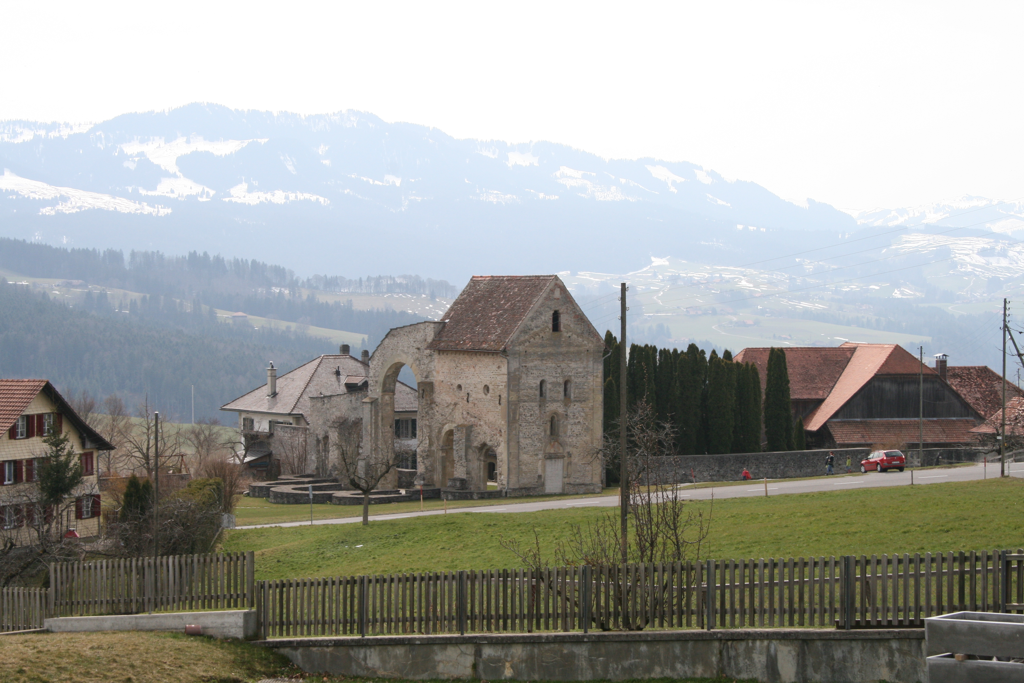
Rüeggisberg is a municipality in the Bern-Mittelland administrative district in the canton of Bern in Switzerland. History Rüeggisberg is first mentioned in 1075 as ''mons Richeri''. In 1224 it was mentioned as ''Ruogersperg''. The oldest trace of a settlement is the Roman road that likely passed through Rüeggisberg between Aventicum / Payerne and the Thun lake area. During the Middle Ages there were three fortifications in the area, Büffelhölzli, Ramsburg and Schlosschäle castles or forts. However no records remain of any of the three and only limited artifacts have been found. Rüeggisberg Priory was founded between 1072 and 1076 by Lütold of Rümligen. He granted the property and estates to Cluny Abbey making it the first Cluniac house in the German-speaking world. Under Cuno of Siegburg and Ulrich of Zell the first cells were built. Construction of the Romanesque church lasted from about 1100 to about 1185, of which there still remain the north transept and parts ... [...More Info...] [...Related Items...] OR: [Wikipedia] [Google] [Baidu] |
Rüschegg
Rüschegg is a municipality in the Bern-Mittelland administrative district in the canton of Bern in Switzerland. It is also a Swiss Reformed Church parish. History Rüschegg is first mentioned around 1417-28 as ''Ruesseg''. Until 1860 Rüschegg was part of Guggisberg. The village church was built in 1813. In 1860, when it became an independent municipality, it also became its own parish. Until the early-20th century it was known as the poorest municipality in the Canton of Bern. With Federal and Cantonal support and rising tourism the local economy improved. Today there are several hotels, hiking trails and ski slopes in the municipality as well as a ropes course in the hamlet of Längeneybad. However, in 2000 about two-thirds of the working population commuted to jobs in Bern and surrounding cities. Geography Rüschegg has an area of . As of 2012, a total of or 41.6% is used for agricultural purposes, while or 49.8% is forested. The rest of the municipality is or 3.0% i ... [...More Info...] [...Related Items...] OR: [Wikipedia] [Google] [Baidu] |
Schattenhalb
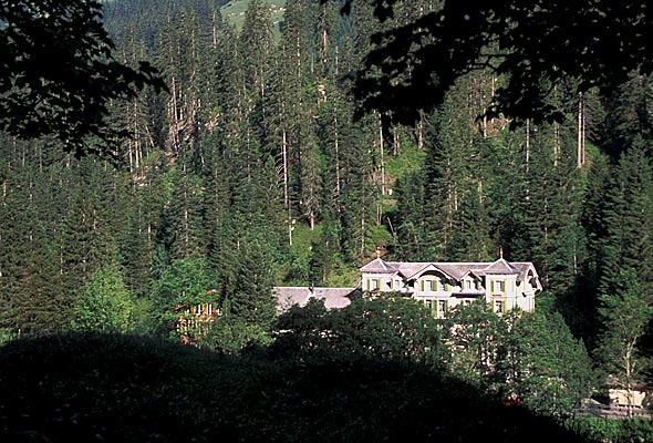
Schattenhalb is a municipality in the Interlaken-Oberhasli administrative district in the canton of Bern in Switzerland. The municipality includes the settlements of Willigen, Geissholz, Falcheren and Lüögen. History The municipality was created in 1834 from the cooperative farms ('' Bäuerten'') of "Willigen," "Geissholz," "Falchern" and "Lugen." The name Schattenhalb ("Shadow-half") refers to the shady face of the mountainside south of Meiringen. The oldest traces of settlements in the area are scattered Bronze Age ax and spear heads and a Roman era coin hoard. By the Middle Ages the scattered Bäuerten of Schattenhalb were part of the parish of Meiringen and the Vogtei of Hasli. In 1334 the entire Vogtei was acquired by the city of Bern. Traditionally the villagers raised cattle and horses in seasonal alpine meadows and then sold the livestock and cheese to traders. During the 18th and 19th century authors, such as Charles Victor de Bonstetten and Jakob Samuel W ... [...More Info...] [...Related Items...] OR: [Wikipedia] [Google] [Baidu] |
Meiringen
Meiringen () is a municipality in the Interlaken-Oberhasli administrative district in the canton of Bern in Switzerland. Besides the village of Meiringen, the municipality includes the settlements of Balm, Brünigen, Eisenbolgen, Hausen, Prasti, Sand, Stein, Unterbach, Unterheidon, Wylerli and Zaun. Meiringen is famous for the nearby Reichenbach Falls, a waterfall that was the setting for the final showdown between Sir Arthur Conan Doyle's fictional detective Sherlock Holmes and his nemesis Professor Moriarty. The village is also known for its claim to have been the place where meringue was first created. The municipal coat of arms shows a black eagle in a yellow field. (" Or an Eagle displayed Sable crowned, beaked, langued and membered of the first.") Formerly the coat of arms of the entire Oberhasli ''Talschaft'', this design continues the imperial coat of arms. Geography Meiringen is located in the eastern Bernese Oberland region, in the Haslital on the upper reaches ... [...More Info...] [...Related Items...] OR: [Wikipedia] [Google] [Baidu] |
Beatenberg
Beatenberg is a municipality in the Interlaken district of the canton of Bern in Switzerland. History Beatenberg is first mentioned in 1275 as ''super rupes''. In 1281 it was mentioned as ''ob den fluen'' and in 1357 as ''Sant Beaten berge''. The earliest trace of a settlement in the area are some early medieval graves near the ''Beatushöhlen'' (Saint Beatus cave). According to legend, Saint Beatus was a Scottish or Irish monk who was sent to evangelize the Helvetii. After finding success in the Jura Mountains, he moved into the Beatenberg area where he defeated a dragon and established a hermitage in the cave overlooking Thun Lake. While the story is probably legendary, the caves became a pilgrimage destination. A chapel was built by the cave for the visiting pilgrims. By 1230 the chapel had grown into a parish church, which in the following century was brought under the control of Interlaken Abbey. During the 13th century a number of local nobles owned land or rig ... [...More Info...] [...Related Items...] OR: [Wikipedia] [Google] [Baidu] |
Habkern
Habkern is a municipality in the Interlaken-Oberhasli administrative district in the canton of Bern in Switzerland. The municipality includes the settlements of Bohlseiten, Bort, Schwendi and Mittelbäuert. Origin of the name The name Habkern comes from the Old High German word ''habuh'' (“hawk”) and the ending ''-arra'', indicating that something is in large numbers. Habkern is thus “”the place where there are many hawks”. History Habkern is first mentioned in 1275 as ''Habcherron''. The land around Habkern was originally owned by the King of the Romans. In 1275, King Rudolph I granted the village to the Freiherr of Eschenbach. It was held briefly by the Habsburg family in Austria before they granted it to Interlaken Abbey. The Abbey remained a supporter of the House of Habsburg after the Swiss Confederation gained ''de facto'' independence from the Habsburgs in the early 14th century. The Abbey launched several raids into Unterwalden Unterwalden, translated from ... [...More Info...] [...Related Items...] OR: [Wikipedia] [Google] [Baidu] |


