|
Linstock, Cumbria
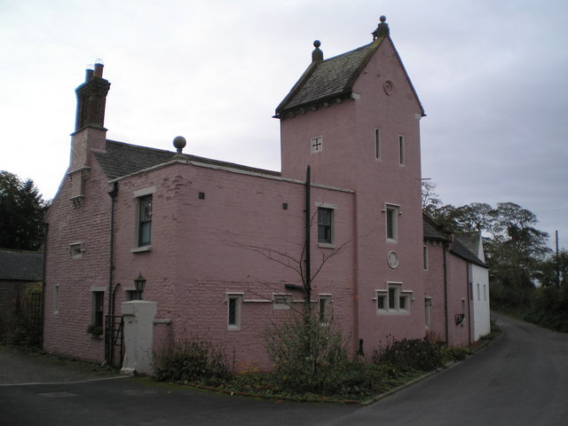
Linstock is a village in the civil parish of Stanwix Rural, in the Carlisle (borough), Carlisle District, in the county of Cumbria, England. It is a few miles away from the city of Carlisle, Cumbria, Carlisle and near the River Eden, Cumbria, River Eden. Circa 1870, it had a population of 205 as recorded in the Imperial Gazetteer of England and Wales. Nearby settlements Nearby settlements include the commuter village of Houghton, Cumbria, Houghton and the hamlets of Brunstock, Walby, Park Broom and Whiteclosegate. Transport For transport there is the B6264 road, the A689 road and the M6 motorway nearby, there is a bridge going over the M6 motorway called Linstock Bridge. There is also the Carlisle railway station a few miles away, which is on the Settle-Carlisle Line. Landmarks Linstock Castle, now a farmhouse, was formerly a tower house built in the 12th or early 13th century as a palace for the Bishops of Carlisle, with 17th-20th century additions and alterations. Hal ... [...More Info...] [...Related Items...] OR: [Wikipedia] [Google] [Baidu] |
Stanwix Rural
Stanwix Rural is a civil parish in the City of Carlisle non-metropolitan district, district of Cumbria, England, immediately to the north east of Carlisle, Cumbria, Carlisle itself – parts of the Carlisle urban area are in the parish boundaries. The parish includes the villages and hamlets of Brunstock, Houghton, Cumbria, Houghton, High Crosby, Linstock, Cumbria, Linstock, Low Crosby, Rickerby, Tarraby and parts of Harker, Cumbria, Harker and Whiteclosegate. Before 1966 the parish was simply called Stanwix although the village of Stanwix itself had been, in 1912, incorporated into the City status in the United Kingdom, city, civil parish and municipal borough of Carlisle. The parish was subject to various boundary changes between 1866 and 1934 when it absorbed the former civil parish of Crosby-on-Eden. The River Eden, Cumbria, River Eden forms the southern edge of the parish and the M6 motorway and A689 road both run through the area. Governance An Wards and electoral divisi ... [...More Info...] [...Related Items...] OR: [Wikipedia] [Google] [Baidu] |
Park Broom
Park Broom is a hamlet in the civil parish of Stanwix Rural, in the Carlisle district, in the county of Cumbria, England. It is a few miles away from the small city of Carlisle and near the River Eden. It was formerly in the township of Linstock. Nearby settlements Nearby settlements include the commuter village of Houghton and the hamlets of Brunstock, Walby and Linstock. Transport For transport there is the A689 about a quarter of a mile away, the B6264 about a mile away and the M6 motorway nearby. There is also Carlisle railway station Carlisle railway station, or Carlisle Citadel, is a Grade II* listed railway station serving the city of Carlisle, Cumbria, England. It is on the West Coast Main Line, south-east of and north north-west of . It is the northern terminus of t ... a few miles away, which is on the Settle-Carlisle Line. References * A-Z Carlisle Hamlets in Cumbria City of Carlisle {{Cumbria-geo-stub ... [...More Info...] [...Related Items...] OR: [Wikipedia] [Google] [Baidu] |
Listed Buildings In Stanwix Rural
Stanwix Rural is a civil parish in the Carlisle district of Cumbria, England. It contains 63 listed buildings that are recorded in the National Heritage List for England. Of these, three are listed at Grade II*, the middle of the three grades, and the others are at Grade II, the lowest grade. The parish is to the northeast of the city of Carlisle, and contains the villages of Houghton, Low Crosby, High Crosby, Brunstock, Linstock, Tarraby, and Rickerby, and the surrounding countryside. The oldest two listed buildings originated as tower houses, and have since been extended and altered. Most of the listed buildings are country houses An English country house is a large house or mansion in the English countryside. Such houses were often owned by individuals who also owned a town house. This allowed them to spend time in the country and in the city—hence, for these peopl ... and smaller houses, some with associated structures, farmhouses and farm building ... [...More Info...] [...Related Items...] OR: [Wikipedia] [Google] [Baidu] |
Peel Tower
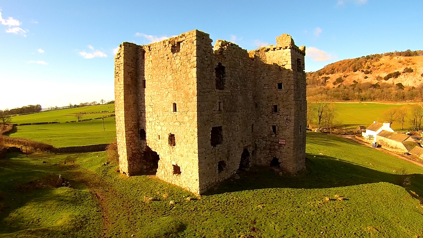
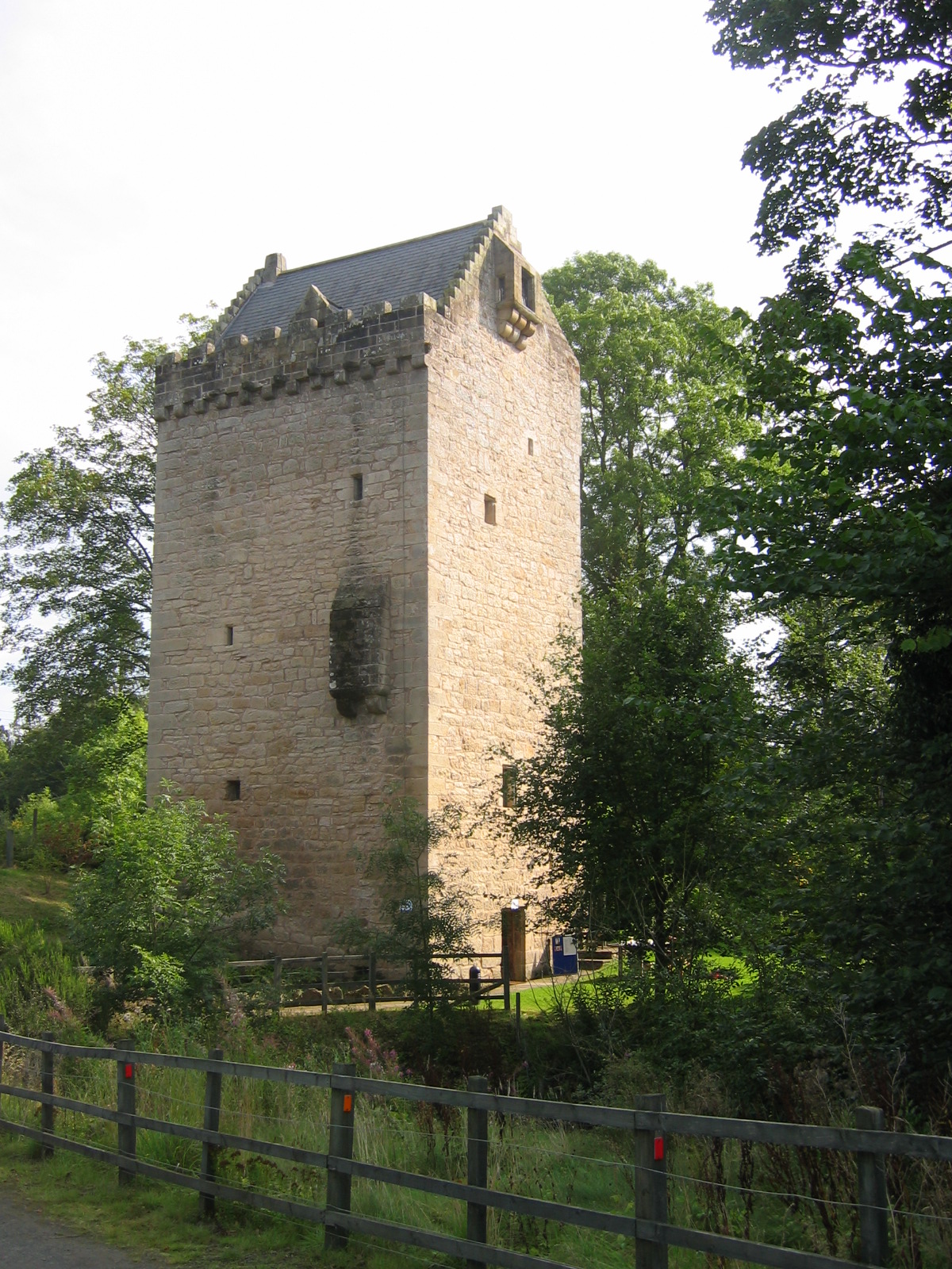
Peel towers (also spelt pele) are small fortified keeps or tower houses, built along the English and Scottish borders in the Scottish Marches and North of England, mainly between the mid-14th century and about 1600. They were free-standing with defence being a prime consideration of their design with "confirmation of status and prestige" also playing a role. They also functioned as watch towers where signal fires could be lit by the garrison to warn of approaching danger. The FISH Vocabulary ''Monument Types Thesaurus'' lists "pele" alongside "bastle", "fortified manor house" and "tower house" under the broader term "fortified house". Pevsner defines a peel as simply a stone tower. Outside of this, "peel" or "pele" can also be used in related contexts, for example a "pele" or "barmkin" (in Ireland a bawn) was an enclosure where livestock were herded in times of danger. The rustling of livestock was an inevitable part of Border raids, and often their main purpose. In th ... [...More Info...] [...Related Items...] OR: [Wikipedia] [Google] [Baidu] |
Tower House
A tower house is a particular type of stone structure, built for defensive purposes as well as habitation. Tower houses began to appear in the Middle Ages, especially in mountainous or limited access areas, in order to command and defend strategic points with reduced forces. At the same time, they were also used as an aristocrat's residence, around which a castle town was often constructed. Europe After their initial appearance in Ireland, Scotland, the Stins, Frisian lands, Basque Country (greater region), Basque Country and England during the High Middle Ages, tower houses were also built in other parts of western Europe, especially in parts of France and Italy. In Italian medieval communes, urban ''palazzi'' with a very tall tower were increasingly built by the local highly competitive Patrician (post-Roman Europe), patrician families as power centres during times of internal strife. Most north Italian cities had a number of these by the end of the Middles Ages, but few no ... [...More Info...] [...Related Items...] OR: [Wikipedia] [Google] [Baidu] |
Carlisle Railway Station
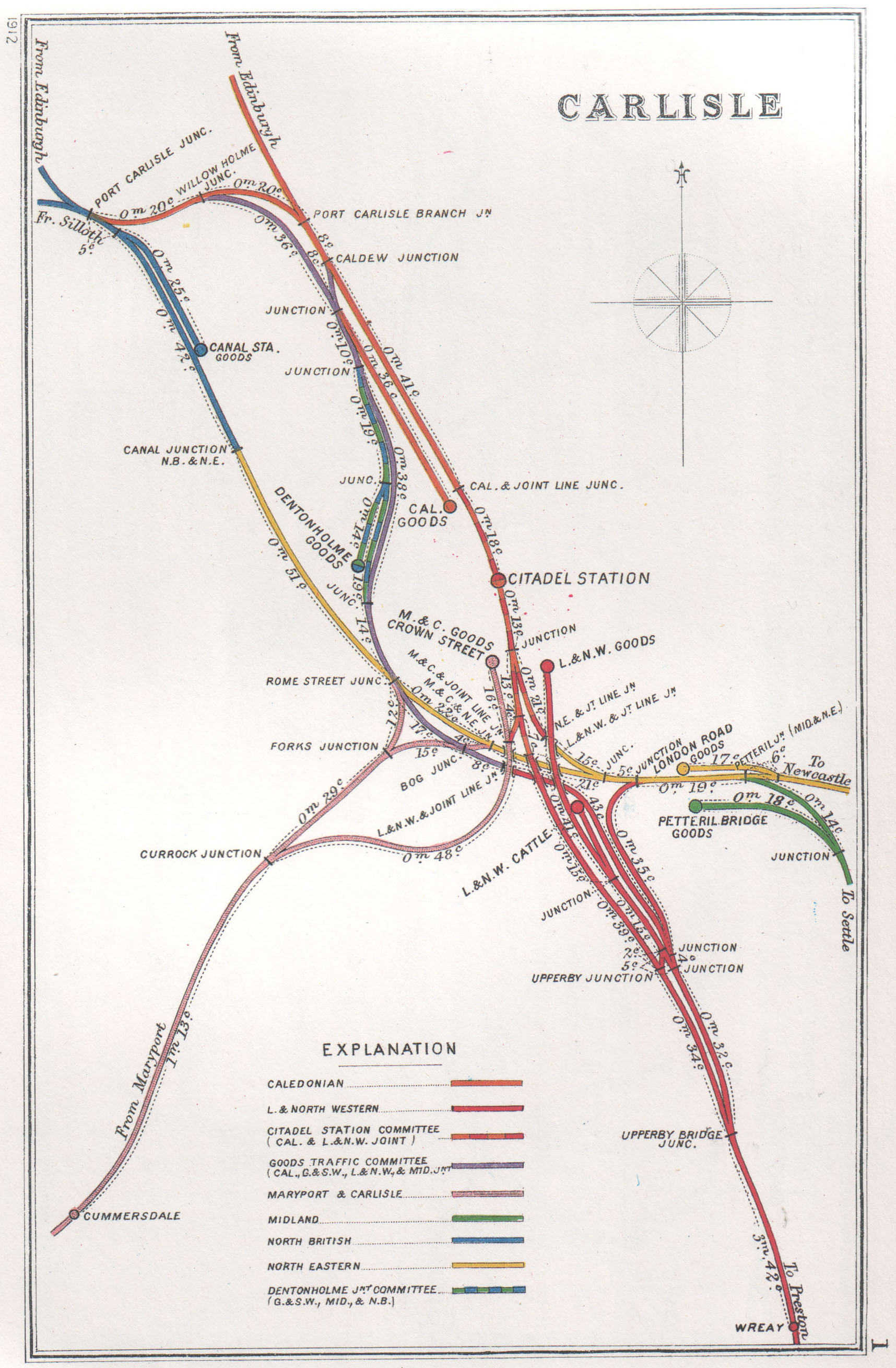
Carlisle railway station, or Carlisle Citadel, is a Grade II* listed railway station serving the city of Carlisle, Cumbria, England. It is on the West Coast Main Line, south-east of and north north-west of . It is the northern terminus of the Settle and Carlisle Line, a continuation of the Midland Main Line from , and . It was formerly the southern terminus of the partially-closed Waverley Route from Edinburgh. It is so named because it is adjacent to Carlisle Citadel, a former medieval fortress. The station is owned by Network Rail. In September 1847, the first services departed the station, even though construction was not completed until the following year. It was built in a neo- Tudor style to the designs of English architect William Tite. Carlisle station was one of a number in the city; the others were Crown Street and London Road, but it became the dominant station by 1851. The other stations had their passenger services redirected to it and were closed. Between 1 ... [...More Info...] [...Related Items...] OR: [Wikipedia] [Google] [Baidu] |
M6 Motorway
The M6 motorway is the longest motorway in the United Kingdom. It is located entirely within England, running for just over from the Midlands to the border with Scotland. It begins at Junction 19 of the M1 and the western end of the A14 at the Catthorpe Interchange, near Rugby before heading north-west. It passes Coventry, Birmingham, Wolverhampton, Stoke-on-Trent, Preston, Lancaster and Carlisle before terminating at Junction 45 near Gretna. Here, just short of the Scottish border it becomes the A74(M) which continues to Glasgow as the M74. Its busiest sections are between junctions 4 and 10a in the West Midlands, and junctions 16 to 19 in Cheshire; these sections have now been converted to smart motorways. It incorporated the Preston By-pass, the first length of motorway opened in the UK and forms part of a motorway "Backbone of Britain", running north−south between London and Glasgow via the industrial North of England. It is also part of the east−west route betwe ... [...More Info...] [...Related Items...] OR: [Wikipedia] [Google] [Baidu] |
A689 Road
The A689 is a road in northern England that runs east from the A595, to the west of Carlisle in Cumbria, to Hartlepool in County Durham. The road begins west of Carlisle, just outside the city at the A595. The initial stretch was recently constructed as part of the Carlisle Northern Development Route, a road bypassing Carlisle from west to north. Crossing the River Eden and the West Coast Main Line, the road intersects with Junction 44 of the M6 at Greymoorhill. From Junction 44 of the M6, the A689 runs roughly south-east to a roundabout, with the B6264. From here, the A689 heads east, and crosses the River Irthing at Ruleholme, then it meets the A69 at a roundabout junction. The A689 joins the route of the A69 around part of the Brampton bypass. Near the village of Milton, the A689 turns right, and continues through Milton and Hallbankgate before crossing the border into the county of Northumberland. The route continues roughly south-east, and re-enters the county o ... [...More Info...] [...Related Items...] OR: [Wikipedia] [Google] [Baidu] |
B6264 Road
New B roads are numbered routes in Great Britain of lesser importance than A roads. See the article Great Britain road numbering scheme The Great Britain road numbering scheme is a numbering scheme used to classify and identify all roads in Great Britain. Each road is given a single letter (which represents the road's category) and a subsequent number (between 1 and 4 digits) ... for the rationale behind the numbers allocated. Zone 6 (3 digits) Zone 6 (4 digits) References {{DEFAULTSORT:B Roads in Zone 6 of the Great Britain Numbering Scheme 6 6 ... [...More Info...] [...Related Items...] OR: [Wikipedia] [Google] [Baidu] |
Whiteclosegate
Whiteclosegate is a hamlet in the Carlisle district of the county of Cumbria, England. Location It is on the B6264 road. Nearby settlements include the city of Carlisle, the villages of Houghton and Rickerby, the hamlets of Linstock and Tarraby and the residential areas of Kingstown and Moorville. Transport For transport, in addition to the B6264, the A689 road, A595 road, A69 road and A6 road and the M6 motorway are nearby. There is also Carlisle railway station Carlisle railway station, or Carlisle Citadel, is a Grade II* listed railway station serving the city of Carlisle, Cumbria, England. It is on the West Coast Main Line, south-east of and north north-west of . It is the northern terminus of ... about a mile and a half away. References * A-Z Carlisle (page 16) Hamlets in Cumbria City of Carlisle {{Cumbria-geo-stub ... [...More Info...] [...Related Items...] OR: [Wikipedia] [Google] [Baidu] |
Walby
Walby is a hamlet in the civil parish of Stanwix Rural, in the Carlisle district, in the county of Cumbria, England. It is a few miles away from the city of Carlisle and near the hamlet of Linstock. It is on Willow Beck near the River Eden and is about half a mile away from the main A689 road. It has an open farm. Circa 1870, it had a population of 40 as recorded in the Imperial Gazetteer of England and Wales. The surname In some cultures, a surname, family name, or last name is the portion of one's personal name that indicates one's family, tribe or community. Practices vary by culture. The family name may be placed at either the start of a person's full name ... derives from the place. References Hamlets in Cumbria City of Carlisle {{Cumbria-geo-stub ... [...More Info...] [...Related Items...] OR: [Wikipedia] [Google] [Baidu] |


