|
Landrake
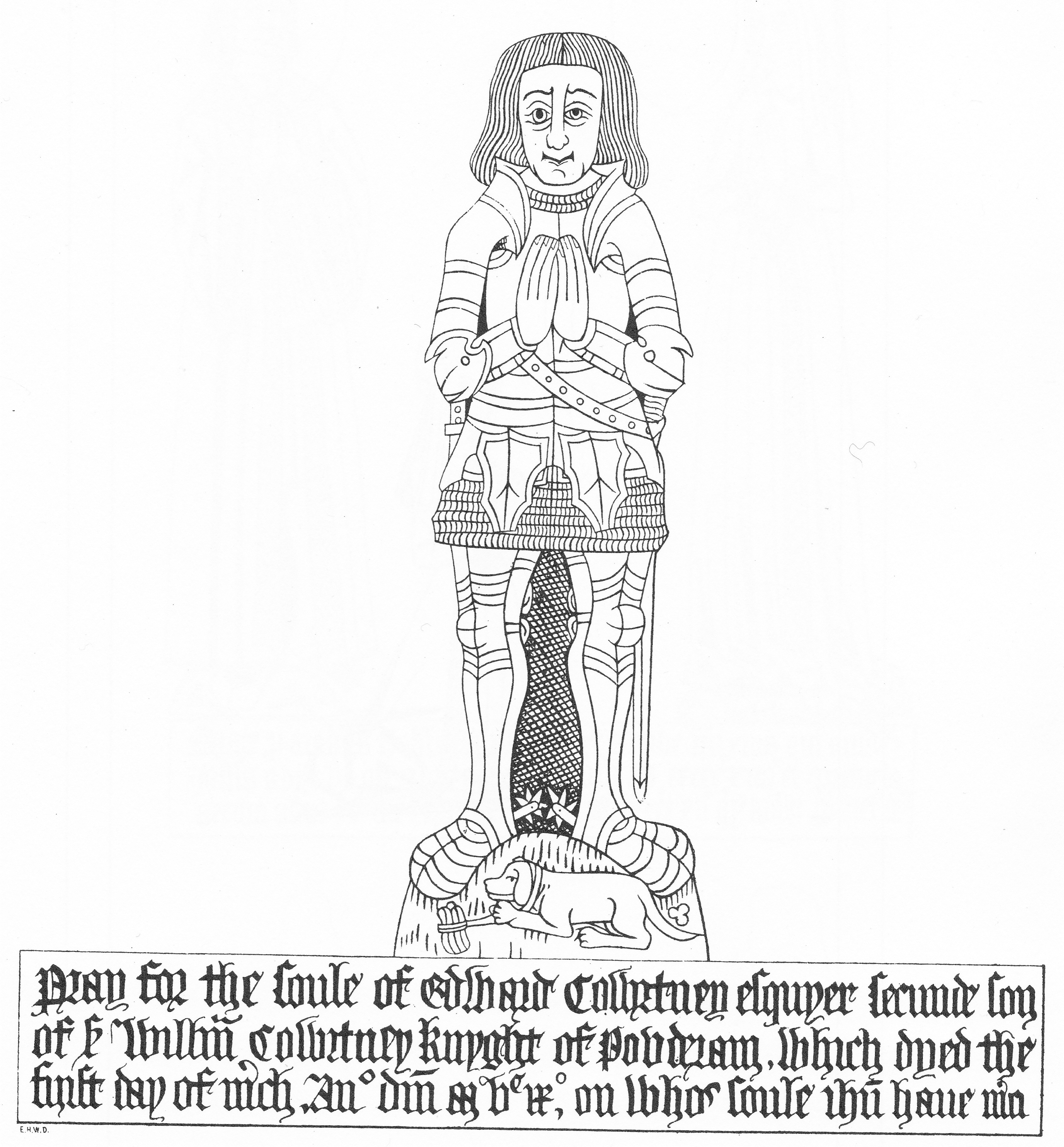
Landrake ( kw, Lannergh) is a village in southeast Cornwall, England, United Kingdom. It is situated approximately three miles (5 km) west of Saltash in the civil parish of Landrake with St Erney (where the population of the 2011 census was included.). The A38 road passes through the village. Landrake has a post office and shop, a pub named the Bullers Arms and Sir Robert Geffery's School, a primary school. The school takes its name from Landrake-born Sir Robert Geffery who, in 1704, bequeathed money to set up a trust to educate children of the parish. Church Landrake Church is dedicated to St Michael. It stands on a hill and the tower is 100 ft high. Parts of the building are Norman but the majority is of the 15th century. There is a brass to Edward Cowrtney, 1509. The church is a Grade I listed building, having been so designated on 23 January 1968. King Edmund gave the parish of Landerch to Bishop Burhwold in exchange for land in Devon; in 1018 this gift was con ... [...More Info...] [...Related Items...] OR: [Wikipedia] [Google] [Baidu] |
Robert Geffrye
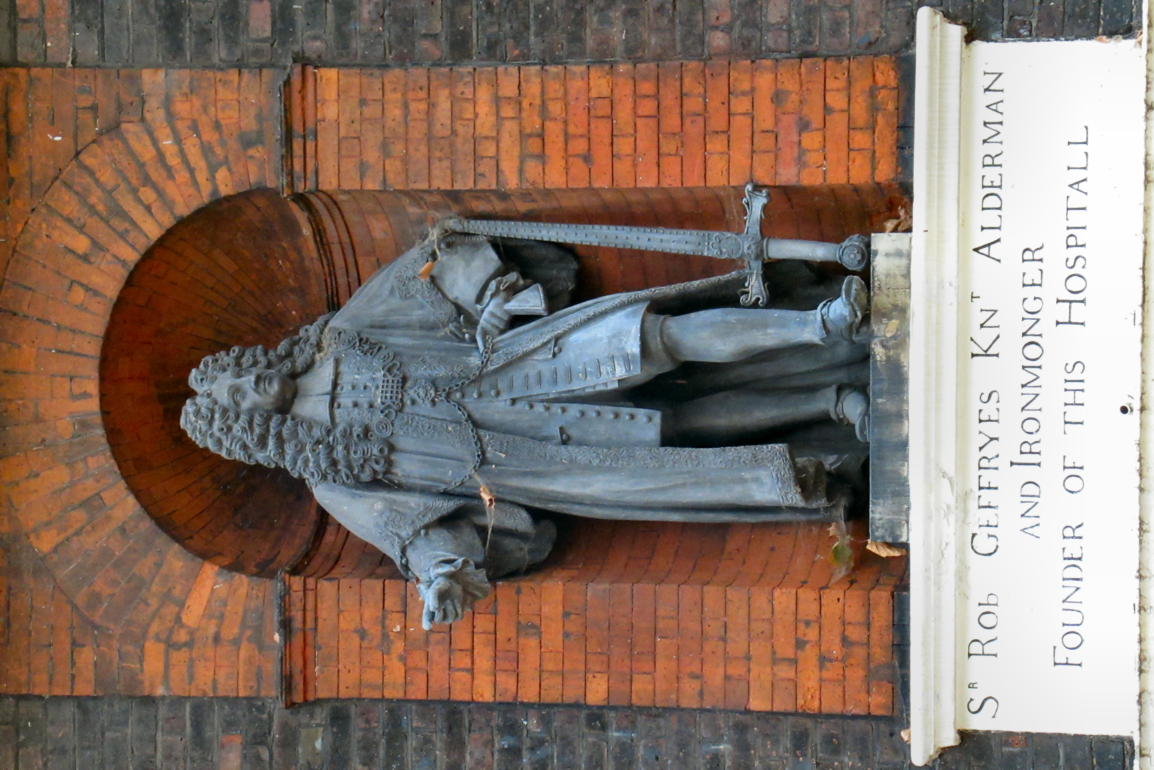
Sir Robert Geffrye (also spelled Geffrey) (1613–1703) was an English merchant, slave trader, and Lord Mayor of London in 1685. "Geffrey, Robert", ''Dictionary of National Biography'', 1885–1900, Volume 10 (wikisource). Life Geffrye was born to poor parents at Landrake, near Saltash, Cornwall, and moved to London, where he became an eminent East India merchant, with his house on Lime Street. He was Master of the Worshipful Company of Ironmongers, knighted in 1673, appointed a Sheriff of London in 1674 and elected Lord Mayor of London in 1685. He was elected president of Bridewell and Bethlehem Hospitals in March 1692–3. He was a significant trader in tobacco. Part of Geffrye's investment was in the Atlantic slave trade, and he had partial ownership of a slave ship, the ''China Merchant''. He married Priscilla, daughter of Luke Cropley, a London merchant, but had no children. On his death he left about £10,000 divided in legacies to friends, relatives, hospitals, and cl ... [...More Info...] [...Related Items...] OR: [Wikipedia] [Google] [Baidu] |
Landrake With St Erney
Landrake with St Erney ( kw, Lannergh a'byth Sen Erney) is a civil parish in Cornwall Cornwall (; kw, Kernow ) is a historic county and ceremonial county in South West England. It is recognised as one of the Celtic nations, and is the homeland of the Cornish people. Cornwall is bordered to the north and west by the Atlantic ..., England, United Kingdom. The parish population at the 2011 census was 1,115. St Erney parish church is dedicated to St Terninus. St Terninus, Terney or Erney is also the patron saint of the parish church of North Hill but nothing is known of him. It has been suggested that he is the same person as St Ternan who evangelised the Picts in the 5th century. The west tower is built of slate and of two stages. The north aisle was added to the existing church building in the 15th century. The font which has a square bowl has been variously dated as 11th century and 13th century.Pevsner, N. (1970) ''Cornwall''; 2nd ed., revised by Enid Radcliffe. Harmond ... [...More Info...] [...Related Items...] OR: [Wikipedia] [Google] [Baidu] |
:Category:People From Landrake ...
{{portal, Cornwall People who were born or raised in the parish of Landrake, Cornwall. Landrake Landrake Landrake ( kw, Lannergh) is a village in southeast Cornwall, England, United Kingdom. It is situated approximately three miles (5 km) west of Saltash in the civil parish of Landrake with St Erney (where the population of the 2011 census was ... [...More Info...] [...Related Items...] OR: [Wikipedia] [Google] [Baidu] |
Francis Rous
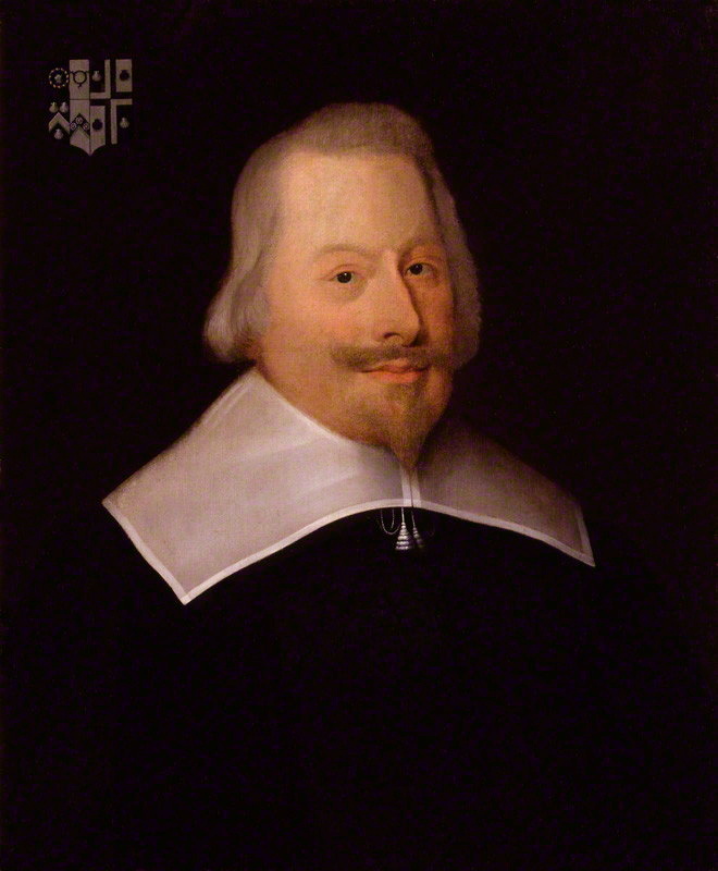
Francis Rous, also spelled Rouse (c. 1581 to 1659), was an English politician and Puritan religious author, who was Provost of Eton from 1644 to 1659, and briefly Speaker of the House of Commons in 1653. Stepbrother of Parliamentary leader John Pym, he joined him in opposing Arminianism in the Church of England, and played a leading role in the impeachment of Archbishop Laud. When the First English Civil War began in 1642, he supported the 1643 Solemn League and Covenant, and was appointed to the Westminster Assembly. Under the Protectorate, he moved away from his Presbyterian colleagues, becoming closer to the religious Independents, and Oliver Cromwell. He died in January 1659, and was buried in Eton College Chapel. Biography Francis Rous was born at Dittisham in Devon around 1581, fourth son of Sir Anthony Rous (ca 1555-1620), and his first wife, Elizabeth Southcote (1547-1585). His father remarried Philippa Colles (died 1620), mother of John Pym; his stepbrother became ... [...More Info...] [...Related Items...] OR: [Wikipedia] [Google] [Baidu] |
Cornwall
Cornwall (; kw, Kernow ) is a historic county and ceremonial county in South West England. It is recognised as one of the Celtic nations, and is the homeland of the Cornish people. Cornwall is bordered to the north and west by the Atlantic Ocean, to the south by the English Channel, and to the east by the county of Devon, with the River Tamar forming the border between them. Cornwall forms the westernmost part of the South West Peninsula of the island of Great Britain. The southwesternmost point is Land's End and the southernmost Lizard Point. Cornwall has a population of and an area of . The county has been administered since 2009 by the unitary authority, Cornwall Council. The ceremonial county of Cornwall also includes the Isles of Scilly, which are administered separately. The administrative centre of Cornwall is Truro, its only city. Cornwall was formerly a Brythonic kingdom and subsequently a royal duchy. It is the cultural and ethnic origin of the Cornish dias ... [...More Info...] [...Related Items...] OR: [Wikipedia] [Google] [Baidu] |
United Kingdom Census 2011
A Census in the United Kingdom, census of the population of the United Kingdom is taken every ten years. The 2011 census was held in all countries of the UK on 27 March 2011. It was the first UK census which could be completed online via the Internet. The Office for National Statistics (ONS) is responsible for the census in England and Wales, the General Register Office for Scotland (GROS) is responsible for the census in Scotland, and the Northern Ireland Statistics and Research Agency (NISRA) is responsible for the census in Northern Ireland. The Office for National Statistics is the executive office of the UK Statistics Authority, a non-ministerial department formed in 2008 and which reports directly to Parliament. ONS is the UK Government's single largest statistical producer of independent statistics on the UK's economy and society, used to assist the planning and allocation of resources, policy-making and decision-making. ONS designs, manages and runs the census in England an ... [...More Info...] [...Related Items...] OR: [Wikipedia] [Google] [Baidu] |
South East Cornwall (UK Parliament Constituency)
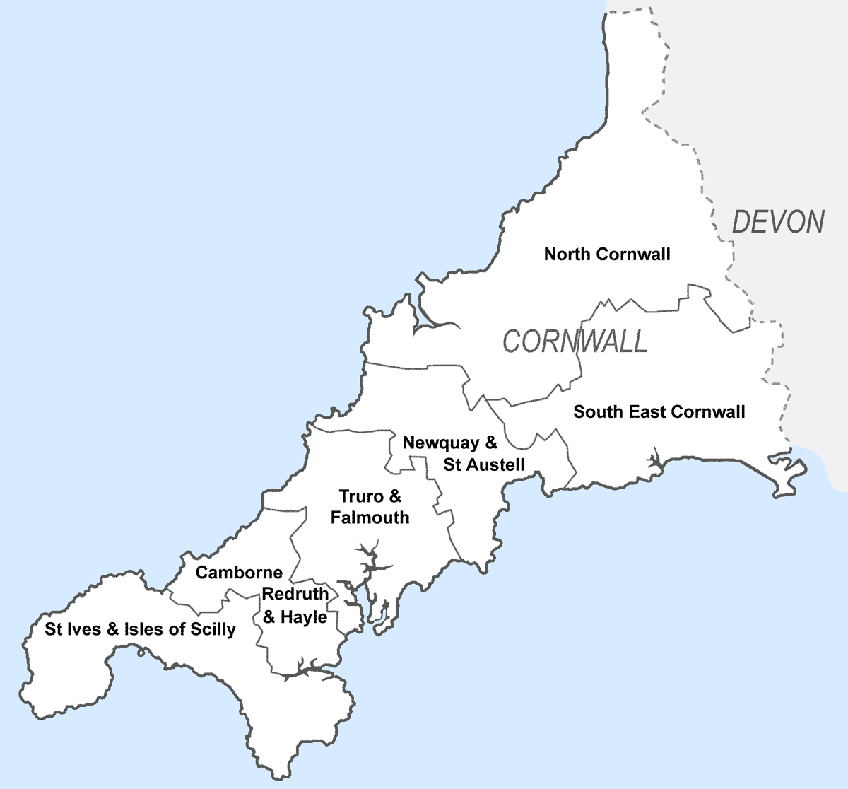
South East Cornwall is a constituency represented in the House of Commons of the UK Parliament since 2010 by Sheryll Murray, a Conservative. Boundaries 1983–2010: The District of Caradon, the Borough of Restormel wards of Fowey, Lostwithiel, St Blaise, and Tywardreath, and the District of North Cornwall ward of Stoke Climsland. 2010–present: The District of Caradon, and the Borough of Restormel ward of Lostwithiel. History The predecessor county division, Bodmin, serving the area from 1885 until 1983 had (during those 98 years) 15 members (two of whom had broken terms of office serving the area), seeing twelve shifts of preference between the Liberal, Liberal Unionist and Conservative parties, spread quite broadly throughout that period. Consistent with this, since 1983 the preference for an MP has alternated between Liberal Democrats and Conservatives. The current constituency territory contains the location of several former borough constituencies which were abol ... [...More Info...] [...Related Items...] OR: [Wikipedia] [Google] [Baidu] |
Saltash
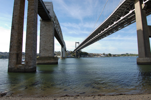
Saltash (Cornish: Essa) is a town and civil parish in south Cornwall, England, United Kingdom. It had a population of 16,184 in 2011 census. Saltash faces the city of Plymouth over the River Tamar and is popularly known as "the Gateway to Cornwall". Saltash’s landmarks include the Tamar Bridge which connects Plymouth to Cornwall by road, and the Royal Albert Bridge. The area of Latchbrook is part of the town. Description Saltash is the location of Isambard Kingdom Brunel's Royal Albert Bridge, opened by Prince Albert on 2 May 1859. It takes the railway line across the River Tamar. Alongside it is the Tamar Bridge, a toll bridge carrying the A38 trunk road, which in 2001 became the first suspension bridge to be widened whilst remaining open to traffic. Saltash railway station, which has a regular train service, with some routes between London Paddington station is close to the town centre. Stagecoach South West, Plymouth Citybus, and Go Cornwall Bus operate bus service ... [...More Info...] [...Related Items...] OR: [Wikipedia] [Google] [Baidu] |
Civil Parish
In England, a civil parish is a type of administrative parish used for local government. It is a territorial designation which is the lowest tier of local government below districts and counties, or their combined form, the unitary authority. Civil parishes can trace their origin to the ancient system of ecclesiastical parishes, which historically played a role in both secular and religious administration. Civil and religious parishes were formally differentiated in the 19th century and are now entirely separate. Civil parishes in their modern form came into being through the Local Government Act 1894, which established elected parish councils to take on the secular functions of the parish vestry. A civil parish can range in size from a sparsely populated rural area with fewer than a hundred inhabitants, to a large town with a population in the tens of thousands. This scope is similar to that of municipalities in Continental Europe, such as the communes of France. However, ... [...More Info...] [...Related Items...] OR: [Wikipedia] [Google] [Baidu] |
A38 Road
The A38, parts of which are known as Devon Expressway, Bristol Road and Gloucester Road, Bristol, Gloucester Road, is a major A-class trunk road in England. The road runs from Bodmin in Cornwall to Mansfield in Nottinghamshire. It is long, making it the longest two-digit A road in England. It was formerly known as the ''Leeds–Exeter Trunk Road'', when this description also included the A61 road (Great Britain), A61. Before the opening of the M5 motorway in the 1960s and 1970s, the A38 formed the main "holiday route" from the Midlands to Somerset, Devon and Cornwall. Considerable lengths of the road in the West Midlands (region), West Midlands closely follow Roman roads, including part of Icknield Street. Between Worcester, England, Worcester and Birmingham the current A38 follows the line of a Saxon salt road; For most of the length of the M5 motorway, the A38 road runs alongside it as a single carriageway road. Route description Bodmin to Birmingham The road starts on t ... [...More Info...] [...Related Items...] OR: [Wikipedia] [Google] [Baidu] |
Norman Architecture
The term Norman architecture is used to categorise styles of Romanesque architecture developed by the Normans in the various lands under their dominion or influence in the 11th and 12th centuries. In particular the term is traditionally used for English Romanesque architecture. The Normans introduced large numbers of castles and fortifications including Norman keeps, and at the same time monasteries, abbeys, churches and cathedrals, in a style characterised by the usual Romanesque rounded arches (particularly over windows and doorways) and especially massive proportions compared to other regional variations of the style. Origins These Romanesque styles originated in Normandy and became widespread in northwestern Europe, particularly in England, which contributed considerable development and where the largest number of examples survived. At about the same time, a Norman dynasty that ruled in Sicily produced a distinctive variation–incorporating Byzantine and Saracen influen ... [...More Info...] [...Related Items...] OR: [Wikipedia] [Google] [Baidu] |
