|
Landican
Landican () is a hamlet on the Wirral Peninsula, in the Metropolitan Borough of Wirral, Merseyside, England. The hamlet is on the outskirts of Birkenhead, near to Woodchurch and the M53 motorway. Historically part of the county of Cheshire, it is within the local government ward of Pensby and Thingwall and the parliamentary constituency of Wirral West. Landican consists of a small group of cottages and farm buildings as well as a cemetery and crematorium. At the 2001 census the community had a population of only 20. History The name possibly derives from ''Llan diacon'', meaning "church of the deacon", with the ''llan-'' prefix being of Welsh origin. However, it does not have a parish church and probably refers to Woodchurch.In this instance, ''Llan de chesne'' would be a Welsh-Norman construct, literally "church uiltof oak (wood)". Alternatively, the name could refer to the "church of St. Tecan/Tegan", an obscure Welsh saint. Landican has been variously spelt over ... [...More Info...] [...Related Items...] OR: [Wikipedia] [Google] [Baidu] |
Birkenhead
Birkenhead (; cy, Penbedw) is a town in the Metropolitan Borough of Wirral, Merseyside, England; historically, it was part of Cheshire until 1974. The town is on the Wirral Peninsula, along the south bank of the River Mersey, opposite Liverpool. At the 2011 census, it had a population of 88,818. Birkenhead Priory and the Mersey Ferry were established in the 12th century. In the 19th century, Birkenhead expanded greatly as a consequence of the Industrial Revolution. Birkenhead Park and Hamilton Square were laid out as well as the first street tramway in Britain. The Mersey Railway connected Birkenhead and Liverpool with the world's first tunnel beneath a tidal estuary; the shipbuilding firm Cammell Laird and a seaport were established. In the second half of the 20th century, the town suffered a significant period of decline, with containerisation causing a reduction in port activity. The Wirral Waters development is planned to regenerate much of the dockland. Toponymy The ... [...More Info...] [...Related Items...] OR: [Wikipedia] [Google] [Baidu] |
Woodchurch, Merseyside
Woodchurch is an area of Birkenhead on the Wirral Peninsula, in England. Administratively, Woodchurch is within the Metropolitan Borough of Wirral, its parliamentary constituency is Wirral West, and its local council ward is Upton. At the 2001 Census, it had a population of 8,400 (3,840 males, 4,560 females). Woodchurch is dominated by a large housing development, known as the Woodchurch Estate. The district is served by several schools and has the major Arrowe Park Hospital just outside its boundary, which was built on of the park itself and opened in 1982. History Woodchurch was originally a farming area and ancient village of the Wirral Hundred, known mainly for its parish church and the neighbouring Arrowe Park country estate. The first recorded owner of the land was an Anglo-Saxon chief called Aescwulf who claimed ownership of Woodchurch, Arrowe and Landican. Although not recorded in the Domesday Book, Woodchurch was recorded as ''Wude Church'' in 1093. The population ... [...More Info...] [...Related Items...] OR: [Wikipedia] [Google] [Baidu] |
Prenton
Prenton is a suburb of Birkenhead, Merseyside, England. Administratively, it is also a ward of the Metropolitan Borough of Wirral. Before local government reorganisation on 1 April 1974, it was part of the County Borough of Birkenhead, within the county of Cheshire. Situated in the east of the Wirral Peninsula, the area is contiguous with Oxton to the north, Tranmere and Rock Ferry to the east and Higher Bebington to the south east. The M53 motorway marks the western boundary. At the 2001 census, the population of Prenton was 14,429. The population of the ward increased slightly to 14,488 in the 2011 census. History Prenton appears as ''Prestune'' in the Domesday Book of 1086, with the name ''Pren-''ton persisting despite the Norman-French accented spelling. Domesday records the presence of a water mill at Prenton, and this has been provisionally identified at Prenton Dell. The Domesday survey also describes Prenton as having a one-league square woodland - which is , if ... [...More Info...] [...Related Items...] OR: [Wikipedia] [Google] [Baidu] |
Wirral Rural District
Wirral Rural District was a rural district on the Wirral Peninsula in Cheshire, England from 1894 to 1933. It was created under the Local Government Act 1894 from the Sanitary district, Wirral Rural Sanitary District. From the beginning of the twentieth century, some civil parishes were transferred to the control of neighbouring local authorities. Netherpool, Whitby and Overpool had become part of Ellesmere Port, Ellesmere Port Urban District by 1911. Landican, Prenton and Thingwall were absorbed into Birkenhead, Birkenhead County Borough in 1928. Wirral Rural District was abolished on 1 April 1933 under a Local Government Act 1929, County Review Order, with the remaining civil parishes being split between Bebington, Bebington Urban District, Birkenhead County Borough, Ellesmere Port Urban District, Hoylake Urban District, Neston, Neston Urban District, Wallasey, Wallasey County Borough and the new Wirral Urban District. As of the area of the former rural district is divided ... [...More Info...] [...Related Items...] OR: [Wikipedia] [Google] [Baidu] |
Wirral Peninsula
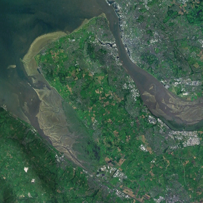
Wirral (; ), known locally as The Wirral, is a peninsula in North West England. The roughly rectangular peninsula is about long and wide and is bounded by the River Dee to the west (forming the boundary with Wales), the River Mersey to the east, and the Irish Sea to the north. Historically, the Wirral was wholly in Cheshire; in the Domesday Book, its border with the rest of the county was placed at "two arrow falls from Chester city walls". However, since the Local Government Act 1972, only the southern third has been in Cheshire, with almost all the rest lying in the Metropolitan Borough of Wirral, Merseyside. An area of saltmarsh to the south-west of the peninsula lies in the Welsh county of Flintshire. The most extensive urban development is on the eastern side of the peninsula. The Wirral contains both affluent and deprived areas, with affluent areas largely in the west, south and north of the peninsula, and deprived areas concentrated in the east, especially Bir ... [...More Info...] [...Related Items...] OR: [Wikipedia] [Google] [Baidu] |
Llan (placename)
Llan () and its variants ( br, lan; kw, lann; xpi, lhan; Irish and gd, lann) are a common element of Celtic placenames in the British Isles and Brittany, especially of Welsh toponymy. In Welsh an (often mutated) name of a local saint or a geomorphological description follows the ''Llan'' morpheme to form a single word: for example Llanfair is the parish or settlement around the church of (Welsh for "Mary"). Goidelic toponyms end in ''-lann''. The various forms of the word are distantly cognate with English ''land'' and ''lawn'' and presumably initially denoted a specially cleared and enclosed area of land. In late antiquity it came to be applied particularly to the sanctified land occupied by communities of Christian converts. It is part of the name of more than 630 locations in Wales and nearly all have some connection with a local patron saint. These were usually the founding saints of the parish,Baring-Gould, Sabine''The Lives of the Saints'', Vol. 16, "The Cel ... [...More Info...] [...Related Items...] OR: [Wikipedia] [Google] [Baidu] |
Wirral Hundred
The Hundred of Wirral is the ancient administrative area for the Wirral Peninsula. Its name is believed to have originated from the ''Hundred of Wilaveston'', the historic name for Willaston, which was an important assembly point in the Wirral Hundred during the Middle Ages. The ''ton'' suffix in a place name normally indicates a previous use as a meeting location for officials. During its existence, the hundred was one of the Hundreds of Cheshire. Since local government reorganisation, implemented on 1 April 1974, the area is split between Merseyside (Metropolitan Borough of Wirral) and Cheshire. Villages The Hundred 100 or one hundred (Roman numeral: C) is the natural number following 99 and preceding 101. In medieval contexts, it may be described as the short hundred or five score in order to differentiate the English and Germanic use of "hundred" to de ... contained the following villages: References Metropolitan Borough of Wirral Hundreds of Cheshire Loc ... [...More Info...] [...Related Items...] OR: [Wikipedia] [Google] [Baidu] |
2001 United Kingdom Census
A nationwide census, known as Census 2001, was conducted in the United Kingdom on Sunday, 29 April 2001. This was the 20th UK census and recorded a resident population of 58,789,194. The 2001 UK census was organised by the Office for National Statistics (ONS) in England and Wales, the General Register Office for Scotland (GROS) and the Northern Ireland Statistics and Research Agency (NISRA). Detailed results by region, council area, ward and output area are available from their respective websites. Organisation Similar to previous UK censuses, the 2001 census was organised by the three statistical agencies, ONS, GROS, and NISRA, and coordinated at the national level by the Office for National Statistics. The Orders in Council to conduct the census, specifying the people and information to be included in the census, were made under the authority of the Census Act 1920 in Great Britain, and the Census Act (Northern Ireland) 1969 in Northern Ireland. In England and Wales these re ... [...More Info...] [...Related Items...] OR: [Wikipedia] [Google] [Baidu] |
Consolidated B-24 Liberator
The Consolidated B-24 Liberator is an American heavy bomber, designed by Consolidated Aircraft of San Diego, California. It was known within the company as the Model 32, and some initial production aircraft were laid down as export models designated as various LB-30s, in the Land Bomber design category. At its inception, the B-24 was a modern design featuring a highly efficient shoulder-mounted, high aspect ratio Davis wing. The wing gave the Liberator a high cruise speed, long range and the ability to carry a heavy bomb load. Early RAF Liberators were the first aircraft to cross the Atlantic Ocean as a matter of routine. In comparison with its contemporaries, the B-24 was relatively difficult to fly and had poor low-speed performance; it also had a lower ceiling and was less robust than the Boeing B-17 Flying Fortress. While aircrews tended to prefer the B-17, General Staff favored the B-24 and procured it in huge numbers for a wide variety of roles. At approximately 18,5 ... [...More Info...] [...Related Items...] OR: [Wikipedia] [Google] [Baidu] |
County Borough
County borough is a term introduced in 1889 in the United Kingdom of Great Britain and Ireland, to refer to a borough or a city independent of county council control, similar to the unitary authorities created since the 1990s. An equivalent term used in Scotland was a county of city. They were abolished by the Local Government Act 1972 in England and Wales, but continue in use for lieutenancy and shrievalty in Northern Ireland. In the Republic of Ireland they remain in existence but have been renamed ''cities'' under the provisions of the Local Government Act 2001. The Local Government (Wales) Act 1994 re-introduced the term for certain "principal areas" in Wales. Scotland did not have county boroughs but instead had counties of cities. These were abolished on 16 May 1975. All four Scottish cities of the time—Aberdeen, Dundee, Edinburgh, and Glasgow—were included in this category. There was an additional category of large burgh in the Scottish system (similar to a munici ... [...More Info...] [...Related Items...] OR: [Wikipedia] [Google] [Baidu] |
United States Air Force
The United States Air Force (USAF) is the air service branch of the United States Armed Forces, and is one of the eight uniformed services of the United States. Originally created on 1 August 1907, as a part of the United States Army Signal Corps, the USAF was established as a separate branch of the United States Armed Forces in 1947 with the enactment of the National Security Act of 1947. It is the second youngest branch of the United States Armed Forces and the fourth in order of precedence. The United States Air Force articulates its core missions as air supremacy, global integrated intelligence, surveillance and reconnaissance, rapid global mobility, global strike, and command and control. The United States Air Force is a military service branch organized within the Department of the Air Force, one of the three military departments of the Department of Defense. The Air Force through the Department of the Air Force is headed by the civilian Secretary of the Air Force ... [...More Info...] [...Related Items...] OR: [Wikipedia] [Google] [Baidu] |
Irish Sea
The Irish Sea or , gv, Y Keayn Yernagh, sco, Erse Sie, gd, Muir Èireann , Ulster-Scots: ''Airish Sea'', cy, Môr Iwerddon . is an extensive body of water that separates the islands of Ireland and Great Britain. It is linked to the Celtic Sea in the south by St George's Channel and to the Inner Seas off the West Coast of Scotland in the north by the North Channel. Anglesey, North Wales, is the largest island in the Irish Sea, followed by the Isle of Man. The term ''Manx Sea'' may occasionally be encountered ( cy, Môr Manaw, ga, Muir Meann gv, Mooir Vannin, gd, Muir Mhanainn). On its shoreline are Scotland to the north, England to the east, Wales to the southeast, Northern Ireland and the Republic of Ireland to the west. The Irish Sea is of significant economic importance to regional trade, shipping and transport, as well as fishing and power generation in the form of wind power and nuclear power plants. Annual traffic between Great Britain and Ireland amounts t ... [...More Info...] [...Related Items...] OR: [Wikipedia] [Google] [Baidu] |
.jpg)


