|
Kyundyulyun
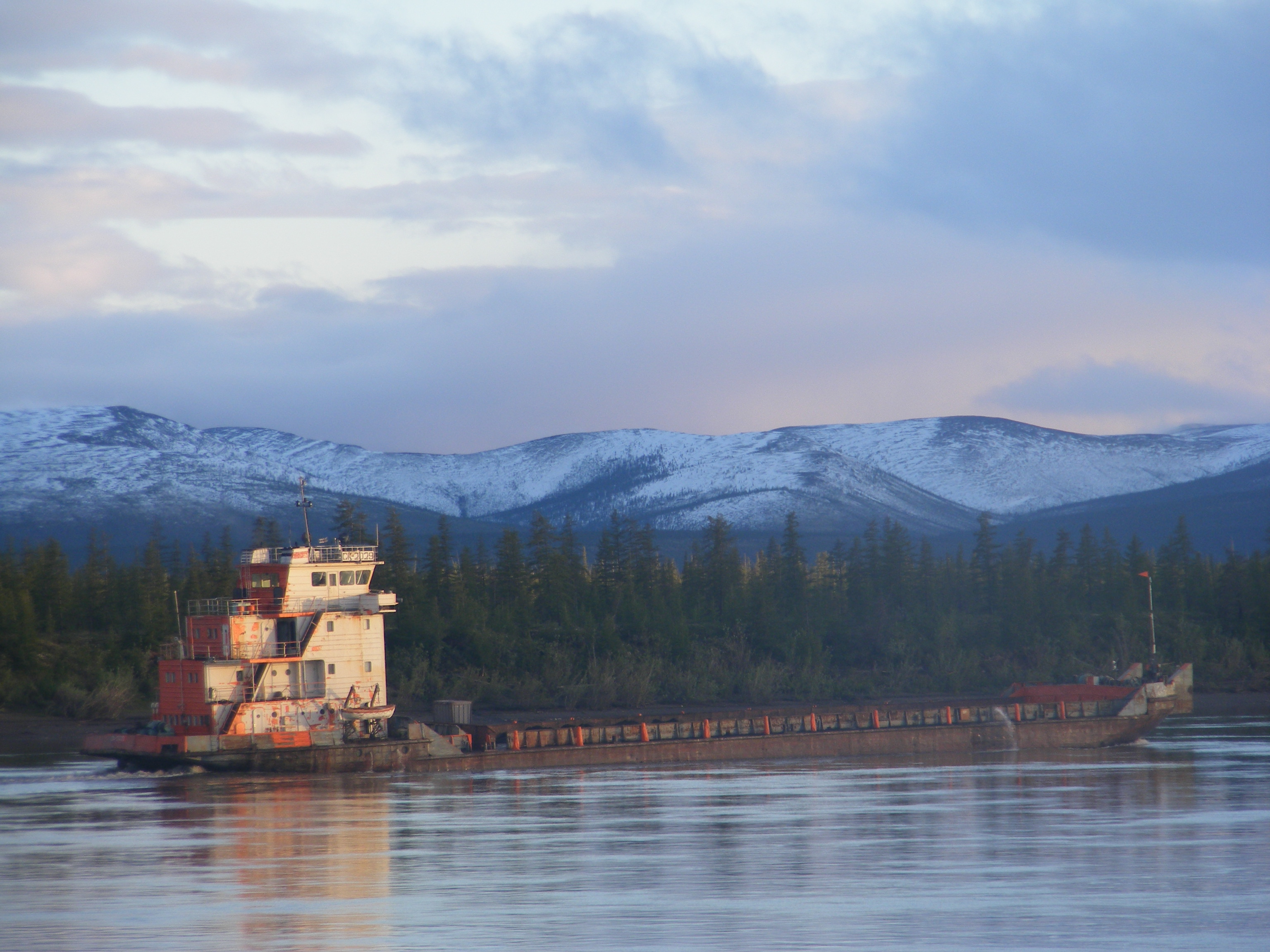
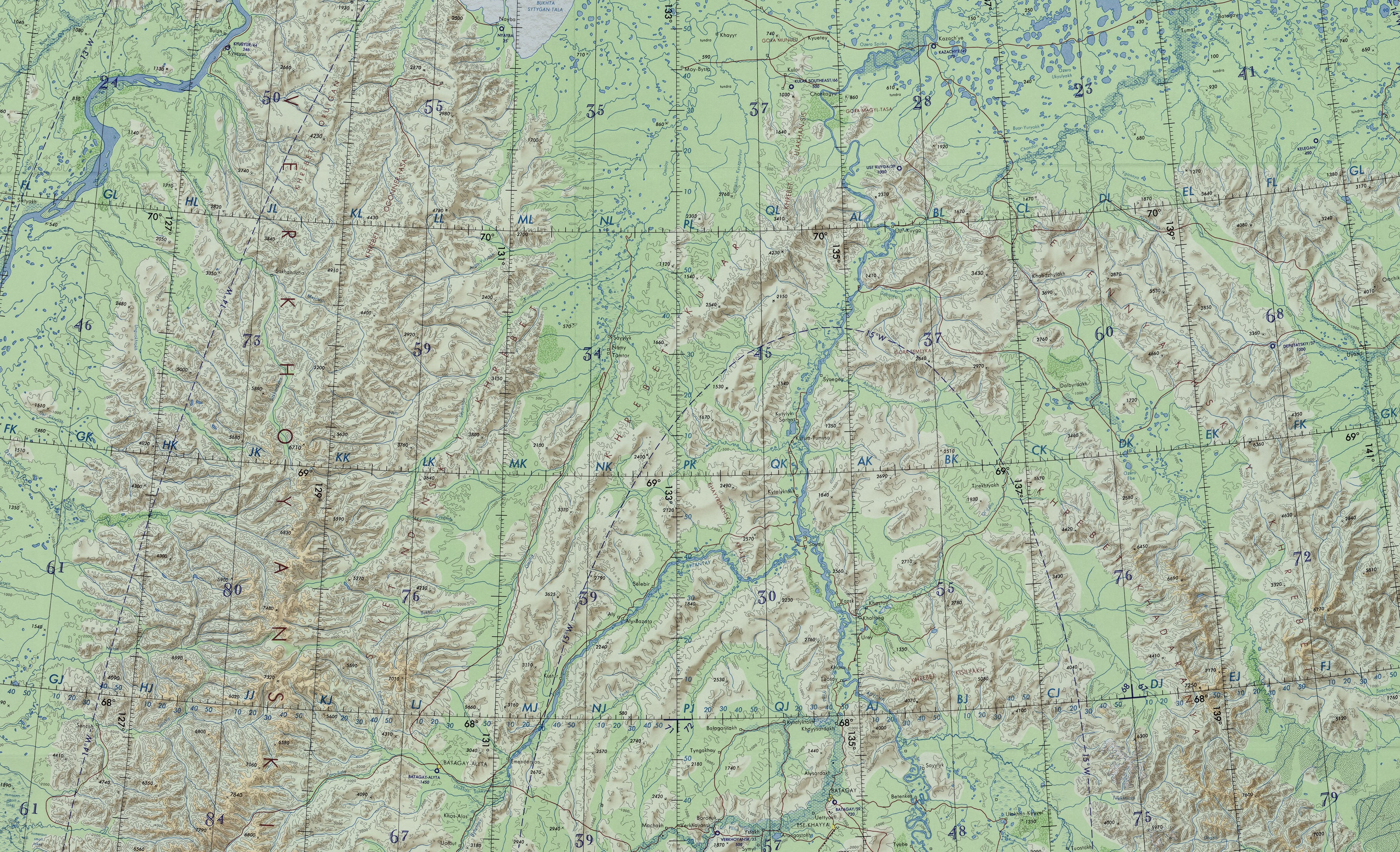
The Kyundyulyun ( rus, Кюндюлюн or Горы Кюндюлюн; sah, Күндүлүн) is a mountain range in the Sakha Republic, Far Eastern Federal District, Russia. The nearest airport is Ust-Kuyga Airport, located in Ust-Yansky District.Google Earth Geography The Kyundyulyun Range is located in northern Yakutia, about north of the Arctic Circle. It is a smooth-looking range, rising above the right bank of the lower course of the Yana River. The Kyundyulyun forms a northeastern prolongation of the Kular Range, which extends from the southwest on the other side of the Yana, overlapping with the northern foothills of the Chersky Range that extend from the southeast. The highest point is an unnamed high summit located in the southwestern part. To the north and northeast the Kyundyulyun is limited by the Yana-Indigirka Lowland, part of the East Siberian Lowland. To the east and southeast the northern foothills of the Chersky Range extend southwards and to the west and ... [...More Info...] [...Related Items...] OR: [Wikipedia] [Google] [Baidu] |
Buor-Yuryakh (Chondon)
The Buor-Yuryakh (russian: Буор-Юрях; sah, Буор-Үрэх) is a river in the Sakha Republic (Yakutia), Russia. It is the second largest tributary of the Chondon. The river has a length of and a drainage basin area of . The Buor-Yuryakh flows north of the Arctic Circle, across desolate territories of the Ust-Yansky District. The name of the river comes from the Yakut "Буор Үрэх" ''"Buor"'' = earth, clay / ''"Yurekh"'' = river. Course The Buor-Yuryakh is a left tributary of the Chondon. It has its sources in the northeastern slopes of the Kyundyulyun at the feet of hign Gory Krest mountain. The river flows roughly eastwards across a floodplain among numerous lakes forming meanders all along its course. Finally the Buor-Yuryakh joins the Chondon from its mouth.Google Earth Tributaries The main tributary of the Buor-Yuryakh is the long Sakhsyr-Yuryege (Сахсыр-Юрэгэ) that joins its left bank before the confluence with the Chondon. There are mo ... [...More Info...] [...Related Items...] OR: [Wikipedia] [Google] [Baidu] |
Ust-Yansky District
Ust-Yansky District (russian: Усть-Я́нский улу́с; sah, Усуйаана улууһа, ''Usuyaana uluuha'', ) is an administrativeConstitution of the Sakha Republic and municipalLaw #172-Z #351-III district (raion, or ''ulus''), one of the thirty-four in the Sakha Republic, Russia. It is located in the north of the republic in the Yana River delta on the coast of the Laptev Sea and borders with Allaikhovsky and Abyysky Districts in the east, Momsky District in the south, Verkhoyansky District in the southwest, and with Bulunsky District in the west. The area of the district is .Registry of the Administrative-Territorial Divisions of the Sakha Republic Its administrative center is the urban locality (a settlement) of Deputatsky. Population: 10,009 ( 2002 Census); The population of Deputatsky accounts for 37.0% of the district's total population. Geography The main rivers in the district include the Yana, the Omoloy with the Ulakhan-Kyuegyulyur, the Sellyakh ... [...More Info...] [...Related Items...] OR: [Wikipedia] [Google] [Baidu] |
Kular Range
The Kular Range (russian: хребет Кулар, ''Khrebet Kular''; sah, Кулар сис, Kular Sis) is a range of mountains in far North-eastern Russia. Administratively the range is part of the Eveno-Bytantaysky National District of the Sakha Republic, Russian Federation.Kular (mountains) / ; in 35 vols. / Ch. ed. Yu. S. Osipov. 2004—2017. This range is one of the places in Yakutia where are found. [...More Info...] [...Related Items...] OR: [Wikipedia] [Google] [Baidu] |
East Siberian Lowland
The East Siberian Lowland ( rus, Восточно-Сибирская низменность), also known as Yana-Kolyma Lowland,Oleg Leonidovič Kryžanovskij, ''A Checklist of the Ground-beetles of Russia and Adjacent Lands.'' p. 16 is a vast plain in Northeastern Siberia, Russia.Yana-Indigirka and Kolyma lowlands (physical map, scale 1: 2 500 000) // National Atlas of Russia . - M .: Roskartografiya, 2004. - T. 1. - S. 260—261. - 496 p. - The territory of the lowland is one of the . Administratively it is part of the |
East Siberian System
The East Siberian Mountains or East Siberian Highlands ( rus, Восточно-Сибирское нагорье) are one of the largest mountain systems of the Russian Federation. They are located between the Central Yakutian Lowland and the Bering Strait in the Far Eastern Federal District and Northeast Siberia. The whole area of the East Siberian System has a very low population density. The territory of the mountain system is one of the Great Russian Regions. In some areas of the East Siberian Mountains, such as the Kisilyakh Range and the Oymyakon Plateau there are kigilyakhs, the rock formations that are highly valued in the culture of the Yakuts. Geography The East Siberian System consists of several separate sections of mountain ranges rising to the north and south of the Arctic Circle. The main group of ranges stretches for a distance of nearly from the Lena River valley to Cape Dezhnev, at the eastern end of the Chukotka Peninsula. Although it reaches a width of roughly ... [...More Info...] [...Related Items...] OR: [Wikipedia] [Google] [Baidu] |
Ust-Kuyga
Ust-Kuyga (russian: Усть-Куйга́; sah, Уус Куйга, translit=Uus Kuyga) is an urban locality (an urban-type settlement) in Ust-Yansky District of the Sakha Republic, Russia.''Registry of the Administrative-Territorial Divisions of the Sakha Republic'' on the Yana River. As of the 2010 Census, its population was 979. Geography The settlement is located by the Kyundyulyun mountains, from Deputatsky, the administrative center of the district, History Urban-type settlement status was granted to Ust-Kuyga in 1967. Administrative and municipal status Within the framework of administrative divisions, the urban-type settlement of Ust-KuygaAccording to Article 7 of the Law #77-I, lower-level administrative divisions with the status of a settlement have their administrative centers in an inhabited locality with the status of an urban-type settlement. According to the ''Registry of the Administrative-Territorial Divisions of the Sakha Republic'', Ust-Kuyga is th ... [...More Info...] [...Related Items...] OR: [Wikipedia] [Google] [Baidu] |
Chondon
The Chondon ( rus, Чондон; sah, Чондоон) is a river in Ust-Yansky District, Sakha Republic (Yakutia), Russia. It is long, with a drainage basin of . The Chondon mammoth was discovered in 2013 in the Chondon basin, at the feet of the Polousny Range, 66 km south-west of the village of Tumat. It had died at the age of 47 to 50 years. Course The river begins in the northern slopes of the Selennyakh Range at an elevation of . It flows roughly northwards west of the Yana River across the Yana-Indigirka Lowland meandering strongly among marshy areas and lakes. In its lower course it flows parallel to the Sellyakh in the east.''Chondon'' // Great Soviet Encyclopedia, in 30 vols. / Ch. ed. A.M. Prokhorov . - 3rd ed. - M .: Soviet Encyclopedia, 1969-197 Yarok Island lies across its mouth, in the Chondon Bay, by the Yana Bay of the Laptev Sea.Google Earth There are over 6,600 lakes in the Chondon basin, with a total area of . The river freezes yearly between early Octo ... [...More Info...] [...Related Items...] OR: [Wikipedia] [Google] [Baidu] |
Chersky Range
The Chersky Range (, ) is a chain of mountains in northeastern Siberia between the Yana River and the Indigirka River. Administratively the area of the range belongs to the Sakha Republic, although a small section in the east is within Magadan Oblast. The highest peak in the range is tall Peak Pobeda (Chersky Range), Peak Pobeda, part of the Ulakhan-Chistay Range. The range also includes important places of traditional Yakut culture, such as Ynnakh Mountain ''(Mat'-Gora)'' and kigilyakh rock formations. The Moma Natural Park is a protected area located in the southern zone of the range. History At some time between 1633 and 1642 Poznik Ivanov ascended a tributary of the lower Lena, crossed the Verkhoyansk Range to the upper Yana and then crossed the Chersky Range to the Indigirka. The range was sighted in 1926 by Sergei Obruchev (Vladimir Obruchev's son) and named by the Russian Geographical Society after the Polish explorer and geographer Ivan Chersky (or Jan Czerski). Geo ... [...More Info...] [...Related Items...] OR: [Wikipedia] [Google] [Baidu] |
Yana-Indigirka Lowland
The Yana-Indigirka Lowland (russian: Яно-Индигирская низменность; sah, Дьааҥы - Индигир намтала) is a large, low alluvial plain located in northern Siberia, Far Eastern Federal District, Russia. Administratively most of the territory of the lowland is part of the Sakha Republic (Yakutia). There are inhabited centers of population in the lowlands such as Chokurdakh, Olenegorsk and Nizhneyansk, but these are very few and scattered. Geography The lowland is named after the Yana River in the west and the Indigirka River in the east and is crossed by both rivers in their middle and lower courses. The area is mostly flat and very marshy, its northern limits extending for over from the Buor Khaya Gulf of the Laptev Sea in the west to the delta of river Indigirka in the East Siberian Sea in the east. It is limited by the Kyundyulyun, the northern end of the Selennyakh Range and the Polousny Range in the south. [...More Info...] [...Related Items...] OR: [Wikipedia] [Google] [Baidu] |
Larch
Larches are deciduous conifers in the genus ''Larix'', of the family Pinaceae (subfamily Laricoideae). Growing from tall, they are native to much of the cooler temperate northern hemisphere, on lowlands in the north and high on mountains further south. Larches are among the dominant plants in the boreal forests of Siberia and Canada. Although they are conifers, larches are deciduous trees that lose their needles in the autumn. Etymology The English name Larch ultimately derives from the Latin "larigna," named after the ancient settlement of Larignum. The story of its naming was preserved by Vitruvius: It is worth while to know how this wood was discovered. The divine Caesar, being with his army in the neighbourhood of the Alps, and having ordered the towns to furnish supplies, the inhabitants of a fortified stronghold there, called Larignum, trusting in the natural strength of their defences, refused to obey his command. So the general ordered his forces to the assault. In ... [...More Info...] [...Related Items...] OR: [Wikipedia] [Google] [Baidu] |
Tundra
In physical geography, tundra () is a type of biome where tree growth is hindered by frigid temperatures and short growing seasons. The term ''tundra'' comes through Russian (') from the Kildin Sámi word (') meaning "uplands", "treeless mountain tract". There are three regions and associated types of tundra: Arctic tundra, alpine tundra, and Antarctic tundra. Tundra vegetation is composed of dwarf shrubs, sedges, grasses, mosses, and lichens. Scattered trees grow in some tundra regions. The ecotone (or ecological boundary region) between the tundra and the forest is known as the tree line or timberline. The tundra soil is rich in nitrogen and phosphorus. The soil also contains large amounts of biomass and decomposed biomass that has been stored as methane and carbon dioxide in the permafrost, making the tundra soil a carbon sink. As global warming heats the ecosystem and causes soil thawing, the permafrost carbon cycle accelerates and releases much of these soil-contained g ... [...More Info...] [...Related Items...] OR: [Wikipedia] [Google] [Baidu] |
Laptev Sea
The Laptev Sea ( rus, мо́ре Ла́птевых, r=more Laptevykh; sah, Лаптевтар байҕаллара, translit=Laptevtar baỹğallara) is a marginal sea of the Arctic Ocean. It is located between the northern coast of Siberia, the Taimyr Peninsula, Severnaya Zemlya and the New Siberian Islands. Its northern boundary passes from the Arctic Cape to a point with co-ordinates of 79°N and 139°E, and ends at the Anisiy Cape. The Kara Sea lies to the west, the East Siberian Sea to the east. The sea is named after the Russian explorers Dmitry Laptev and Khariton Laptev; formerly, it had been known under various names, the last being Nordenskiöld Sea (russian: link=no, мо́ре Норденшёльда), after explorer Adolf Erik Nordenskiöld. The sea has a severe climate with temperatures below 0 °C (32 °F) over more than nine months per year, low water salinity, scarcity of flora, fauna and human population, and low depths (mostly less than 50 meters) ... [...More Info...] [...Related Items...] OR: [Wikipedia] [Google] [Baidu] |


.jpg)


