|
Kurobe Dam
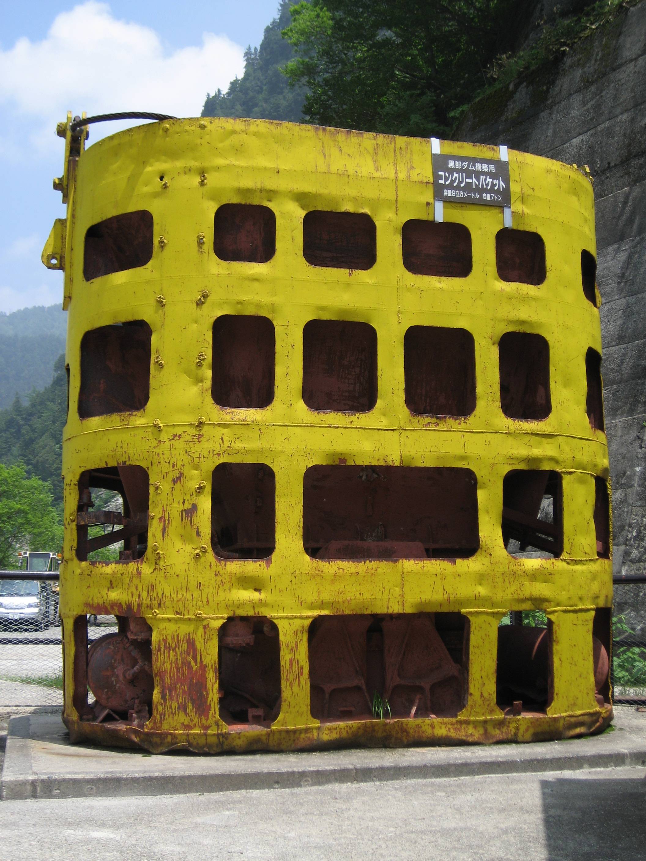
The or , is a high variable-radius arch dam on the Kurobe River in Toyama Prefecture, Japan. The tallest dam in Japan, it supports the 335 MW Kurobe No. 4 Hydropower Plant and is owned by Kansai Electric Power Company. It was constructed between 1956 and 1963 at a cost of ¥51.3 billion yen. The project was a difficult engineering feat for the rapidly growing post–World War II Japan, and claimed the lives of 171 people. History In 1951, the Kansai Electric Power Company was formed to provide electric power for the Kansai region of Japan. Shortly after their formation, the area suffered from drought which caused power rationing. The drought along with the rapid growth of post–World War II Japan pushed the company to increase their generating capacity. After a series of geological and hydrological studies of the Kurobe River and Gorge, it was announced in late 1955 that the Kurobe Dam would be constructed. In July 1956, construction on the dam began. Problems quickly arose w ... [...More Info...] [...Related Items...] OR: [Wikipedia] [Google] [Baidu] |
Kurobe River
The is a river in Toyama Prefecture, Japan. in length, it has a watershed of 689 km². The river rises from Mount Washiba in the Hida Mountains and carves the deep valley known as the Kurobe Gorge. It comes out of the mountains at Unazuki and forms an alluvial fan which directly sinks into the Sea of Japan The Sea of Japan is the marginal sea between the Japanese archipelago, Sakhalin, the Korean Peninsula, and the mainland of the Russian Far East. The Japanese archipelago separates the sea from the Pacific Ocean. Like the Mediterranean Sea, it h .... Geography Tributary *Kuronagi River References External linksThe Kurobe River and Pure Water Rivers of Toyama Prefecture Toyama (city) Nyūzen, Toyama Kurobe, Toyama Rivers of Japan {{Japan-river-stub ... [...More Info...] [...Related Items...] OR: [Wikipedia] [Google] [Baidu] |
Reservoir
A reservoir (; from French ''réservoir'' ) is an enlarged lake behind a dam. Such a dam may be either artificial, built to store fresh water or it may be a natural formation. Reservoirs can be created in a number of ways, including controlling a watercourse that drains an existing body of water, interrupting a watercourse to form an embayment within it, through excavation, or building any number of retaining walls or levees. In other contexts, "reservoirs" may refer to storage spaces for various fluids; they may hold liquids or gasses, including hydrocarbons. ''Tank reservoirs'' store these in ground-level, elevated, or buried tanks. Tank reservoirs for water are also called cisterns. Most underground reservoirs are used to store liquids, principally either water or petroleum. Types Dammed valleys Dammed reservoirs are artificial lakes created and controlled by a dam A dam is a barrier that stops or restricts the flow of surface water or underground streams ... [...More Info...] [...Related Items...] OR: [Wikipedia] [Google] [Baidu] |
Tateyama Tunnel Trolleybus
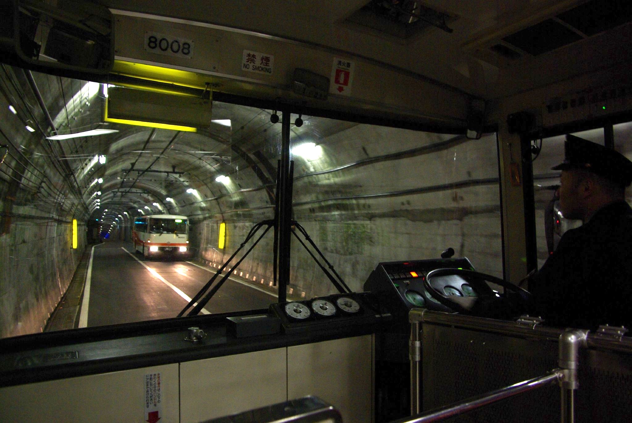
The , officially the , is a Japanese trolleybus line in Tateyama, Toyama, operated by the Tateyama Kurobe Kankō Company. The line is entirely underground (in tunnel), including both termini. It is the last remaining trolleybus line in Japan with the conversion of the Kanden Tunnel Trolleybus line to battery operation in November 2018. It is also the last remaining right-hand drive trolleybus line in the world. The line is a part of the Tateyama Kurobe Alpine Route. The line originally opened as a normal (diesel) bus line in April 1971,''Trolleybus Magazine'' No. 209 (September–October 1996), pp. 124–125. National Trolleybus Association (UK). . but was later re-equipped for trolleybuses. The trolleybus line opened on 23 April 1996.Murray, Alan (2000). ''World Trolleybus Encyclopaedia''. Yateley, Hampshire, UK: Trolleybooks. . Basic data *Distance: ''Trolleybus Magazine'' (TM) No. 202 (July–August 1995), p. 106. ISSN 0266-7452. *Stations: 3 *Double-track line: None *Elec ... [...More Info...] [...Related Items...] OR: [Wikipedia] [Google] [Baidu] |
Murodō Station
is a trolleybus station in Tateyama, Toyama, Japan. It is situated on the Murodō Plateau, 2,400 m above sea level. Murodō is the main station providing access to the Japanese Alps, including Mount Tate and Mount Tsurugi. Lines *Tateyama Kurobe Kankō **Tateyama Tunnel Trolley Bus (Tateyama Kurobe Alpine Route The is a mountain sightseeing route between Tateyama, Toyama and Ōmachi, Nagano, Japan. Opened on June 1, 1971, it is long, with a difference in elevation of as much as . The Alpine Route goes through Tateyama in the Hida Mountains with m ...) Adjacent stations External links Tateyama Kurobe Alpine Route official website Tateyama, Toyama {{Toyama-railstation-stub ... [...More Info...] [...Related Items...] OR: [Wikipedia] [Google] [Baidu] |
Bijodaira Station
is a funicular station in Tateyama, Nakaniikawa District, Toyama Prefecture, Japan. Lines *Tateyama Kurobe Kankō **Tateyama Cable Car (Tateyama Kurobe Alpine Route The is a mountain sightseeing route between Tateyama, Toyama and Ōmachi, Nagano, Japan. Opened on June 1, 1971, it is long, with a difference in elevation of as much as . The Alpine Route goes through Tateyama in the Hida Mountains with m ...) Adjacent stations Railway stations in Toyama Prefecture {{Toyama-railstation-stub ... [...More Info...] [...Related Items...] OR: [Wikipedia] [Google] [Baidu] |
Tateyama Cable Car
The is a Japanese funicular line of in Tateyama, Toyama, with its official name . The company also operates another funicular, Kurobe Cable Car with the same official name. The line is a part of Tateyama Kurobe Alpine Route. It opened in 1954. Basic data *Distance: *Gauge: *Stations: 2 *Vertical interval: Stations * * See also *List of funicular railways *List of railway lines in Japan *Tateyama Kurobe Alpine Route The is a mountain sightseeing route between Tateyama, Toyama and Ōmachi, Nagano, Japan. Opened on June 1, 1971, it is long, with a difference in elevation of as much as . The Alpine Route goes through Tateyama in the Hida Mountains with man ... * Tateyama Sabō Erosion Control Works Service Train External links Tateyama Kurobe Alpine Routeofficial website Funicular railways in Japan Rail transport in Toyama Prefecture Tateyama Kurobe Alpine Route Railway lines opened in 1954 1067 mm gauge railways in Japan 1954 establishments in Japan Tate ... [...More Info...] [...Related Items...] OR: [Wikipedia] [Google] [Baidu] |
Toyama Chihō Railway Tateyama Line
The is a Japanese railway line which connects Terada Station with Tateyama Station, all within Tateyama, Nakaniikawa District Toyama Prefecture. It is owned and run by Toyama Chihō Railway. History The first section of what is now this line was opened by Tateyama Light Railway Co. as a 762mm gauge line between Gohyakkoku and Namerikawa (on the Toyama Chiho Railway Main Line Toyama may refer to: Places and organizations * Toyama Prefecture, a prefecture of Japan located in the Hokuriku region on the main Honshu island * Toyama, Toyama, the capital city of Toyama Prefecture * Toyama Station, the main station of Toyama, ...) in 1913. The Gohyakkoku – Iwakuraji section opened in 1921. In 1931 the company merged with the Toyama Electric Railway Co., which opened the Terada – Gohyakkoku section the same year, 1067mm gauge and electrified at 1500 VDC. The Gohyakkoku – Iwakuraji section was converted to 1067mm gauge and electrified in 1936. In the meantime the Toyama Prefectu ... [...More Info...] [...Related Items...] OR: [Wikipedia] [Google] [Baidu] |
Tateyama Station (Toyama)
is a railway station in the town of Tateyama, Nakaniikawa District, Toyama Prefecture, Japan, operated by the private railway operator Toyama Chihō Railway. Lines Tateyama Station is a terminus of the Toyama Chihō Railway Tateyama Line, and is 24.2 kilometers from the opposing terminus at . It is also the starting point for the Tateyama Kurobe Kankō Tateyama Cable Car ( Tateyama Kurobe Alpine Route). Station layout The station has one ground-level bay platform serving two tracks. The station is staffed. History Tateyama Station was opened on 1 August 1954. Services of the Tateyama Cable Car were relocated to this station on 1 April 1970. The station building was renovated in 1982. Adjacent stations Passenger statistics In fiscal 2015, the station was used by 591 passengers daily. Surrounding area *Tateyama Ski area *Tateyama Caldera Sabo Museum See also * List of railway stations in Japan The links below contain all of the 8579 railway stations in Japa ... [...More Info...] [...Related Items...] OR: [Wikipedia] [Google] [Baidu] |
Toyama, Toyama
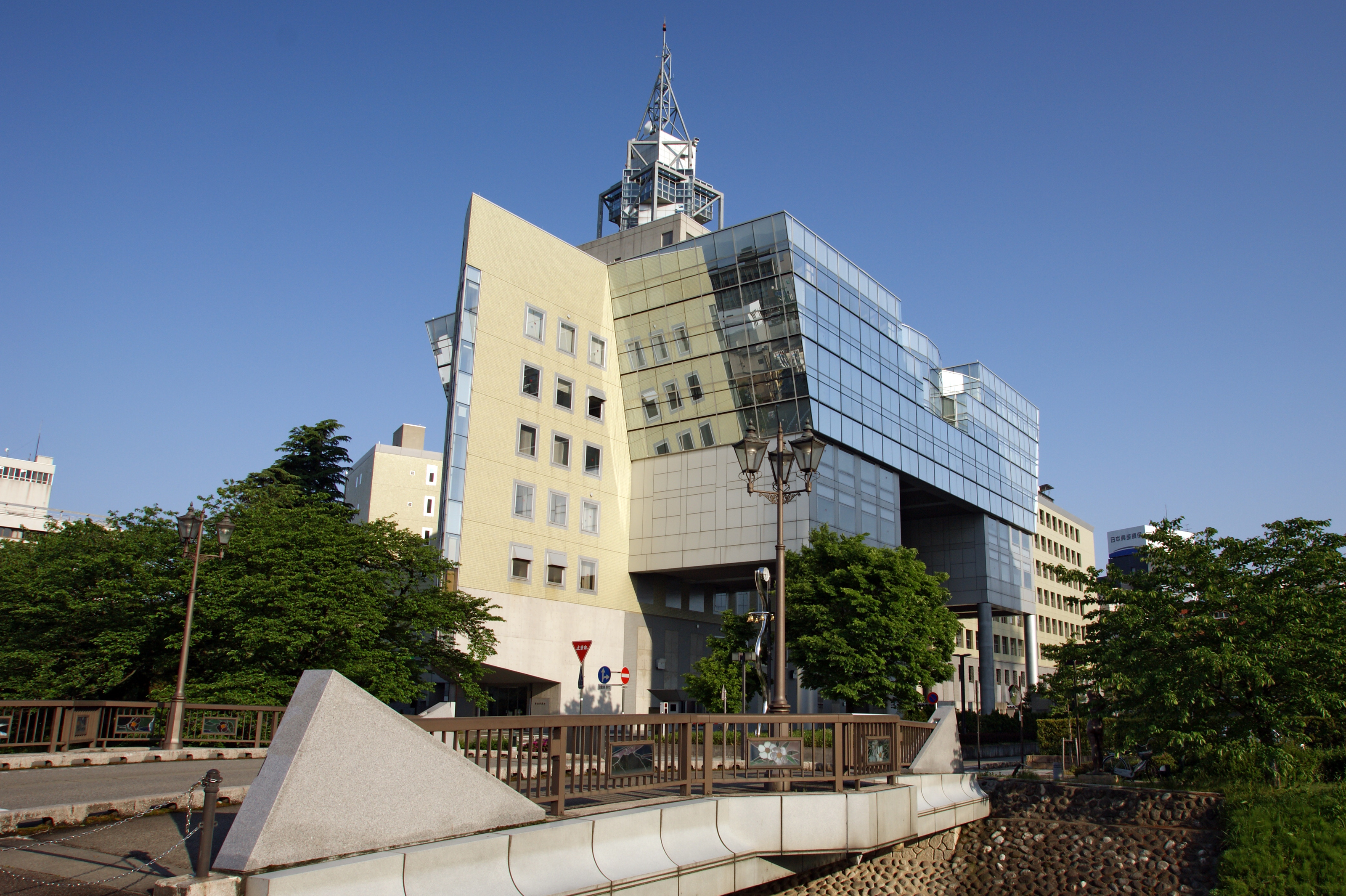
is the capital city of Toyama Prefecture, Japan, located on the coast of the Sea of Japan in the Chūbu region on central Honshū, about north of the city of Nagoya and northwest of Tokyo. , the city had an estimated population of 415,844 in 176,643 households, and a population density of 335 persons per km2. Its total area was . Overview The city has been designated an environmental model city by the national government for its efforts to reduce the emission of greenhouse gases. Cityscapes File:Toyama Castle (4207284334).jpg, Toyama Castle(2009) File:Anyobo, Toyama, Toyama Prefecture 930-0881, Japan - panoramio (35).jpg, Skyline of Toyama City(2015) File:View from Toyama City Hall, north side.jpg, CBD of Toyama(2018) File:Sogawa st.jpeg, Downtown Sōgawa(2016) File:Fugan unga.JPG, Toyama Kansui park(2016) Geography Located in the middle of its prefecture, Toyama is a seaside city by the coast of the Sea of Japan. Its municipal territory borders with ... [...More Info...] [...Related Items...] OR: [Wikipedia] [Google] [Baidu] |
Hokuriku Shinkansen
The is a high-speed Shinkansen railway line jointly operated by East Japan Railway Company (JR East) and West Japan Railway Company (JR West), connecting Tokyo with in the Hokuriku region of Japan. The first section, between and in Nagano Prefecture, opened on 1 October 1997, originally called the (Takasaki is linked to Tokyo by the Jōetsu Shinkansen). The extension to in Toyama Prefecture and in Ishikawa Prefecture opened on 14 March 2015. Construction of a further section onward to and in Fukui Prefecture commenced in 2012, with scheduled opening in Spring 2024. The route of the final section to Shin-Osaka was decided on 20 December 2016 as the Osaka–Kyoto route, with construction expected to begin in 2030 and take 15 years. Train names and service patterns Since March 2015, services on the line are split into four types, with train names as listed below. Trains operate over the Joetsu and Tohoku Shinkansen tracks between Tokyo and Takasaki. * ''Kagayaki'': Toky ... [...More Info...] [...Related Items...] OR: [Wikipedia] [Google] [Baidu] |
Tateyama Kurobe Alpine Route
The is a mountain sightseeing route between Tateyama, Toyama and Ōmachi, Nagano, Japan. Opened on June 1, 1971, it is long, with a difference in elevation of as much as . The Alpine Route goes through Tateyama in the Hida Mountains with many scenic sites as well as walking trails, including Japan's largest dam, Kurobe Dam. Some stations have hotels around them and are used as bases for mountain climbing or trekking. From the top of the mountain, it is possible to see Mount Fuji on a fine day. Overview The route is composed of seven different transportation services using five different modes: funicular, bus, trolleybus, aerial tramway, and walking. They have been built without any damage to the surrounding environment. Three lines go through tunnels (to protect them from snow), including one funicular railway and two bus lines - one using trolleybuses (the last in Japan), and the other using all-electric buses (trolleybuses until 2018), because they do not exhaust fumes in ... [...More Info...] [...Related Items...] OR: [Wikipedia] [Google] [Baidu] |
Surge Chamber
Surge means a sudden transient rush or flood, and may refer to: Science * Storm surge, the onshore gush of water associated with a low-pressure weather system * Surge (glacier), a short-lived event where a glacier can move up to velocities 100 times faster than normal * Pyroclastic surge, the fluidised mass of turbulent gas and rock fragments ejected during some volcanic eruptions * Characteristic impedance, also known as "surge impedance" in electrical engineering * Voltage surge, short duration surges in electrical circuits * Compressor stall, also known as "compressor surge", in aviation * Surge in compressors in industrial compressors * Hydraulic surge in liquid pipes; also called pressure surge and water hammer (see surge control) * Surge (translational motion), one of the translational degrees of freedom of any stiff body (for example a vehicle), describing motion along the longitudinal axis (forward or backwards) * Surge (waves), transient or periodic motion in the direct ... [...More Info...] [...Related Items...] OR: [Wikipedia] [Google] [Baidu] |


