|
Kurahashi-jima
, also called in ancient texts, is an island in Hiroshima Bay located in southwestern Hiroshima Prefecture, Japan. Geography The island is roughly T-shaped, with the northern, most mountainous lobe sandwiched between mainland Kure and Etajima island. Transportation The island is connected to mainland of Honshu by a pair of bridges over 80 meters wide strait. The island is served by the national route 487. Also, travel by bus is possible since 2005. Attractions *Katsurahama - one of the *Kurahashi shipbuilding museum History *7-8th century - a major center of shipbuilding and port for Yamato period Japan *13th century - an outpost against Wokou pirates for Kamakura period Japan *1709 - island come under government of Hiroshima Domain as an important stop-over on the trade route to Kaminoseki *1860 - coastal artillery fort is built *1 April 1889 - establishment of Kurahashi-jima village *1890 - with the assignment of island to the Kure Naval District, the access to the island ... [...More Info...] [...Related Items...] OR: [Wikipedia] [Google] [Baidu] |
Kurahashi, Hiroshima
was a town located in Aki District, Hiroshima Prefecture, Japan. It was located on the Kurahashi-jima island and surrounding islets. As of 2003, the town had an estimated population of 7,193 and a density of 132.13 persons per km². The total area was 54.44 km². On March 20, 2005, Kurahashi, along with the towns of Ondo and Kamagari (all from Aki District), and the towns of Yasuura, Toyohama and Yutaka (all from Toyota District), was merged into the expanded city of Kure and no longer exists as an independent municipality A municipality is usually a single administrative division having corporate status and powers of self-government or jurisdiction as granted by national and regional laws to which it is subordinate. The term ''municipality'' may also mean the go .... External links Official website of Kure (somEnglish content Dissolved municipalities of Hiroshima Prefecture {{Hiroshima-geo-stub ... [...More Info...] [...Related Items...] OR: [Wikipedia] [Google] [Baidu] |
Etajima
, also called , ''Nomijima'', ''Nomi Island'', or is an island in Hiroshima Bay located in southwestern Hiroshima Prefecture, Japan. The mess with island name originates from the ancient (and possibly legendary) strait at now town . Geography The island is roughly Y-shaped, with the former Nōmi occupying center, the Okimi - north-western branch, Etajima - north-eastern branch, and Ōgaki - the southern branch. The island's highest peak, mount high, is located on the western edge of Nōmi town. Transportation Since 1973, the island is connected to the Japanese mainland of Honshu by the bridge passing through the Kurahashi-jima island. The island is served by the national route 487. Also, ferries are available from the cities of Hiroshima and Kure on Honshu island and Matsuyama on Shikoku island. History The Imperial Japanese Naval Academy was moved to ''Etajima Island'' in 1888. While the academy still exists under the name Naval Academy Etajima, modern Etajima focuses rat ... [...More Info...] [...Related Items...] OR: [Wikipedia] [Google] [Baidu] |
Seto Inland Sea
The , sometimes shortened to the Inland Sea, is the body of water separating Honshū, Shikoku, and Kyūshū, three of the four main islands of Japan. It serves as a waterway connecting the Pacific Ocean to the Sea of Japan. It connects to Osaka Bay and provides a sea transport link to industrial centers in the Kansai region, including Osaka and Kobe. Before the construction of the San'yō Main Line, it was the main transportation link between Kansai and Kyūshū. Yamaguchi Prefecture, Yamaguchi, Hiroshima Prefecture, Hiroshima, Okayama Prefecture, Okayama, Hyōgo Prefecture, Hyōgo, Osaka Prefecture, Osaka, Wakayama Prefecture, Wakayama, Kagawa Prefecture, Kagawa, Ehime Prefecture, Ehime, Tokushima Prefecture, Tokushima, Fukuoka Prefecture, Fukuoka, and Ōita Prefecture, Ōita prefectures have coastlines on the Seto Inland Sea; the cities of Hiroshima, Iwakuni, Takamatsu, Kagawa, Takamatsu, and Matsuyama, Ehime, Matsuyama are also located on it. The Setouchi Region, Setouchi re ... [...More Info...] [...Related Items...] OR: [Wikipedia] [Google] [Baidu] |
Kamakura Period
The is a period of Japanese history that marks the governance by the Kamakura shogunate, officially established in 1192 in Kamakura by the first ''shōgun'' Minamoto no Yoritomo after the conclusion of the Genpei War, which saw the struggle between the Taira and Minamoto clans. The period is known for the emergence of the samurai, the warrior caste, and for the establishment of feudalism in Japan. During the early Kamakura period, the shogunate continued warfare against the Northern Fujiwara which was only defeated in 1189. Then, the authority to the Kamakura rulers waned in the 1190s and power was transferred to the powerful Hōjō clan in the early 13th century with the head of the clan as regent (Shikken) under the shogun which became a powerless figurehead. The later Kamakura period saw the invasions of the Mongols in 1274 and again in 1281. To reduce the amount of chaos, the Hōjō rulers decided to decentralize power by allowing two imperial lines – Northern and Southern ... [...More Info...] [...Related Items...] OR: [Wikipedia] [Google] [Baidu] |
Kure Naval District
was the second of four main administrative districts of the pre-war Imperial Japanese Navy. Its territory included the Seto Inland Sea, Inland Sea of Japan and the Pacific Ocean, Pacific coasts of southern Honshū from Wakayama prefecture, Wakayama to Yamaguchi prefectures, eastern and northern Kyūshū and Shikoku. The area of the Kure Naval District encompassed Hashirajima Anchoring Area located at the south end of Hiroshima Bay, 30-40 kilometers southwest of Kure. When not in need of repairs ships usually anchored in this area to free up pier space at Kure. Hashirajima was also a major staging area for fleet operations. Tokuyama, Yamaguchi, Tokuyama port, was also part of Kure Naval District, and had the largest fuel depot in the Japanese Navy. History The location of Kure, Hiroshima, Kure within the sheltered Inland Sea of Japan was recognized of strategic importance in controlling the sea lanes around western Japan by the Meiji government and early Imperial Japanese Navy. Wi ... [...More Info...] [...Related Items...] OR: [Wikipedia] [Google] [Baidu] |
Kaminoseki
is a town located in Kumage District, Yamaguchi Prefecture, Japan. As of 2022, the town has an estimated population of 2,193 and a density of . The total area is . Geography Islands * Iwaishima * Yashima * Nagashima Neighbouring municipalities * Yanai * Hirao Transportation Kaminoseki does not have any train stations, the closest one being Yanai Station is a railway station in Yanai, Yamaguchi Prefecture, Japan, operated by West Japan Railway Company (JR West). Lines Yanai Station is served by the Sanyō Main Line. See also * List of railway stations in Japan The links below contain all of t ..., which is located about 20 kilometers from the town. References External links * (in Japanese) Towns in Yamaguchi Prefecture {{Yamaguchi-geo-stub ... [...More Info...] [...Related Items...] OR: [Wikipedia] [Google] [Baidu] |
Hiroshima Domain
The was a domain of the Tokugawa Shogunate of Japan during the Edo period from 1601 to 1871. The Hiroshima Domain was based at Hiroshima Castle in Aki Province, in the modern city of Hiroshima, located in the Chūgoku region of the island of Honshu. The Hiroshima Domain was ruled for most of its existence by the ''daimyō'' of the Asano clan and encompassed Aki Province and parts of Bingo Province with a ''Kokudaka'' system value of 426,500 ''koku''. The Hiroshima Domain was dissolved in the abolition of the han system in 1871 by the Meiji government and its territory was absorbed into Hiroshima Prefecture. History In 1589, Hiroshima Castle was commissioned by Mōri Terumoto, head of the powerful Mōri clan and a member of Toyotomi Hideyoshi's Council of Five Elders. In 1591, Terumoto relocated to Hiroshima while it was still under construction, using it as his base to rule his domain covering most of the Chūgoku region. Following the Battle of Sekigahara in 1600, the Mōri we ... [...More Info...] [...Related Items...] OR: [Wikipedia] [Google] [Baidu] |
Yamato Period
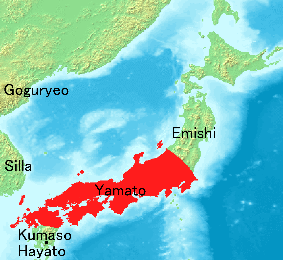
The is the period of Japanese history when the Imperial court ruled from modern-day Nara Prefecture, then known as Yamato Province. While conventionally assigned to the period 250–710, including both the Kofun period (–538) and the Asuka period (538–710), the actual start of Yamato rule is disputed. The Yamato court's supremacy was challenged during the Kofun period by other polities centered in various parts of Japan. What is certain is that Yamato clans had major advantages over their neighbouring clans in the 6th century. This period is divided by the relocation of the capital to Asuka, in modern Nara Prefecture. However, the Kofun period is an archaeological period while the Asuka period is a historical period. Therefore, many think of this as an old division and this concept of period division is no longer applicable. At the era of Prince Shōtoku in the early 7th century, a new constitution was prescribed for Japan based on the Chinese model. After the fall of B ... [...More Info...] [...Related Items...] OR: [Wikipedia] [Google] [Baidu] |
Wokou
''Wokou'' (; Japanese: ''Wakō''; Korean: 왜구 ''Waegu''), which literally translates to "Japanese pirates" or "dwarf pirates", were pirates who raided the coastlines of China and Korea from the 13th century to the 16th century.Wakō Encyclopaedia Britannica The wokou came from , , and ethnicities which varied over time and raided the mainland from islands in the |
Hiroshima Prefecture
is a Prefectures of Japan, prefecture of Japan located in the Chūgoku region of Honshu. Hiroshima Prefecture has a population of 2,811,410 (1 June 2019) and has a geographic area of 8,479 km² (3,274 sq mi). Hiroshima Prefecture borders Okayama Prefecture to the east, Tottori Prefecture to the northeast, Shimane Prefecture to the north, and Yamaguchi Prefecture to the southwest. Hiroshima is the capital and largest city of Hiroshima Prefecture, and the largest city in the Chūgoku region, with other major cities including Fukuyama, Hiroshima, Fukuyama, Kure, Hiroshima, Kure, and Higashihiroshima. Hiroshima Prefecture is located on the Seto Inland Sea across from the island of Shikoku, and is bounded to the north by the Chūgoku Mountains. Hiroshima Prefecture is one of the three prefectures of Japan with more than one UNESCO World Heritage Site. History The area around Hiroshima was formerly divided into Bingo Province and Aki Province. This location has been a center of tra ... [...More Info...] [...Related Items...] OR: [Wikipedia] [Google] [Baidu] |
Japan National Route 487
National Route 487 is a national highway of Japan. The highway connects Kure, Hiroshima and Minami-ku, Hiroshima is one of the eight wards of the city of Hiroshima, Japan. As of March 1, 2012, the ward had an estimated population of 138,471, with 66,706 households and a population density Population density (in agriculture: standing stock or plant den .... It has a total length of . References 487 Roads in Hiroshima Prefecture {{Japan-road-stub ... [...More Info...] [...Related Items...] OR: [Wikipedia] [Google] [Baidu] |


