|
Kunur River
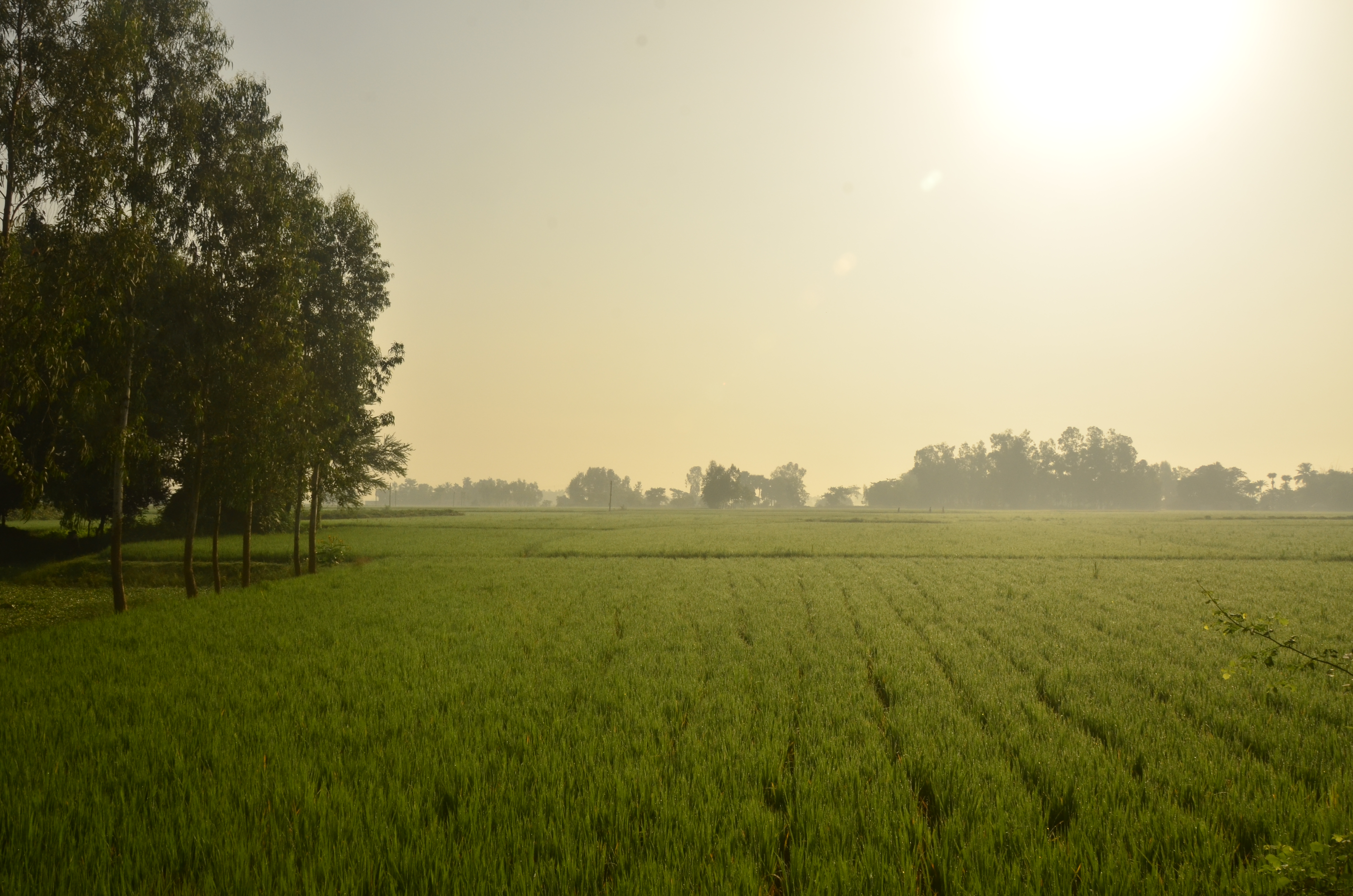
Kunur River, one of the main tributaries of the Ajay, in length, has its origin near Bansgara in the Faridpur police station area. With water from several small streams swelling it during the monsoons, it often floods large areas of the Ausgram community blocks and Mangalkot police stations of Bardhaman district. It joins the Ajay near Ujani village. Archaeology Microlith A microlith is a small Rock (geology), stone tool usually made of flint or chert and typically a centimetre or so in length and half a centimetre wide. They were made by humans from around 35,000 to 3,000 years ago, across Europe, Africa, Asia an ...s of crystalline stone and petrified wood from about 1250–1000 BC are found in many places in the Ajay-Kunur- Kopai river system. References Rivers of West Bengal Rivers of India {{India-river-stub ... [...More Info...] [...Related Items...] OR: [Wikipedia] [Google] [Baidu] |
India
India, officially the Republic of India (Hindi: ), is a country in South Asia. It is the seventh-largest country by area, the second-most populous country, and the most populous democracy in the world. Bounded by the Indian Ocean on the south, the Arabian Sea on the southwest, and the Bay of Bengal on the southeast, it shares land borders with Pakistan to the west; China, Nepal, and Bhutan to the north; and Bangladesh and Myanmar to the east. In the Indian Ocean, India is in the vicinity of Sri Lanka and the Maldives; its Andaman and Nicobar Islands share a maritime border with Thailand, Myanmar, and Indonesia. Modern humans arrived on the Indian subcontinent from Africa no later than 55,000 years ago., "Y-Chromosome and Mt-DNA data support the colonization of South Asia by modern humans originating in Africa. ... Coalescence dates for most non-European populations average to between 73–55 ka.", "Modern human beings—''Homo sapiens''—originated in Africa. Then, int ... [...More Info...] [...Related Items...] OR: [Wikipedia] [Google] [Baidu] |
West Bengal
West Bengal (, Bengali: ''Poshchim Bongo'', , abbr. WB) is a state in the eastern portion of India. It is situated along the Bay of Bengal, along with a population of over 91 million inhabitants within an area of . West Bengal is the fourth-most populous and thirteenth-largest state by area in India, as well as the eighth-most populous country subdivision of the world. As a part of the Bengal region of the Indian subcontinent, it borders Bangladesh in the east, and Nepal and Bhutan in the north. It also borders the Indian states of Odisha, Jharkhand, Bihar, Sikkim and Assam. The state capital is Kolkata, the third-largest metropolis, and seventh largest city by population in India. West Bengal includes the Darjeeling Himalayan hill region, the Ganges delta, the Rarh region, the coastal Sundarbans and the Bay of Bengal. The state's main ethnic group are the Bengalis, with the Bengali Hindus forming the demographic majority. The area's early history featured a succession ... [...More Info...] [...Related Items...] OR: [Wikipedia] [Google] [Baidu] |
Guskara
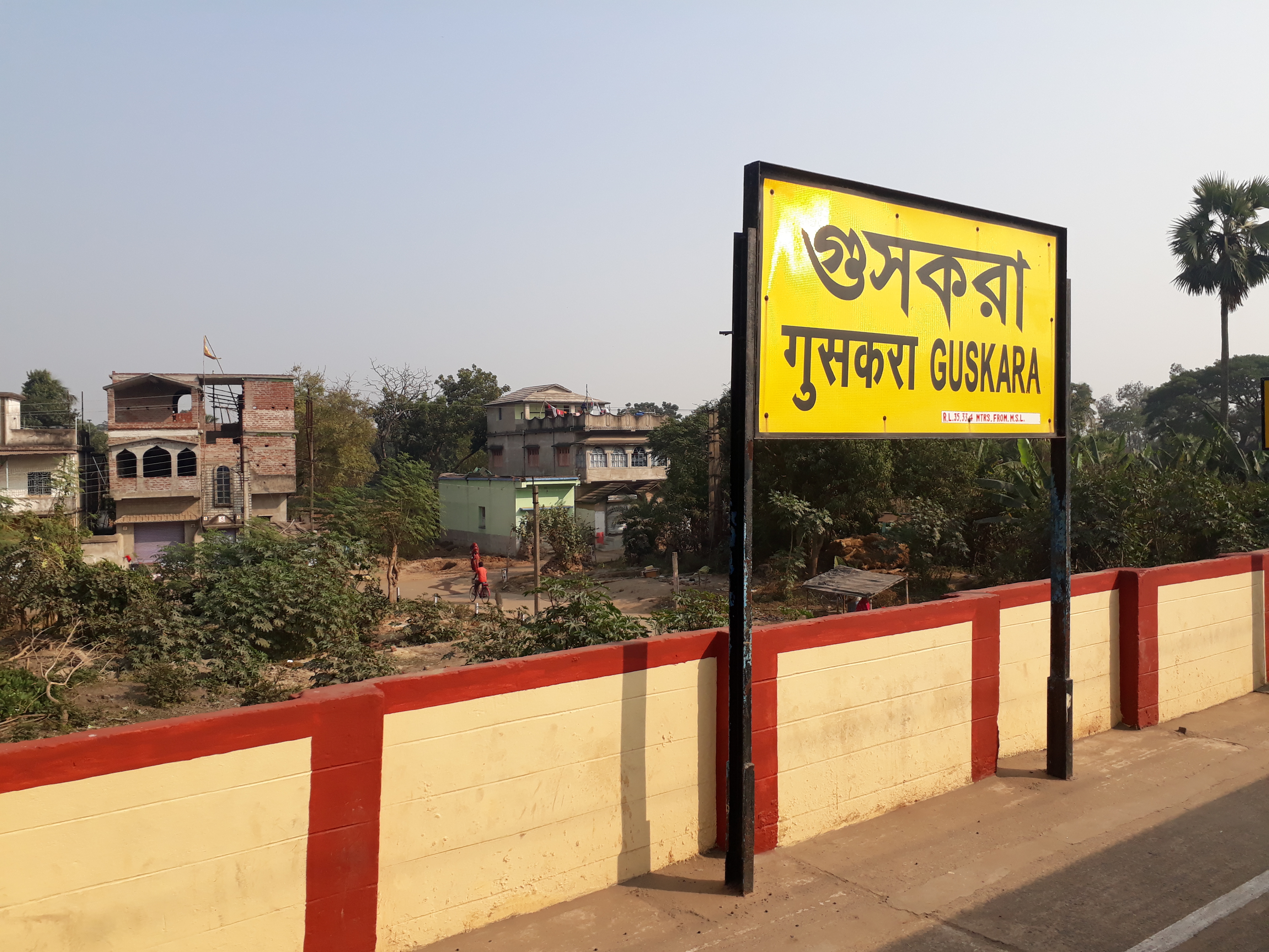
Guskara is a town and a municipality under the Ausgram police station in Bardhaman Sadar North subdivision of Purba Bardhaman district in the Indian state of West Bengal. History The area between the Damodar and Ajay was previously known as Gopbhum. Geography Location Guskara is located at . It has an average elevation of 38 metres (125 feet). Guskara is located in the alluvial flood plains of several rivers. Kunur River flows past it. Urbanisation 73.58% of the population of Bardhaman Sadar North subdivision lives in rural areas. Only 26.42% of the population lives in urban areas, and that is the highest proportion of urban population amongst the four subdivisions in Purba Bardhaman district. The map alongside presents some of the notable locations in the subdivision. All places marked in the map are linked in the larger full-screen map. Guskara Airfield Guskara Airfield is a former wartime United States Army Air Forces airfield in India used during the Bur ... [...More Info...] [...Related Items...] OR: [Wikipedia] [Google] [Baidu] |
Ajay River
Ajay (/ˈədʒɑɪ/) is a river which flows through the Indian states of Bihar, Jharkhand and West Bengal. The catchment area of Ajay River is . See also List of rivers of India This is a list of rivers of India, starting in the west and moving along the Indian coast southward, then northward. Tributary rivers are listed hierarchically in upstream order: the lower in the list, the more upstream. The overall discharge of r ... References * http://pib.nic.in/newsite/mbErel.aspx?relid=147477 {{Coord, 23, 39, N, 88, 08, E, display=title, region:IN_type:river_source:GNS-enwiki Rivers of Bihar Rivers of Jharkhand Rivers of West Bengal Rivers of India ... [...More Info...] [...Related Items...] OR: [Wikipedia] [Google] [Baidu] |
Faridpur, Durgapur
Durgapur Faridpur is a community development block that forms an administrative division in Durgapur subdivision of Paschim Bardhaman district in the Indian state of West Bengal. History Faridpur is an old village. The area was earlier densely forested. Some ancient Buddhist sculptures were discovered in the village of Pratapur under Faridpur police station. Peterson's Gazetteer of 1910 mentions five police stations under Asansol subdivision – Asansol, Raniganj, Kanksa, Barakar and Faridpur. Geography Laudoha, a constituent gram panchayat of Durgapur-Faridpur CD Block, is located at . The southern part of Durgapur Faridpur CD Block is part of the Ajay Damodar Barakar tract. This area is sort of an extension of the Chota Nagpur Plateau. It is a rocky undulating area with laterite soil, with the Ajay on the north, the Damodar on the south and the Barakar on the west. The northern part of the CD Block is part of the Kanksa Ketugram plain. For ages the area was heavily fore ... [...More Info...] [...Related Items...] OR: [Wikipedia] [Google] [Baidu] |
Mangalkot
Mongalkote is a village in Mongalkote CD block in Katwa subdivision of Purba Bardhaman district in the state of West Bengal, India. History Mongalkote is an ancient place. In the Jataka tale (around 4th century BC) '' Vessantara'', the capital of Shivirattha kingdom was mentioned as a place called Jatuttara. In his publication ''Sibi Kings Vessantara, His Country and Cultural Heritage'', Aswini Kumar Choudhury has mentioned Jetuttara as being located at or near the present day Mangalkota, which was a flourishing place from the Gupta period to the Sena dynasty, but it rose to its greatest heights during Muslim rule. There are graves of five pirs, including Gholam Panjatan. Mosques were built by Danesh Mand and Hussain Shah. During the long Hindu and Buddhist periods, Mongalkote was obviously an important centre of activity. It is even thought that it had links with adjoining Gopbhum. However, not much is known about the period.Ghosh, Binoy, ''Paschim Banger Sanskriti'', , part ... [...More Info...] [...Related Items...] OR: [Wikipedia] [Google] [Baidu] |
Bardhaman District
Bardhaman district (, ; also spelled Burdwan or Barddhaman or Vardhaman) was a district in West Bengal. On 7 April 2017, the district was bifurcated into two districts: Purba Bardhaman and Paschim Bardhaman district. The headquarters of the district was Bardhaman, and it housed the cities of Asansol and Durgapur. Indian revolutionary Rashbehari Bose was born in village Subaldaha, Bardhaman district. Bengali poet Kumud Ranjan Mullick was born at Kogram and poet Kazi Nazrul Islam was born at Churulia in the same district. Notable persons like Prabhat Kumar Mukhopadhyay, Akshay Kumar Datta, Jatindranath Sengupta were also born in erstwhile Bardhaman district. It was the seventh most populous district in India (out of 640) at the time of bifurcation. Etymology Historians link the name of the district to the 24th and last Jain ''tirthankara'', Mahavira Vardhamana, who came to preach in the area. A Jain image is in the collection of Vidyasagar Mandir in the Midnapur town. A Jaina b ... [...More Info...] [...Related Items...] OR: [Wikipedia] [Google] [Baidu] |
Microlith
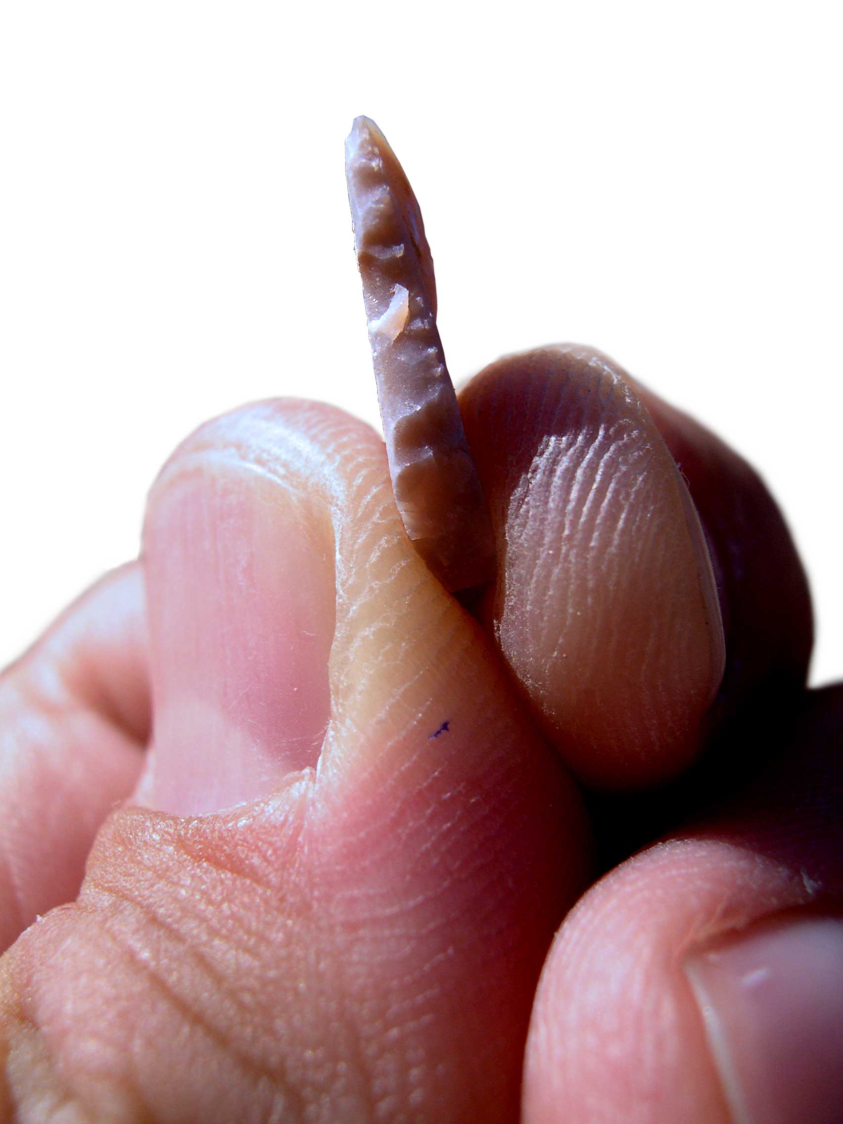
A microlith is a small Rock (geology), stone tool usually made of flint or chert and typically a centimetre or so in length and half a centimetre wide. They were made by humans from around 35,000 to 3,000 years ago, across Europe, Africa, Asia and Australia. The microliths were used in spear points and arrowheads. Microliths are produced from either a small blade (Microblade technology, microblade) or a larger blade-like piece of flint by abrupt or truncated retouch (lithics), retouching, which leaves a very typical piece of waste, called a microburin. The microliths themselves are sufficiently worked so as to be distinguishable from workshop waste or accidents. Two families of microliths are usually defined: laminar and geometric. An assemblage of microliths can be used to date an archeological site. Laminar microliths are slightly larger, and are associated with the end of the Upper Paleolithic and the beginning of the Epipaleolithic era; geometric microliths are characteristic ... [...More Info...] [...Related Items...] OR: [Wikipedia] [Google] [Baidu] |
Kopai River
The Kopai River (also called Sal River) is a tributary of the Bakreshwar River. It flows past such towns as Santiniketan, Bolpur, Kankalitala, Kirnahar and Labhpur in Birbhum district in the Indian state of West Bengal. It is a small river in dry season but overflows its banks during the monsoon. There is a village name Chhora (ছোড়া) beside this river. Also Nichinta (নিচিন্তা), Rupuspur (রুপুসপুর), Perua, (পেরুয়া) etc are depend on this river. Literary association The area around the river quite often has purple soil, which forms ravines on the river bank with weathering and is popular as the khoai. It has inspired literary figures in the area. It is described by Rabindranath Tagore as follows – : ''amader chhoto nadi chale banke bankebaisakh mase taar hantu jal thake'' ::Our small stream moves forward in bends and curvesIn the month of Baisakh it only has knee deep waters The local name of a sickle-shaped, channel l ... [...More Info...] [...Related Items...] OR: [Wikipedia] [Google] [Baidu] |
Rivers Of West Bengal
A river is a natural flowing watercourse, usually freshwater, flowing towards an ocean, sea, lake or another river. In some cases, a river flows into the ground and becomes dry at the end of its course without reaching another body of water. Small rivers can be referred to using names such as creek, brook, rivulet, and rill. There are no official definitions for the generic term river as applied to geographic features, although in some countries or communities a stream is defined by its size. Many names for small rivers are specific to geographic location; examples are "run" in some parts of the United States, "burn" in Scotland and northeast England, and "beck" in northern England. Sometimes a river is defined as being larger than a creek, but not always: the language is vague. Rivers are part of the water cycle. Water generally collects in a river from precipitation through a drainage basin from surface runoff and other sources such as groundwater recharge, springs, a ... [...More Info...] [...Related Items...] OR: [Wikipedia] [Google] [Baidu] |


