|
Krabi
Krabi ( th, กระบี่, ) is the main town in the province of Krabi (''thesaban mueang'') on the west coast of southern Thailand at the mouth of the Krabi River where it empties in Phang Nga Bay. As of 2020, the town had a population of 32,644. The town is the capital of Krabi Province and the 10 Krabi city sub-districts. Tourism is an important industry. Krabi is south of Bangkok by road. History At the start of the Rattanakosin period in the late eighteenth century, when the capital was finally settled at Bangkok, an elephant kraal was established in Krabi by order of Chao Phraya Nakhon (Noi), the governor of Nakhon Si Thammarat, which was by then a part of the Thai Kingdom. He sent his vizier, the Phra Palad, to oversee this task, which was to ensure a regular supply of elephants for the larger town. So many followers immigrated in the steps of the Phra Palad that soon Krabi had a large community in three different boroughs: Pakasai, Khlong Pon, and Pak Lao. In ... [...More Info...] [...Related Items...] OR: [Wikipedia] [Google] [Baidu] |
Krabi Airport
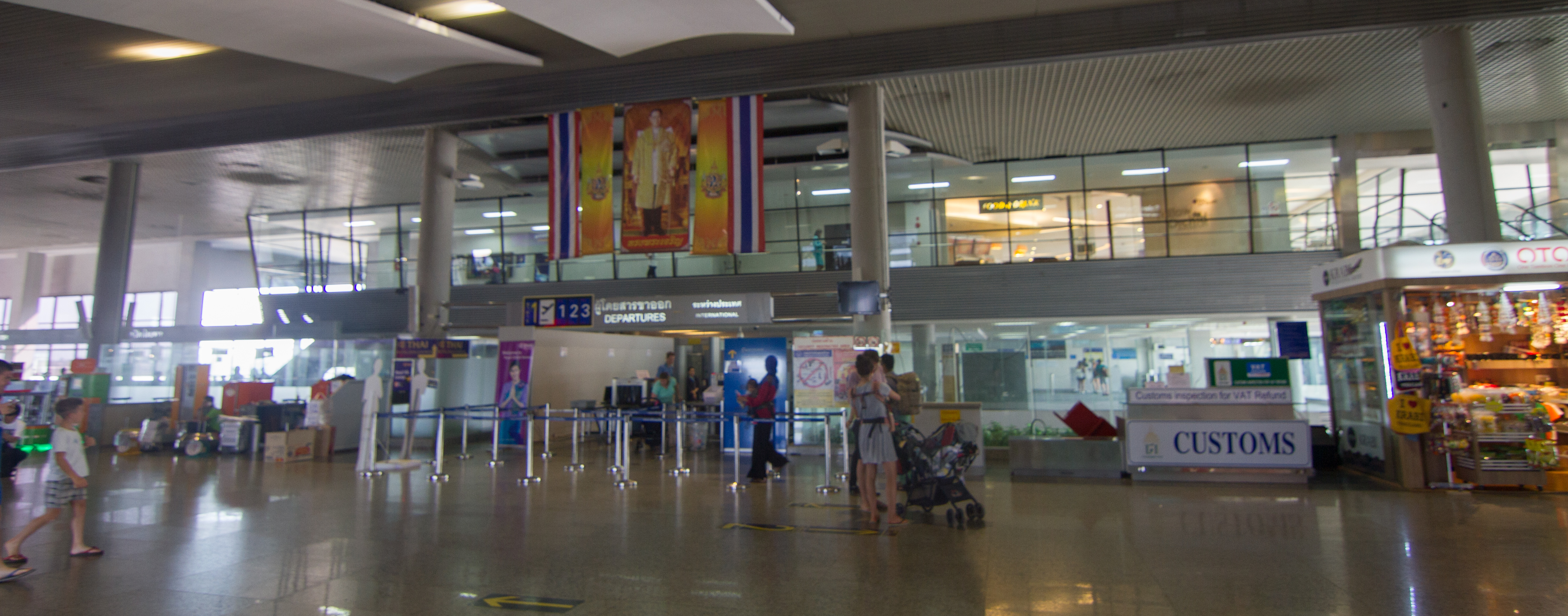
Krabi International Airport ( th, ท่าอากาศยานนานาชาติกระบี่ , is an international airport serving Krabi Province, Krabi, Thailand. It is about east of the city center. The airport opened in 1999. In 2017, the airport handled over 4.3 million passengers. The terminal is designed for three million passengers, a number that has already been exceeded, and expansion will push its capacity to over 8 million. Airport operations On 10 February 2016 the Krabi Airport terminal was plunged into darkness for over six hours (09:00–15:30) due to an electrical power outage. The Provincial Electricity Authority (PEA) had notified Krabi Airport two days in advance that it would shut down power in the area for maintenance. Airport authorities activated back-up generators, but they did not work. Krabi's airport director stated after the event that management will rent generators in the future to prevent blackouts from happening. With no power f ... [...More Info...] [...Related Items...] OR: [Wikipedia] [Google] [Baidu] |
Phi Phi Islands
The Phi Phi Islands ( th, หมู่เกาะพีพี, , ) are an island group in Thailand between the large island of Phuket and the Straits of Malacca coast of Thailand. The islands are administratively part of Krabi Province. Ko Phi Phi Don ( th, เกาะพีพีดอน, ) (''ko'' th, เกาะ 'island') is the largest and most populated island of the group, although the beaches of the second largest island, Ko Phi Phi Le ( th, เกาะพีพีเล, ) are visited by many people as well. The rest of the islands in the group, including Bida Nok, Bida Nai, and Bamboo Island ( Ko Mai Phai), are not much more than large limestone rocks jutting out of the sea. The islands are reachable by speedboats or long-tail boats most often from Krabi town or from piers in Phuket Province. Phi Phi Don was initially populated by Thai Malays fishermen during the late-1940s, and later became a coconut plantation. The resident Thai population of Phi Phi Don re ... [...More Info...] [...Related Items...] OR: [Wikipedia] [Google] [Baidu] |
Ko Phi Phi
The Phi Phi Islands ( th, หมู่เกาะพีพี, , ) are an island group in Thailand between the large island of Phuket and the Straits of Malacca coast of Thailand. The islands are administratively part of Krabi Province. Ko Phi Phi Don ( th, เกาะพีพีดอน, ) (''ko'' th, เกาะ 'island') is the largest and most populated island of the group, although the beaches of the second largest island, Ko Phi Phi Le ( th, เกาะพีพีเล, ) are visited by many people as well. The rest of the islands in the group, including Bida Nok, Bida Nai, and Bamboo Island ( Ko Mai Phai), are not much more than large limestone rocks jutting out of the sea. The islands are reachable by speedboats or long-tail boats most often from Krabi town or from piers in Phuket Province. Phi Phi Don was initially populated by Thai Malays fishermen during the late-1940s, and later became a coconut plantation. The resident Thai population of Phi Phi Don remain ... [...More Info...] [...Related Items...] OR: [Wikipedia] [Google] [Baidu] |
Ko Lanta
Ko Lanta ( th, เกาะลันตา, ) is a district (''amphoe'') in Krabi province, Thailand. History The district was established in December 1901. It consists of four island groups: Mu Ko Lanta (170 km2), Mu Ko Klang (162 km2), Mu Ko Rok (3.5 km2), and Mu Ko Ngai (3.6 km2). Other island groups are smaller, like Mu Ko Haa. The origin of the name is unclear, but it may originate from the Javanese word ''lantas'', meaning a type of grill for fish. The name of the island was officially changed to ''Lanta'' in 1917. It is believed that the area was one of the oldest communities in Thailand, dating back to the prehistoric period. It is believed that this province may have taken its name after the meaning of ''Krabi'', which means 'sword'. This may have stemmed from a legend that an ancient sword was unearthed prior to the city's founding. Geography The district, approximately 70 km from Krabi town, consists of three major islands. The fir ... [...More Info...] [...Related Items...] OR: [Wikipedia] [Google] [Baidu] |
Krabi River
The Krabi River ( th, แม่น้ำกระบี่, , ) is a river in Southern Thailand. The Krabi river is 5 kilometres long, as it is the main channel within a larger estuary to the Andaman Sea. The other two main channels are the Yuan River to the south and Chi Lat Chi or CHI may refer to: Greek *Chi (letter), the Greek letter (uppercase Χ, lowercase χ); Chinese * ''Chi'' (length) (尺), a traditional unit of length, about ⅓ meter *Chi (mythology) (螭), a dragon *Chi (surname) (池, pinyin: ''chí'' ... to the west. The 31 km upper stretch of the river are named ''Khlong Krabi Yai'', which originates at the Phanom mountain. The estuary of the Krabi river is listed as Ramsar wetland number 1100 since July 5 2001. The protected area of 213 km² covers more than 100 km² of mangrove forests and 12 km² of up to 2 km wide tidal mudflats. The area is popular with birdwatchers coming to spot some of the most diverse and rare species in the world, the masked fi ... [...More Info...] [...Related Items...] OR: [Wikipedia] [Google] [Baidu] |
Ko Lanta National Park
Mu Ko Lanta National Park ( th, อุทยานแห่งชาติหมู่เกาะลันตา) is a national park in the southern part of Krabi Province, Thailand, consisting of several islands. The two largest islands are Ko Lanta Noi and Ko Lanta Yai. Although both are inhabited, Ko Lanta Yai is the primary tourist destination. The park was established on 15 August 1990 A clan of Chao Ley, or "sea gypsies" lives on Ko Lanta Yai. The clan still practices many of their ancient customs and ceremonies, such as the setting of ceremonial boats adrift to bring good luck and prosperity on the full moon nights of the sixth and eleventh months. Toponymy Ko Lanta was once known by its Malay name, "Pulao Satak", which means "Long Beach Island". Later, many Thais, both Buddhist and Muslim, moved to the island making the island known as the island of "a million eyes" ("lan ta" in Thai). The name may also be derived from the Javanese "lan-tas", or fish grill (built ... [...More Info...] [...Related Items...] OR: [Wikipedia] [Google] [Baidu] |
Ao Nang
Ao Nang ( th, อ่าวนาง, ) is a resort town and one of the ten subdistricts (tambon) of Mueang Krabi District, Krabi, Thailand. Geography Ao Nang is a central point of the coastal province of Krabi, Thailand Thailand ( ), historically known as Siam () and officially the Kingdom of Thailand, is a country in Southeast Asia, located at the centre of the Indochinese Peninsula, spanning , with a population of almost 70 million. The country is b .... The town consists chiefly of a main street, which is dominated by restaurants, pubs, shops and other commerce aimed at tourists. The main beach is used by sunbathers to a certain extent, but there are a large number of long-tail boats which offer access to other beaches on the mainland and on nearby islands. Environmental issues Ao Nang has a wastewater treatment plant that is able to handle about 3,000 m3 of wastewater per day, not nearly enough, according to Ao Nang Administrative Organization (''Or Bor Tor'') ... [...More Info...] [...Related Items...] OR: [Wikipedia] [Google] [Baidu] |
Khao Phanom Bencha National Park
Khao Phanom Bencha National Park ( th, อุทยานแห่งชาติเขาพนมเบญจา) is a national park in Krabi Province, Thailand. The park is named for Khao Phanom Bencha mountain and protects an area of virgin rainforest and rare wildlife. Geography Khao Phanom Bencha is north of Krabi town and encompasses parts of Krabi, Khao Phanom and Ao Luek districts. The park's area is 31,325 rai ~ and reaches its highest point at the peak of Khao Phanom Bencha, part of a mountain range running north to south. Attractions The park has numerous large waterfalls, including Huai To Falls, a waterfall of five cascades and a height of . Nearby Huai Sakhe Falls is a waterfall of three cascades. Khao Pheung is a cave featuring stalactites and stalagmites. The Khao Phanom Bencha mountain peak is thickly forested and climbable on a multi-day trek. Flora and fauna The park's forest includes such tree species as teak, takian, '' Dipterocarpus alatus'', '' ... [...More Info...] [...Related Items...] OR: [Wikipedia] [Google] [Baidu] |
Railay Beach
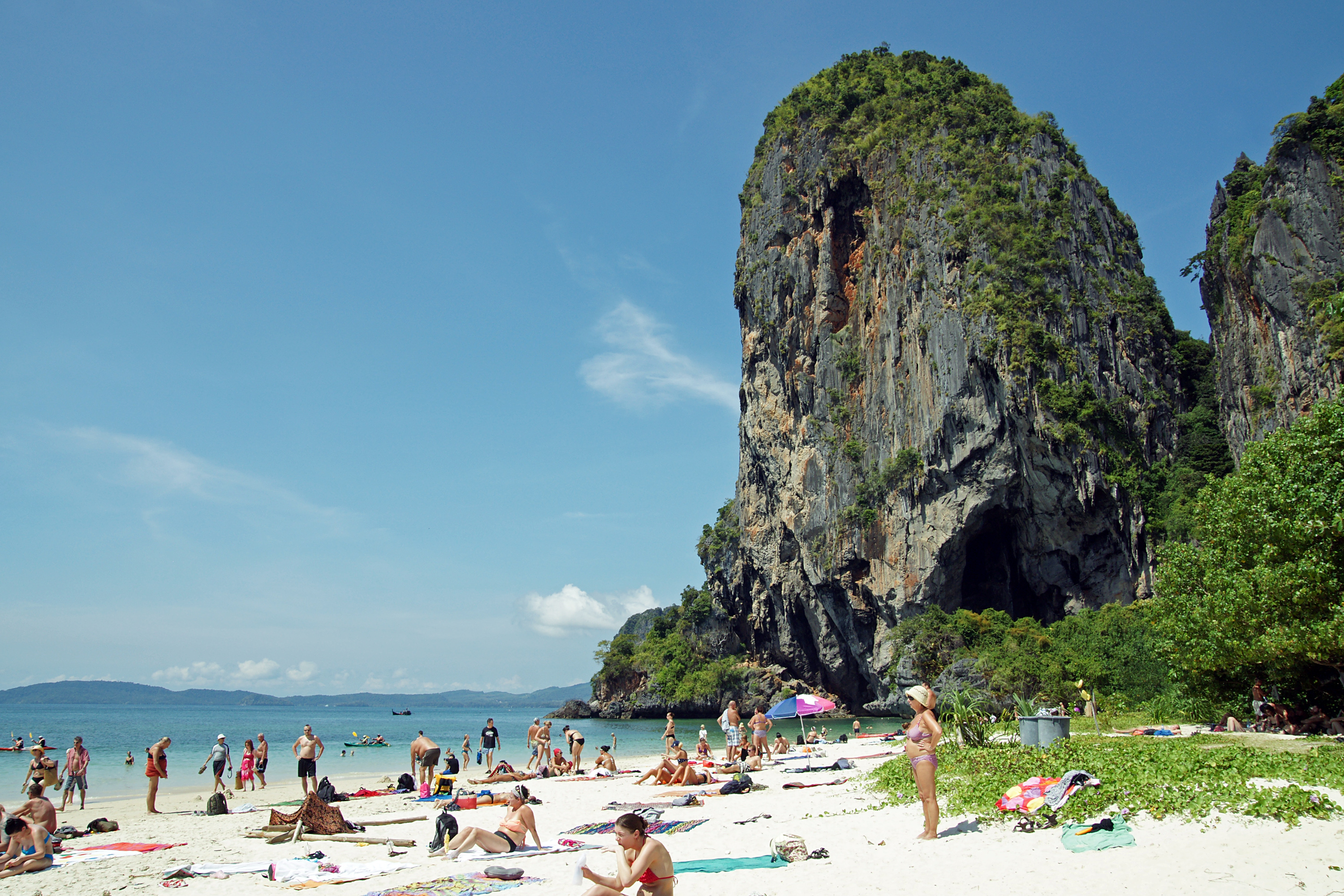
Railay ( th, ไร่เลย์, ), also known as Rai Leh, is a small peninsula between the city of Krabi and Ao Nang in Thailand. It is accessible only by boat due to high limestone cliffs cutting off mainland access. These cliffs attract rock climbers from all over the world, but the area is also popular due to its beautiful beaches and quiet relaxing atmosphere. Accommodation ranges from bungalows and medium-priced resorts in East Railay to a collection of luxury resorts focused on West Railay, though one, Royavadee, spans both waterfronts and also has a beachfront restaurant at Ao Phra Nang. The four main areas of Railay consist of Phra Nang, West Railay, East Railay, and Ton Sai. Ton Sai caters to climbers and the backpacker set and is more rustic than the glitz of West Railay and the shops and restaurants of the East Railay boardwalk. Railay beach was not severely affected by the tsunami of 26 December 2004. East Railay East Railay Beach is the docking point for boats ... [...More Info...] [...Related Items...] OR: [Wikipedia] [Google] [Baidu] |
Moken People
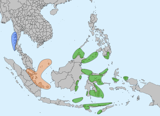
The Moken (also ''Mawken or'' ''Morgan''; ; th, ชาวเล, lit=sea people, translit=chao le) are an Austronesian people of the Mergui Archipelago, a group of approximately 800 islands claimed by both Myanmar and Thailand. Most of the 2,000 to 3,000 Moken live a semi-nomadic hunter-gatherer lifestyle heavily based on the sea, though this is increasingly under threat. The Moken identify in a common culture; there are 1500 men and 1500 women who speak the Moken language, a distinct Austronesian language. Attempts by both Myanmar and Thailand to assimilate the Moken into the wider regional culture have met with very limited success. However, the Moken face an uncertain future as their population decreases and their nomadic lifestyle and unsettled legal status leave them marginalized by modern property and immigration laws, maritime conservation and development programs, and tightening border policies. Nomenclature The people refer to themselves as Moken. The name is used ... [...More Info...] [...Related Items...] OR: [Wikipedia] [Google] [Baidu] |
Ko Phi Phi Don
Ko Phi Phi Don ( th, เกาะพีพีดอน, , ) is the largest of the islands in the Ko Phi Phi archipelago, in Thailand. Phi Phi Don is 9.73 km2 (3.76 mi2): 8 kilometres (5.0 miles) in length and 3.5 kilometres (2.2 miles) wide. Part of the islands are administratively part of Ao Nang in Krabi Province. It is the only island in the group with permanent inhabitants, although most are temporary workers servicing the tourist trade. Like the other islands in the archipelago, Phi Phi Don is a non-volcanic island largely made of limestone. It is almost separated into two islands, but a strand of flat land connects them. On this strand lies the largest settlement on the island, as well as most of the resorts. Villages *Ban Laem Tong * Laem Tong *Ban Ton Sai *Hat Yao 2004 tsunami More than 1,000 people died 26 December 2004 when a tsunami struck the island. Lohdalum Bay was hit the hardest, with the majority of the bungalows and restaurants along the beach de ... [...More Info...] [...Related Items...] OR: [Wikipedia] [Google] [Baidu] |
Phuket Province
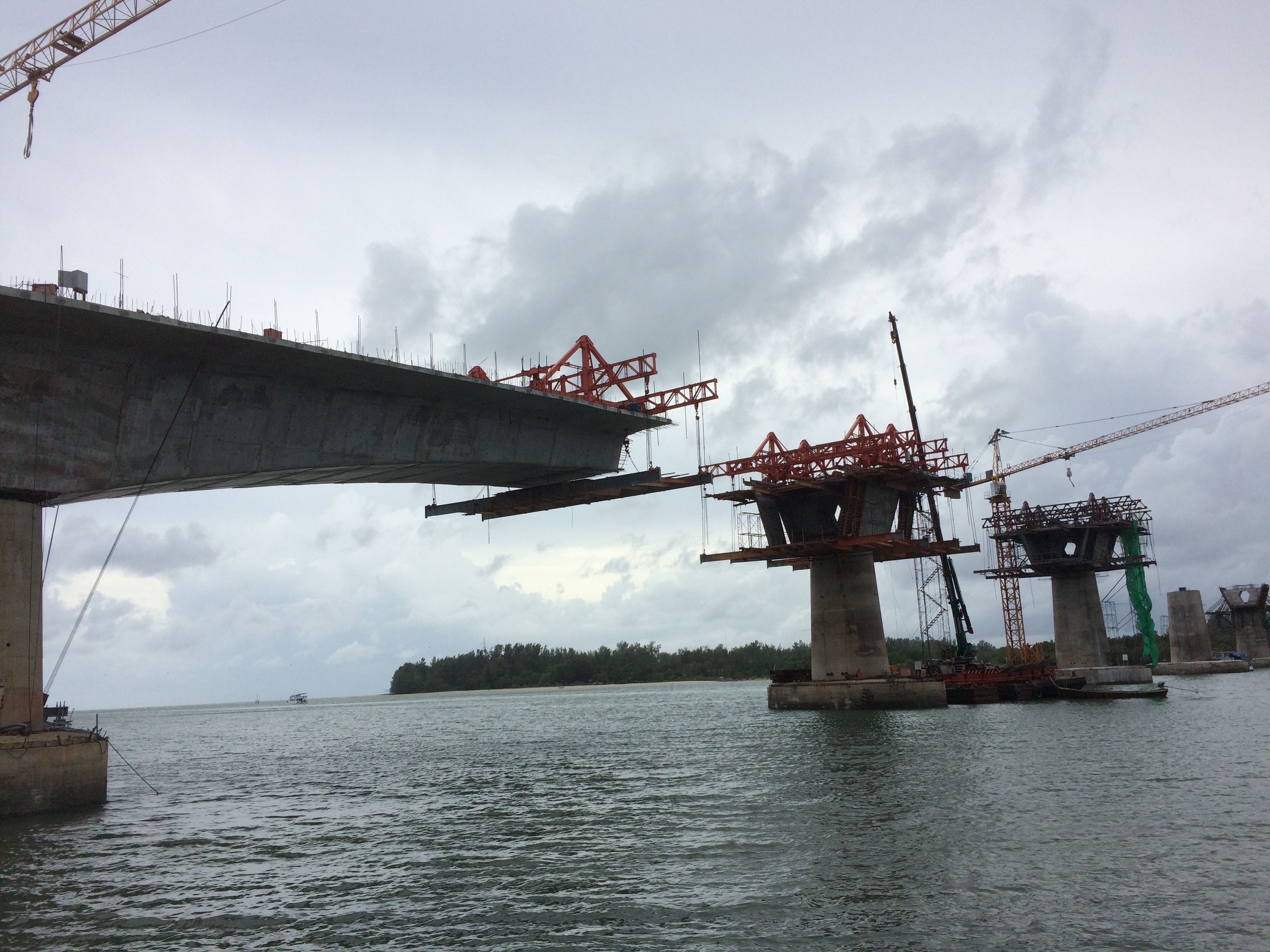
Phuket (; th, ภูเก็ต, , ms, Bukit or ''Tongkah''; Hokkien:普吉; ) is one of the southern provinces (''changwat'') of Thailand. It consists of the island of Phuket, the country's largest island, and another 32 smaller islands off its coast. It lies off the west coast of mainland Thailand in the Andaman Sea. Phuket Island is connected by the Sarasin Bridge to Phang Nga province to the north. The next nearest province is Krabi, to the east across Phang Nga Bay. Phuket province has an area of , somewhat less than that of Singapore, and is the second-smallest province of Thailand. The island was on one of the major trading routes between India and China, and was frequently mentioned in foreign ships' logs of Portuguese, French, Dutch, and English traders, but was never colonised by a European power. It formerly derived its wealth from tin and rubber and now from tourism. Toponymy There are several possible derivations of the relatively recent name "Phuket" ... [...More Info...] [...Related Items...] OR: [Wikipedia] [Google] [Baidu] |


.jpg)