|
Kosmosdale, Louisville
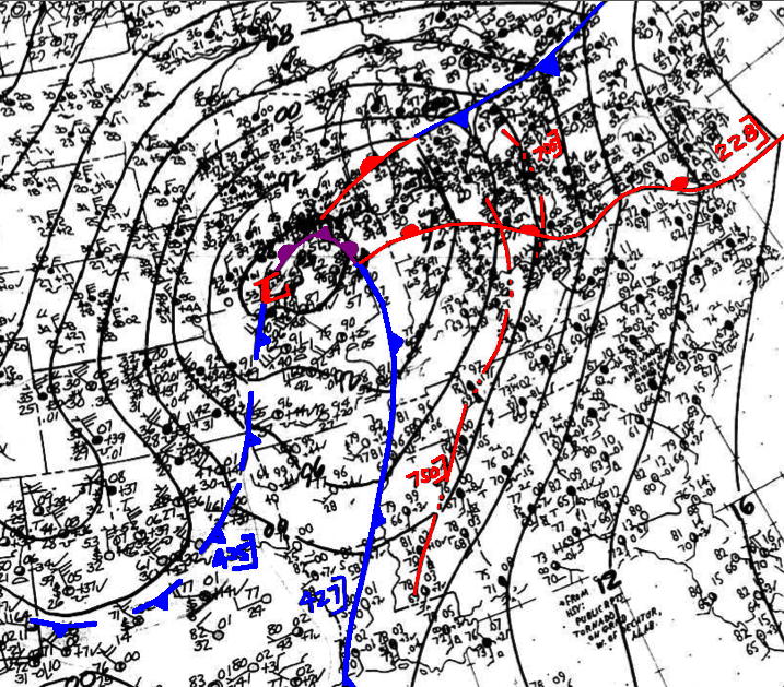
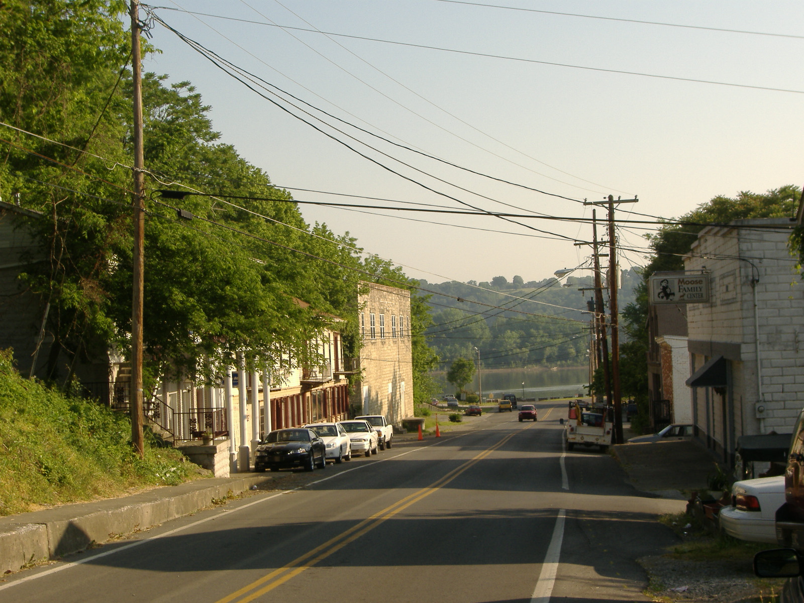
Kosmosdale is a neighborhood in southwestern Louisville, Kentucky located along Dixie Highway (US 31W) near Depot Lane and is named after the Kosmos Cement Company. The Kosmos Cement Company was purchased by the Flintkote Corporation in 1957 and operated as a Division of Flintkote for many years. It is now operated by Eagle Materials Inc. after being purchased from CEMEX USA in 2020. An F4 tornado formed in the southwest part of Jefferson County near this area on April 3, 1974, during the Super Outbreak. It took three lives, but injured two hundred and seven Louisville citizens. This storm derived from the same supercell that formed the F5 tornado in Brandenburg. Geography Kosmosdale is located at . References # External links "Kosmosdale: Cement Firm Became Center of Workers' Universe, Offering Places to Live, Learn, Heal and Shop"— Article by Linda Lyly of ''The Courier-Journal ''The Courier-Journal'', also known as the ''Louisville Courier Journal'' (and i ... [...More Info...] [...Related Items...] OR: [Wikipedia] [Google] [Baidu] |
Louisville, Kentucky
Louisville ( , , ) is the largest city in the Commonwealth of Kentucky and the 28th most-populous city in the United States. Louisville is the historical seat and, since 2003, the nominal seat of Jefferson County, on the Indiana border. Named after King Louis XVI of France, Louisville was founded in 1778 by George Rogers Clark, making it one of the oldest cities west of the Appalachians. With nearby Falls of the Ohio as the only major obstruction to river traffic between the upper Ohio River and the Gulf of Mexico, the settlement first grew as a portage site. It was the founding city of the Louisville and Nashville Railroad, which grew into a system across 13 states. Today, the city is known as the home of boxer Muhammad Ali, the Kentucky Derby, Kentucky Fried Chicken, the University of Louisville and its Cardinals, Louisville Slugger baseball bats, and three of Kentucky's six ''Fortune'' 500 companies: Humana, Kindred Healthcare, and Yum! Brands. Muhamm ... [...More Info...] [...Related Items...] OR: [Wikipedia] [Google] [Baidu] |
US 31W (KY)
U.S. Route 31W (US 31W) is the westernmost of two parallel routes for U.S. Route 31 from Nashville, Tennessee to Louisville, Kentucky. At one time, it split with U.S. Route 31E at Sellersburg, Indiana, crossing into nearby Louisville via the Kentucky & Indiana Terminal Bridge. Tennessee State Route 41 (SR 41) is its unsigned companion route in Tennessee. During the December 2021 tornado outbreak, an EF-3 tornado devastated stretches of US 31W in Bowling Green, Kentucky. Route description US 31W begins in Nashville, at an interchange with Ellington Parkway and US 31 and US 31E. The route continues west as Spring Street, concurrent with US 41/ US 431/ SR 11. The four highways continue north onto Dickerson Pike, closely paralleling Interstate 24 (I-24) through Nashville. At an intersection with Trinity Lane, all the routes but US 41 and SR 11 split from US 31W and continue west, while US 31W continues north, away from I-2 ... [...More Info...] [...Related Items...] OR: [Wikipedia] [Google] [Baidu] |
Cemex
CEMEX S.A.B. de C.V., known as Cemex, is a Mexican multinational building materials company headquartered in San Pedro, near Monterrey, Mexico. It manufactures and distributes cement, ready-mix concrete and aggregates in more than 50 countries. In 2020 it was ranked as the 5th largest cement company (by amount of cement produced annually) in the world, at 87.09 million tonnes. Lorenzo Zambrano was the chairman and chief executive officer until his death on May 21, 2014. The Board of Directors named Rogelio Zambrano Lozano as chairman, and Fernando A. Gonzalez as CEO. About a quarter of the company's sales come from its Mexico operations, a third from its plants in the U.S., 30% from its operations in Europe, North Africa, the Middle East and Asia, and the rest from its other plants around the world. CEMEX currently operates on four continents, with 64 cement plants, 1,348 ready-mix-concrete facilities, 246 quarries, 269 distribution centers and 68 marine terminals. In the 20 ... [...More Info...] [...Related Items...] OR: [Wikipedia] [Google] [Baidu] |
Fujita Scale
The Fujita scale (F-Scale; ), or Fujita–Pearson scale (FPP scale), is a scale for rating tornado intensity, based primarily on the damage tornadoes inflict on human-built structures and vegetation. The official Fujita scale category is determined by meteorologists and engineers after a ground or aerial damage survey, or both; and depending on the circumstances, ground-swirl patterns (cycloidal marks), weather radar data, witness testimonies, media reports and damage imagery, as well as photogrammetry or videogrammetry if motion picture recording is available. The Fujita scale was replaced with the Enhanced Fujita scale (EF-Scale) in the United States in February 2007. In April 2013, Canada adopted the EF-Scale over the Fujita scale along with 31 "Specific Damage Indicators" used by Environment Canada (EC) in their ratings. Background The scale was introduced in 1971 by Ted Fujita of the University of Chicago, in collaboration with Allen Pearson, head of the National Sev ... [...More Info...] [...Related Items...] OR: [Wikipedia] [Google] [Baidu] |
Tornado
A tornado is a violently rotating column of air that is in contact with both the surface of the Earth and a cumulonimbus cloud or, in rare cases, the base of a cumulus cloud. It is often referred to as a twister, whirlwind or cyclone, although the word cyclone is used in meteorology to name a weather system with a low-pressure area in the center around which, from an observer looking down toward the surface of the Earth, winds blow counterclockwise in the Northern Hemisphere and clockwise in the Southern. Tornadoes come in many shapes and sizes, and they are often visible in the form of a condensation funnel originating from the base of a cumulonimbus cloud, with a cloud of rotating debris and dust beneath it. Most tornadoes have wind speeds less than , are about across, and travel several kilometers (a few miles) before dissipating. The most extreme tornadoes can attain wind speeds of more than , are more than in diameter, and stay on the ground for more than 100 k ... [...More Info...] [...Related Items...] OR: [Wikipedia] [Google] [Baidu] |
Jefferson County, Kentucky
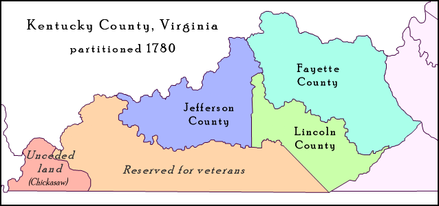
Jefferson County is located in the north central portion of the U.S. state of Kentucky. As of the 2020 census, the population was 782,969. It is the most populous county in the commonwealth (with more than twice the population of second ranked Fayette County). Since a city-county merger in 2003, the county's territory, population and government have been coextensive with the city of Louisville, which also serves as county seat. The administrative entity created by this merger is the Louisville/Jefferson County Metro Government, abbreviated to Louisville Metro. Jefferson County is the anchor of the Louisville-Jefferson County, KY-IN Metropolitan Statistical Area, locally referred to as Kentuckiana. History Jefferson County—originally Jefferson County, Virginia—was established by the Virginia General Assembly in June 1780, when it abolished and partitioned Kentucky County into three counties: Fayette, Jefferson and Lincoln. Named for Thomas Jefferson, who was governor ... [...More Info...] [...Related Items...] OR: [Wikipedia] [Google] [Baidu] |
1974 Super Outbreak
The 1974 Super Outbreak was the second-largest tornado outbreak on record for a single 24-hour period, just behind the 2011 Super Outbreak. It was also the most violent tornado outbreak ever recorded, with 30 F4/F5 tornadoes confirmed. From April 3 to 4, 1974, there were 148 tornadoes confirmed in 13 U.S. states and the Canadian province of Ontario. In the United States, tornadoes struck Illinois, Indiana, Michigan, Ohio, Kentucky, Tennessee, Alabama, Mississippi, Georgia, North Carolina, Virginia, West Virginia, and New York. The outbreak caused roughly $843 million USD (~equivalent to $4.58 billion in 2019) in damage, with more than $600 million (~equivalent to $3.3 billion in 2019) occurring in the United States. The outbreak extensively damaged approximately along a total combined path length of . At one point, as many as 15 separate tornadoes were on the ground simultaneously. The 1974 Super Outbreak was the first tornado outbreak in recorded history to produce more than ... [...More Info...] [...Related Items...] OR: [Wikipedia] [Google] [Baidu] |
Brandenburg, Kentucky
Brandenburg is a home rule-class city on the Ohio River in Meade County, Kentucky, in the United States. The city is southwest of Louisville. It is the seat of its county. The population was 2,643 at the 2010 census. History Brandenburg was built on a tract of land called Falling Springs, purchased in 1804 by Solomon Brandenburg. He opened a tavern around which the community grew. In 1825, the community became the seat of Meade County, but it wasn't formally incorporated by the state assembly until March 28, 1872. During the Civil War, Confederate General John Hunt Morgan crossed at Brandenburg to start his raid into Indiana in July, 1863. During the Battle of Brandenburg Crossing, two men on the Indiana side of the river were killed by cannon fire from Brandenburg. A Union gunship was deployed to block the crossing, but it ran out of ammunition and Morgan and his men were able to pass into Indiana. Brandenburg was devastated by an F5 tornado during the Super Outbreak o ... [...More Info...] [...Related Items...] OR: [Wikipedia] [Google] [Baidu] |
The Courier-Journal
''The Courier-Journal'', also known as the ''Louisville Courier Journal'' (and informally ''The C-J'' or ''The Courier''), is the highest circulation newspaper in Kentucky. It is owned by Gannett and billed as "Part of the ''USA Today'' Network". According to the ''1999 Editor & Publisher International Yearbook'', the paper is the 48th-largest daily paper in the United States. History Origins ''The Courier-Journal'' was created from the merger of several newspapers introduced in Kentucky in the 19th century. Pioneer paper ''The Focus of Politics, Commerce and Literature'', was founded in 1826 in Louisville when the city was an early settlement of less than 7,000 individuals. In 1830 a new newspaper, ''The Louisville Daily Journal'', began distribution in the city and, in 1832, absorbed ''The Focus of Politics, Commerce and Literature''. The ''Journal'' was an organ of the Whig Party, founded and edited by George D. Prentice, a New Englander who initially came to Kentu ... [...More Info...] [...Related Items...] OR: [Wikipedia] [Google] [Baidu] |
Meadow Lawn, Louisville
A meadow ( ) is an open habitat, or field, vegetated by grasses, herbs, and other non-woody plants. Trees or shrubs may sparsely populate meadows, as long as these areas maintain an open character. Meadows may be naturally occurring or artificially created from cleared shrub or woodland. They can occur naturally under favourable conditions (see perpetual meadows), but they are often maintained by humans for the production of hay, fodder, or livestock. Meadow habitats, as a group, are characterized as "semi-natural grasslands", meaning that they are largely composed of species native to the region, with only limited human intervention. Meadows attract a multitude of wildlife, and support flora and fauna that could not thrive in other habitats. They are ecologically important as they provide areas for animal courtship displays, nesting, food gathering, pollinating insects, and sometimes sheltering, if the vegetation is high enough. There are multiple types of meadows, incl ... [...More Info...] [...Related Items...] OR: [Wikipedia] [Google] [Baidu] |
Orell, Louisville
Orell is a neighborhood of Louisville, Kentucky centered along Dixie Highway (US 31W U.S. Route 31W (US 31W) is the westernmost of two parallel routes for U.S. Route 31 from Nashville, Tennessee to Louisville, Kentucky. At one time, it split with U.S. Route 31E at Sellersburg, Indiana, crossing into nearby Louisville via the Ke ...) and Orell Road. Geography Orell, Louisville is located at . References # Neighborhoods in Louisville, Kentucky {{JeffersonCountyKY-geo-stub ... [...More Info...] [...Related Items...] OR: [Wikipedia] [Google] [Baidu] |
Ohio River
The Ohio River is a long river in the United States. It is located at the boundary of the Midwestern and Southern United States, flowing southwesterly from western Pennsylvania to its mouth on the Mississippi River at the southern tip of Illinois. It is the third largest river by discharge volume in the United States and the largest tributary by volume of the north-south flowing Mississippi River that divides the eastern from western United States. It is also the 6th oldest river on the North American continent. The river flows through or along the border of six states, and its drainage basin includes parts of 14 states. Through its largest tributary, the Tennessee River, the basin includes several states of the southeastern U.S. It is the source of drinking water for five million people. The lower Ohio River just below Louisville is obstructed by rapids known as the Falls of the Ohio where the elevation falls in restricting larger commercial navigation, although in the 18th ... [...More Info...] [...Related Items...] OR: [Wikipedia] [Google] [Baidu] |


