|
Kongo-Wara Rebellion
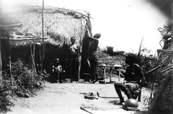
The Kongo-Wara rebellion, also known as the War of the Hoe Handle and the Baya War, was a rural, anticolonial rebellion in the former colonies of French Equatorial Africa and French Cameroon which began as a result of recruitment of the native population in railway construction and rubber tapping. It was a large colonial uprising but also among the least well-known uprisings during the interwar period. Much of the conflict took place in what is now part of the Central African Republic. Background Barka Ngainoumbey, known as Karnou (meaning "he who can change the world"), was a Gbaya religious prophet and healer from the Sangha River basin region. In 1924 he began preaching non-violent resistance against the French colonisers in response to the recruitment of natives in the construction of the Congo-Ocean Railway and rubber tapping, and mistreatment by European concessionary companies. Karnou also preached against Europeans and the Fula, who administered sections of Gbaya territory ... [...More Info...] [...Related Items...] OR: [Wikipedia] [Google] [Baidu] |
French Equatorial Africa
French Equatorial Africa (french: link=no, Afrique-Équatoriale française), or the AEF, was the federation of French colonial possessions in Equatorial Africa, extending northwards from the Congo River into the Sahel, and comprising what are today the countries of Chad, the Central African Republic, the Republic of the Congo, and Gabon. History Established in 1910, the Federation contained four (later five) colonial possessions: French Gabon, French Congo, Ubangi-Shari and French Chad. The Governor-General was based in Brazzaville with deputies in each territory. In 1911, France ceded parts of the territory to German Kamerun as a result of the Agadir Crisis. The territory was returned after Germany's defeat in World War I, while most of Cameroon proper became a French League of Nations mandate not integrated into the AEF. French Equatorial Africa, especially the region of Ubangi-Shari had a similar concession system as the Congo Free State and similar atrocities were a ... [...More Info...] [...Related Items...] OR: [Wikipedia] [Google] [Baidu] |
Vina (department)
Vina Department is a department (''département'') of the Adamawa Province in Cameroon. The department covers an area of 17,196 km and as of 2001 had a total population of 247,427. The capital of the department lies at Ngaoundéré. Subdivisions The department is divided administratively into 7 communes and in turn into villages. Communes # Belel # Mbe # Nganha # Ngaoundéré (urban) # Ngaoundéré (rural) # Nyambaka # Martap Martap is a town and commune in Cameroon.Dictionnaire des villages de l'Adamaoua', ONAREST, Yaoundé, October 1974, 133 p. See also *Communes of Cameroon The Arrondissements of Cameroon are the third-level units of administration in Cameroon. ... References Departments of Cameroon Adamawa Region {{Cameroon-geo-stub ... [...More Info...] [...Related Items...] OR: [Wikipedia] [Google] [Baidu] |
Sangha-Mbaéré
Sangha-Mbaéré is one of the 16 prefectures of the Central African Republic. Its capital is Nola Nola is a town and a municipality in the Metropolitan City of Naples, Campania, southern Italy. It lies on the plain between Mount Vesuvius and the Apennines. It is traditionally credited as the diocese that introduced bells to Christian wor .... ReferencesCentral African Republic at GeoHive Prefectures of the Central African Republic {{CentralAfricanRepublic-geo-stub ... [...More Info...] [...Related Items...] OR: [Wikipedia] [Google] [Baidu] |
Encyclopædia Britannica
The (Latin for "British Encyclopædia") is a general knowledge English-language encyclopaedia. It is published by Encyclopædia Britannica, Inc.; the company has existed since the 18th century, although it has changed ownership various times through the centuries. The encyclopaedia is maintained by about 100 full-time editors and more than 4,000 contributors. The 2010 version of the 15th edition, which spans 32 volumes and 32,640 pages, was the last printed edition. Since 2016, it has been published exclusively as an online encyclopaedia. Printed for 244 years, the ''Britannica'' was the longest running in-print encyclopaedia in the English language. It was first published between 1768 and 1771 in the Scottish capital of Edinburgh, as three volumes. The encyclopaedia grew in size: the second edition was 10 volumes, and by its fourth edition (1801–1810) it had expanded to 20 volumes. Its rising stature as a scholarly work helped recruit eminent ... [...More Info...] [...Related Items...] OR: [Wikipedia] [Google] [Baidu] |
Meiganga
Meiganga (Fula: Meiganga 𞤥𞤫𞤭𞤺𞤢𞤲𞤺𞤢) is a town in the Adamawa Province of Cameroon Cameroon (; french: Cameroun, ff, Kamerun), officially the Republic of Cameroon (french: République du Cameroun, links=no), is a country in west-central Africa. It is bordered by Nigeria to the west and north; Chad to the northeast; the C .... It is located at around . Its estimated population in 2012 is 41,314. References Populated places in Adamawa Region {{Cameroon-geo-stub ... [...More Info...] [...Related Items...] OR: [Wikipedia] [Google] [Baidu] |
Lokoti
Lokoti is a village in the Mbéré department of the Adamawa Region in Cameroon. The village is crossed by a tar-sealed road. Climate The climate is temperate with savannah vegetation. Infrastructure There is a high school for general education, a primary school, and a maternal school. The village also possesses a health centre. Demographics The population consists of Catholics and Muslims. Lokoti is administrated by a . The ethnic groups incled the Mambila The Mambilla or Mambila people of Nigeria live on the Mambilla Plateau (in 'Sardauna' local government area of Taraba State in Nigeria). A small fraction of Mambilla migrants left the Mambilla Plateau for the Ndom Plain (also known as northern Tik ... and the . Economy The economy is based on agriculture and motorcycle transport. References {{Portal, Cameroon Populated places in Adamawa Region ... [...More Info...] [...Related Items...] OR: [Wikipedia] [Google] [Baidu] |
Ngando People
The Ngando people (or Bongando, Ngandu) are Bantu subsistence farmers who live in eastern part of Équateur and the western part of Orientale province in the Democratic Republic of the Congo. Population The Bongado are a branch of the Mongo cluster, with an estimated population in 1990 of 450,000-500,000. They speak Longando in the village setting; almost all will also use the Lingala language in other settings. Longando is related to the Lalia language. Ethnologue reports that the Ngando live in the Maringa River area, north of Ikela Ikela is a market town in Tshuapa, Democratic Republic of Congo, lying on the Tshuapa River east of Boende. Founded by Belgium in the early twentieth century as a trading post, it became an important local centre. It is the headquarters of the ..., and had a population of 220,000 in 1995. Location and economy The Bongando live in the tropical rain forest of the Congo basin. Daily temperatures range from to and annual rainfall is abou ... [...More Info...] [...Related Items...] OR: [Wikipedia] [Google] [Baidu] |
Lobaye
Lobaye is one of the 16 prefectures of the Central African Republic. Its capital is Mbaïki. Emperor Duy Tân of Vietnam died here on December 26, 1945 in a plane crash. David Dacko, the first and third president of the Central African Republic from 1960-1965 and 1979–1981, was from Lobaye. Location The prefecture is located in the southern part of the country, bordering the Republic of the Congo and the Democratic Republic of the Congo. It shares borders with the prefectures of Mambéré-Kadéï to the northwest, Sangha-Mbaéré to the west, and Ombella-M'Poko to the northeast. It is named for the Lobaye River. Economy Besides Mbaïki, other important cities include Boda, in the north, and Mongoumba, by the Ubangi River. Most of the inhabitants are coffea ''Coffea'' is a genus of flowering plants in the family Rubiaceae. ''Coffea'' species are shrubs or small trees native to tropical and southern Africa and tropical Asia. The seeds of some species, called coffe ... [...More Info...] [...Related Items...] OR: [Wikipedia] [Google] [Baidu] |
Mambéré-Kadéï
Mambéré-Kadéï is one of the 16 prefectures of the Central African Republic. The prefecture covers 30,203 km2 and had a population of 289,688 as of the 2003 census, giving a population density of less than 10 inhabitants/km2. Its capital is Berbérati Berbérati is the second-largest city in the Central African Republic, with a population of 105,155(2013 census). Located in the south-west of the country near the border with Cameroon, it serves as capital of the Mambéré-Kadéï Prefecture and g .... Until 1992, it was known as Haute-Sangha. Sources Provinces of the CAR; lists name changes including Haute-Sangha Prefectures of the Central African Republic {{CentralAfricanRepublic-geo-stub ... [...More Info...] [...Related Items...] OR: [Wikipedia] [Google] [Baidu] |
Boda, Lobaye
Boda is a town located in the Central African Republic prefecture of Lobaye. History On 29 January 2014 Anti-balaka took control of Boda following Seleka withdrawal. In September 2016 Boda was declared to be free from rebel groups. In August 2017 it was reported that the town was under control of security forces following withdrawal of international forces three months before. On 18 December 2020 Boda was captured by rebels from Coalition of Patriots for Change The Coalition of Patriots for Change (''Coalition des patriotes pour le changement'') is a coalition of major rebel groups in the Central African Republic created in 2020 to disrupt the 2020–21 Central African general election. Background O .... It was recaptured by government forces on 24 January 2021. References Sub-prefectures of the Central African Republic Populated places in Lobaye {{CentralAfricanRepublic-geo-stub ... [...More Info...] [...Related Items...] OR: [Wikipedia] [Google] [Baidu] |
N'Délé
N'Délé or Ndele is a market town and sub prefecture in the north eastern Central African Republic, lying east of the Bamingui-Bangoran National Park. Ndélé is the capital of Bamingui-Bangoran, one of the 14 prefectures of the Central African Republic. N'Délé had a population of 10,850 as of the 2003 census; and a calculated 2013 population of 13,704. History The ''tata'', or fortified wall, creates a citadel-like palace on a hill overlooking N'Délé. It was constructed at the behest of Sultan Mohammed al-Sanussi of Dar al Kuti in the late 19th century. N'Délé, the ''tata'', and the Kaga-Kpoungouvou Caves were collectively added to the UNESCO World Heritage Tentative List on April 11, 2006, in the Cultural category. There is an airport in the city. When the fighting resumed in December 2012 between the FACA loyalists and the rebel coalition of Séléka, the city fell to rebel forces. In 2020 heavy clashes erupted in the city between ex-Séléka FPRC and RPRC groups ... [...More Info...] [...Related Items...] OR: [Wikipedia] [Google] [Baidu] |


