|
Komeutyuyam Range
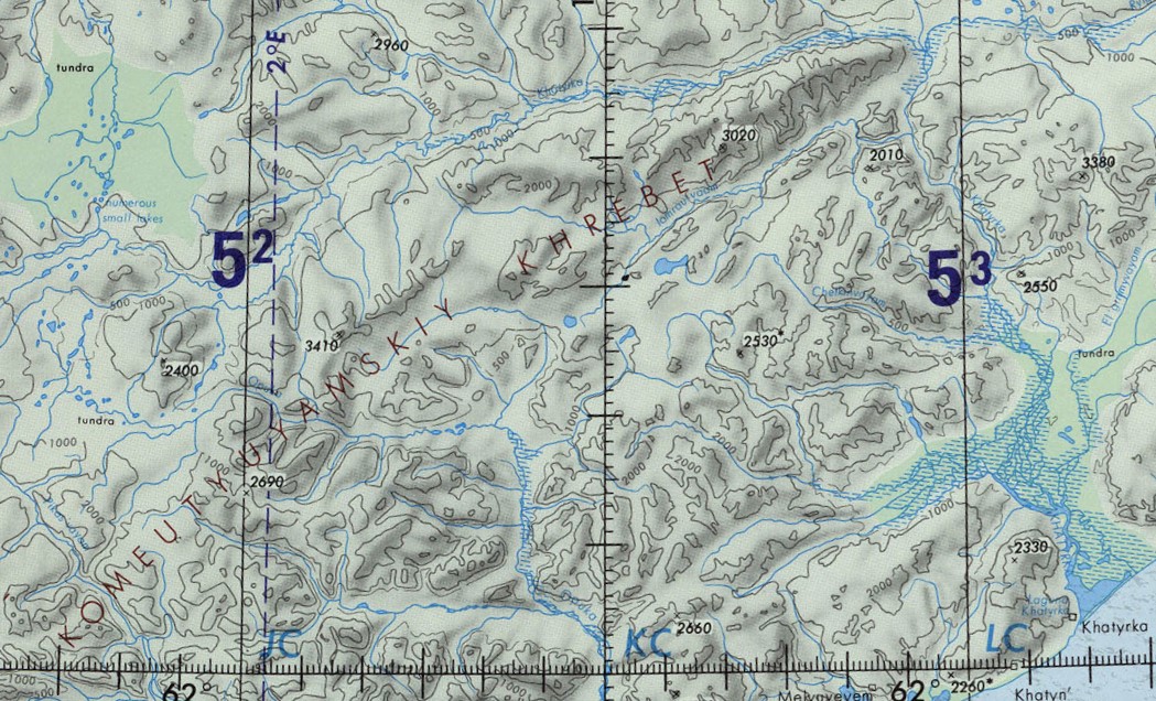
The Komeutyuyam Range (russian: Комеутюямский хребет; zh, 科梅乌秋亚姆斯基山) is a range of mountains in Chukotka Autonomous Okrug and Kamchatka Krai, Russian Far East. Administratively the northern section of the range belongs to the Anadyr District of Chukotka Autonomous Okrug, and the southern to Olyutorsky District of Kamchatka Krai.Google Earth Geography The Komeutyuyam Range is part of the Koryak Highland system. It stretches parallel to the Bering Sea coast, about inland, in a NE/SW direction between the western end of the Ukvushvuynen Range in the north and the Pikas Range in the south. The valley of the Pikasvayam, the largest tributary of the Ukelayat, marks its southern end. The highest point of the range is Mt Volokvyneitkon (гора Волоквынейткон) — or Mt Valvykvyneitkon (гора Валвыквынейткон), a high peak, located in the southwestern sector of the range, near the limit between Chukotka Auton ... [...More Info...] [...Related Items...] OR: [Wikipedia] [Google] [Baidu] |
Operational Navigation Chart
An aeronautical chart is a map designed to assist in the navigation of aircraft, much as nautical charts do for watercraft, or a roadmap does for drivers. Using these charts and other tools, pilots are able to determine their position, safe altitude, best route to a destination, navigation aids along the way, alternative landing areas in case of an in-flight emergency, and other useful information such as radio frequencies and airspace boundaries. There are charts for all land masses on Earth, and long-distance charts for trans-oceanic travel. Specific charts are used for each phase of a flight and may vary from a map of a particular airport facility to an overview of the instrument routes covering an entire continent (e.g., global navigation charts), and many types in between. Visual flight charts are categorized according to their scale, which is proportional to the size of the area covered by one map. The amount of detail is necessarily reduced when larger areas are represen ... [...More Info...] [...Related Items...] OR: [Wikipedia] [Google] [Baidu] |
Bering Sea
The Bering Sea (, ; rus, Бе́рингово мо́ре, r=Béringovo móre) is a marginal sea of the Northern Pacific Ocean. It forms, along with the Bering Strait, the divide between the two largest landmasses on Earth: Eurasia and The Americas. It comprises a deep water basin, which then rises through a narrow slope into the shallower water above the continental shelf, continental shelves. The Bering Sea is named for Vitus Bering, a Denmark, Danish navigator in Russian service, who, in 1728, was the first European to systematically explore it, sailing from the Pacific Ocean northward to the Arctic Ocean. The Bering Sea is separated from the Gulf of Alaska by the Alaska Peninsula. It covers over and is bordered on the east and northeast by Alaska, on the west by the Russian Far East and the Kamchatka Peninsula, on the south by the Alaska Peninsula and the Aleutian Islands and on the far north by the Bering Strait, which connects the Bering Sea to the Arctic Ocean's Chukchi ... [...More Info...] [...Related Items...] OR: [Wikipedia] [Google] [Baidu] |
List Of Mountains And Hills Of Russia ...
This is a list of mountains and hills of Russia. List by elevation Over 5000 meters 4000 to 4999 meters 3000 to 3999 meters 2000 to 2999 meters 1000 to 1999 meters Under 1000 metres See also *Highest points of Russian Federal subjects *List of Altai mountains *List of mountains in Mongolia *List of mountains in China *List of ultras of Northeast Asia *List of volcanoes in Russia *List of lakes of Russia Notes References External links Russia - Highest Mountainsfrom GeoNamesfrom World AtlasRussia mountainsfrom Peakery {{Russia topics Russia Russia Russia Mountains and hills Russia Russia Russia (, , ), or the Russian Federation, is a List of transcontinental countries, transcontinental country spanning Eastern Europe and North Asia, Northern Asia. It is the List of countries and dependencies by area, largest country in the ... [...More Info...] [...Related Items...] OR: [Wikipedia] [Google] [Baidu] |
Khatyrka Meteorite
Khatyrka (russian: метеорит Хатырка) is a meteorite found in 2011 in the valley of the Iomrautvaam, a tributary of the Khatyrka river, Chukotka Autonomous Okrug, Russian Far East. It is a CV3 (oxidized) chondrite meteorite. History The meteorite had fallen in the Iomrautvaam river basin at and was discovered during an expedition to Chukotka in July 2011. Nine small pieces were found, each less than 1 mm in size, buried in a 7,000-year-old layer of dirt. It was named Khatyrka meteorite.Звизда Т. В., Мануйлов А. А., Василенко А. М. ''Отчет о геологической съемке масштаба 1:50000 и поисках месторождений полезных ископаемых в бассейне нижнего течения р. Иомраутваам на территории листов Р-60-38-В,'' Г; 39-В. Анадырь, 1977. 221 с. Specimens Three representative fragments were deposited at the Department o ... [...More Info...] [...Related Items...] OR: [Wikipedia] [Google] [Baidu] |
Bering Tundra
The Bering tundra ecoregion (WWF ID: PA1102) is an ecoregion that covers a portion of northeastern Russia, between the Kolyma Mountains on the west, and the Bering Sea coast to the east. The area is an important stopping place for migratory birds. It has an area of . Location and description The ecoregion stretches approximately 1,000 km on alignment from southwest-to-northeast, between the Kolyma Mountains on the west, the Bering Sea coast to the east, and Kamchatka peninsula to the south. Climate The climate of Koryak is '' Humid continental climate, cool summer'' (Köppen climate classification (Dfc)). This climate is characterised by long cold winters (at least one month averaging below ), and short, cool summers (one to three months greater than , but no month averaging above ). Mean precipitation is about 358 mm/year. The mean temperature at the center of the ecoregion is in January, and in July. Flora and fauna The ecoregion supports flora and fa ... [...More Info...] [...Related Items...] OR: [Wikipedia] [Google] [Baidu] |
Khatyrka (river)
The Khatyrka (russian: Хатырка; ckt, Ватыркан) is a river in Chukotka Autonomous Okrug, Russia. The length of the river is and the area of is drainage basin . The name of the river comes from the Chukot ''"vatyrkan"'' ''(Ватыркан)'', meaning "dry, depleted place". Course The Khatyrka has its source in the Koryak Highlands. It first flows in an ENE direction along the northern slopes of the Komeutyuyam Range as a mountain river within a narrow valley. It bends to the SSE at the northeastern end of the range and the valley expands, the river dividing into channels. In its lower course it flows along a marshy floodplain. A stretch of the river forms the border with the Olyutorsky District of Kamchatka Krai. Its mouth is in an estuary that is separated by a narrow landspit from the Bering Sea. Khatyrka village lies at the mouth of the estuary. Google Earth Tributaries The main tributary of the Khatyrka is the long Iomrautvaam (Иомраутваам ... [...More Info...] [...Related Items...] OR: [Wikipedia] [Google] [Baidu] |
Iomrautvaam
The Iomrautvaam (russian: Иомраутваам; ckt, Емрауткенваам) is a river in Chukotka Autonomous Okrug, Russia. The length of the river is and the area of is drainage basin . The Iomrautvaam is the longest tributary of the Khatyrka river. Course The Iomrautvaam has its source in the Komeutyuyam Range of the Koryak Highlands. It flows in a roughly northeastern direction in the northern section of the range. Finally it meets the right bank of the Khatyrka from its mouth, close to the northeastern end of the ridge. Google Earth Khatyrka meteorite The Khatyrka meteorite, a unique-type of meteorite fell in the area of the Iomrautvaam river basin at . It was found during an expedition to Chukotka in the summer of 2011 buried in a 7,000-year-old layer of dirt and was named Khatyrka meteorite. Flora and fauna The river basin is characterized by tundra vegetation, including mosses, lichens, dwarf shrubs, and sedges.V. Yu. Neshataeva, ''Vegetation cover of ... [...More Info...] [...Related Items...] OR: [Wikipedia] [Google] [Baidu] |
USSR
The Soviet Union,. officially the Union of Soviet Socialist Republics. (USSR),. was a transcontinental country that spanned much of Eurasia from 1922 to 1991. A flagship communist state, it was nominally a federal union of fifteen national republics; in practice, both its government and its economy were highly centralized until its final years. It was a one-party state governed by the Communist Party of the Soviet Union, with the city of Moscow serving as its capital as well as that of its largest and most populous republic: the Russian SFSR. Other major cities included Leningrad (Russian SFSR), Kiev ( Ukrainian SSR), Minsk ( Byelorussian SSR), Tashkent (Uzbek SSR), Alma-Ata (Kazakh SSR), and Novosibirsk (Russian SFSR). It was the largest country in the world, covering over and spanning eleven time zones. The country's roots lay in the October Revolution of 1917, when the Bolsheviks, under the leadership of Vladimir Lenin, overthrew the Russian Provisional Gove ... [...More Info...] [...Related Items...] OR: [Wikipedia] [Google] [Baidu] |
Ukelayat
The Ukelayat (russian: Укэлаят; Koryak: Вуквылгаят) is a river in Kamchatka Krai, Russia. The length of the river is and the area of is drainage basin . The name of the river comes from the Koryak ''"vukvylgayat"'' ''(Вуквылгаят)'', meaning "rock/fall". Course The Ukelayat has its source in the Koryak Highlands. It is fed by glaciers of the northern slopes of the adjoining ranges. It flows roughly eastwards within a valley bound by the Pikas Range to the north and the Ukelayat Range to the south. The river divides into channels along its middle and lower course. Its mouth is in the small Dezhnyov Bay of the Bering Sea. Google Earth Its main tributary is the long Pikasvayam, joining it from the left about halfway through its course. Flora and fauna The river basin is characterized by tundra vegetation, including mosses, lichens, dwarf shrubs, and sedges.V. Yu. Neshataeva, ''Vegetation cover of the North of the Kamchatka Okrug (Kamchatsky Krai ... [...More Info...] [...Related Items...] OR: [Wikipedia] [Google] [Baidu] |
Pikas Range
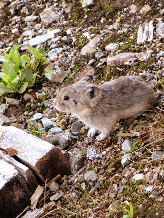
A pika ( or ; archaically spelled pica) is a small, mountain-dwelling mammal found in Asia and North America. With short limbs, very round body, an even coat of fur, and no external tail, they resemble their close relative, the rabbit, but with short, rounded ears. The large-eared pika of the Himalayas and nearby mountains is found at heights of more than , among the highest of any mammal. Pikas prefer rocky slopes and graze on a range of plants, mostly grasses, flowers and young stems. In the autumn they pull hay, soft twigs and other stores of food into their burrows to eat during the long, cold winter. The pika is also known as the whistling hare because of its high-pitched alarm call when diving into its burrow. The name ‘pika’ appears to be derived from the Tungus ''piika'', and the scientific name ''Ochotona'' is from the Mongolian word ''ogutun-a, оготно'', which means pika. It is used for any member of the Ochotonidae, a family within the order of lagomorph ... [...More Info...] [...Related Items...] OR: [Wikipedia] [Google] [Baidu] |


