|
Knoydart
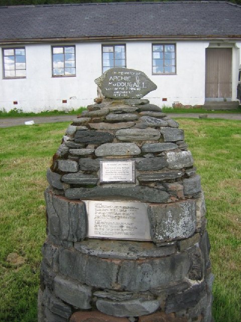
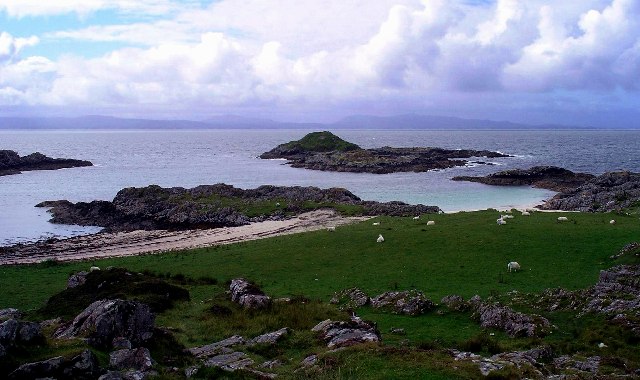
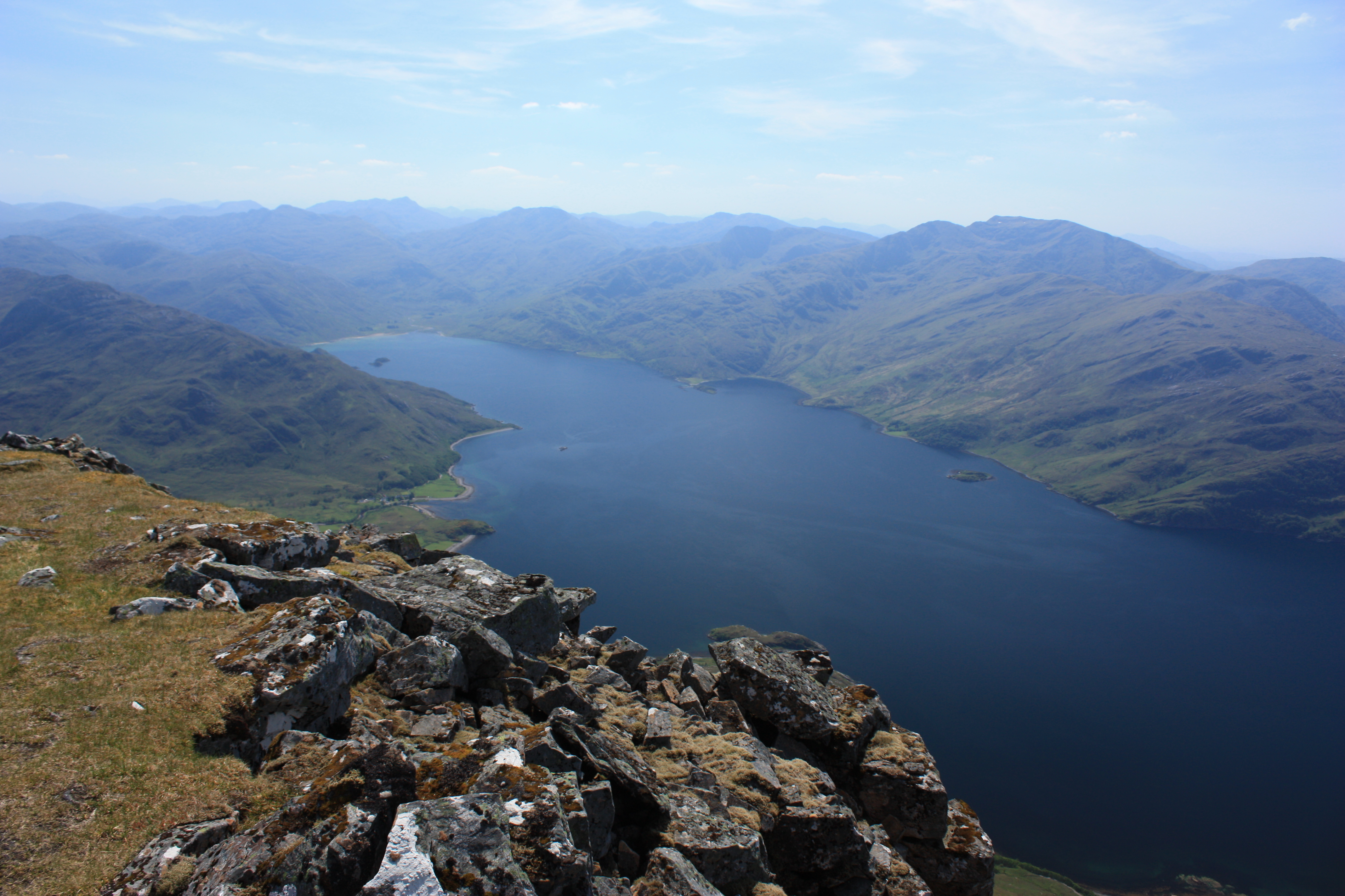
Knoydart (Scottish Gaelic: ''Cnòideart'') is a peninsula in Lochaber, Highland, on the west coast of Scotland. Knoydart is sandwiched between Lochs Nevis and Hourn — often translated as "Loch Heaven" (from the Gaelic ''Loch Néimh'') and "Loch Hell" (Gaelic: ''Loch Iutharn'') respectively, although the somewhat poetic nature of these derivations is disputed. Forming the northern part of what is traditionally known as ''na Garbh-Chrìochan'' or "the Rough Bounds", because of its harsh terrain and remoteness, Knoydart is also referred to as "Britain's last wilderness". It is only accessible by boat, or by a 16-mile (26 km) walk through rough country, and the seven miles (11 km) of tarred road are not connected to the UK road system. Knoydart is designated as one of the forty national scenic areas in Scotland, which are defined so as to identify areas of exceptional scenery and to ensure their protection from inappropriate development. The designated area covers ... [...More Info...] [...Related Items...] OR: [Wikipedia] [Google] [Baidu] |
The Rough Bounds
The Rough Bounds ( gd, Na Garbh Chriochan), in the Scottish Highlands, is the area of West Inverness-shire bounded by Loch Hourn, Loch Shiel, and Loch Moidart, consisting of the districts of Knoydart, North Morar, Arisaig and Moidart. The area is famous for its wildness and inaccessibility and remains very sparsely populated. 'All these countries viz. Knoydart, the Two Morrirs, Moydart, and Arisaig, are the most Rough Mountainous and impassible parts in all the Highlands of Scotland, and are commonly called by the Inhabitants of the Neighbouring countries the highlands of the Highlands' - anonymous writer in 1750 Prehistory The Re-alignment of a 6 km section of the A830 road in Arisaig led to archaeological investigations in 2000-2001 by the Centre for Field Archaeology (CFA), University of Edinburgh, and Headland Archaeology Ltd which found a Bronze Age kerb cairn, turf buildings and shieling huts. The shielings were repeatedly reused through the medieval and post-me ... [...More Info...] [...Related Items...] OR: [Wikipedia] [Google] [Baidu] |
Loch Nevis
Loch Nevis (Scottish Gaelic: ''Loch Nibheis'') is a sea loch in Lochaber on the west coast of Scotland. It runs inland from the Sound of Sleat, and is bounded on the north by the peninsula of Knoydart and on the south by North Morar (the region north of Loch Morar, and containing the village of Morar). Two ferry services cross Loch Nevis. One, a small passenger ferry, links the town of Mallaig with the village of Inverie on Knoydart and the hamlet of Tarbet. The otherKnoydart Seabridge a daily ferry service which can transport vehicles as well as passengers and equipment, sails directly between Mallaig and Inverie. The ferry operated by Caledonian MacBrayne to the Small Isles The Small Isles ('' gd, Na h-Eileanan Tarsainn'') are a small archipelago of islands in the Inner Hebrides, off the west coast of Scotland. They lie south of Skye and north of Mull and Ardnamurchan – the most westerly point of mainl ... from Mallaig is named after the loch, the MV '' ... [...More Info...] [...Related Items...] OR: [Wikipedia] [Google] [Baidu] |
Mallaig
Mallaig (; gd, Malaig derived from Old Norse , meaning sand dune bay) is a port in Lochaber, on the west coast of the Highlands of Scotland. The local railway station, Mallaig, is the terminus of the West Highland railway line (Fort William and Mallaig branch) and the town is linked to Fort William by the A830 road – the " Road to the Isles". Development The village of Mallaig was founded in the 1840s when Lord Lovat, owner of North Morar Estate, divided up the farm of Mallaigvaig into 17 parcels of land and encouraged his tenants to move to the western part of the peninsula and turn to fishing as a way of life. The population and local economy expanded rapidly in the 20th century with the arrival of the railway. Ferries operated by Caledonian MacBrayne and Western Isles Cruises sail from the port to Armadale on the Isle of Skye, Inverie in Knoydart, Lochboisdale on South Uist and the isles of Rùm, Eigg, Muck, and Canna. Mallaig is the main commercial fis ... [...More Info...] [...Related Items...] OR: [Wikipedia] [Google] [Baidu] |
Beinn Na Caillich (Knoydart)
Beinn na Caillich () is a mountain with a height of in Knoydart, in the Northwest Highlands of Scotland. It is on the southern shore of Loch Hourn, north-west of the Munro A Munro () is defined as a mountain in Scotland with a height over , and which is on the Scottish Mountaineering Club (SMC) official list of Munros; there is no explicit topographical prominence requirement. The best known Munro is Ben Nevis ... of Ladhar Bheinn. References {{Authority control Corbetts Marilyns of Scotland Mountains and hills of the Northwest Highlands ... [...More Info...] [...Related Items...] OR: [Wikipedia] [Google] [Baidu] |
Meall Buidhe, Knoydart
Meall Buidhe (946 m) is a mountain in the Northwest Highlands, Scotland. It lies on the Knoydart peninsula in Lochaber. A rocky mountain, Meall Buidhe is one of three Munros on Knoydart, and presents a challenging peak to climb from all directions. The nearest village is Inverie Inverie (; ) is the main village on the Knoydart peninsula in the Scottish Highlands. It is located on the north side of Loch Nevis and, although on the mainland of Britain, the network of single-track roads surrounding the village is not connec .... References Mountains and hills of the Northwest Highlands Marilyns of Scotland Munros {{Scotland-geo-stub ... [...More Info...] [...Related Items...] OR: [Wikipedia] [Google] [Baidu] |
Loch Hourn
Loch Hourn ( gd, Loch Shubhairne) is a sea loch which separates the peninsulas of Glenelg to the north and Knoydart to the south, on the west coast of Scotland. Geography Loch Hourn runs inland from the Sound of Sleat, opposite the island of Skye, for 22 km (c. 14 miles) to the head of the loch at Kinloch Hourn. At the entrance, its confluence with the Sound of Sleat, it is 5 km (3 miles) wide, becoming less than 2 km wide for much of its length, with successive narrows in the upper reaches and reducing to a 300-metre-wide basin at the head. Sometimes described as the most fjord-like of the sea lochs of northwest Scotland, it is steep-sided, with Beinn Sgritheall to the north and Ladhar Bheinn rising from the southern shore. The sea floor has been shaped by glaciation into five progressively deeper basins with relatively shallow sills; combined with the narrow and sheltered aspect of the loch and the high local rainfall, these result in an unusually wide varia ... [...More Info...] [...Related Items...] OR: [Wikipedia] [Google] [Baidu] |
Ladhar Bheinn
Ladhar Bheinn is the highest mountain in the Knoydart region of the Highlands of Scotland. It is the most westerly Munro on the Scottish mainland. The mountain may be climbed from Barrisdale to the northeast or Inverie to the south. From Barrisdale the mountain may be climbed as part of circuit of Coire Dhorrcaill; this route involves a certain amount of scrambling, particularly on the section immediately north of the subsidiary summit of Stob a Chearcaill. References This listgives information about map, grid ref and neighbours Munros Marilyns of Scotland Mountains and hills of the Northwest Highlands One-thousanders of the British Isles {{Highland-geo-stub ... [...More Info...] [...Related Items...] OR: [Wikipedia] [Google] [Baidu] |
Ben Aden
Ben Aden (887m) is a mountain in the Northwest Highlands of Scotland. It lies on the Knoydart peninsula in Lochaber. Regarded as one of the finest Corbetts in Scotland and one of the toughest to climb, the mountain is steep and rocky on all sides. The nearest village is Inverie Inverie (; ) is the main village on the Knoydart peninsula in the Scottish Highlands. It is located on the north side of Loch Nevis and, although on the mainland of Britain, the network of single-track roads surrounding the village is not connec .... References Mountains and hills of the Northwest Highlands Marilyns of Scotland Corbetts {{Scotland-geo-stub ... [...More Info...] [...Related Items...] OR: [Wikipedia] [Google] [Baidu] |
Clan MacDonell Of Glengarry
Clan MacDonnell of Glengarry ( gd, Clann Dòmhnaill Ghlinne Garaidh) is a Scottish clan and is a branch of the larger Clan Donald.Way, George and Squire, Romily. ''Collins Scottish Clan & Family Encyclopedia''. (Foreword by The Rt Hon. The Earl of Elgin KT, Convenor, The Standing Council of Scottish Chiefs). Published in 1994. Pages 214 – 215. The clan takes its name from Glen Garry where the river Garry runs eastwards through Loch Garry to join the Great Glen about 16 miles (25 km) north of Fort William, Highland. History Origins of the clan Glengarry is in Lochaber which was part of the ancient Kingdom of Moray that was ruled by the Picts. Ranald was the son of John of Islay, Lord of the Isles, and Ranald himself had five sons. One of them was Alan, the progenitor of the Clan Macdonald of Clanranald and another was Donald. Donald married twice: firstly Laleve, daughter of the chief of Clan MacIver, by whom he had one son named John. Donald married secondly a ... [...More Info...] [...Related Items...] OR: [Wikipedia] [Google] [Baidu] |
National Scenic Area (Scotland)
National scenic area (NSA) is a conservation designation used in Scotland, and administered by NatureScot on behalf of the Scottish Government. The designation's purpose is to identify areas of exceptional scenery and to protect them from inappropriate development. There are currently 40 national scenic areas (NSAs) in Scotland, covering 13% of the land area of Scotland. The areas protected by the designation are considered to represent the type of scenic beauty "popularly associated with Scotland and for which it is renowned". As such they tend to be mainly found in remote and mountainous areas, with a review in 1997 noting a potential weakness of national scenic areas was that the original selection placed undue emphasis on mountainous parts of the country. National scenic areas do however also cover seascapes, with approximately 26% of the total area protected by the designation being marine. The designation is primarily concerned with scenic qualities, although designated nat ... [...More Info...] [...Related Items...] OR: [Wikipedia] [Google] [Baidu] |
Munro
A Munro () is defined as a mountain in Scotland with a height over , and which is on the Scottish Mountaineering Club (SMC) official list of Munros; there is no explicit topographical prominence requirement. The best known Munro is Ben Nevis (Beinn Nibheis), the highest mountain in the British Isles at . Munros are named after Sir Hugh Munro, 4th Baronet (1856–1919), who produced the first list of such hills, known as ''Munro's Tables'', in 1891. Also included were what Munro considered lesser peaks, now known as Munro Tops, which are also over 3,000 feet but are lower than the nearby primary mountain. The publication of the original list is usually considered to be the epoch event of modern peak bagging. The list has been the subject of subsequent variation and as of 10 December 2020, the Scottish Mountaineering Club has listed 282 Munros and 226 Munro Tops. "Munro bagging" is the activity of climbing all the listed Munros. As of 31 December 2021, 7,098 people had repo ... [...More Info...] [...Related Items...] OR: [Wikipedia] [Google] [Baidu] |
Highland (council Area)
Highland ( gd, A' Ghàidhealtachd, ; sco, Hieland) is a council area in the Scottish Highlands and is the largest local government area in the United Kingdom. It was the 7th most populous council area in Scotland at the 2011 census. It shares borders with the council areas of Aberdeenshire, Argyll and Bute, Moray and Perth and Kinross. Their councils, and those of Angus and Stirling, also have areas of the Scottish Highlands within their administrative boundaries. The Highland area covers most of the mainland and inner-Hebridean parts of the historic counties of Inverness-shire and Ross and Cromarty, all of Caithness, Nairnshire and Sutherland and small parts of Argyll and Moray. Despite its name, the area does not cover the entire Scottish Highlands. Name Unlike the other council areas of Scotland, the name ''Highland'' is often not used as a proper noun. The council's website only sometimes refers to the area as being ''Highland'', and other times as being ''the ... [...More Info...] [...Related Items...] OR: [Wikipedia] [Google] [Baidu] |


.jpg)

