|
Klahoose First Nation
The ƛoʔos Klahoose are one of the three groups comprising the ''ʔayʔaǰuθəm'' Tla'Amin or Mainland Comox. The other two divisions of this once-populous group are the χʷɛmaɬku Homalco and Sliammon (which is a corruption of "Tla A'min"). The Klahoose, Homalco and Sliammon are, according to oral tradition, the descendants of the survivors of the Great Flood.Hutchings and Williams 2020 The three groups were split by colonialism into different band councils but united historically as the Tla A'min, known as the Mainland Comox, and K’ómoks, the larger grouping of the Comox people, also known as the Island Comox and before the merger with the Laich-kwil-tach culture (which were known as the Sahtloot). Historically both groups are a subgroup of the Coast Salish though the K’ómoks name is from, and their language today, is the Lik'wala (Southern Kwakiutl) dialect of Kwak'wala. The ancestral tongue is the Comox language, though the Sahtloot/Island dialect is extinct. The ... [...More Info...] [...Related Items...] OR: [Wikipedia] [Google] [Baidu] |
Vancouver Island
Vancouver Island is an island in the northeastern Pacific Ocean and part of the Canadian Provinces and territories of Canada, province of British Columbia. The island is in length, in width at its widest point, and in total area, while are of land. The island is the largest by area and the most populous along the west coasts of the Americas. The southern part of Vancouver Island and some of the nearby Gulf Islands are the only parts of British Columbia or Western Canada to lie south of the 49th parallel north, 49th parallel. This area has one of the warmest climates in Canada, and since the mid-1990s has been mild enough in a few areas to grow Mediterranean Sea, Mediterranean crops such as olives and lemons. The population of Vancouver Island was 864,864 as of 2021. Nearly half of that population (~400,000) live in the metropolitan area of Greater Victoria, the capital city of British Columbia. Other notable cities and towns on Vancouver Island include Nanaimo, Port Alberni, ... [...More Info...] [...Related Items...] OR: [Wikipedia] [Google] [Baidu] |
Sunshine Coast (British Columbia)
The Sunshine Coast is a geographic subregion of the British Columbia Coast that generally comprises the regional districts of qathet and Sunshine Coast. While populous and frequently visited by tourists, the Sunshine Coast can be reached only by ferry (commonly BC Ferries) or by floatplane, as no access roads have been built around or across the fjords separating it from the rest of the province. Geography The Sunshine Coast is a subregion of the mainland coast of British Columbia. It is bound by Howe Sound to the southeast, Desolation Sound to the northwest, the Pacific Ranges to the northeast, and the Strait of Georgia to the southwest. The region is bisected by Jervis Inlet. The region features a coastal lowland that gradually transitions to steep-sided mountains as you move toward the northeast. The major islands of the Sunshine Coast include Anvil Island, Gambier Island, Goat Island, Hernando Island, Keats Island, Savary Island, and most of the Northern Gulf Islands. E ... [...More Info...] [...Related Items...] OR: [Wikipedia] [Google] [Baidu] |
Desolation Sound
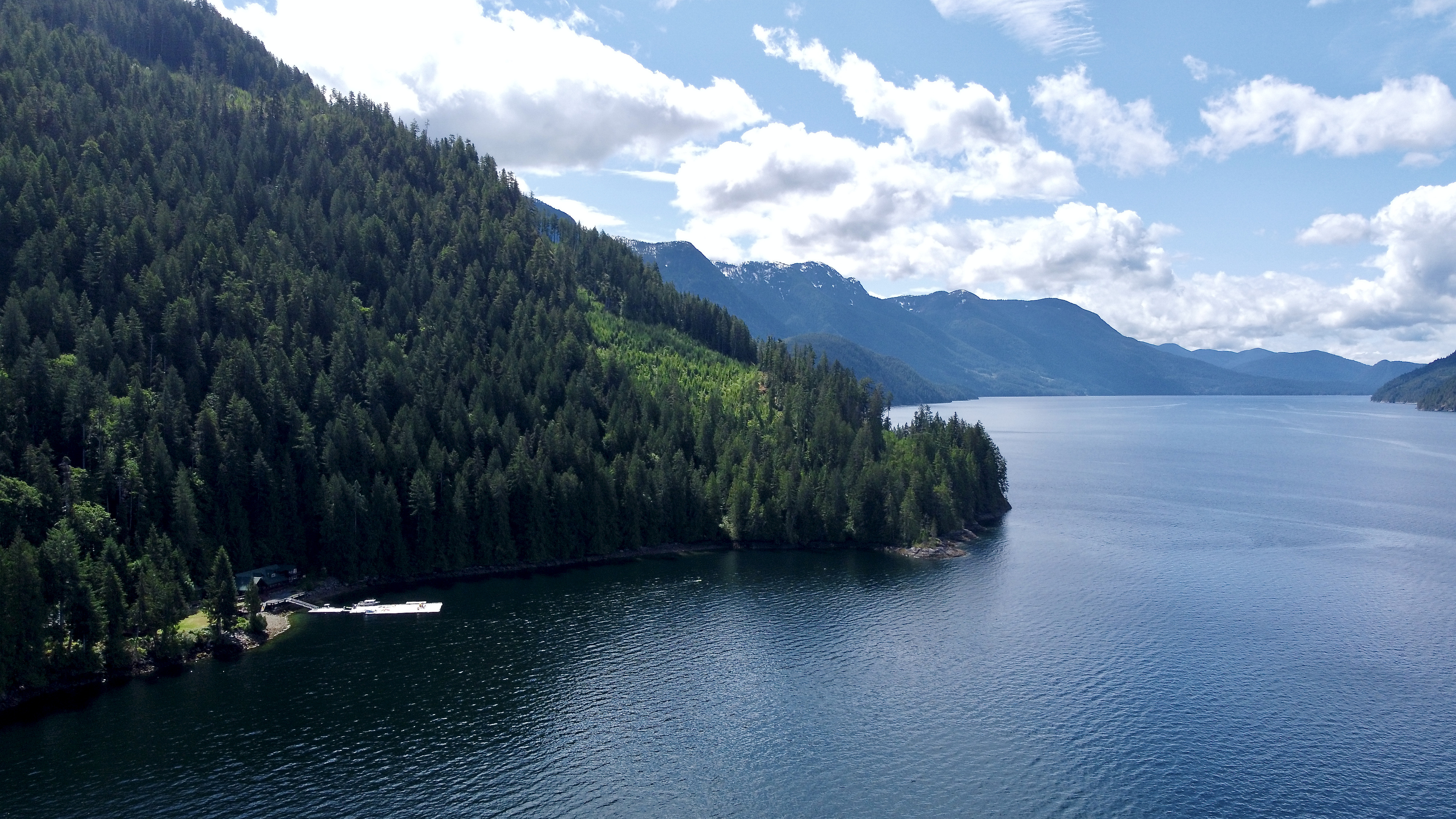
, image = Desolation sound 2006.jpg , image_size = 250px , alt = , caption = Desolation Sound , image_bathymetry = Carte baie Desolation fr.png , alt_bathymetry = , caption_bathymetry = Extent of Desolation Sound , location = Discovery Islands, British Columbia , group = , coordinates = , type = Sound , etymology = , part_of = Salish Sea , inflow = , rivers = , outflow = , oceans = , catchment = , basin_countries = , agency = , designation = , date-built = , engineer = , date-flooded = , length = , width = , area = , depth = , max-depth = , volume = , residence_time = , salinity = , shore = , elevation ... [...More Info...] [...Related Items...] OR: [Wikipedia] [Google] [Baidu] |
Homfray Channel
, image = , alt = , caption = , image_bathymetry = Carte baie Desolation fr.png , alt_bathymetry = , caption_bathymetry = Homfray Channel is located between East Redonda Island and the mainland coast of British Columbia , location = Desolation Sound, Discovery Islands, British Columbia , group = , coordinates = , type = Strait , etymology = , part_of = , inflow = Toba Inlet , rivers = Forbes Creek, Homfray Creek, Lloyd Creek , outflow = , oceans = Salish Sea , catchment = , basin_countries = , agency = , designation = , date-built = , engineer = , date-flooded = , length = , width = , area = , depth = , max-depth = , volume = , residence_time = ... [...More Info...] [...Related Items...] OR: [Wikipedia] [Google] [Baidu] |
Naut'sa Mawt Tribal Council
Naut’sa mawt Tribal Council is a First Nations Tribal Council located in British Columbia, Canada, with offices in Tsawwassen and Nanaimo. NmTC advises and assists its 11-member Nations in the areas of Community Planning, Economic Development, Financial Management, Governance and Technical Services (which includes community infrastructure, capital projects, housing development and inspections, water quality and emergency preparedness.) NmTC is also actively involved in fostering dialogue and understanding between its members and their neighbouring communities. The member Nations of the region span the Strait of Georgia, touch the Strait of Juan de Fuca and encompass eastern and southern Vancouver Island, the Lower Mainland and the Sunshine Coast. The head office of the Tribal Council is on Snuneymuxw First Nation lands in Nanaimo. A mainland office is located on Tsawwassen First Nation lands near the Tsawwassen area of the city of Delta. Member governments *Halalt First Nat ... [...More Info...] [...Related Items...] OR: [Wikipedia] [Google] [Baidu] |
British Columbia
British Columbia (commonly abbreviated as BC) is the westernmost province of Canada, situated between the Pacific Ocean and the Rocky Mountains. It has a diverse geography, with rugged landscapes that include rocky coastlines, sandy beaches, forests, lakes, mountains, inland deserts and grassy plains, and borders the province of Alberta to the east and the Yukon and Northwest Territories to the north. With an estimated population of 5.3million as of 2022, it is Canada's third-most populous province. The capital of British Columbia is Victoria and its largest city is Vancouver. Vancouver is the third-largest metropolitan area in Canada; the 2021 census recorded 2.6million people in Metro Vancouver. The first known human inhabitants of the area settled in British Columbia at least 10,000 years ago. Such groups include the Coast Salish, Tsilhqotʼin, and Haida peoples, among many others. One of the earliest British settlements in the area was Fort Victoria, established ... [...More Info...] [...Related Items...] OR: [Wikipedia] [Google] [Baidu] |
Strait Of Georgia
The Strait of Georgia (french: Détroit de Géorgie) or the Georgia Strait is an arm of the Salish Sea between Vancouver Island and the extreme southwestern mainland coast of British Columbia, Canada and the extreme northwestern mainland coast of Washington, United States. It is approximately long and varies in width from .Environmental History and Features of Puget Sound , NOAA-NWFSC Along with the and , it is a constituent part of the |
Indian Act
The ''Indian Act'' (, long name ''An Act to amend and consolidate the laws respecting Indians'') is a Canadian act of Parliament that concerns registered Indians, their bands, and the system of Indian reserves. First passed in 1876 and still in force with amendments, it is the primary document that defines how the Government of Canada interacts with the 614 First Nation bands in Canada and their members. Throughout its long history, the act has been a subject of controversy and has been interpreted in different ways by both Indigenous Canadians and non-Indigenous Canadians. The legislation has been amended many times, including "over five major changes" made in 2002. The act is very wide-ranging in scope, covering governance, land use, healthcare, education, and more on Indian reserves. Notably, the original ''Indian Act'' defines two elements that affect all Indigenous Canadians: :It says how reserves and bands can operate. The act sets out rules for governing Indian reser ... [...More Info...] [...Related Items...] OR: [Wikipedia] [Google] [Baidu] |
Band Government
In Canada, an Indian band or band (french: bande indienne, link=no), sometimes referred to as a First Nation band (french: bande de la Première Nation, link=no) or simply a First Nation, is the basic unit of government for those peoples subject to the ''Indian Act'' (i.e. status Indians or First Nations). Bands are typically small groups of people: the largest in the country, the Six Nations of the Grand River First Nation had 22,294 members in September 2005, and many have a membership below 100 people. Each First Nation is typically represented by a band council (french: conseil de bande) chaired by an elected chief, and sometimes also a hereditary chief. As of 2013, there were 614 bands in Canada. Membership in a band is controlled in one of two ways: for most bands, membership is obtained by becoming listed on the Indian Register maintained by the government. As of 2013, there were 253 First Nations which had their own membership criteria, so that not all status Indians are ... [...More Info...] [...Related Items...] OR: [Wikipedia] [Google] [Baidu] |
First Nations In Canada
First Nations (french: Premières Nations) is a term used to identify those Indigenous Canadian peoples who are neither Inuit nor Métis. Traditionally, First Nations in Canada were peoples who lived south of the tree line, and mainly south of the Arctic Circle. There are 634 recognized First Nations governments or bands across Canada. Roughly half are located in the provinces of Ontario and British Columbia. Under Charter jurisprudence, First Nations are a "designated group," along with women, visible minorities, and people with physical or mental disabilities. First Nations are not defined as a visible minority by the criteria of Statistics Canada. North American indigenous peoples have cultures spanning thousands of years. Some of their oral traditions accurately describe historical events, such as the Cascadia earthquake of 1700 and the 18th-century Tseax Cone eruption. Written records began with the arrival of European explorers and colonists during the Age of Dis ... [...More Info...] [...Related Items...] OR: [Wikipedia] [Google] [Baidu] |
Klahoose
The ƛoʔos Klahoose are one of the three groups comprising the ''ʔayʔaǰuθəm'' Tla'Amin or Mainland Comox. The other two divisions of this once-populous group are the χʷɛmaɬku Homalco and Sliammon (which is a corruption of "Tla A'min"). The Klahoose, Homalco and Sliammon are, according to oral tradition, the descendants of the survivors of the Great Flood.Hutchings and Williams 2020 The three groups were split by colonialism into different band councils but united historically as the Tla A'min, known as the Mainland Comox, and K’ómoks, the larger grouping of the Comox people, also known as the Island Comox and before the merger with the Laich-kwil-tach culture (which were known as the Sahtloot). Historically both groups are a subgroup of the Coast Salish though the K’ómoks name is from, and their language today, is the Lik'wala (Southern Kwakiutl) dialect of Kwak'wala. The ancestral tongue is the Comox language, though the Sahtloot/Island dialect is extinct. The ... [...More Info...] [...Related Items...] OR: [Wikipedia] [Google] [Baidu] |


